Mount Tamalpais State Park
| Mount Tamalpais State Park | |
|---|---|
|
IUCN category III (natural monument or feature) | |
 | |
 | |
| Location | Marin County, California, USA |
| Nearest city | Mill Valley, CA |
| Coordinates | 37°55′26.12″N 122°35′47.92″W / 37.9239222°N 122.5966444°W / 37.9239222; -122.5966444Coordinates: 37°55′26.12″N 122°35′47.92″W / 37.9239222°N 122.5966444°W / 37.9239222; -122.5966444 |
| Area | 6,300 acres (25 km2) |
| Established | 1963 |
| Visitors | 564,000 (in 2003) |
| Governing body | CA Dept. of Parks & Recreation |

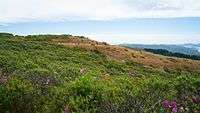
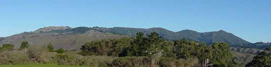
Mount Tamalpais State Park is a California state park, located in Marin County, California. The primary feature of the park is the 2,571 feet (784 m) Mount Tamalpais. The park contains mostly redwood and oak forests. The mountain itself covers around 25,000 acres (100 km2). There are about 60 miles (97 km) of hiking trails, which are connected to a larger, 200 miles (320 km) network of trails in neighboring public lands. The park received 564,000 visitors in as of 2003. Muir Woods National Monument is surrounded by the state park.
From the peak of the mountain, visitors can see up to 25 miles (40 km), in a view that encompasses San Francisco, most of the North and East Bay, and the Farallon Islands. Occasionally, the Sierra Nevada are visible, 125 miles (201 km) away.
Cushing Memorial Amphitheatre
"The Mountain Theater (AKA The Cushing Memorial Theater) was constructed by the Civilian Conservation Corps in the 1930s. The natural-stone amphitheater seats 3,750 people and features the Mountain Play each spring, produced every year since 1913. In the summer, monthly astronomy programs are held in the theater, free to the public." - http://www.parks.ca.gov/?page_id=471
See also
References
External links
- Official California State Parks department site describing the park