Kootenai National Forest
| Kootenai National Forest | |
|---|---|
|
IUCN category VI (protected area with sustainable use of natural resources) | |
|
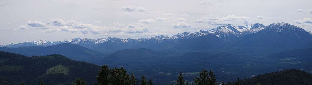
Panorama of the southern Cabinet Mountains | |
 | |
| Location | Montana-Idaho, United States |
| Nearest city | Libby, MT |
| Coordinates | 48°11′0″N 115°28′0″W / 48.18333°N 115.46667°WCoordinates: 48°11′0″N 115°28′0″W / 48.18333°N 115.46667°W |
| Area | 2.2 million acres (8,900 km2) |
| Established | 1907 |
| Governing body | U.S. Forest Service |
| Website | Kootenai National Forest |
The Kootenai National Forest is a national forest located in the far northwestern section of Montana and the northeasternmost lands in the Idaho panhandle in the United States, along the Canada–US border. Of the 2.2 million acres (8,900 km2) administered by the forest, less than 3 percent is located in the state of Idaho. Forest headquarters are located in Libby, Montana. There are local ranger district offices in Eureka, Fortine, Libby, Trout Creek, and Troy, Montana.[1] About 53 percent of the 94,272-acre (381.51 km2) Cabinet Mountains Wilderness is located within the forest, with the balance lying in neighboring Kaniksu National Forest.[2]
Snowshoe Peak in the Cabinet Mountains Wilderness, at 8,738 feet (2,663 m), is the highest peak within the forest. Mountain ranges included in the forest include the Whitefish, Purcell, Bitterroot, Salish, and Cabinet ranges.
The Pacific Northwest National Scenic Trail traverses the Forest. More than 90 miles (140 km) of the 1,200-mile (1,900 km) trail are within the Kootenai.
The Kootenai and the Clark Fork rivers are the major rivers and are fed by abundant rainfall that is more than double that amount found elsewhere in Montana. Three major hydroelectric dams exist in the Kootenai National Forest. Libby Dam on the Kootenai River creates a 90-mile (140 km)-long lake known as Lake Koocanusa (a play on Kootenai-Canada-United States of America), which extends into Canada. The shores of the lake are all forested with no private property easements. The lowest elevation in Montana is where the Kootenai River leaves the state, 1,832 feet (558 m) above sea level. Other rivers in the forest include the Yaak, Fisher, Tobacco and Vermillion, with water flowing from over 100 lakes.
The climate of the Kootenai has been described as "modified Pacific maritime" in character, meaning that compared to the remainder of Montana, this area's climate resembles that found along the Pacific coast. The character becomes "modified" by occasional intrusions of arctic air masses, more common elsewhere in Montana, which can bring winter temperatures down to −30 °F (−34 °C). Winters also feature heavy snowfalls in the mountains.
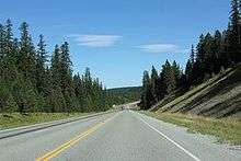
Access into the forest is via U.S. Highway 2, U.S. Highway 93, and Montana State Highways 37, 56, 200, and 508.
The national forest is located overwhelmingly (almost 95 percent) in Lincoln County, Montana, but extends into neighboring counties. In descending order of forestland area, they are Flathead County in Montana, Bonner and Boundary counties in Idaho, and Sanders County in Montana.
See also
References
External links
| Wikimedia Commons has media related to Kootenai National Forest. |
- "Kootenai National Forest". U.S. Forest Service. Retrieved 2006-07-08.
- "Pacific Northwest Trail". U.S. Forest Service. Retrieved 2013-11-19.
- "Cabinet Mountains Wilderness". The National Wilderness Preservation System. Wilderness.net. Retrieved 2006-07-08.