Lake County, Oregon
| Lake County, Oregon | |
|---|---|
 Lake County Courthouse in Lakeview | |
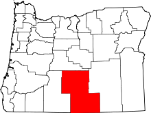 Location in the U.S. state of Oregon | |
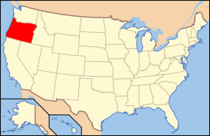 Oregon's location in the U.S. | |
| Founded | October 24, 1874 |
| Seat | Lakeview |
| Largest city | Lakeview |
| Area | |
| • Total | 8,358 sq mi (21,647 km2) |
| • Land | 8,139 sq mi (21,080 km2) |
| • Water | 219 sq mi (567 km2), 2.6% |
| Population (est.) | |
| • (2015) | 7,829 |
| • Density | 1.0/sq mi (0/km²) |
| Congressional district | 2nd |
| Time zone | Pacific: UTC-8/-7 |
| Website |
www |
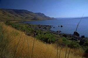
Lake County is a county in the south-central region of the U.S. state of Oregon. As of the 2010 census, the population was 7,895.[1] Its county seat is Lakeview.[2][3] The county is named for the many lakes found within its boundaries,[4] including Lake Abert, Summer Lake, Hart Lake, and Goose Lake.
Lake County is in the high desert region known as the Oregon Outback, on the northwestern edge of the Great Basin. The county is generally divided between the communities around Lakeview and Paisley to the south and the communities around Christmas Valley, Fort Rock, and Silver Lake to the north.
Its economy consists largely of agriculture and natural resource management and extraction. It is home to many large cattle ranches, hay farms, and timber holdings (both public and private), as well as several frontier towns and early 20th-century homesteads. Although lumber was once a primary economic driver in Lake County, today only one mill remains, at Lakeview.
History
Pre-Columbian
Pre-Clovis era coprolites found in the Paisley Caves in northern Lake County in 2007 have been radiocarbon dated to 14,300 calendar years before present. DNA extracted from these human remains bears certain genetic markers found only in Native American populations.[5] Luther Cressman found prehistoric artifacts in the Fort Rock Caves of northern Lake County in 1938, including basketry, stone tools,[6] and a cache of woven sagebrush bark sandals which have been dated to more than 10,000 years ago.[7]
Modern
European traders, explorers and military expeditions arrived in the region during the early part of the 19th century. Peter Skene Ogden led Hudson's Bay Company trappers to Goose Lake in 1827. In 1832, the Hudson Bay trappers under John Work were in the Goose Lake Valley and their journals mentioned Hunter's Hot Springs. Work's expedition visited Warner Lakes and Lake Abert and camped at Crooked Creek in the Chandler Park area. There they documented eating wild plums, which still grow in the area. They also reported being attacked by Indians.[8] In 1838, Colonel J. J. Abert, a U.S. engineer, prepared a map that includes Warner Lakes and other natural features using information from the Hudson Bay trappers. In 1843, John C. Fremont led a party which named Christmas (Hart) Lake.[8]
Lake County once hosted significant populations of Basque[9] and Irish sheepherders.[10] Disputes over grazing rights, exacerbated by the introduction of wheat farming, led to the eruption of range wars between cattle ranchers and sheep herders. At least one band of masked rifle-armed cattlemen killed sheep in the northern part of the county and in Deschutes County during the early 20th century and they came to be known as "sheepshooters". According to the Oregon History Project, 2,300 sheep were killed in a single night in April 1904 in Lake County.[11]
Lake County grew with the arrival of homesteaders, but the dry climate made for challenging development.
Lake County was created from Jackson and Wasco Counties on October 24, 1874, by the State Legislature. It then included the present Klamath County and all of the present Lake County except Warner Valley. In 1882, land was assigned to create Klamath County, and in 1885 the Warner area from Grant County was added. Linkville, now Klamath Falls, was the first county seat.[12]
M. Bullard gave 20 acres (80,000 m2) as the Lakeview townsite. By the 1875 election, a town had been started and an election moved the county seat to Lakeview. Because of poor transportation connections with the rest of Oregon, the early economic orientation of Lake County was toward California: both the San Francisco Chronicle and the San Francisco Examiner arrived in Lakeview daily, often before The Oregonian. During the 1840s and 1850s the county was part of the military courier route between The Dalles on the Columbia River and the Presidio in San Francisco.
The county acquired a railroad connection in the 1890s. That railroad spur, the Nevada–California–Oregon Railway line running from Lakeview to Reno, Nevada, emphasized the isolation of the county from the rest of Oregon.[13] A devastating fire in 1900 destroyed much of Lakeview, including 75 businesses.[8]
During the summer of 2012, two wildfires burned larges areas of Lake County. Both fires were the result of lightning strikes. The Lava Fire burned over 21,500 acres (87 km2) of public rangeland and scrub forest in and around lava beds north of Fort Rock. The Barry Point Fire burned 92,977 acres (376.26 km2) of public and private forest land along the California border.[14][15]
Geography
According to the U.S. Census Bureau, the county has a total area of 8,358 square miles (21,650 km2), of which 8,139 square miles (21,080 km2) is land and 219 square miles (570 km2) (2.6%) is water.[16] It is the third-largest county in Oregon.
Lake County ranges in elevation from 4,130 to 8,446 feet (1,259 to 2,574 m).[17] The highest point in Lake County is Crane Mountain. The mountain is located 6 miles (9.7 km) north of the California border. Lake County has six other peaks with elevations above 8,000 feet (2,400 m), all located in the southern half of the county. Hager Mountain is the highest peak in the northern part of the county.[18][19][20]
The area includes alkali lakes, high desert scrub, and forests of Western Juniper, Ponderosa Pine, and Lodgepole Pine in the hills and mountains. There are also several unusual geologic features and good areas for rockhounding and geological touring.
Lost Forest Research Natural Area is a protected relic forest closely associated with the Christmas Valley Sand Dunes in northeastern Lake County. Fossil Lake is an area nearby where many fossils of prehistoric animals have been identified. Glass Buttes is an obsidian complex in the extreme northeast corner of the county. Crack in the Ground, northeast of Christmas Valley is a long fissure with ice in its floor year round. Big Hole, Hole-in-the-Ground, and Fort Rock are ancient maar craters in the northwestern part of the county.
Watersheds
These twelve watersheds occur in whole or in part within Lake County:[21]
- Beaver-South Fork watershed
- Goose Lake watershed
- Guano watershed
- Lake Abert watershed
- Little Deschutes
- Lost River watershed
- Crooked River, South Fork
- Silver watershed
- Sprague
- Summer Lake watershed
- Warner Lakes watershed
- Williamson
Lakes
Named lakes wholly or partly in Lake County include:
- Abert Lake
- Alkali Lake[22]
- Duncan Reservoir
- Thompson Reservoir
- Ana Reservoir
- Campbell Lake
- Crump Lake
- Deadhorse Lake
- Dog Lake[23][24]
- Drews Reservoir
- Goose Lake
- Hart Lake[25]
- Heart Lake [26]
- Silver Lake
- Summer Lake
- Warner Lakes (Pelican, Crump, Hart, Anderson, Swamp, Mugwump, Flagstaff, Upper Campbell, Lower Campbell, Stone Corral, Turpin, and Bluejoint).[27][28][29][30][31]
Adjacent counties
- Deschutes County (north)
- Klamath County (west)
- Harney County (east)
- Modoc County, California (south)
- Washoe County, Nevada (south)
National protected areas
- Deschutes National Forest (part)
- Fremont National Forest (part)
- Hart Mountain National Antelope Refuge
- Sheldon National Wildlife Refuge (part)
Demographics
| Historical population | |||
|---|---|---|---|
| Census | Pop. | %± | |
| 1880 | 2,804 | — | |
| 1890 | 2,604 | −7.1% | |
| 1900 | 2,847 | 9.3% | |
| 1910 | 4,658 | 63.6% | |
| 1920 | 3,991 | −14.3% | |
| 1930 | 4,833 | 21.1% | |
| 1940 | 6,293 | 30.2% | |
| 1950 | 6,649 | 5.7% | |
| 1960 | 7,158 | 7.7% | |
| 1970 | 6,343 | −11.4% | |
| 1980 | 7,532 | 18.7% | |
| 1990 | 7,186 | −4.6% | |
| 2000 | 7,422 | 3.3% | |
| 2010 | 7,895 | 6.4% | |
| Est. 2015 | 7,829 | [32] | −0.8% |
| U.S. Decennial Census[33] 1790-1960[34] 1900-1990[35] 1990-2000[36] 2010-2015[1] | |||
2000 census
As of the census[37] of 2000, there were 7,422 people, 3,084 households, and 2,152 families residing in the county. The population density was 1 person per square mile (0/km2). There were 3,999 housing units at an average density of 0 per square mile (0/km2). The racial makeup of the county was 90.97% White, 0.13% Black or African American, 2.37% Native American, 0.71% Asian, 0.13% Pacific Islander, 3.19% from other races, and 2.48% from two or more races. 5.44% of the population were Hispanic or Latino of any race. 14.1% were of Irish, 14.0% United States or American, 13.8% German and 11.8% English ancestry. 95.9% spoke English and 3.6% Spanish as their first language.
There were 3,084 households out of which 29.00% had children under the age of 18 living with them, 58.60% were married couples living together, 7.50% had a female householder with no husband present, and 30.20% were non-families. 26.20% of all households were made up of individuals and 11.10% had someone living alone who was 65 years of age or older. The average household size was 2.39 and the average family size was 2.84.
In the county, the population was spread out with 24.90% under the age of 18, 5.10% from 18 to 24, 24.30% from 25 to 44, 28.10% from 45 to 64, and 17.70% who were 65 years of age or older. The median age was 43 years. For every 100 females there were 100.50 males. For every 100 females age 18 and over, there were 98.30 males.
The median income for a household in the county was $29,506, and the median income for a family was $36,182. Males had a median income of $29,454 versus $23,475 for females. The per capita income for the county was $16,136. About 13.40% of families and 16.10% of the population were below the poverty line, including 20.40% of those under age 18 and 9.50% of those age 65 or over.
2010 census
As of the 2010 United States Census, there were 7,895 people, 3,378 households, and 2,148 families residing in the county.[38] The population density was 1.0 inhabitant per square mile (0.39/km2). There were 4,439 housing units at an average density of 0.5 per square mile (0.19/km2).[39] The racial makeup of the county was 90.3% white, 2.1% American Indian, 0.7% Asian, 0.5% black or African American, 0.1% Pacific islander, 3.1% from other races, and 3.3% from two or more races. Those of Hispanic or Latino origin made up 6.9% of the population.[38] In terms of ancestry, 27.9% were German, 19.3% were Irish, 19.2% were English, and 5.1% were American.[40]
Of the 3,378 households, 24.5% had children under the age of 18 living with them, 52.1% were married couples living together, 7.4% had a female householder with no husband present, 36.4% were non-families, and 31.3% of all households were made up of individuals. The average household size was 2.20 and the average family size was 2.73. The median age was 47.4 years.[38]
The median income for a household in the county was $41,105 and the median income for a family was $47,188. Males had a median income of $39,435 versus $26,000 for females. The per capita income for the county was $22,586. About 13.1% of families and 17.5% of the population were below the poverty line, including 27.4% of those under age 18 and 5.8% of those age 65 or over.[41]
Politics
Though Lake County is located in central Oregon, politically it falls in line with the eastern side of the state. The majority of registered voters who are part of a political party in Lake County, as well as most counties in eastern Oregon, are members of the Republican Party.[42] In the 2008 presidential election, 71.53% of Lake County voters voted for Republican John McCain, while 25.95% voted for Democrat Barack Obama and 1.53% of voters either voted for a Third Party candidate or wrote in a candidate.[43] These numbers show a small shift towards the Democratic candidate when compared to the 2004 presidential election, in which 77.8% of Lake Country voters voted for George W. Bush, while 20.5% voted for John Kerry, and 1.7% of voters either voted for a Third Party candidate or wrote in a candidate.[44]
.gif)
Economy
The economy in Lake County is reliant on lumber, agriculture, natural resource extraction, health care, a prison[45] and government. The area is also trying to promote itself for the many outdoor recreational and sightseeing opportunities offered.[46]
Lake County includes numerous cattle ranches. Irrigation has also permitted some agriculture based upon the raising of livestock and the growing of hay and grain despite the low rainfall and a short growing season.
Lumber and wood products are taken from the Fremont National Forest, Bureau of Land Management properties and private landholdings. The Collins Companies operates the last remaining mill in the area, the Lakeview sawmill, and is also a large landowner in the region.[47] Over 78% of the land in Lake County is owned and managed by the federal and state government.[17]
The Lakeview area of Lake County also includes a perlite mine[48] and once included uranium mining[49] (now subject to clean-up operations).[50] Several exploratory wells were dug for oil, but without success.
A railroad line ships timber products and perlite to Burlington Northern's rail hub in Alturas, California. At one time the railway was the only County owned and operated rail line in the country.
Government employment for the national forest and the regional Bureau of Land Management headquarters provides many of the higher salary jobs in an economy that otherwise would have to rely on seasonal agricultural, tourism and lumber jobs. The Bureau of Land Management is landowner of 49% of the lands within the county.
Tourism is a growing industry because of the county's many attractions which include Hart Mountain National Antelope Refuge, Hunter's Hot Springs, Goose Lake, Warner Canyon, hanggliding[51] and areas for rock hunting.
Lake County is home to the Lakeview Hospital, and other regional health care facilities. It's also the location for The Warner Creek Correctional Facility opened in 2005 and is a 400-bed minimum security state prison. The prison employs an average of 110 correctional professionals and is located on a site comprising 91 acres (370,000 m2). The facility itself occupies less than 15 acres (61,000 m2) and utilizes approximately 117,000 sq ft (10,900 m2). of building space which includes areas for inmate housing, work and education programs, health services, food services, religious services, physical plant, warehouse and storage, vehicle maintenance, a laundry facility, recreational activities, administration and various other functions. A unique feature of the prison is its use of natural geothermal sources deep inside the Earth. The geothermally heated water is pumped up through a well and piped into a heat exchange unit where the heat is then transferred to the prison’s water-loop system. Once the heat has been transferred and the water has cooled, the water is re-injected back into the ground.[52] Two prisoners briefly escaped in 2008.[53]
Arts and culture
Museums and other points of interest
North Lake County includes many geological sites including the Fort Rock, a crater marked by wave activity in what was once an ice age lake bed, and the Fort Rock Homestead Village Museum. It's also a site where camel bones and Native American artifacts have been uncovered. The "world's oldest shoes" were found here in 1938, changing the dates range scientists believed that humans inhabited the far west from 4,000 years ago.[54]
Several subsequent discoveries of even older sandals in the northern Great Basin confirmed the importance of archaeologist Luther Cressman's work. For this find, and for other research that broke down standing theories about the nature of the prehistoric Northwest, Cressman became known as the father of Oregon archaeology. [54] Other sights in North Lake include the Lost Forest, Crack-in-the-ground, and Hole-in-the-ground[55]
Oregon sunstones are found north of Plush.[56] Sunstone is Oregon's state gemstone.
Other areas of interest include, Abert Lake and Abert Rim, Goose Lake, Hunter's Hot Springs and its Old Perpetual Geyser, Schminck Memorial Museum and Lake County Museum,[57] Lake County Round-Up Museum, Schmink Museum, Warner Canyon ski area, Gearhart Mountain Wilderness, Sheldon National Wildlife Refuge, Summer Lake Hot Springs, sunstones (Oregon's state gemstone) near Plush, Warner Wetlands,[58][59] Summer Lake Wildlife Area[60] and sections of the Fremont National Forest of the Fremont–Winema National Forests.
The Hart Mountain National Antelope Refuge includes big-horn sheep, pronghorn, sage grouse, predatory birds and migratory birds. The Lake County Examiner is located in Lakeview and has been published continuously since the late 19th century.[61]
Media
Newspapers
- Desert Whispers
- Lake County Examiner
- The Community Breeze
Infrastructure
Major highways
Passenger and freight railways
Communities
Cities
Census-designated places
Unincorporated communities
- Adel
- Christmas Valley
- Five Corners
- Fort Rock
- New Pine Creek
- Plush
- Quartz Mountain
- Silver Lake
- Summer Lake
- Valley Falls
- West Side
See also
References
- 1 2 "State & County QuickFacts". United States Census Bureau. Retrieved November 15, 2013.
- ↑ Lake County, Oregon website
- ↑ "Find a County". National Association of Counties. Retrieved 2011-06-07.
- ↑ McArthur, Lewis A. and Lewis L. McArthur, "Lake County", Oregon Geographic Names (Seventh Edition), Oregon Historical Society Press, Portland, Oregon, 2003, p. 553.
- ↑ "Pre-Clovis Breakthrough". Archaeology.org. Retrieved 2011-02-12.
- ↑ "Cultural Sequence in the Northern Great Basin: The View From Fort Rock". University of Oregon Department of Anthropology. Archived from the original on July 15, 2004. Retrieved 2007-04-09.
- ↑ "World's Oldest Shoes". University of Oregon. Retrieved 2007-04-09.
- 1 2 3 "lakecountymuseum.com". lakecountymuseum.com. Retrieved 2011-02-12.
- ↑ http://www.heraldandnews.com/articles/2008/10/12/news/diversions/doc48d2fbf09b840436604006.txt
- ↑ http://www.irishsheepherders.com/index.html
- ↑ "Oregon History Project". Ohs.org. Retrieved 2013-11-04.
- ↑ "lakecountymuseum.com". lakecountymuseum.com. Retrieved 2011-02-12.
- ↑ Nevada-California-Oregon Railroad from trainweb.org
- ↑ "Morning update - August 7, 2012", "Wildfire - Oregon Department of Forestry", Oregon Department of Forestry, Salem, Oregon, 7 August 2012.
- ↑ Barry Point Fire Retrospectives and Lessons Learned, United States Department of Agriculture, United states Forest Service, Pacific Northwest Region, Fremont–Winema National Forest, Lakeview, Oregon, 3 May 2013.
- ↑ "2010 Census Gazetteer Files". United States Census Bureau. August 22, 2012. Retrieved February 26, 2015.
- 1 2 "Lakeview". Lakecountychamber.org. Retrieved 2011-02-12.
- ↑ "Feature Detail Report for: Crane Mountain", Geologic Names Information System, United States Geological Survey, United States Department of the Interior, Reston, Virginia, 27 November 2014.
- ↑ "Oregon Top 100", SummitPost.org, accessed 6 January 2015.
- ↑ "Feature Detail Report for: Hager Mountain", Geologic Names Information System, United States Geological Survey, United States Department of the Interior, Reston, Virginia, 27 November 2014.
- ↑ "Lake County | Surf Your Watershed | US EPA". Cfpub.epa.gov. 2006-06-28. Retrieved 2011-02-12.
- ↑ "Alkali Lake in Lake County Southern Oregon". Southernoregon.com. Retrieved 2011-02-12.
- ↑ "Fremont-Winema National Forests - Recreational Activities". Fs.fed.us. 2004-10-19. Retrieved 2011-02-12.
- ↑ "Dog Lake in Fremont National Forest Southern Oregon". Southernoregon.com. Retrieved 2011-02-12.
- ↑ "Hart Lake Reservoir in Lake County Southern Oregon". Southernoregon.com. Retrieved 2011-02-12.
- ↑ "Heart Lake in Southern Oregon". Southernoregon.com. Retrieved 2011-02-12.
- ↑ McArthur, Lewis A. and Lewis L. McArthur, "Warner Valley", Oregon Geographic Names (Seventh Edition), Oregon Historical Society Press, Portland, Oregon, 2003, p. 1010-1011.
- ↑ "Bluejoint Lake in Lake County Warner Valley Southern Oregon". Southernoregon.com. Retrieved 2011-02-12.
- ↑ "Southern Oregon Lakes". Southernoregon.com. Retrieved 2011-02-12.
- ↑ Gottberg, John Anderson, "Pronghorn Paradise", The Bulletin, Bend, Oregon, 16 August 2009.
- ↑ Jackman, E.R. and R.A. Long,The Oregon Desert, Canton Press, Caldwell, Idaho: 1964, p. 361.
- ↑ "County Totals Dataset: Population, Population Change and Estimated Components of Population Change: April 1, 2010 to July 1, 2015". Retrieved July 2, 2016.
- ↑ "U.S. Decennial Census". United States Census Bureau. Retrieved February 26, 2015.
- ↑ "Historical Census Browser". University of Virginia Library. Retrieved February 26, 2015.
- ↑ Forstall, Richard L., ed. (March 27, 1995). "Population of Counties by Decennial Census: 1900 to 1990". United States Census Bureau. Retrieved February 26, 2015.
- ↑ "Census 2000 PHC-T-4. Ranking Tables for Counties: 1990 and 2000" (PDF). United States Census Bureau. April 2, 2001. Retrieved February 26, 2015.
- ↑ "American FactFinder". United States Census Bureau. Retrieved 2008-01-31.
- 1 2 3 "DP-1 Profile of General Population and Housing Characteristics: 2010 Demographic Profile Data". United States Census Bureau. Retrieved 2016-02-23.
- ↑ "Population, Housing Units, Area, and Density: 2010 - County". United States Census Bureau. Retrieved 2016-02-23.
- ↑ "DP02 SELECTED SOCIAL CHARACTERISTICS IN THE UNITED STATES – 2006-2010 American Community Survey 5-Year Estimates". United States Census Bureau. Retrieved 2016-02-23.
- ↑ "DP03 SELECTED ECONOMIC CHARACTERISTICS – 2006-2010 American Community Survey 5-Year Estimates". United States Census Bureau. Retrieved 2016-02-23.
- ↑ http://www.sos.state.or.us/elections/votreg/apr09.pdff Retrieved on 5/26/09
- ↑ "Dave Leip's Atlas of U.S. Presidential Elections - State Data". Uselectionatlas.org. Retrieved 2011-02-12.
- ↑ http://www.city-data.com/county/Lake_County-OR.html Retrieved on 5/26/09
- ↑ "DOC Operations Division: Prison Warner Creek Correctional Facility". Oregon.gov. 2010-03-16. Retrieved 2011-02-12.
- ↑ Lake County Chamber of Commerce
- ↑ Collins Companies
- ↑ "Perlite Ore - We specialize in Perlite processing. Mining, and Marketing of Perlite". Cornerstonemineral.com. Retrieved 2011-02-12.
- ↑ "Fremont Nat. Forest Uranium Mines (USDA)". Yosemite.epa.gov. Retrieved 2011-02-12.
- ↑ "White King/Lucky Lass" (PDF). Retrieved 2011-02-12.
- ↑ Larry Leonard. "Oregon Magazine". Oregonmag.com. Retrieved 2011-02-12.
- ↑ Warner Creek Correctional Facility
- ↑ http://egov.oregon.gov/OSP/NEWSRL/news/09_07_2008_wccf_escape.shtml
- 1 2 "Oregon Historical County Records Guide: Lake County History". Arcweb.sos.state.or.us. Retrieved 2011-02-12.
- ↑ Archived December 30, 2009, at the Wayback Machine.
- ↑ "About Lakeview | Oregon/Washington | Bureau of Land Management (BLM) | US Department of the Interior". Blm.gov. Retrieved 2011-02-12.
- ↑ "lakecountymuseum.com". lakecountymuseum.com. Retrieved 2011-02-12.
- ↑ "Warner Wetlands Details | Oregon/Washington | Bureau of Land Management (BLM) | US Department of the Interior". Blm.gov. Retrieved 2011-02-12.
- ↑ "Warner Wetlands - OR". Paddling.net. 2007-06-25. Retrieved 2011-02-12.
- ↑ "ODFW: Summer Lake Wildlife Area". Dfw.state.or.us. 2010-11-16. Retrieved 2011-02-12.
- ↑ "Hart Mountain National Antelope Refuge". Fws.gov. 2008-07-18. Retrieved 2011-02-12.
External links
- Information on Lake County from the Oregon Blue Book
- Irish Sheepherders of Lake County Oregon
- Jervie H. Eastman, Lakeview, Oregon Roundup and Parade, 1938. University of California Davis, Department of Special Collections. —Silent 16 mm color movie.
 |
Deschutes County | | ||
| Klamath County | |
Harney County | ||
| ||||
| | ||||
| Modoc County, California and Washoe County, Nevada |
Municipalities and communities of Lake County, Oregon, United States | ||
|---|---|---|
| Cities | | |
| CDPs | ||
| Other unincorporated communities | ||
Coordinates: 42°47′N 120°23′W / 42.79°N 120.39°W