Boggs Mountain Demonstration State Forest
| Boggs Mountain Demonstration State Forest | |
|---|---|
|
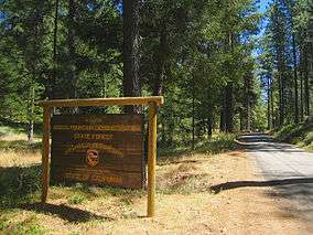
Entrance to Boggs Mountain Demonstration State Forest on Forestry Rd., Cobb, CA | |
  | |
| Location | Lake County, California |
| Nearest city | Cobb, California |
| Coordinates | 38°49′N 122°41′W / 38.82°N 122.69°WCoordinates: 38°49′N 122°41′W / 38.82°N 122.69°W |
| Area | 3,433 acres (14 km2) |
| Established | 1949 |
| Governing body | Calfire |
Boggs Mountain Demonstration State Forest is a state forest located on State Route 175, eight miles (13 km) south of Clear Lake in Lake County, California, USA. It is one of the largest mountains in the area, with a length of 10 miles (16 km) east to west and width of 4 miles (6 km) north to south. The mountain's highest point is 3,750 feet (1,143 m) elevation. Like nearby mountains such as Cobb Mountain, Boggs is volcanic in origin. It receives heavy rainfall, winter snow and has at least two perennial springs. Boggs Mountain State Forest is managed by the California Department of Forestry (CDF). CDF (now officially renamed Cal-Fire) purchased 3,433 acres (13.89 km2) in 1949 from the Calso Company for 38,000 dollars[1] Due to hazards from the Valley Fire, the forest is now closed until further notice.[2]
History
One of the earliest names given to the mountain was Harbin, from James M. Harbin who lived on the eastern side around 1856 and built the first resort in the area, still in operation today as Harbin Hot Springs.[3] Later, the name changed to Digger Jones Mountain, then for a short time, Hawley's Mountain after Hawley who died around 1870.
The Boggs family
Henry C. Boggs was the son of Liburn W. Boggs, a Napa Valley farmer, merchant and former governor of the state of Missouri. In 1880, Henry C. bought a small lot on the eastern edge of the present forest boundary, moved his sawmill there and cut stands of Ponderosa pine, sugar pine and Douglas-fir. By 1884, he had bought (and logged) most of the area of the state forest. The Farmers Savings Bank became the owners of the property in 1898.
The property was sold several times after 1898 and one of the owners was Jim McCauley, who died in 1941. His heirs then sold the timber rights to Setzer Forest Products. Setzer clearcut more than 2,800 acres (11 km2) of the property.
The state purchases the land
Under the authority of the State Forest Purchase Act (Section 4631 of the public Resources code), California purchased the land intending the use as a demonstration forest. Setzer completed logging operations in 1950, and by 1954, all timber interests and titles were conveyed to the state.[4]
Forestry and recreation
The forest is managed as multiple-use, so in addition to logging, there are two campgrounds and 22 miles (35 km) of dirt roads, 14 miles (23 km) of trails for hiking, mountain biking and horseback riding. There is a variety of terrain including meadows, ridge tops, and dense forests of pine, canyon live oak, black oak, Western dogwood and madrone. Campsites consist of tables and fire rings. No water is available. Camping, campfires and use of gas stoves are limited to campgrounds.
According to data from the Boggs Mountain State Demonstration Forest brochure, the timber growth rate of the forest is 300 board feet per acre per year.
Hunting is permitted under applicable State game laws. Pets are welcome but must be leashed and controlled. Horses are allowed in camp only with a special use permit.[5] All Terrain Vehicles (ATV) are not allowed at Boggs; only street legal vehicles are allowed and must stay on the forest roadways.
CDF also maintains a helicopter base at Boggs Mountain which was established in 1972 for fire and rescue operations and provides coverage for Mendocino National Forest to the north, San Francisco Bay Area to the south and the Sacramento Valley to the east.[6]
References
Mauldin, Henry Mountains & Pioneers of Lake County(book) Earthen Vessels Productions, Inc, 1995, pp 11–13
Footnotes
- ↑ Mauldin, Henry Mountains & Pioneers of Lake County(book) Earthen Vessels Productions, Inc, 1995 pp 13
- ↑ http://calfire.ca.gov/resource_mgt/resource_mgt_stateforests_boggsmtn
- ↑ Harbin Hot Springs'Frequently Asked Questions Archived November 25, 2007, at the Wayback Machine.
- ↑ The Friends of Boggs Mountain website, state ownership page. retrieved 2-13-2008
- ↑ CDF webpage on regulations in state forests. Retrieved 2-11-2008
- ↑ CDF information document retrieved 6-15-2008
External links
- The Friends of Boggs Mountain
- The California Department of Forestry: "statewide Demonstration Forests"