Happy Camp, California
| Happy Camp athithúf-vuunupma | |
|---|---|
| census-designated place | |
 Happy Camp Location within the state of California | |
| Coordinates: 41°47′48″N 123°22′31″W / 41.79667°N 123.37528°WCoordinates: 41°47′48″N 123°22′31″W / 41.79667°N 123.37528°W | |
| Country |
|
| State |
|
| County |
|
| Area[1] | |
| • Total | 12.346 sq mi (31.976 km2) |
| • Land | 12.107 sq mi (31.357 km2) |
| • Water | 0.239 sq mi (0.619 km2) 1.94% |
| Elevation | 1,660 ft (505 m) |
| Population (2010) | |
| • Total | 1,190 |
| • Density | 96/sq mi (37/km2) |
| Time zone | PST (UTC-8) |
| • Summer (DST) | PDT (UTC-7) |
| ZIP Code | 96039 |
| Area code(s) | 530 |
Happy Camp (Karuk: athithúf-vuunupma)[2] is a census-designated place (CDP) in Siskiyou County, California in the United States. The population was 1,190 at the 2010 census.
The town of Happy Camp "The Heart of the Klamath" is located on State Route 96, about 70 miles (110 km) west of Interstate 5 and 100 miles (160 km) northeast of Willow Creek. The town of O'Brien, Oregon is accessible from Happy Camp (which is nearly 40 miles (64 km) away). The shortest route to Oregon, over the Grey Back pass, is a seasonal summer road and is not cleared or maintained in snowy conditions. The Forest Service, located in Happy Camp on SR 96,[3] provides road closure information.
Name
Happy Camp was so named by miners in early days of prosperity.[4] It has frequently been noted on lists of unusual place names.[5][6] H. C. Chester, who interviewed Jack Titus in 1882 or 83, states that Titus named the camp because his partner James Camp, upon arriving there, exclaimed "This is the happiest day in my life." Redick McKee mentions the camp on Nov 8, 1851, as 'Mr Roache's Happy Camp' at the place known as Murderer's Bar (Indian Report 1853:178)[7]
Geography
Happy Camp sits on the Klamath River and a nexus of creeks including: Elk Creek; Little Grider Creek; Indian Creek; Doolittle Creek; Ikes Creek; Deer Lick Creek and Cade Creek.
According to the United States Census Bureau, the CDP covers an area of 12.3 square miles (32 km2), 12.1 square miles (31 km2) of it is land and 0.2 square miles (0.52 km2) of it (1.94%) is water.
The town of Happy Camp is also known as the "Gateway to the Marbles." There are many trail heads for this Wilderness Area within 10 miles (16 km) of the town for which the U.S. Forest Service provides trail information. The Marble Mountains cover thousands of acres, and contain almost a hundred lakes. Among the most interesting lakes are Spirit Lake, which contains a luminescent chemical and has been seen to "glow" in the dark; Ukonom Lake, which is very large and beautiful even though the area is recovering from fire damage; and the Green and Blue Granite Lakes, where trout swim in the cold and clear waters. Deer, bear, elk, and mountain lion are common in the Wilderness Area.
Demographics
The 2010 United States Census[8] reported that Happy Camp had a population of 1,190. The population density was 96.4 people per square mile (37.2/km²). The racial makeup of Happy Camp was 814 (68.4%) White, 2 (0.2%) African American, 277 (23.3%) Native American, 7 (0.6%) Asian, 1 (0.1%) Pacific Islander, 18 (1.5%) from other races, and 71 (6.0%) from two or more races. Hispanic or Latino of any race were 95 persons (8.0%).
The Census reported that 1,190 people (100% of the population) lived in households, 0 (0%) lived in non-institutionalized group quarters, and 0 (0%) were institutionalized.
There were 525 households, out of which 129 (24.6%) had children under the age of 18 living in them, 208 (39.6%) were opposite-sex married couples living together, 63 (12.0%) had a female householder with no husband present, 26 (5.0%) had a male householder with no wife present. There were 63 (12.0%) unmarried opposite-sex partnerships, and 5 (1.0%) same-sex married couples or partnerships. 175 households (33.3%) were made up of individuals and 67 (12.8%) had someone living alone who was 65 years of age or older. The average household size was 2.27. There were 297 families (56.6% of all households); the average family size was 2.84.
The population was spread out with 238 people (20.0%) under the age of 18, 98 people (8.2%) aged 18 to 24, 232 people (19.5%) aged 25 to 44, 428 people (36.0%) aged 45 to 64, and 194 people (16.3%) who were 65 years of age or older. The median age was 47.3 years. For every 100 females there were 107.0 males. For every 100 females age 18 and over, there were 110.2 males.
There were 646 housing units at an average density of 52.3 per square mile (20.2/km²), of which 299 (57.0%) were owner-occupied, and 226 (43.0%) were occupied by renters. The homeowner vacancy rate was 3.4%; the rental vacancy rate was 8.0%. 677 people (56.9% of the population) lived in owner-occupied housing units and 513 people (43.1%) lived in rental housing units.
Climate
As typical of California, Happy Camp has a mediterranean climate.[9] It is marked by very hot summer days, being shielded in the valley behind the mountains from the cooling Pacific influence affecting nearby coastal locations. The winters are much cooler than in inland locations further south, albeit still very mild compared to areas to the east of the continent. The dry and hot summers make the surrounding forest prone to wildfires, seen in a 2014 disaster, when it took months to extinguish an extensive fire that almost went up to the Oregon border.[10] The high winter rainfall however, keeps the area greener than its summer climate would suggest. Average lows remain cool year-round, relieving the intense daytime heat and keeping the average July temperature at around 73 °F (23 °C) in sharp contrast to the 95 °F (35 °C) average highs.[11]
| Climate data for Happy Camp | |||||||||||||
|---|---|---|---|---|---|---|---|---|---|---|---|---|---|
| Month | Jan | Feb | Mar | Apr | May | Jun | Jul | Aug | Sep | Oct | Nov | Dec | Year |
| Record high °F (°C) | 64.9 (18.3) |
80.1 (26.7) |
91.9 (33.3) |
95 (35) |
108 (42.2) |
111.9 (44.4) |
115 (46.1) |
115 (46.1) |
109.9 (43.3) |
100 (37.8) |
82 (27.8) |
69.1 (20.6) |
115 (46.1) |
| Average high °F (°C) | 46.2 (7.9) |
53.8 (12.1) |
61 (16.1) |
70 (21.1) |
77.7 (25.4) |
85.6 (29.8) |
95 (35) |
94.1 (34.5) |
86.9 (30.5) |
72.1 (22.3) |
56.1 (13.4) |
46.9 (8.3) |
70.45 (21.37) |
| Daily mean °F (°C) | 38.7 (3.7) |
43.3 (6.3) |
47.7 (8.7) |
53.8 (12.1) |
59.7 (15.4) |
66.4 (19.1) |
73 (22.8) |
72 (22.2) |
66 (18.9) |
56.1 (13.4) |
45.7 (7.6) |
39.9 (4.4) |
55.19 (12.88) |
| Average low °F (°C) | 30.7 (−0.7) |
33.1 (0.6) |
34.3 (1.3) |
37.6 (3.1) |
42.1 (5.6) |
46.9 (8.3) |
51.3 (10.7) |
49.8 (9.9) |
45.1 (7.3) |
39.9 (4.4) |
35.8 (2.1) |
33.1 (0.6) |
39.98 (4.43) |
| Record low °F (°C) | 6.1 (−14.4) |
6.1 (−14.4) |
19 (−7.2) |
21.9 (−5.6) |
21.9 (−5.6) |
27 (−2.8) |
28 (−2.2) |
30 (−1.1) |
24.1 (−4.4) |
18 (−7.8) |
10 (−12.2) |
−2 (−18.9) |
−2 (−18.9) |
| Average precipitation inches (mm) | 9.49 (241) |
7.13 (181) |
5.87 (149) |
2.83 (72) |
1.69 (43) |
0.83 (21) |
0.35 (9) |
0.35 (9) |
0.91 (23) |
3.35 (85) |
7.32 (186) |
9.37 (238) |
49.49 (1,257) |
| Average precipitation days | 14 | 12 | 12 | 9 | 7 | 4 | 1 | 2 | 3 | 7 | 11 | 13 | 95 |
| Source: [12] | |||||||||||||
Karuk Tribe
The Karuk Tribe is headquartered in Happy Camp.
United States Forest Service
The U.S. Forest Service maintains an office in town. Happy Camp is the administration site for the Happy Camp/Oak Knoll Ranger Districts of the Klamath National Forest.[3]
Education
- Happy Camp Elementary School
- Happy Camp High School
- Jefferson High Continuation School
- College of the Siskiyous - Happy Camp
Government
Klamath Controversy: Gold prospectors, conservation groups, the California Department of Fish and Game, the U.S. Forest Service, and the Karuk, Hoopa and Yurok tribes are at odds with each other over what constitutes fair and ethical use of the river.{{POV-statement}} A range of issues include property rights, endangered species, and Native American civil rights.[13]
In the state legislature Happy Camp is in the 1st Senate District, represented by Republican Ted Gaines,[14] and the 1st Assembly District, represented by Republican Brian Dahle.[15]
Federally, Happy Camp is in California's 1st congressional district, represented by Republican Doug LaMalfa.[16]
Notable people
- Daniel R. Hokanson, lieutenant general in the United States Army.[17]
- Jetty Rae, musician and independent artist lived in Happy Camp during her childhood.[18]
- Ricky Ray, pro-football quarterback was born in Happy Camp and went to Shasta High and Shasta College.[19]
See also
Happy Camp Family Resource Center
References
- ↑ U.S. Census
- ↑ Bright, William. "Karuk language section. Revised Karuk dictionary section. Karuk "a" (karuk_A_00-7-6.doc)". Retrieved 2012-07-06.
- 1 2 National Forest - Contact Us "Klamath National Forest - Contact Us" Check
|url=value (help). About the Forest. USDA Forest Service. Jan 21, 2010. Retrieved February 2, 2010.Happy Camp/Oak Knoll Ranger District 63822 Highway 96 P.O. Box 377 Happy Camp, CA 96039-0377 (530) 493-2243 FAX (530) 493-1796 TDD (530) 493-1777
- ↑ Gannett, Henry (1905). The Origin of Certain Place Names in the United States. Govt. Print. Off. p. 149.
- ↑ Thompson, George E. (2009). You Live Where?: Interesting and Unusual Facts about where We Live. iUniverse. p. 11.
- ↑ Gallant, Frank K. (2012). A Place Called Peculiar: Stories about Unusual American Place-Names. Courier Dover Publications. p. 25.
- ↑ Gudde, Erwin G. (1998). California place names : the origin and etymology of current geographical names (4th ed., rev. and enl. ed.). Berkeley: University of California Press. p. 159. ISBN 0520213165.
- ↑ "2010 Census Interactive Population Search: CA - Happy Camp CDP". U.S. Census Bureau. Retrieved July 12, 2014.
- ↑ "Happy Camp, California Climate Summary". Weatherbase. Retrieved 21 June 2015.
- ↑ "Happy Camp Complex". Incident Information System. Retrieved 21 June 2015.
- ↑ "Happy Camp, California Temperature Averages". Weatherbase. Retrieved 21 June 2015.
- ↑ http://www.weatherbase.com/weather/weather.php3?s=167340&cityname=Happy-Camp-California-United-States-of-America. Retrieved 3 November 2014. Missing or empty
|title=(help) - ↑ Larson, Elizabeth (November 16, 2009). "Rural California: Battle over suction dredge mining headed for court" (PDF). Lake County News. p. 3. Retrieved February 2, 2010.
The ongoing battle over suction dredge mining is headed to federal court, as a group of miners plans to challenge a state-imposed moratorium on the practice which went into effect in August, 2010. The topic of suction dredge mining is a complex one, complete with proponents and opponents with fiercely held views, each bringing to the table science that backs their stances and a deep ideological divide about the use of natural resources.
- ↑ "Senators". State of California. Retrieved March 10, 2013.
- ↑ "Members Assembly". State of California. Retrieved March 2, 2013.
- ↑ "California's 1st Congressional District - Representatives & District Map". Civic Impulse, LLC. Retrieved March 1, 2013.
- ↑ "Happy Camp Graduate Becomes Lt. General". Siskiyou Daily News. Yreka, CA. September 16, 2015.
- ↑ Rae, Jetty (February 12, 2011). "Woman to Woman" (Interview). Interview with Phyllis Wallace. KFUO-AM. Retrieved March 20, 2013.
- ↑ Lawrence, Thomas, Ray's success a valuable lesson in heart: Shasta High and Shasta College QB has had incredible Canadian career, The Redding Searchlight, November 30, 2012
External links
- Happy Camp, California at DMOZ
- Happy Camp Chamber of Commerce
- Happy Camp News
- Virtual tour of the State of Jefferson Scenic Byway along the Klamath River.
| States and counties | 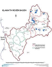 | |
|---|---|---|
| Significant cities | ||
| Major tributaries | ||
| Geography | ||
| Native American tribes | ||
| History | ||
| Dams and infrastructure |
| |
Municipalities and communities of Siskiyou County, California, United States | ||
|---|---|---|
| Cities | 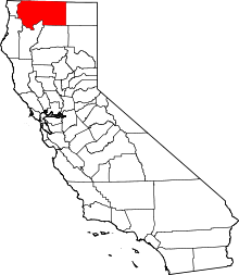 | |
| CDPs | ||
| Unincorporated communities | ||
| Indian reservation | ||
| Ghost towns | ||
| Footnotes | ‡This populated place also has portions in an adjacent county or counties | |