Weitchpec, California
Coordinates: 41°11′17″N 123°42′30″W / 41.18806°N 123.70833°W
| Weitchpec | |
|---|---|
| Unincorporated community | |
 Weitchpec Location in California | |
| Coordinates: 41°11′17″N 123°42′30″W / 41.18806°N 123.70833°W | |
| Country | United States |
| State | California |
| County | Humboldt County |
| Elevation[1] | 361 ft (110 m) |
| Zip code | 95546 |
Weitchpec (formerly, Durkee's Ferry and Weitchpec Bar)[2] (Karuk: ansáfriik,[3] Yurok: Wechpues, Wech) [4] is an unincorporated community in Humboldt County, California, United States.[1] It is located 35 miles (56 km) northeast of Eureka,[2] at an elevation of 361 feet (110 m).[1] The ZIP Code is 95546.[5]
Weitchpec (pronounced Wech-Peck)[6] is located in the northwestern part of the state at the confluence of the Klamath and Trinity Rivers, and the junction of State Highways 96 and 169.[7]
History
Weitchpec was originally the site of a Yurok village. The name Durkee's Ferry recalls Clark W. Durkee, who operated a ferry at the place in 1851.[2] In 1855, a temporary Federal post called Camp Strowbridge was established at Weitchpec, it was later called Fort Wool. The settlement was first within the bounds of Trinity County, then in 1851 Klamath County and after 1874, Humboldt County. A post office operated at Weitchpec from 1858 to 1860 and from 1891 to 1962.[2]
Today Weitchpec features Pearson's Grocery, a small store/gas station; the Yurok Tribal Office and Community Center; and Weitchpec Elementary School. As of 2010, evening classes were available in Weitchpec in the Yurok language.[8]
2012 earthquake
A 5.6 earthquake with an epicenter near Weitchpec struck on February 13, 2012.[9]
See also
-
 California portal
References
- 1 2 3 U.S. Geological Survey Geographic Names Information System: Weitchpec, California
- 1 2 3 4 Durham, David L. (1998). California's Geographic Names: A Gazetteer of Historic and Modern Names of the State. Clovis, Calif.: Word Dancer Press. p. 165. ISBN 1-884995-14-4.
- ↑ Bright, William; Susan Gehr. "Karuk Dictionary and Texts". Retrieved 2012-07-06.
- ↑ "Yurok Dictionary: Wechpues". Retrieved 2012-07-07.
- ↑ USPS ZIP Code lookup tool
- ↑ per Greg Long, The Making of Bigfoot (2004), page 32
- ↑ USGS Map "Weitchpec Quadrangle, 1997" 7.5 min. series
- ↑
- Atherton, Kelley. "Back from the Brink: Learning the Yurok Language". The Daily Triplicate. Published 16 October 2010. Accessed 30 April 2012.
- ↑ Strong Motion Stations for 5.6Mw Weitchpec Earthquake of 13 Feb 2012, 1307 PST, Retrieved January 1, 2015
| States and counties | 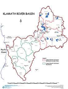 | |
|---|---|---|
| Significant cities | ||
| Major tributaries | ||
| Geography | ||
| Native American tribes | ||
| History | ||
| Dams and infrastructure |
| |
