Reuilly, Eure
| Reuilly | ||
|---|---|---|
 | ||
| ||
 Reuilly | ||
|
Location within Normandy region  Reuilly | ||
| Coordinates: 49°04′46″N 1°13′27″E / 49.0794°N 1.2242°ECoordinates: 49°04′46″N 1°13′27″E / 49.0794°N 1.2242°E | ||
| Country | France | |
| Region | Normandy | |
| Department | Eure | |
| Arrondissement | Évreux | |
| Canton | Évreux-Nord | |
| Intercommunality | Évreux | |
| Government | ||
| • Mayor (2008–2014) | Thierry Lefrançois | |
| Area1 | 9.73 km2 (3.76 sq mi) | |
| Population (2008)2 | 557 | |
| • Density | 57/km2 (150/sq mi) | |
| Time zone | CET (UTC+1) | |
| • Summer (DST) | CEST (UTC+2) | |
| INSEE/Postal code | 27489 / 27930 | |
| Elevation |
49–144 m (161–472 ft) (avg. 139 m or 456 ft) | |
|
1 French Land Register data, which excludes lakes, ponds, glaciers > 1 km² (0.386 sq mi or 247 acres) and river estuaries. 2 Population without double counting: residents of multiple communes (e.g., students and military personnel) only counted once. | ||
.svg.png)
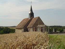
Reuilly is a commune in the Eure department in northern France.
Population
| Historical population | ||
|---|---|---|
| Year | Pop. | ±% |
| 1793 | 330 | — |
| 1800 | 328 | −0.6% |
| 1806 | 354 | +7.9% |
| 1821 | 315 | −11.0% |
| 1831 | 334 | +6.0% |
| 1836 | 349 | +4.5% |
| 1841 | 372 | +6.6% |
| 1846 | 323 | −13.2% |
| 1851 | 299 | −7.4% |
| 1856 | 291 | −2.7% |
| 1861 | 286 | −1.7% |
| 1866 | 286 | +0.0% |
| 1872 | 246 | −14.0% |
| 1876 | 254 | +3.3% |
| 1881 | 231 | −9.1% |
| 1886 | 249 | +7.8% |
| 1891 | 234 | −6.0% |
| 1896 | 233 | −0.4% |
| 1901 | 217 | −6.9% |
| 1906 | 211 | −2.8% |
| 1911 | 197 | −6.6% |
| 1921 | 203 | +3.0% |
| 1926 | 193 | −4.9% |
| 1931 | 178 | −7.8% |
| 1936 | 180 | +1.1% |
| 1946 | 203 | +12.8% |
| 1954 | 219 | +7.9% |
| 1962 | 223 | +1.8% |
| 1968 | 199 | −10.8% |
| 1975 | 239 | +20.1% |
| 1982 | 322 | +34.7% |
| 1990 | 426 | +32.3% |
| 1999 | 501 | +17.6% |
| 2008 | 557 | +11.2% |
See also
References
| Wikimedia Commons has media related to Reuilly (Eure). |
This article is issued from Wikipedia - version of the 2/11/2016. The text is available under the Creative Commons Attribution/Share Alike but additional terms may apply for the media files.