Lorleau
| Lorleau | |
|---|---|
 | |
 Lorleau | |
|
Location within Normandy region  Lorleau | |
| Coordinates: 49°24′54″N 1°30′07″E / 49.415°N 1.502°ECoordinates: 49°24′54″N 1°30′07″E / 49.415°N 1.502°E | |
| Country | France |
| Region | Normandy |
| Department | Eure |
| Arrondissement | Les Andelys |
| Canton | Lyons-la-Forêt |
| Government | |
| • Mayor (2008–2014) | Jean-Michel Paris |
| Area1 | 12.31 km2 (4.75 sq mi) |
| Population (2008)2 | 152 |
| • Density | 12/km2 (32/sq mi) |
| Time zone | CET (UTC+1) |
| • Summer (DST) | CEST (UTC+2) |
| INSEE/Postal code | 27373 / 27480 |
| Elevation |
86–171 m (282–561 ft) (avg. 154 m or 505 ft) |
|
1 French Land Register data, which excludes lakes, ponds, glaciers > 1 km² (0.386 sq mi or 247 acres) and river estuaries. 2 Population without double counting: residents of multiple communes (e.g., students and military personnel) only counted once. | |
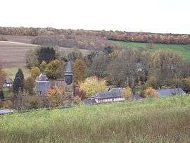
Lorleau is a commune in the Eure department in Haute-Normandie in northern France.
Population
| Historical population | ||
|---|---|---|
| Year | Pop. | ±% |
| 1868 | 354 | — |
| 1962 | 107 | −69.8% |
| 1968 | 119 | +11.2% |
| 1975 | 111 | −6.7% |
| 1982 | 110 | −0.9% |
| 1990 | 118 | +7.3% |
| 1999 | 137 | +16.1% |
| 2008 | 152 | +10.9% |
See also
References
| Wikimedia Commons has media related to Lorleau. |
This article is issued from Wikipedia - version of the 11/9/2013. The text is available under the Creative Commons Attribution/Share Alike but additional terms may apply for the media files.