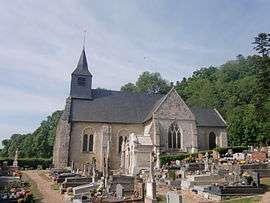
Manneville-la-Raoult
| Manneville-la-Raoult | |
|---|---|
 | |
 Manneville-la-Raoult | |
|
Location within Normandy region  Manneville-la-Raoult | |
| Coordinates: 49°22′26″N 0°19′01″E / 49.374°N 0.317°ECoordinates: 49°22′26″N 0°19′01″E / 49.374°N 0.317°E | |
| Country | France |
| Region | Normandy |
| Department | Eure |
| Arrondissement | Bernay |
| Canton | Beuzeville |
| Intercommunality | Canton de Beuzeville |
| Government | |
| • Mayor (2008–2014) | Maurice Dozeville |
| Area1 | 7.37 km2 (2.85 sq mi) |
| Population (2008)2 | 512 |
| • Density | 69/km2 (180/sq mi) |
| Time zone | CET (UTC+1) |
| • Summer (DST) | CEST (UTC+2) |
| INSEE/Postal code | 27243 / 27210 |
| Elevation |
17–128 m (56–420 ft) (avg. 73 m or 240 ft) |
|
1 French Land Register data, which excludes lakes, ponds, glaciers > 1 km² (0.386 sq mi or 247 acres) and river estuaries. 2 Population without double counting: residents of multiple communes (e.g., students and military personnel) only counted once. | |
Manneville-la-Raoult is a commune in the Eure department in Haute-Normandie in northern France.
Population
| Historical population | ||
|---|---|---|
| Year | Pop. | ±% |
| 1962 | 260 | — |
| 1968 | 241 | −7.3% |
| 1975 | 260 | +7.9% |
| 1982 | 331 | +27.3% |
| 1990 | 336 | +1.5% |
| 1999 | 416 | +23.8% |
| 2008 | 512 | +23.1% |
See also
References
| Wikimedia Commons has media related to Manneville-la-Raoult. |
This article is issued from Wikipedia - version of the 11/9/2013. The text is available under the Creative Commons Attribution/Share Alike but additional terms may apply for the media files.