Gauville-la-Campagne
| Gauville-la-Campagne | ||
|---|---|---|
|
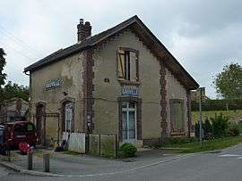
Former train station | ||
| ||
 Gauville-la-Campagne | ||
|
Location within Normandy region  Gauville-la-Campagne | ||
| Coordinates: 49°02′56″N 1°05′14″E / 49.0489°N 1.0872°ECoordinates: 49°02′56″N 1°05′14″E / 49.0489°N 1.0872°E | ||
| Country | France | |
| Region | Normandy | |
| Department | Eure | |
| Arrondissement | Évreux | |
| Canton | Évreux-Nord | |
| Intercommunality | Évreux | |
| Government | ||
| • Mayor (2008–2014) | Josette Harent | |
| Area1 | 6.15 km2 (2.37 sq mi) | |
| Population (2008)2 | 515 | |
| • Density | 84/km2 (220/sq mi) | |
| Time zone | CET (UTC+1) | |
| • Summer (DST) | CEST (UTC+2) | |
| INSEE/Postal code | 27282 / 27930 | |
| Elevation |
107–146 m (351–479 ft) (avg. 139 m or 456 ft) | |
|
1 French Land Register data, which excludes lakes, ponds, glaciers > 1 km² (0.386 sq mi or 247 acres) and river estuaries. 2 Population without double counting: residents of multiple communes (e.g., students and military personnel) only counted once. | ||
.svg.png)
Gauville-la-Campagne is a commune in the Eure department in northern France.
Population
| Historical population | ||
|---|---|---|
| Year | Pop. | ±% |
| 1962 | 172 | — |
| 1968 | 194 | +12.8% |
| 1975 | 275 | +41.8% |
| 1982 | 431 | +56.7% |
| 1990 | 544 | +26.2% |
| 1999 | 537 | −1.3% |
| 2008 | 515 | −4.1% |
See also
References
External links
| Wikimedia Commons has media related to Gauville-la-Campagne. |
This article is issued from Wikipedia - version of the 3/15/2016. The text is available under the Creative Commons Attribution/Share Alike but additional terms may apply for the media files.