Le Favril, Eure
| Le Favril | |
|---|---|
|
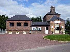
Town hall and school | |
 Le Favril | |
|
Location within Normandy region  Le Favril | |
| Coordinates: 49°11′01″N 0°31′57″E / 49.1836°N 0.5325°ECoordinates: 49°11′01″N 0°31′57″E / 49.1836°N 0.5325°E | |
| Country | France |
| Region | Normandy |
| Department | Eure |
| Arrondissement | Bernay |
| Canton | Thiberville |
| Government | |
| • Mayor (2008–2014) | Christian Verkinder |
| Area1 | 4.03 km2 (1.56 sq mi) |
| Population (2008)2 | 163 |
| • Density | 40/km2 (100/sq mi) |
| Time zone | CET (UTC+1) |
| • Summer (DST) | CEST (UTC+2) |
| INSEE/Postal code | 27237 / 27230 |
| Elevation |
167–176 m (548–577 ft) (avg. 175 m or 574 ft) |
|
1 French Land Register data, which excludes lakes, ponds, glaciers > 1 km² (0.386 sq mi or 247 acres) and river estuaries. 2 Population without double counting: residents of multiple communes (e.g., students and military personnel) only counted once. | |
Le Favril is a commune in the Eure department in the Haute-Normandie region in northern France.
Population
| Historical population | ||
|---|---|---|
| Year | Pop. | ±% |
| 1962 | 189 | — |
| 1968 | 191 | +1.1% |
| 1975 | 153 | −19.9% |
| 1982 | 146 | −4.6% |
| 1990 | 141 | −3.4% |
| 1999 | 145 | +2.8% |
| 2008 | 163 | +12.4% |
See also
References
| Wikimedia Commons has media related to Le Favril (Eure). |
This article is issued from Wikipedia - version of the 11/6/2013. The text is available under the Creative Commons Attribution/Share Alike but additional terms may apply for the media files.