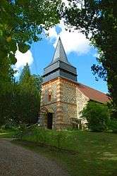
Chauvincourt-Provemont
| Chauvincourt-Provemont | |
|---|---|
 | |
 Chauvincourt-Provemont | |
|
Location within Normandy region  Chauvincourt-Provemont | |
| Coordinates: 49°16′43″N 1°38′25″E / 49.2786°N 1.6403°ECoordinates: 49°16′43″N 1°38′25″E / 49.2786°N 1.6403°E | |
| Country | France |
| Region | Normandy |
| Department | Eure |
| Arrondissement | Les Andelys |
| Canton | Étrépagny |
| Intercommunality | Canton d'Étrépagny |
| Government | |
| • Mayor (2008–2014) | Fernand Vieren |
| Area1 | 10.83 km2 (4.18 sq mi) |
| Population (2008)2 | 329 |
| • Density | 30/km2 (79/sq mi) |
| Time zone | CET (UTC+1) |
| • Summer (DST) | CEST (UTC+2) |
| INSEE/Postal code | 27153 / 27150 |
| Elevation | 64–102 m (210–335 ft) |
|
1 French Land Register data, which excludes lakes, ponds, glaciers > 1 km² (0.386 sq mi or 247 acres) and river estuaries. 2 Population without double counting: residents of multiple communes (e.g., students and military personnel) only counted once. | |
Chauvincourt-Provemont is a commune in the Eure department in northern France.
Population
| Historical population | ||
|---|---|---|
| Year | Pop. | ±% |
| 1962 | 281 | — |
| 1968 | 289 | +2.8% |
| 1975 | 263 | −9.0% |
| 1982 | 243 | −7.6% |
| 1990 | 248 | +2.1% |
| 1999 | 293 | +18.1% |
| 2008 | 329 | +12.3% |
See also
References
| Wikimedia Commons has media related to Chauvincourt-Provemont. |
This article is issued from Wikipedia - version of the 11/5/2013. The text is available under the Creative Commons Attribution/Share Alike but additional terms may apply for the media files.