Flipou
| Flipou | |
|---|---|
 | |
 Flipou | |
|
Location within Normandy region  Flipou | |
| Coordinates: 49°18′55″N 1°16′48″E / 49.3153°N 1.28°ECoordinates: 49°18′55″N 1°16′48″E / 49.3153°N 1.28°E | |
| Country | France |
| Region | Normandy |
| Department | Eure |
| Arrondissement | Les Andelys |
| Canton | Fleury-sur-Andelle |
| Intercommunality | L'Andelle |
| Government | |
| • Mayor (2008–2014) | Émile Vigneux |
| Area1 | 6.97 km2 (2.69 sq mi) |
| Population (2008)2 | 340 |
| • Density | 49/km2 (130/sq mi) |
| Time zone | CET (UTC+1) |
| • Summer (DST) | CEST (UTC+2) |
| INSEE/Postal code | 27247 / 27380 |
| Elevation |
25–157 m (82–515 ft) (avg. 90 m or 300 ft) |
|
1 French Land Register data, which excludes lakes, ponds, glaciers > 1 km² (0.386 sq mi or 247 acres) and river estuaries. 2 Population without double counting: residents of multiple communes (e.g., students and military personnel) only counted once. | |
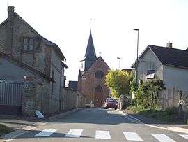
Flipou is a commune in the Eure department in the Haute-Normandie region in northern France.
Population
| Historical population | ||
|---|---|---|
| Year | Pop. | ±% |
| 1793 | 362 | — |
| 1800 | 334 | −7.7% |
| 1806 | 362 | +8.4% |
| 1821 | 276 | −23.8% |
| 1831 | 262 | −5.1% |
| 1836 | 286 | +9.2% |
| 1841 | 273 | −4.5% |
| 1846 | 258 | −5.5% |
| 1851 | 267 | +3.5% |
| 1856 | 360 | +34.8% |
| 1861 | 351 | −2.5% |
| 1866 | 322 | −8.3% |
| 1872 | 316 | −1.9% |
| 1876 | 272 | −13.9% |
| 1881 | 298 | +9.6% |
| 1886 | 258 | −13.4% |
| 1891 | 219 | −15.1% |
| 1896 | 231 | +5.5% |
| 1901 | 212 | −8.2% |
| 1906 | 210 | −0.9% |
| 1911 | 207 | −1.4% |
| 1921 | 233 | +12.6% |
| 1926 | 217 | −6.9% |
| 1931 | 195 | −10.1% |
| 1936 | 191 | −2.1% |
| 1946 | 188 | −1.6% |
| 1954 | 195 | +3.7% |
| 1962 | 177 | −9.2% |
| 1968 | 217 | +22.6% |
| 1975 | 223 | +2.8% |
| 1982 | 275 | +23.3% |
| 1990 | 310 | +12.7% |
| 1999 | 310 | +0.0% |
| 2008 | 340 | +9.7% |
See also
References
| Wikimedia Commons has media related to Flipou. |
This article is issued from Wikipedia - version of the 3/15/2016. The text is available under the Creative Commons Attribution/Share Alike but additional terms may apply for the media files.