Hacqueville
| Hacqueville | |
|---|---|
 | |
 Hacqueville | |
|
Location within Normandy region  Hacqueville | |
| Coordinates: 49°16′57″N 1°33′23″E / 49.2825°N 1.5564°ECoordinates: 49°16′57″N 1°33′23″E / 49.2825°N 1.5564°E | |
| Country | France |
| Region | Normandy |
| Department | Eure |
| Arrondissement | Les Andelys |
| Canton | Étrépagny |
| Intercommunality | Canton d'Étrépagny |
| Government | |
| • Mayor (2008–2014) | Jean-Jacques Pilinski |
| Area1 | 9.81 km2 (3.79 sq mi) |
| Population (2008)2 | 467 |
| • Density | 48/km2 (120/sq mi) |
| Time zone | CET (UTC+1) |
| • Summer (DST) | CEST (UTC+2) |
| INSEE/Postal code | 27310 / 27150 |
| Elevation |
95–151 m (312–495 ft) (avg. 118 m or 387 ft) |
|
1 French Land Register data, which excludes lakes, ponds, glaciers > 1 km² (0.386 sq mi or 247 acres) and river estuaries. 2 Population without double counting: residents of multiple communes (e.g., students and military personnel) only counted once. | |
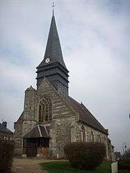
Hacqueville is a commune in the Eure department in north western France.
Population
| Historical population | ||
|---|---|---|
| Year | Pop. | ±% |
| 1962 | 346 | — |
| 1968 | 378 | +9.2% |
| 1975 | 293 | −22.5% |
| 1982 | 322 | +9.9% |
| 1990 | 368 | +14.3% |
| 1999 | 420 | +14.1% |
| 2008 | 467 | +11.2% |
Personalities
- Marc Isambart Brunel, builder of the Thames Tunnel, was born in Hacqueville in 1769.
See also
References
| Wikimedia Commons has media related to Hacqueville. |
This article is issued from Wikipedia - version of the 8/16/2016. The text is available under the Creative Commons Attribution/Share Alike but additional terms may apply for the media files.