Tosny
| Tosny | |
|---|---|
 | |
 Tosny | |
|
Location within Normandy region  Tosny | |
| Coordinates: 49°13′07″N 1°22′25″E / 49.2186°N 1.3736°ECoordinates: 49°13′07″N 1°22′25″E / 49.2186°N 1.3736°E | |
| Country | France |
| Region | Normandy |
| Department | Eure |
| Arrondissement | Les Andelys |
| Canton | Gaillon-Campagne |
| Intercommunality | Eure-Madrie-Seine |
| Government | |
| • Mayor (2008–2014) | Gérard Potel |
| Area1 | 15.02 km2 (5.80 sq mi) |
| Population (2008)2 | 644 |
| • Density | 43/km2 (110/sq mi) |
| Time zone | CET (UTC+1) |
| • Summer (DST) | CEST (UTC+2) |
| INSEE/Postal code | 27647 / 27700 |
| Elevation |
7–78 m (23–256 ft) (avg. 32 m or 105 ft) |
|
1 French Land Register data, which excludes lakes, ponds, glaciers > 1 km² (0.386 sq mi or 247 acres) and river estuaries. 2 Population without double counting: residents of multiple communes (e.g., students and military personnel) only counted once. | |
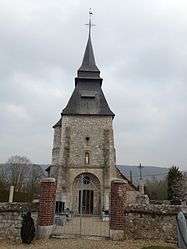
Tosny is a commune in the Eure department in Haute-Normandie in northern France, some ten miles south of Rouen.
Population
| Historical population | ||
|---|---|---|
| Year | Pop. | ±% |
| 1962 | 233 | — |
| 1968 | 303 | +30.0% |
| 1975 | 362 | +19.5% |
| 1982 | 362 | +0.0% |
| 1990 | 446 | +23.2% |
| 1999 | 569 | +27.6% |
| 2008 | 644 | +13.2% |
Personalities
See also
References
| Wikimedia Commons has media related to Tosny. |
This article is issued from Wikipedia - version of the 11/15/2013. The text is available under the Creative Commons Attribution/Share Alike but additional terms may apply for the media files.