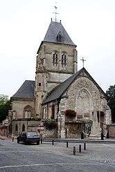
Alizay
For other uses referred to by a similar spelling, see Alizé.
| Alizay | |
|---|---|
 | |
 Alizay | |
|
Location within Normandy region  Alizay | |
| Coordinates: 49°19′18″N 1°10′36″E / 49.3217°N 1.1767°ECoordinates: 49°19′18″N 1°10′36″E / 49.3217°N 1.1767°E | |
| Country | France |
| Region | Normandy |
| Department | Eure |
| Arrondissement | Les Andelys |
| Canton | Pont-de-l'Arche |
| Intercommunality | Seine-Bord |
| Government | |
| • Mayor (2008–2014) | Gaëtan Levitre |
| Area1 | 8.62 km2 (3.33 sq mi) |
| Population (2008)2 | 1,374 |
| • Density | 160/km2 (410/sq mi) |
| Time zone | CET (UTC+1) |
| • Summer (DST) | CEST (UTC+2) |
| INSEE/Postal code | 27008 / 27460 |
| Elevation |
4–135 m (13–443 ft) (avg. 66 m or 217 ft) |
|
1 French Land Register data, which excludes lakes, ponds, glaciers > 1 km² (0.386 sq mi or 247 acres) and river estuaries. 2 Population without double counting: residents of multiple communes (e.g., students and military personnel) only counted once. | |
Alizay is a commune in the Eure department in Haute-Normandie in northern France.
Population
| Historical population | ||
|---|---|---|
| Year | Pop. | ±% |
| 1793 | 530 | — |
| 1800 | 482 | −9.1% |
| 1806 | 506 | +5.0% |
| 1821 | 526 | +4.0% |
| 1831 | 536 | +1.9% |
| 1836 | 570 | +6.3% |
| 1841 | 572 | +0.4% |
| 1846 | 654 | +14.3% |
| 1851 | 606 | −7.3% |
| 1856 | 608 | +0.3% |
| 1861 | 600 | −1.3% |
| 1866 | 550 | −8.3% |
| 1872 | 553 | +0.5% |
| 1876 | 553 | +0.0% |
| 1881 | 540 | −2.4% |
| 1886 | 601 | +11.3% |
| 1891 | 583 | −3.0% |
| 1896 | 562 | −3.6% |
| 1901 | 518 | −7.8% |
| 1906 | 520 | +0.4% |
| 1911 | 553 | +6.3% |
| 1921 | 559 | +1.1% |
| 1926 | 608 | +8.8% |
| 1931 | 642 | +5.6% |
| 1936 | 646 | +0.6% |
| 1946 | 684 | +5.9% |
| 1954 | 859 | +25.6% |
| 1962 | 802 | −6.6% |
| 1968 | 853 | +6.4% |
| 1975 | 865 | +1.4% |
| 1982 | 855 | −1.2% |
| 1990 | 1,090 | +27.5% |
| 1999 | 1,264 | +16.0% |
| 2008 | 1,374 | +8.7% |
See also
References
| Wikimedia Commons has media related to Alizay. |
This article is issued from Wikipedia - version of the 5/7/2015. The text is available under the Creative Commons Attribution/Share Alike but additional terms may apply for the media files.