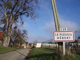
Le Plessis-Hébert
| Le Plessis-Hébert | |
|---|---|
 | |
 Le Plessis-Hébert | |
|
Location within Normandy region  Le Plessis-Hébert | |
| Coordinates: 48°59′24″N 1°21′09″E / 48.99°N 1.3525°ECoordinates: 48°59′24″N 1°21′09″E / 48.99°N 1.3525°E | |
| Country | France |
| Region | Normandy |
| Department | Eure |
| Arrondissement | Évreux |
| Canton | Pacy-sur-Eure |
| Intercommunality | Portes de l'Eure |
| Government | |
| • Mayor (2008–2014) | Claude Bricout |
| Area1 | 11.73 km2 (4.53 sq mi) |
| Population (2008)2 | 418 |
| • Density | 36/km2 (92/sq mi) |
| Time zone | CET (UTC+1) |
| • Summer (DST) | CEST (UTC+2) |
| INSEE/Postal code | 27465 / 27120 |
| Elevation |
55–133 m (180–436 ft) (avg. 129 m or 423 ft) |
|
1 French Land Register data, which excludes lakes, ponds, glaciers > 1 km² (0.386 sq mi or 247 acres) and river estuaries. 2 Population without double counting: residents of multiple communes (e.g., students and military personnel) only counted once. | |
Le Plessis-Hébert is a commune in the Eure department in Haute-Normandie in northern France.
Population
| Historical population | ||
|---|---|---|
| Year | Pop. | ±% |
| 1962 | 196 | — |
| 1968 | 201 | +2.6% |
| 1975 | 192 | −4.5% |
| 1982 | 258 | +34.4% |
| 1990 | 318 | +23.3% |
| 1999 | 345 | +8.5% |
| 2008 | 418 | +21.2% |
See also
References
| Wikimedia Commons has media related to Le Plessis-Hébert. |
This article is issued from Wikipedia - version of the 2/18/2016. The text is available under the Creative Commons Attribution/Share Alike but additional terms may apply for the media files.