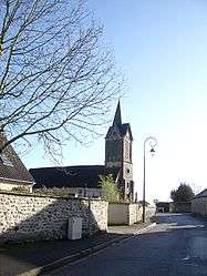
Saint-Vincent-des-Bois
| Saint-Vincent-des-Bois | ||
|---|---|---|
 | ||
| ||
 Saint-Vincent-des-Bois | ||
|
Location within Normandy region  Saint-Vincent-des-Bois | ||
| Coordinates: 49°04′20″N 1°23′59″E / 49.0722°N 1.3997°ECoordinates: 49°04′20″N 1°23′59″E / 49.0722°N 1.3997°E | ||
| Country | France | |
| Region | Normandy | |
| Department | Eure | |
| Arrondissement | Évreux | |
| Canton | Vernon-Sud | |
| Intercommunality | Portes de l'Eure | |
| Government | ||
| • Mayor (2008–2014) | Jean-Yves Hillion | |
| Area1 | 5.29 km2 (2.04 sq mi) | |
| Population (2008)2 | 285 | |
| • Density | 54/km2 (140/sq mi) | |
| Time zone | CET (UTC+1) | |
| • Summer (DST) | CEST (UTC+2) | |
| INSEE/Postal code | 27612 / 27950 | |
| Elevation |
113–146 m (371–479 ft) (avg. 144 m or 472 ft) | |
|
1 French Land Register data, which excludes lakes, ponds, glaciers > 1 km² (0.386 sq mi or 247 acres) and river estuaries. 2 Population without double counting: residents of multiple communes (e.g., students and military personnel) only counted once. | ||

Saint-Vincent-des-Bois is a commune in the Eure department in Haute-Normandie in northern France.
Population
| Historical population | ||
|---|---|---|
| Year | Pop. | ±% |
| 1962 | 134 | — |
| 1968 | 151 | +12.7% |
| 1975 | 168 | +11.3% |
| 1982 | 225 | +33.9% |
| 1990 | 243 | +8.0% |
| 1999 | 261 | +7.4% |
| 2008 | 285 | +9.2% |
See also
References
| Wikimedia Commons has media related to Saint-Vincent-des-Bois. |
This article is issued from Wikipedia - version of the 11/15/2013. The text is available under the Creative Commons Attribution/Share Alike but additional terms may apply for the media files.