Pennington County, South Dakota
| Pennington County, South Dakota | |
|---|---|
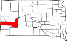 Location in the U.S. state of South Dakota | |
 South Dakota's location in the U.S. | |
| Founded | 1877 |
| Named for | John L. Pennington |
| Seat | Rapid City |
| Largest city | Rapid City |
| Area | |
| • Total | 2,784 sq mi (7,211 km2) |
| • Land | 2,777 sq mi (7,192 km2) |
| • Water | 7.7 sq mi (20 km2), 0.3% |
| Population (est.) | |
| • (2015) | 108,702 |
| • Density | 36/sq mi (14/km²) |
| Congressional district | At-large |
| Time zone | Mountain: UTC-7/-6 |
| Website |
www |
Pennington County is a county located in the U.S. state of South Dakota. As of the 2010 census, the population was 100,948,[1] making it the second-most populous county in South Dakota. Its county seat is Rapid City.[2] The county was created in 1875 and organized in 1877.[3] It is named for John L. Pennington, fifth Governor of Dakota Territory, who held office in 1875 when the county was formed.[4]
Pennington County is included in the Rapid City, SD Metropolitan Statistical Area. It is also the location of the Mount Rushmore National Memorial.
Geography

According to the U.S. Census Bureau, the county has a total area of 2,784 square miles (7,210 km2), of which 2,777 square miles (7,190 km2) is land and 7.7 square miles (20 km2) (0.3%) is water.[5] It is the third-largest county in South Dakota by area. Mount Rushmore National Memorial lies in the county. Black Elk Peak, South Dakota's highest mountain, is located in the county. At 7,242 feet (2,208 m) it is the highest natural point between the Rocky Mountains and the French Alps. Part of Badlands National Park lies within the county. The park also extends into neighboring Oglala Lakota and Jackson counties.
Major highways
Adjacent counties
- Meade County, South Dakota – north
- Haakon County, South Dakota – northeast
- Jackson County, South Dakota – southeast
- Oglala Lakota County, South Dakota – south
- Custer County, South Dakota – southwest
- Weston County, Wyoming – west
- Lawrence County, South Dakota – northwest
National protected areas
- Badlands National Park (part)
- Black Hills National Forest (part)
- Buffalo Gap National Grassland (part)
- Minuteman Missile National Historic Site (part)
- Mount Rushmore National Memorial
Demographics
| Historical population | |||
|---|---|---|---|
| Census | Pop. | %± | |
| 1880 | 2,244 | — | |
| 1890 | 6,540 | 191.4% | |
| 1900 | 5,610 | −14.2% | |
| 1910 | 12,453 | 122.0% | |
| 1920 | 12,720 | 2.1% | |
| 1930 | 20,079 | 57.9% | |
| 1940 | 23,799 | 18.5% | |
| 1950 | 34,053 | 43.1% | |
| 1960 | 58,195 | 70.9% | |
| 1970 | 59,349 | 2.0% | |
| 1980 | 70,361 | 18.6% | |
| 1990 | 81,343 | 15.6% | |
| 2000 | 88,565 | 8.9% | |
| 2010 | 100,948 | 14.0% | |
| Est. 2015 | 108,702 | [6] | 7.7% |
| U.S. Decennial Census[7] 1790-1960[8] 1900-1990[9] 1990-2000[10] 2010-2015[1] | |||
2000 census
As of the census[11] of 2000, there were 88,565 people, 34,641 households, and 23,278 families residing in the county. The population density was 32 people per square mile (12/km²). There were 37,249 housing units at an average density of 13 per square mile (5/km²). The racial makeup of the county was 86.70% White, 0.85% Black or African American, 8.09% Native American, 0.88% Asian, 0.06% Pacific Islander, 0.68%% from other races, and 2.74% from two or more races. 2.64% of the population were Hispanic or Latino of any race.
There were 34,641 households out of which 33.50% had children under the age of 18 living with them, 51.30% were married couples living together, 11.70% had a female householder with no husband present, and 32.80% were non-families. 26.10% of all households were made up of individuals and 8.40% had someone living alone who was 65 years of age or older. The average household size was 2.49 and the average family size was 3.00.
In the county, the population was spread out with 26.60% under the age of 18, 10.50% from 18 to 24, 29.20% from 25 to 44, 21.90% from 45 to 64, and 11.80% who were 65 years of age or older. The median age was 35 years. For every 100 females there were 98.30 males. For every 100 females age 18 and over, there were 95.70 males.
The median income for a household in the county was $37,485, and the median income for a family was $44,796. Males had a median income of $30,608 versus $21,540 for females. The per capita income for the county was $18,938. About 8.60% of families and 11.50% of the population were below the poverty line, including 15.60% of those under age 18 and 6.50% of those age 65 or over.
2010 census
As of the 2010 United States Census, there were 100,948 people, 41,251 households, and 26,323 families residing in the county.[12] The population density was 36.4 inhabitants per square mile (14.1/km2). There were 44,949 housing units at an average density of 16.2 per square mile (6.3/km2).[13] The racial makeup of the county was 83.6% white, 9.7% American Indian, 1.0% black or African American, 1.0% Asian, 0.1% Pacific islander, 0.8% from other races, and 3.8% from two or more races. Those of Hispanic or Latino origin made up 4.0% of the population.[12] In terms of ancestry, 38.0% were German, 14.3% were Irish, 11.0% were Norwegian, 10.2% were English, and 3.6% were American.[14]
Of the 41,251 households, 31.5% had children under the age of 18 living with them, 47.1% were married couples living together, 11.7% had a female householder with no husband present, 36.2% were non-families, and 29.0% of all households were made up of individuals. The average household size was 2.38 and the average family size was 2.93. The median age was 36.8 years.[12]
The median income for a household in the county was $46,849 and the median income for a family was $57,278. Males had a median income of $38,626 versus $30,251 for females. The per capita income for the county was $25,894. About 9.4% of families and 14.0% of the population were below the poverty line, including 20.7% of those under age 18 and 7.6% of those age 65 or over.[15]
Search and rescue
The Pennington County Search and Rescue (PCSAR) team is a volunteer search and rescue (SAR) team based in Rapid City, South Dakota. The team was established in October 1973, prompted by a 1972 flood in Rapid City. PCSAR trains for and performs vehicle extrication, vertical rescue, searches, communication support, Fire Department and dive team air supply support, trench rescue, mass casualty support, and emergency winter weather transportation.
Communities
| Year | Republican | Democratic |
|---|---|---|
| 2016[16] | 62.4% 29,804 | 29.5% 14,074 |
| 2012 | 63.5% 28,232 | 34.0% 15,125 |
| 2008 | 59.6% 27,603 | 38.5% 17,802 |
| 2004 | 66.7% 29,976 | 31.6% 14,213 |
| 2000 | 67.6% 24,696 | 30.4% 11,123 |
| 1996 | 54.3% 19,293 | 36.0% 12,784 |
| 1992 | 47.9% 18,052 | 29.5% 11,106 |
| 1988 | 61.4% 19,510 | 38.0% 12,068 |
| 1984 | 72.2% 21,947 | 27.1% 8,224 |
| 1980 | 67.3% 18,991 | 25.2% 7,121 |
| 1976 | 56.3% 13,352 | 42.4% 10,058 |
| 1972 | 61.2% 13,654 | 38.5% 8,592 |
| 1968 | 53.3% 9,671 | 40.2% 7,303 |
| 1964 | 47.5% 8,926 | 52.5% 9,881 |
| 1960 | 60.3% 11,364 | 39.7% 7,478 |
Cities
- Box Elder
- Hill City
- New Underwood
- Rapid City (county seat)
Towns
Census-designated places
Unincorporated communities
Ghost towns
Townships
The county is divided into 20 townships:
- Ash
- Castle Butte
- Cedar Butte
- Conata
- Crooked Creed
- Fairview
- Flat Butte
- Huron
- Imlay
- Lake Creek
- Lake Flat
- Lake Hill
- Owanka
- Peno
- Quinn
- Rainy Creek/Cheyenne
- Scenic
- Shyne
- Sunnyside
- Wasta
Unorganized territories
The county contains seven areas of unorganized territory:
- Central Pennington
- Dalzell Canyon
- East Central Pennington
- Mount Rushmore
- Northeast Pennington
- Rapid City East
- West Pennington
See also
References
- 1 2 "State & County QuickFacts". United States Census Bureau. Retrieved November 28, 2013.
- ↑ "Find a County". National Association of Counties. Retrieved 2011-06-07.
- ↑ "Dakota Territory, South Dakota, and North Dakota: Individual County Chronologies". Dakota Territory Atlas of Historical County Boundaries. The Newberry Library. 2006. Retrieved March 31, 2015.
- ↑ "Pennington County, SD History". Pennington County official website. Retrieved 2011-01-08.
- ↑ "2010 Census Gazetteer Files". United States Census Bureau. August 22, 2012. Retrieved March 28, 2015.
- ↑ "County Totals Dataset: Population, Population Change and Estimated Components of Population Change: April 1, 2010 to July 1, 2015". Retrieved July 2, 2016.
- ↑ "U.S. Decennial Census". United States Census Bureau. Retrieved March 28, 2015.
- ↑ "Historical Census Browser". University of Virginia Library. Retrieved March 28, 2015.
- ↑ Forstall, Richard L., ed. (March 27, 1995). "Population of Counties by Decennial Census: 1900 to 1990". United States Census Bureau. Retrieved March 28, 2015.
- ↑ "Census 2000 PHC-T-4. Ranking Tables for Counties: 1990 and 2000" (PDF). United States Census Bureau. April 2, 2001. Retrieved March 28, 2015.
- ↑ "American FactFinder". United States Census Bureau. Retrieved 2011-05-14.
- 1 2 3 "DP-1 Profile of General Population and Housing Characteristics: 2010 Demographic Profile Data". United States Census Bureau. Retrieved 2016-03-12.
- ↑ "Population, Housing Units, Area, and Density: 2010 - County". United States Census Bureau. Retrieved 2016-03-12.
- ↑ "DP02 SELECTED SOCIAL CHARACTERISTICS IN THE UNITED STATES – 2006-2010 American Community Survey 5-Year Estimates". United States Census Bureau. Retrieved 2016-03-12.
- ↑ "DP03 SELECTED ECONOMIC CHARACTERISTICS – 2006-2010 American Community Survey 5-Year Estimates". United States Census Bureau. Retrieved 2016-03-12.
- ↑ http://uselectionatlas.org/RESULTS/index.html
External links
- Pennington County, SD government website
- Badlands Visitor Information Badlands Visitor Information and Recommendations
 |
Lawrence County | Meade County | Haakon County | |
| Weston County, Wyoming | |
|||
| ||||
| | ||||
| Custer County | Oglala Lakota County | Jackson County |
Municipalities and communities of Pennington County, South Dakota, United States | ||
|---|---|---|
| Cities | | |
| Towns | ||
| CDPs | ||
| Other unincorporated communities | ||
| Ghost towns | ||
| Footnotes | ‡This populated place also has portions in an adjacent county or counties | |
Coordinates: 44°01′N 102°49′W / 44.01°N 102.82°W