Tea, South Dakota
| Tea, South Dakota | |
|---|---|
| City | |
| Motto: "Tea...A Growing Tradition" | |
 Location in Lincoln County and the state of South Dakota | |
| Coordinates: 43°26′53″N 96°50′15″W / 43.44806°N 96.83750°WCoordinates: 43°26′53″N 96°50′15″W / 43.44806°N 96.83750°W | |
| Country | United States |
| State | South Dakota |
| County | Lincoln |
| Founded | 1894[1] |
| Area[2] | |
| • Total | 1.69 sq mi (4.38 km2) |
| • Land | 1.69 sq mi (4.38 km2) |
| • Water | 0 sq mi (0 km2) |
| Elevation | 1,490 ft (454 m) |
| Population (2010)[3] | |
| • Total | 3,806 |
| • Estimate (2015)[4] | 4,839 |
| • Density | 2,252.1/sq mi (869.5/km2) |
| Time zone | Central (CST) (UTC-6) |
| • Summer (DST) | CDT (UTC-5) |
| ZIP code | 57064 |
| Area code(s) | 605 |
| FIPS code | 46-63100 |
| GNIS feature ID | 1265702[5] |
| Website | City of Tea |
Tea is a city in Lincoln County, South Dakota, United States and is a suburb of Sioux Falls. The population was 3,806 at the 2010 census.
Tea was laid out in 1894.[6]
Geography
Tea is located at 43°26′53″N 96°50′15″W / 43.44806°N 96.83750°W (43.448055, -96.837587).[7]
According to the United States Census Bureau, the city has a total area of 1.69 square miles (4.38 km2), all of it land.[2]
Demographics
| Historical population | |||
|---|---|---|---|
| Census | Pop. | %± | |
| 1910 | 134 | — | |
| 1920 | 165 | 23.1% | |
| 1930 | 148 | −10.3% | |
| 1940 | 165 | 11.5% | |
| 1950 | 151 | −8.5% | |
| 1960 | 188 | 24.5% | |
| 1970 | 302 | 60.6% | |
| 1980 | 729 | 141.4% | |
| 1990 | 786 | 7.8% | |
| 2000 | 1,742 | 121.6% | |
| 2010 | 3,806 | 118.5% | |
| Est. 2015 | 4,839 | [8] | 27.1% |
| U.S. Decennial Census[9] 2015 Estimate[4] | |||
2010 census
As of the census[3] of 2010, there were 3,806 people, 1,254 households, and 1,009 families residing in the city. The population density was 2,252.1 inhabitants per square mile (869.5/km2). There were 1,354 housing units at an average density of 801.2 per square mile (309.3/km2). The racial makeup of the city was 96.9% White, 0.7% African American, 0.1% Native American, 0.1% Asian, 0.3% from other races, and 1.9% from two or more races. Hispanic or Latino of any race were 1.3% of the population.
There were 1,254 households of which 59.1% had children under the age of 18 living with them, 63.2% were married couples living together, 12.6% had a female householder with no husband present, 4.7% had a male householder with no wife present, and 19.5% were non-families. 14.0% of all households were made up of individuals and 2.2% had someone living alone who was 65 years of age or older. The average household size was 3.04 and the average family size was 3.35.
The median age in the city was 27.7 years. 37.5% of residents were under the age of 18; 7.6% were between the ages of 18 and 24; 38.3% were from 25 to 44; 13.9% were from 45 to 64; and 3% were 65 years of age or older. The gender makeup of the city was 50.6% male and 49.4% female.
2000 census
As of the census of 2000, there were 1,742 people, 590 households, and 489 families residing in the city. The population density was 2,877.8 people per square mile (1,102.6/km²). There were 600 housing units at an average density of 991.2 per square mile (379.8/km²). The racial makeup of the city was 96.67% White, 0.40% African American, 0.34% Native American, 0.34% Asian, 0.06% Pacific Islander, 0.40% from other races, and 1.78% from two or more races. Hispanic or Latino of any race were 0.86% of the population.
There were 590 households out of which 55.6% had children under the age of 18 living with them, 67.3% were married couples living together, 12.7% had a female householder with no husband present, and 17.1% were non-families. 13.1% of all households were made up of individuals and 2.2% had someone living alone who was 65 years of age or older. The average household size was 2.95 and the average family size was 3.23.
In the city the population was spread out with 36.2% under the age of 18, 7.3% from 18 to 24, 40.8% from 25 to 44, 12.5% from 45 to 64, and 3.2% who were 65 years of age or older. The median age was 28 years. For every 100 females there were 98.4 males. For every 100 females age 18 and over, there were 94.9 males.
As of 2000 the median income for a household in the city was $50,671, and the median income for a family was $52,297. Males had a median income of $32,734 versus $23,860 for females. The per capita income for the city was $17,719. About 2.1% of families and 3.1% of the population were below the poverty line, including 3.8% of those under age 18 and 5.8% of those age 65 or over.
Education
Tea Public Schools are part of the Tea Area School District. The Tea Area School District has one elementary school, one intermediate school, one middle school, and one high school. Students attend Tea Area High School.[10]
Parks
Tea contains three recreational areas: Tea Athletic Complex, Howling Ridge Park, and Prairie Trails Park.[11]
Annual events
Teapot Days is an annual community event held each June that lasts 3 days. The event features carnival rides, fireworks, food vendors, musical concerts, craft/art shows and a parade.[12]
References
- ↑ "SD Towns" (PDF). South Dakota State Historical Society. Retrieved 2010-02-16.
- 1 2 "US Gazetteer files 2010". United States Census Bureau. Retrieved 2012-06-21.
- 1 2 "American FactFinder". United States Census Bureau. Retrieved 2012-06-21.
- 1 2 "Population Estimates". United States Census Bureau. Retrieved June 7, 2016.
- ↑ "US Board on Geographic Names". United States Geological Survey. 2007-10-25. Retrieved 2008-01-31.
- ↑ Federal Writers' Project (1940). South Dakota place-names, v.1-3. University of South Dakota. p. 63.
- ↑ "US Gazetteer files: 2010, 2000, and 1990". United States Census Bureau. 2011-02-12. Retrieved 2011-04-23.
- ↑ "Annual Estimates of the Resident Population for Incorporated Places: April 1, 2010 to July 1, 2015". Retrieved July 2, 2016.
- ↑ United States Census Bureau. "Census of Population and Housing". Retrieved September 23, 2013.
- ↑ "Tea Area School District". Tea Area School District. Retrieved August 5, 2012.
- ↑ http://www.teasd.com/index.asp?SEC=6F357EDD-BDCA-4C7C-803B-2CA72A15622F&Type=B_LOC
- ↑ http://www.teasd.com/index.asp?SEC=D752FB77-68C4-460F-9FE7-A759F1A8EE96&Type=B_BASIC
External links
Municipalities and communities of Lincoln County, South Dakota, United States | ||
|---|---|---|
| Cities | 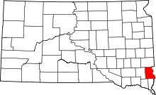 | |
| Towns | ||
| Townships |
| |
| CDP | ||
| Footnotes | ‡This populated place also has portions in an adjacent county or counties | |