Minnehaha County, South Dakota
| Minnehaha County, South Dakota | |
|---|---|
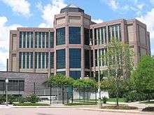 Minnehaha County Courthouse in Sioux Falls | |
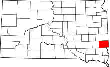 Location in the U.S. state of South Dakota | |
 South Dakota's location in the U.S. | |
| Founded | 1868 |
| Seat | Sioux Falls |
| Largest city | Sioux Falls |
| Area | |
| • Total | 814 sq mi (2,108 km2) |
| • Land | 807 sq mi (2,090 km2) |
| • Water | 6.7 sq mi (17 km2), 0.8% |
| Population (est.) | |
| • (2015) | 185,197 |
| • Density | 210/sq mi (81/km²) |
| Congressional district | At-large |
| Time zone | Central: UTC-6/-5 |
| Website |
www |
Minnehaha County is a county located along the eastern border in the state of South Dakota. As of the 2010 census, the population was 169,468,[1] making it the most populous county in South Dakota. Its county seat is Sioux Falls,[2] the largest city in the state. The county was created by European Americans in 1862 and organized in 1868.[3] Its name was derived from the Sioux word Mnihaha, meaning "rapid water," or "waterfall" (often also incorrectly translated as "laughing water").
Minnehaha County is part of the Sioux Falls, SD Metropolitan Statistical Area, the largest in the state. It is the site of a former listed Superfund site, the Williams Pipeline Company Disposal Site, which has been cleaned up under direction of the Environmental Protection Agency to contain and remove environmental hazards.
Geography
According to the U.S. Census Bureau, the county has a total area of 814 square miles (2,110 km2), of which 807 square miles (2,090 km2) is land and 6.7 square miles (17 km2) (0.8%) is water.[4] The Big Sioux River flows through it.
Lakes
- Beaver Lake
- Buffalo Lake
- Clear Lake
- Covell Lake
- Fenstrman Slough
- Grass Lake
- Loss Lake
- Lost Lake
- Rehfeldt Slough
- Scott Lake
Major highways
Airport
Sioux Falls Regional Airport (FSD) serves Minnehaha county and the surrounding communities.
Adjacent counties
- Moody County, South Dakota - north
- Rock County, Minnesota - east
- Lyon County, Iowa - southeast
- Lincoln County, South Dakota - south
- Turner County, South Dakota - southwest
- McCook County, South Dakota - west
- Lake County, South Dakota - northwest
Demographics
| Historical population | |||
|---|---|---|---|
| Census | Pop. | %± | |
| 1870 | 355 | — | |
| 1880 | 8,251 | 2,224.2% | |
| 1890 | 21,879 | 165.2% | |
| 1900 | 23,926 | 9.4% | |
| 1910 | 29,631 | 23.8% | |
| 1920 | 42,490 | 43.4% | |
| 1930 | 50,872 | 19.7% | |
| 1940 | 57,697 | 13.4% | |
| 1950 | 70,910 | 22.9% | |
| 1960 | 86,575 | 22.1% | |
| 1970 | 95,209 | 10.0% | |
| 1980 | 109,435 | 14.9% | |
| 1990 | 123,809 | 13.1% | |
| 2000 | 148,281 | 19.8% | |
| 2010 | 169,468 | 14.3% | |
| Est. 2015 | 185,197 | [5] | 9.3% |
| U.S. Decennial Census[6] 1790-1960[7] 1900-1990[8] 1990-2000[9] 2010-2015[1] | |||
2000 census
As of the census[10] of 2000, there were 148,281 people, 57,996 households, and 37,581 families residing in the county. The population density was 183 people per square mile (71/km²). There were 60,237 housing units at an average density of 74 per square mile (29/km²). The racial makeup of the county was 93.03% White, 1.51% Black or African American, 1.85% Native American, 1.01% Asian, 0.05% Pacific Islander, 1.04% from other races, and 1.51% from two or more races. 2.15% of the population were Hispanic or Latino of any race.
There were 57,996 households out of which 33.80% had children under the age of 18 living with them, 51.80% were married couples living together, 9.50% had a female householder with no husband present, and 35.20% were non-families. 27.80% of all households were made up of individuals and 8.60% had someone living alone who was 65 years of age or older. The average household size was 2.46 and the average family size was 3.04.
In the county, the population was spread out with 26.20% under the age of 18, 10.80% from 18 to 24, 32.00% from 25 to 44, 20.00% from 45 to 64, and 11.00% who were 65 years of age or older. The median age was 34 years. For every 100 females there were 98.10 males. For every 100 females age 18 and over, there were 95.40 males.
The median income for a household in the county was $42,566, and the median income for a family was $52,031. Males had a median income of $32,208 versus $24,691 for females. The per capita income for the county was $20,713. About 5.00% of families and 7.50% of the population were below the poverty line, including 8.90% of those under age 18 and 7.20% of those age 65 or over.
2010 census
As of the 2010 United States Census, there were 169,468 people, 67,028 households, and 42,052 families residing in the county.[11] The population density was 210.0 inhabitants per square mile (81.1/km2). There were 71,557 housing units at an average density of 88.7 per square mile (34.2/km2).[12] The racial makeup of the county was 88.1% white, 3.8% black or African American, 2.5% American Indian, 1.5% Asian, 0.1% Pacific islander, 1.8% from other races, and 2.3% from two or more races. Those of Hispanic or Latino origin made up 4.1% of the population.[11] In terms of ancestry, 43.8% were German, 17.7% were Norwegian, 11.6% were Irish, 6.8% were Dutch, 6.3% were English, and 3.2% were American.[13]
Of the 67,028 households, 32.7% had children under the age of 18 living with them, 47.7% were married couples living together, 10.5% had a female householder with no husband present, 37.3% were non-families, and 29.3% of all households were made up of individuals. The average household size was 2.43 and the average family size was 3.03. The median age was 34.5 years.[11]
The median income for a household in the county was $51,799 and the median income for a family was $64,645. Males had a median income of $40,187 versus $31,517 for females. The per capita income for the county was $26,392. About 6.9% of families and 9.7% of the population were below the poverty line, including 12.2% of those under age 18 and 7.6% of those age 65 or over.[14]
Politics
| Year | GOP | DEM | Others |
|---|---|---|---|
| 2016[15] | 53.7% 42,043 | 39.1% 30,610 | 7.2% 5,610 |
| 2012 | 52.7% 40,342 | 45.3% 34,674 | 2.0% 1,567 |
| 2008 | 48.7% 39,251 | 49.5% 39,838 | 1.8% 1,463 |
| 2004 | 56.9% 44,189 | 41.6% 32,314 | 1.5% 1,129 |
| 2000 | 54.5% 33,428 | 44.1% 27,042 | 1.5% 899 |
| 1996 | 44.2% 27,432 | 48.1% 29,790 | 8.6% 4,782 |
| 1992 | 39.3% 25,081 | 42.4% 27,016 | 18.3% 11,689 |
| 1988 | 47.7% 26,765 | 51.9% 29,135 | 0.4% 195 |
| 1984 | 56.3% 29,908 | 43.3% 23,042 | 0.4% 221 |
| 1980 | 51.0% 26,256 | 38.9% 20,008 | 10.1% 5,214 |
| 1976 | 51.1% 23,286 | 48.4% 22,068 | 0.4% 202 |
| 1972 | 49.9% 22,447 | 49.8% 22,386 | 0.2% 155 |
| 1968 | 53.3% 20,141 | 43.6% 16,462 | 3.1% 1,177 |
| 1964 | 44.5% 16,766 | 55.5% 20,929 | 0.0% 0 |
| 1960 | 60.5% 23,238 | 39.5% 15,152 | 0.0% 0 |
| 1956 | 63.0% 22,285 | 37.0% 13,093 | 0.0% 0 |
| 1952 | 71.5% 23,559 | 28.5% 9,390 | 0.0% 0 |
Minnehaha is a fairly Republican county with only one Democratic presidential candidate, Michael Dukakis in 1988, receiving an absolute majority in the last fifty years. However, Democratic candidates have won four of the last eight presidential elections in the county.
Communities
Cities
- Baltic
- Brandon
- Colton
- Crooks
- Dell Rapids
- Garretson
- Hartford
- Sioux Falls (county seat)
- Valley Springs
Towns
Unincorporated communities
Townships
The county is divided into twenty-four townships:
- Brandon
- Benton
- Buffalo
- Burk
- Clear Lake
- Dell Rapids
- Edison
- Grand Meadow
- Hartford
- Highland
- Humboldt
- Logan
- Lyons
- Mapleton
- Palisade
- Red Rock
- Sioux Falls
- Split Rock
- Sverdrup
- Taopi
- Valley Springs
- Wall Lake
- Wayne
- Wellington
Historical townsites

- East Sioux Falls
- Eminija
- Huntimer
- South Sioux Falls
- West Sioux Falls
- Wingert
See also
| Wikimedia Commons has media related to Minnehaha County, South Dakota. |
References
- 1 2 "State & County QuickFacts". United States Census Bureau. Retrieved November 25, 2013.
- ↑ "Find a County". National Association of Counties. Retrieved 2011-06-07.
- ↑ "Dakota Territory, South Dakota, and North Dakota: Individual County Chronologies". Dakota Territory Atlas of Historical County Boundaries. The Newberry Library. 2006. Retrieved March 30, 2015.
- ↑ "2010 Census Gazetteer Files". United States Census Bureau. August 22, 2012. Retrieved March 28, 2015.
- ↑ "County Totals Dataset: Population, Population Change and Estimated Components of Population Change: April 1, 2010 to July 1, 2015". Retrieved July 2, 2016.
- ↑ "U.S. Decennial Census". United States Census Bureau. Retrieved March 28, 2015.
- ↑ "Historical Census Browser". University of Virginia Library. Retrieved March 28, 2015.
- ↑ Forstall, Richard L., ed. (March 27, 1995). "Population of Counties by Decennial Census: 1900 to 1990". United States Census Bureau. Retrieved March 28, 2015.
- ↑ "Census 2000 PHC-T-4. Ranking Tables for Counties: 1990 and 2000" (PDF). United States Census Bureau. April 2, 2001. Retrieved March 28, 2015.
- ↑ "American FactFinder". United States Census Bureau. Retrieved 2011-05-14.
- 1 2 3 "DP-1 Profile of General Population and Housing Characteristics: 2010 Demographic Profile Data". United States Census Bureau. Retrieved 2016-03-12.
- ↑ "Population, Housing Units, Area, and Density: 2010 - County". United States Census Bureau. Retrieved 2016-03-12.
- ↑ "DP02 SELECTED SOCIAL CHARACTERISTICS IN THE UNITED STATES – 2006-2010 American Community Survey 5-Year Estimates". United States Census Bureau. Retrieved 2016-03-12.
- ↑ "DP03 SELECTED ECONOMIC CHARACTERISTICS – 2006-2010 American Community Survey 5-Year Estimates". United States Census Bureau. Retrieved 2016-03-12.
- ↑ http://uselectionatlas.org/RESULTS/index.html
External links
- Minnehaha County, SD government website
- Envision 2035 Comprehensive Plan webpage
- Capture Minnehaha County website
-
 "Minnehaha". The American Cyclopædia. 1879.
 |
Lake County | Moody County | Pipestone County, Minnesota | |
| McCook County | |
Rock County, Minnesota | ||
| ||||
| | ||||
| Turner County | Lincoln County | Lyon County, Iowa |
Municipalities and communities of Minnehaha County, South Dakota, United States | ||
|---|---|---|
| Cities | | |
| Towns | ||
| CDPs |
| |
| Other unincorporated communities | ||
| Townships | ||
| Footnotes | ‡This populated place also has portions in an adjacent county or counties | |
Coordinates: 43°41′N 96°47′W / 43.68°N 96.79°W