Clark, South Dakota
| Clark, South Dakota | |
|---|---|
| City | |
|
Clark County Courthouse in Clark | |
 Location within Clark County and South Dakota | |
| Coordinates: 44°52′46″N 97°44′3″W / 44.87944°N 97.73417°WCoordinates: 44°52′46″N 97°44′3″W / 44.87944°N 97.73417°W | |
| Country | United States |
| State | South Dakota |
| County | Clark |
| Incorporated | 1886[1] |
| Area[2] | |
| • Total | 1.28 sq mi (3.32 km2) |
| • Land | 1.28 sq mi (3.32 km2) |
| • Water | 0 sq mi (0 km2) |
| Elevation | 1,798 ft (548 m) |
| Population (2010)[3] | |
| • Total | 1,139 |
| • Estimate (2015)[4] | 1,050 |
| • Density | 889.8/sq mi (343.6/km2) |
| Time zone | Central (CST) (UTC-6) |
| • Summer (DST) | CDT (UTC-5) |
| ZIP code | 57225 |
| Area code(s) | 605 |
| FIPS code | 46-12180 |
| GNIS feature ID | 1265158[5] |
| Website | clarksd.com |

Clark is a city in Clark County, South Dakota, United States. The population was 1,139 at the 2010 census. It is the county seat of Clark County.[6]
The Clark County Courier is a weekly newspaper published in Clark. Dakota Style potato chips are produced on a farm near Clark.
History

A post office was established at Clark in 1880.[7] Clark was platted in 1882.[8] The city took its name from Clark County.[8] An early variant name was Clark Center.[9]
Geography
Clark is located at 44°52′46″N 97°44′3″W / 44.87944°N 97.73417°W (44.879459, -97.734182).[10]
According to the United States Census Bureau, the city has a total area of 1.28 square miles (3.32 km2), all of it land.[2]
Clark has been assigned the ZIP code 57225 and the FIPS place code 12180.
Demographics
| Historical population | |||
|---|---|---|---|
| Census | Pop. | %± | |
| 1880 | 25 | — | |
| 1890 | 592 | 2,268.0% | |
| 1900 | 684 | 15.5% | |
| 1910 | 1,220 | 78.4% | |
| 1920 | 1,392 | 14.1% | |
| 1930 | 1,290 | −7.3% | |
| 1940 | 1,291 | 0.1% | |
| 1950 | 1,471 | 13.9% | |
| 1960 | 1,484 | 0.9% | |
| 1970 | 1,356 | −8.6% | |
| 1980 | 1,351 | −0.4% | |
| 1990 | 1,292 | −4.4% | |
| 2000 | 1,285 | −0.5% | |
| 2010 | 1,139 | −11.4% | |
| Est. 2015 | 1,050 | [11] | −7.8% |
| U.S. Decennial Census[12] 2015 Estimate[4] | |||
2010 census
As of the census[3] of 2010, there were 1,139 people, 552 households, and 306 families residing in the city. The population density was 889.8 inhabitants per square mile (343.6/km2). There were 627 housing units at an average density of 489.8 per square mile (189.1/km2). The racial makeup of the city was 98.5% White, 0.1% African American, 0.2% Asian, 0.3% from other races, and 1.0% from two or more races. Hispanic or Latino of any race were 1.4% of the population.
There were 552 households of which 19.2% had children under the age of 18 living with them, 46.4% were married couples living together, 6.0% had a female householder with no husband present, 3.1% had a male householder with no wife present, and 44.6% were non-families. 40.6% of all households were made up of individuals and 24.1% had someone living alone who was 65 years of age or older. The average household size was 1.99 and the average family size was 2.68.
The median age in the city was 51.5 years. 18.8% of residents were under the age of 18; 3.7% were between the ages of 18 and 24; 20.1% were from 25 to 44; 24.8% were from 45 to 64; and 32.7% were 65 years of age or older. The gender makeup of the city was 47.1% male and 52.9% female.
2000 census
As of the census of 2000, there were 1,285 people, 558 households, and 334 families residing in the city. The population density was 979.3 people per square mile (378.7/km²). There were 632 housing units at an average density of 481.6 per square mile (186.3/km²). The racial makeup of the city was 98.68% White, 0.23% African American, 0.39% Native American, 0.31% Asian, 0.08% from other races, and 0.31% from two or more races. Hispanic or Latino of any race were 0.31% of the population.
There were 558 households out of which 24.0% had children under the age of 18 living with them, 50.7% were married couples living together, 6.6% had a female householder with no husband present, and 40.1% were non-families. 37.5% of all households were made up of individuals and 24.2% had someone living alone who was 65 years of age or older. The average household size was 2.19 and the average family size was 2.90.
In the city the population was spread out with 22.8% under the age of 18, 4.4% from 18 to 24, 19.9% from 25 to 44, 23.1% from 45 to 64, and 29.7% who were 65 years of age or older. The median age was 47 years. For every 100 females there were 84.1 males. For every 100 females age 18 and over, there were 80.4 males.
As of 2000 the median income for a household in the city was $29,432, and the median income for a family was $39,167. Males had a median income of $26,771 versus $17,868 for females. The per capita income for the city was $14,758. About 6.3% of families and 9.1% of the population were below the poverty line, including 7.0% of those under age 18 and 18.8% of those age 65 or over.
Notable people
- Samuel Elrod, the fifth Governor of South Dakota.
- Doug Hegdahl, former sailor of United States Navy and prisoner of war (POW) during Vietnam War.
- Orator LaCraft, South Dakota State Senator.
- Urban Odson, NFL player for the Green Bay Packers.
References
- ↑ "SD Towns" (PDF). South Dakota State Historical Society. Archived from the original (PDF) on 2010-02-10. Retrieved 2010-02-11.
- 1 2 "US Gazetteer files 2010". United States Census Bureau. Archived from the original on 2012-01-24. Retrieved 2012-06-21.
- 1 2 "American FactFinder". United States Census Bureau. Retrieved 2012-06-21.
- 1 2 "Population Estimates". United States Census Bureau. Retrieved June 7, 2016.
- ↑ "US Board on Geographic Names". United States Geological Survey. 2007-10-25. Retrieved 2008-01-31.
- ↑ "Find a County". National Association of Counties. Archived from the original on 2011-05-31. Retrieved 2011-06-07.
- ↑ "Clark County". Jim Forte Postal History. Retrieved 28 February 2015.
- 1 2 Chicago and North Western Railway Company (1908). A History of the Origin of the Place Names Connected with the Chicago & North Western and Chicago, St. Paul, Minneapolis & Omaha Railways. p. 57.
- ↑ Federal Writers' Project (1940). South Dakota place-names, v.1-3. University of South Dakota. p. 30.
- ↑ "US Gazetteer files: 2010, 2000, and 1990". United States Census Bureau. 2011-02-12. Retrieved 2011-04-23.
- ↑ "Annual Estimates of the Resident Population for Incorporated Places: April 1, 2010 to July 1, 2015". Retrieved July 2, 2016.
- ↑ United States Census Bureau. "Census of Population and Housing". Archived from the original on May 11, 2015. Retrieved July 15, 2014.
External links
Municipalities and communities of Clark County, South Dakota, United States | ||
|---|---|---|
| Cities | 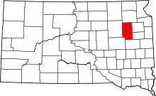 | |
| Towns | ||
| CDP | ||
| Unincorporated communities | ||