Parkston, South Dakota
| Parkston, South Dakota | |
|---|---|
| City | |
| Motto: "A Great Place To Grow" | |
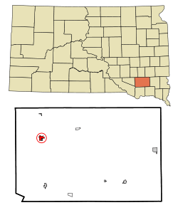 Location in Hutchinson County and the state of South Dakota | |
| Coordinates: 43°23′39″N 97°59′14″W / 43.39417°N 97.98722°WCoordinates: 43°23′39″N 97°59′14″W / 43.39417°N 97.98722°W | |
| Country | United States |
| State | South Dakota |
| County | Hutchinson |
| Incorporated | 1886[1] |
| Area[2] | |
| • Total | 0.91 sq mi (2.36 km2) |
| • Land | 0.91 sq mi (2.36 km2) |
| • Water | 0 sq mi (0 km2) |
| Elevation | 1,398 ft (426 m) |
| Population (2010)[3] | |
| • Total | 1,508 |
| • Estimate (2015)[4] | 1,488 |
| • Density | 1,657.1/sq mi (639.8/km2) |
| Time zone | Central (CST) (UTC-6) |
| • Summer (DST) | CDT (UTC-5) |
| ZIP code | 57366 |
| Area code(s) | 605 |
| FIPS code | 46-48460 |
| GNIS feature ID | 1256956[5] |
| Website | http://www.parkston.com/ |
Parkston is a city in Hutchinson County, South Dakota, United States. The population was 1,508 at the 2010 census.
History
The city was named for R. S. Parke, a landowner.[6] Parkston was founded in 1886.[7]
Geography
Parkston is located at 43°23′39″N 97°59′14″W / 43.39417°N 97.98722°W (43.394269, -97.987279).[8]
According to the United States Census Bureau, the city has a total area of 0.91 square miles (2.36 km2), all of it land.[2]
Parkston has been assigned the ZIP code 57366 and the FIPS place code 48460.
Demographics
| Historical population | |||
|---|---|---|---|
| Census | Pop. | %± | |
| 1890 | 262 | — | |
| 1900 | 596 | 127.5% | |
| 1910 | 970 | 62.8% | |
| 1920 | 1,230 | 26.8% | |
| 1930 | 1,336 | 8.6% | |
| 1940 | 1,305 | −2.3% | |
| 1950 | 1,354 | 3.8% | |
| 1960 | 1,514 | 11.8% | |
| 1970 | 1,611 | 6.4% | |
| 1980 | 1,545 | −4.1% | |
| 1990 | 1,572 | 1.7% | |
| 2000 | 1,674 | 6.5% | |
| 2010 | 1,508 | −9.9% | |
| Est. 2015 | 1,488 | [9] | −1.3% |
| U.S. Decennial Census[10] 2015 Estimate[4] | |||
2010 census
As of the census[3] of 2010, there were 1,508 people, 663 households, and 404 families residing in the city. The population density was 1,657.1 inhabitants per square mile (639.8/km2). There were 737 housing units at an average density of 809.9 per square mile (312.7/km2). The racial makeup of the city was 97.1% White, 0.2% African American, 1.7% Native American, 0.1% Asian, and 0.9% from two or more races. Hispanic or Latino of any race were 0.5% of the population.
There were 663 households of which 24.6% had children under the age of 18 living with them, 51.9% were married couples living together, 6.0% had a female householder with no husband present, 3.0% had a male householder with no wife present, and 39.1% were non-families. 36.8% of all households were made up of individuals and 22.5% had someone living alone who was 65 years of age or older. The average household size was 2.15 and the average family size was 2.80.
The median age in the city was 47.6 years. 22.8% of residents were under the age of 18; 4.9% were between the ages of 18 and 24; 19.1% were from 25 to 44; 25.4% were from 45 to 64; and 28% were 65 years of age or older. The gender makeup of the city was 46.8% male and 53.2% female.
2000 census
As of the census of 2000, there were 1,674 people, 699 households, and 448 families residing in the city. The population density was 1,839.5 people per square mile (710.3/km²). There were 752 housing units at an average density of 826.4 per square mile (319.1/km²). The racial makeup of the city was 97.79% White, 0.18% African American, 1.55% Native American, and 0.48% from two or more races. Hispanic or Latino of any race were 0.72% of the population.
There were 699 households out of which 25.2% had children under the age of 18 living with them, 56.8% were married couples living together, 4.7% had a female householder with no husband present, and 35.8% were non-families. 33.9% of all households were made up of individuals and 23.6% had someone living alone who was 65 years of age or older. The average household size was 2.24 and the average family size was 2.87.
In the city the population was spread out with 23.4% under the age of 18, 5.4% from 18 to 24, 21.1% from 25 to 44, 17.9% from 45 to 64, and 32.1% who were 65 years of age or older. The median age was 45 years. For every 100 females there were 85.2 males. For every 100 females age 18 and over, there were 83.1 males.
As of 2000 the median income for a household in the city was $29,662, and the median income for a family was $39,688. Males had a median income of $29,063 versus $17,500 for females. The per capita income for the city was $15,260. About 3.3% of families and 5.7% of the population were below the poverty line, including 5.2% of those under age 18 and 11.1% of those age 65 or over.
Climate
Humid continental climate is a climatic region typified by large seasonal temperature differences, with warm to hot (and often humid) summers and cold (sometimes severely cold) winters. Precipitation is relatively well distributed year-round in many areas with this climate. The Köppen Climate Classification subtype for this climate is "Dfa" (Hot Summer Continental Climate).[11]
References
- ↑ "SD Towns" (PDF). South Dakota State Historical Society. Retrieved 2010-02-15.
- 1 2 "US Gazetteer files 2010". United States Census Bureau. Archived from the original on January 24, 2012. Retrieved 2012-06-21.
- 1 2 "American FactFinder". United States Census Bureau. Retrieved 2012-06-21.
- 1 2 "Population Estimates". United States Census Bureau. Retrieved June 7, 2016.
- ↑ "US Board on Geographic Names". United States Geological Survey. 2007-10-25. Retrieved 2008-01-31.
- ↑ Federal Writers' Project (1940). South Dakota place-names, v.1-3. University of South Dakota. p. 54.
- ↑ Columbia-Lippincott Gazeteer, p. 1432
- ↑ "US Gazetteer files: 2010, 2000, and 1990". United States Census Bureau. 2011-02-12. Retrieved 2011-04-23.
- ↑ "Annual Estimates of the Resident Population for Incorporated Places: April 1, 2010 to July 1, 2015". Retrieved July 2, 2016.
- ↑ United States Census Bureau. "Census of Population and Housing". Archived from the original on May 11, 2015. Retrieved July 7, 2014.
- ↑ Climate Summary
External links
Municipalities and communities of Hutchinson County, South Dakota, United States | ||
|---|---|---|
| Cities | 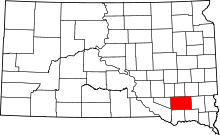 | |
| Towns | ||
| CDPs | ||