Fort Pierre, South Dakota
| Fort Pierre, South Dakota | |
|---|---|
| City | |
|
United Church of Christ Congregational in Fort Pierre | |
| Motto: "Where The West Begins" | |
 Location in Stanley County and the state of South Dakota | |
| Coordinates: 44°21′32″N 100°22′33″W / 44.35889°N 100.37583°WCoordinates: 44°21′32″N 100°22′33″W / 44.35889°N 100.37583°W | |
| Country | United States |
| State | South Dakota |
| County | Stanley |
| Incorporated | 1890[1] |
| Area[2] | |
| • Total | 3.16 sq mi (8.18 km2) |
| • Land | 3.11 sq mi (8.05 km2) |
| • Water | 0.05 sq mi (0.13 km2) |
| Elevation | 1,434 ft (437 m) |
| Population (2010)[3] | |
| • Total | 2,078 |
| • Estimate (2015)[4] | 2,117 |
| • Density | 668.2/sq mi (258.0/km2) |
| Time zone | Mountain (MST) (UTC-7) |
| • Summer (DST) | MDT (UTC-6) |
| ZIP code | 57532 |
| Area code(s) | 605 |
| FIPS code | 46-22260[5] |
| GNIS feature ID | 1255113[6] |
| Website | http://www.fortpierre.com/ |

Fort Pierre is a city in Stanley County, South Dakota, United States. It is part of the Pierre, South Dakota Micropolitan Statistical Area and the county seat of Stanley County. The population was 2,078 at the 2010 census. Lily Park in Fort Pierre is situated at the confluence of the Bad and Missouri rivers.
History
On March 30, 1743, Francois and Louis-Joseph Gaultier de La Vérendrye reached the area of present-day Fort Pierre during their expedition west from Quebec.[7] They left a metal plate buried in a hill to mark their journey and claim the land for France.[8] The Lewis and Clark Corps of Discovery Expedition met with the Teton Sioux on the south side of the mouth of the Bad River on 24–28 September 1804. Fort Pierre Chouteau was established in 1832 as a trading post and fort by St Louis industrial fur trader Pierre Chouteau, Jr. on the north side of the river's mouth to replace Fort Tecumseh, established 1822 and a mile to the north.
Geography
Fort Pierre is located at 44°21′32″N 100°22′33″W / 44.35889°N 100.37583°W (44.358941, -100.375742).[9]
According to the United States Census Bureau, the city has a total area of 3.16 square miles (8.18 km2), of which, 3.11 square miles (8.05 km2) is land and 0.05 square miles (0.13 km2) is water.[2]
Fort Pierre has been assigned the ZIP code 57532 and the FIPS place code 22260.
Demographics
| Historical population | |||
|---|---|---|---|
| Census | Pop. | %± | |
| 1880 | 287 | — | |
| 1890 | 360 | 25.4% | |
| 1900 | 395 | 9.7% | |
| 1910 | 792 | 100.5% | |
| 1920 | 805 | 1.6% | |
| 1930 | 683 | −15.2% | |
| 1940 | 764 | 11.9% | |
| 1950 | 951 | 24.5% | |
| 1960 | 2,649 | 178.5% | |
| 1970 | 1,448 | −45.3% | |
| 1980 | 1,789 | 23.5% | |
| 1990 | 1,854 | 3.6% | |
| 2000 | 1,991 | 7.4% | |
| 2010 | 2,078 | 4.4% | |
| Est. 2015 | 2,117 | [10] | 1.9% |
| U.S. Decennial Census[11] 2015 Estimate[4] | |||
.jpg)
2010 census
As of the census[3] of 2010, there were 2,078 people, 893 households, and 586 families residing in the city. The population density was 668.2 inhabitants per square mile (258.0/km2). There were 959 housing units at an average density of 308.4 per square mile (119.1/km2). The racial makeup of the city was 89.4% White, 0.3% African American, 6.6% Native American, 0.2% Asian, 0.2% from other races, and 3.3% from two or more races. Hispanic or Latino of any race were 0.7% of the population.
There were 893 households of which 30.5% had children under the age of 18 living with them, 51.6% were married couples living together, 9.7% had a female householder with no husband present, 4.3% had a male householder with no wife present, and 34.4% were non-families. 30.6% of all households were made up of individuals and 11.2% had someone living alone who was 65 years of age or older. The average household size was 2.33 and the average family size was 2.86.
The median age in the city was 41.8 years. 24.1% of residents were under the age of 18; 6.6% were between the ages of 18 and 24; 23.2% were from 25 to 44; 30% were from 45 to 64; and 16% were 65 years of age or older. The gender makeup of the city was 49.4% male and 50.6% female.
2000 census
As of the census[5] of 2000, there were 1,991 people, 810 households, and 538 families residing in the city. The population density was 686.6 people per square mile (265.1/km²). There were 875 housing units at an average density of 301.8 per square mile (116.5/km²). The racial makeup of the city was 92.16% White, 0.20% African American, 5.22% Native American, 0.30% Asian, 0.15% from other races, and 1.96% from two or more races. Hispanic or Latino of any race were 0.40% of the population.
There were 810 households out of which 34.3% had children under the age of 18 living with them, 51.4% were married couples living together, 10.9% had a female householder with no husband present, and 33.5% were non-families. 28.4% of all households were made up of individuals and 8.9% had someone living alone who was 65 years of age or older. The average household size was 2.45 and the average family size was 3.01.
In the city the population was spread out with 28.0% under the age of 18, 6.9% from 18 to 24, 28.3% from 25 to 44, 25.4% from 45 to 64, and 11.3% who were 65 years of age or older. The median age was 37 years. For every 100 females there were 99.9 males. For every 100 females age 18 and over, there were 95.8 males.
As of 2000 the median income for a household in the city was $41,181, and the median income for a family was $47,885. Males had a median income of $29,948 versus $21,208 for females. The per capita income for the city was $20,478. About 7.4% of families and 8.9% of the population were below the poverty line, including 12.2% of those under age 18 and 14.8% of those age 65 or over.
Media
AM Radio
- KGFX (AM) 1060, (Country Music)
- KCCR AM 1240, (Adult Contemporary)
FM Radio
- KGFX-FM 92.7, (Adult Contemporary)
- KPLO-FM 94.5, (Country Music)
- KLXS FM 95.3, (Classic Hits)
- KJBI FM 100.1, (Classic Hits)
Television
The Capital Journal is the local newspaper.
Notable natives
- John C. Waldron - World War II aviator from Fort Pierre.
- Walter Dale Miller - Former governor.
- George Philip Jr. - World War II sailor, Commanding officer of USS Twiggs (DD-591), Navy Cross recipient and namesake of USS George Philip (FFG-12)
- Casey Tibbs - American cowboy and actor.
External links
References
- ↑ "SD Towns" (PDF). South Dakota State Historical Society. Retrieved 2010-02-12.
- 1 2 "US Gazetteer files 2010". United States Census Bureau. Retrieved 2012-06-21.
- 1 2 "American FactFinder". United States Census Bureau. Retrieved 2012-06-21.
- 1 2 "Population Estimates". United States Census Bureau. Retrieved June 7, 2016.
- 1 2 "American FactFinder". United States Census Bureau. Retrieved 2008-01-31.
- ↑ "US Board on Geographic Names". United States Geological Survey. 2007-10-25. Retrieved 2008-01-31.
- ↑ Hogan, Edward Patrick; Fouberg, Erin Hogan (2001). The Geography of South Dakota (Third ed.). Sioux Falls, SD: The Center for Western Studies – Augustana College. ISBN 0-931170-79-6.
- ↑ "Vérendrye Museum". National Park Service. Retrieved March 12, 2015.
- ↑ "US Gazetteer files: 2010, 2000, and 1990". United States Census Bureau. 2011-02-12. Retrieved 2011-04-23.
- ↑ "Annual Estimates of the Resident Population for Incorporated Places: April 1, 2010 to July 1, 2015". Retrieved July 2, 2016.
- ↑ United States Census Bureau. "Census of Population and Housing". Retrieved October 20, 2014.
Municipalities and communities of Stanley County, South Dakota, United States | ||
|---|---|---|
| City | 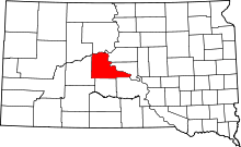 | |
| Unincorporated communities | ||
| Indian reservations | ||
| Ghost towns | ||
| Footnotes | ‡This populated place also has portions in an adjacent county or counties | |