Sully County, South Dakota
| Sully County, South Dakota | |
|---|---|
 Sully Courthouse in July 2013 | |
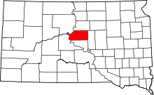 Location in the U.S. state of South Dakota | |
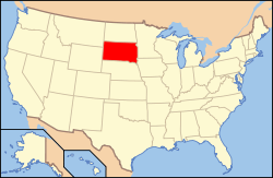 South Dakota's location in the U.S. | |
| Founded | 1883 |
| Named for | Alfred Sully |
| Seat | Onida |
| Largest city | Onida |
| Area | |
| • Total | 1,070 sq mi (2,771 km2) |
| • Land | 1,007 sq mi (2,608 km2) |
| • Water | 63 sq mi (163 km2), 5.9% |
| Population (est.) | |
| • (2015) | 1,426 |
| • Density | 1.4/sq mi (1/km²) |
| Congressional district | At-large |
| Time zone | Central: UTC-6/-5 |
| Website |
www |
Sully County is a county located in the U.S. state of South Dakota. As of the 2010 census, the population was 1,373,[1] making it the third-least populous county in South Dakota. Its county seat is Onida.[2] The county was created in 1873 and organized in 1883.[3] It is named after General Alfred Sully who built Fort Sully.[4]
Sully County is included in the Pierre, SD Micropolitan Statistical Area.
Geography
According to the U.S. Census Bureau, the county has a total area of 1,070 square miles (2,800 km2), of which 1,007 square miles (2,610 km2) is land and 63 square miles (160 km2) (5.9%) is water.[5]
Major highways
 U.S. Highway 83
 South Dakota Highway 1804
Adjacent counties
- Potter County, South Dakota – north
- Hyde County, South Dakota – east
- Hughes County, South Dakota – south
- Stanley County, South Dakota – southwest
- Dewey County, South Dakota – northwest
Demographics
| Historical population | |||
|---|---|---|---|
| Census | Pop. | %± | |
| 1880 | 296 | — | |
| 1890 | 2,412 | 714.9% | |
| 1900 | 1,715 | −28.9% | |
| 1910 | 2,462 | 43.6% | |
| 1920 | 2,831 | 15.0% | |
| 1930 | 3,852 | 36.1% | |
| 1940 | 2,668 | −30.7% | |
| 1950 | 2,713 | 1.7% | |
| 1960 | 2,607 | −3.9% | |
| 1970 | 2,362 | −9.4% | |
| 1980 | 1,990 | −15.7% | |
| 1990 | 1,589 | −20.2% | |
| 2000 | 1,556 | −2.1% | |
| 2010 | 1,373 | −11.8% | |
| Est. 2015 | 1,426 | [6] | 3.9% |
| U.S. Decennial Census[7] 1790–1960[8] 1900–1990[9] 1990–2000[10] 2010–2015[1] | |||
2000 census
As of the census[11] of 2000, there were 1,556 people, 630 households, and 442 families residing in the County. The population density was 2 people per square mile (1/km²). There were 844 housing units at an average density of 1 per square mile (0/km²). The racial makeup of Sully County was 97.81% White, 0.77% Native American, 0.13% Asian, 0.13% from other races, and 1.16% from two or more races. 0.77% of the population were Hispanic or Latino of any race.
There were 630 households out of which 31.00% had children under the age of 18 living with them, 62.50% were married couples living together, 4.30% had a female householder with no husband present, and 29.70% were non-families. 25.70% of all households were made up of individuals and 10.60% had someone living alone who was 65 years of age or older. The average household size was 2.47 and the average family size was 2.99.
In the County, the population was spread out with 25.50% under the age of 18, 6.10% from 18 to 24, 26.50% from 25 to 44, 24.40% from 45 to 64, and 17.40% who were 65 years of age or older. The median age was 40 years. For every 100 females there were 105.50 males. For every 100 females age 18 and over, there were 108.50 males.
The median income for a household in the county was $32,500, and the median income for a family was $38,304. Males had a median income of $25,265 versus $20,521 for females. The per capita income for the county was $17,407. About 10.60% of families and 12.10% of the population were below the poverty line, including 13.40% of those under age 18 and 15.10% of those age 65 or over.
2010 census
As of the 2010 United States Census, there were 1,373 people, 610 households, and 397 families residing in the county.[12] The population density was 1.4 inhabitants per square mile (0.54/km2). There were 845 housing units at an average density of 0.8 per square mile (0.31/km2).[13] The racial makeup of the county was 96.6% white, 1.2% American Indian, 0.1% black or African American, 0.0% from other races, and 2.2% from two or more races. Those of Hispanic or Latino origin made up 0.9% of the population.[12] In terms of ancestry,[14]
Of the 610 households, 27.0% had children under the age of 18 living with them, 57.5% were married couples living together, 4.6% had a female householder with no husband present, 34.9% were non-families, and 31.6% of all households were made up of individuals. The average household size was 2.25 and the average family size was 2.82. The median age was 46.6 years.[12]
The median income for a household in the county was $48,958 and the median income for a family was $58,875. Males had a median income of $34,375 versus $29,087 for females. The per capita income for the county was $26,596. About 4.4% of families and 8.0% of the population were below the poverty line, including 12.8% of those under age 18 and 8.4% of those age 65 or over.[15]
Communities
City
- Onida (county seat)
Town
Unorganized territories
The county is divided into two areas of unorganized territory: West Sully and East Sully.
See also
References
- 1 2 "State & County QuickFacts". United States Census Bureau. Retrieved November 28, 2013.
- ↑ "Find a County". National Association of Counties. Retrieved 2011-06-07.
- ↑ "Dakota Territory, South Dakota, and North Dakota: Individual County Chronologies". Dakota Territory Atlas of Historical County Boundaries. The Newberry Library. 2006. Retrieved March 31, 2015.
- ↑ Legislative Manual, South Dakota, 2005, p. 597.
- ↑ "2010 Census Gazetteer Files". United States Census Bureau. August 22, 2012. Retrieved March 28, 2015.
- ↑ "County Totals Dataset: Population, Population Change and Estimated Components of Population Change: April 1, 2010 to July 1, 2015". Retrieved July 2, 2016.
- ↑ "U.S. Decennial Census". United States Census Bureau. Retrieved March 28, 2015.
- ↑ "Historical Census Browser". University of Virginia Library. Retrieved March 28, 2015.
- ↑ Forstall, Richard L., ed. (March 27, 1995). "Population of Counties by Decennial Census: 1900 to 1990". United States Census Bureau. Retrieved March 28, 2015.
- ↑ "Census 2000 PHC-T-4. Ranking Tables for Counties: 1990 and 2000" (PDF). United States Census Bureau. April 2, 2001. Retrieved March 28, 2015.
- ↑ "American FactFinder". United States Census Bureau. Retrieved 2011-05-14.
- 1 2 3 "DP-1 Profile of General Population and Housing Characteristics: 2010 Demographic Profile Data". United States Census Bureau. Retrieved 2016-03-12.
- ↑ "Population, Housing Units, Area, and Density: 2010 – County". United States Census Bureau. Retrieved 2016-03-12.
- ↑ "DP02 SELECTED SOCIAL CHARACTERISTICS IN THE UNITED STATES – 2006–2010 American Community Survey 5-Year Estimates". United States Census Bureau. Retrieved 2016-03-12.
- ↑ "DP03 SELECTED ECONOMIC CHARACTERISTICS – 2006–2010 American Community Survey 5-Year Estimates". United States Census Bureau. Retrieved 2016-03-12.
 |
Dewey County | Potter County | | |
| |
Hyde County | |||
| ||||
| | ||||
| Stanley County | Hughes County |
Coordinates: 44°43′N 100°08′W / 44.71°N 100.13°W
Municipalities and communities of Sully County, South Dakota, United States | ||
|---|---|---|
| City | | |
| Town | ||
| CDP |
| |