Keystone, South Dakota
| Keystone, South Dakota | |
|---|---|
| Town | |
|
Business district in Keystone | |
| Motto: "Home Of Mount Rushmore" | |
 Location in Pennington County and the state of South Dakota | |
| Coordinates: 43°53′37″N 103°25′34″W / 43.89361°N 103.42611°WCoordinates: 43°53′37″N 103°25′34″W / 43.89361°N 103.42611°W | |
| Country | United States |
| State | South Dakota |
| County | Pennington |
| Area[1] | |
| • Total | 2.86 sq mi (7.41 km2) |
| • Land | 2.86 sq mi (7.41 km2) |
| • Water | 0 sq mi (0 km2) |
| Elevation | 4,331 ft (1,320 m) |
| Population (2010)[2] | |
| • Total | 337 |
| • Estimate (2012[3]) | 342 |
| • Density | 117.8/sq mi (45.5/km2) |
| Time zone | Mountain (MST) (UTC-7) |
| • Summer (DST) | MDT (UTC-6) |
| ZIP code | 57751 |
| Area code(s) | 605 |
| FIPS code | 46-33820[4] |
| GNIS feature ID | 1261912[5] |

Keystone is a town in the Black Hills region of Pennington County, South Dakota, United States. The population was 337 at the 2010 census. It had its origins in 1883 as a mining town, and has since transformed itself into a resort town, serving the needs of the millions of visitors to Mount Rushmore National Memorial, which is located just beyond city limits.
The town took its name from a local mine, which most likely was named after the keystone Masonic symbol.[6]
Geography
Keystone is located at 43°53′37″N 103°25′34″W / 43.893744°N 103.426080°W.[7]
According to the United States Census Bureau, the town has a total area of 2.86 square miles (7.41 km2), all of it land.[1]
Keystone has been assigned the ZIP code 57751 and the FIPS place code 33820.
Demographics
| Historical population | |||
|---|---|---|---|
| Census | Pop. | %± | |
| 1980 | 295 | — | |
| 1990 | 232 | −21.4% | |
| 2000 | 311 | 34.1% | |
| 2010 | 337 | 8.4% | |
| Est. 2015 | 343 | [8] | 1.8% |
2010 census
As of the census[2] of 2010, there were 337 people, 153 households, and 81 families residing in the town. The population density was 117.8 inhabitants per square mile (45.5/km2). There were 230 housing units at an average density of 80.4 per square mile (31.0/km2). The racial makeup of the town was 93.8% White, 3.3% Native American, 0.6% Asian, 0.3% Pacific Islander, 0.3% from other races, and 1.8% from two or more races. Hispanic or Latino of any race were 8.3% of the population.
There were 153 households of which 23.5% had children under the age of 18 living with them, 39.2% were married couples living together, 8.5% had a female householder with no husband present, 5.2% had a male householder with no wife present, and 47.1% were non-families. 34.0% of all households were made up of individuals and 10.4% had someone living alone who was 65 years of age or older. The average household size was 2.20 and the average family size was 2.83.
The median age in the town was 42.8 years. 22.3% of residents were under the age of 18; 3.8% were between the ages of 18 and 24; 27.5% were from 25 to 44; 33.5% were from 45 to 64; and 12.8% were 65 years of age or older. The gender makeup of the town was 50.7% male and 49.3% female.
2000 census
As of the census[4] of 2000, there were 311 people, 152 households, and 84 families residing in the town. The population density was 108.6 people per square mile (42.0/km2). There were 209 housing units at an average density of 73.0 per square mile (28.2/km2). The racial makeup of the town was 95.50% White, 1.93% Native American, 0.32% from other races, and 2.25% from two or more races. Hispanic or Latino of any race were 3.54% of the population.
There were 152 households out of which 27.0% had children under the age of 18 living with them, 37.5% were married couples living together, 12.5% had a female householder with no husband present, and 44.1% were non-families. 35.5% of all households were made up of individuals and 11.8% had someone living alone who was 65 years of age or older. The average household size was 2.05 and the average family size was 2.60.
In the town the population was spread out with 20.9% under the age of 18, 5.8% from 18 to 24, 30.9% from 25 to 44, 30.9% from 45 to 64, and 11.6% who were 65 years of age or older. The median age was 41 years. For every 100 females there were 89.6 males. For every 100 females age 18 and over, there were 95.2 males.
As of 2000 the median income for a household in the town was $26,406, and the median income for a family was $36,250. Males had a median income of $24,219 versus $17,500 for females. The per capita income for the town was $15,828. About 13.9% of families and 16.9% of the population were below the poverty line, including 17.9% of those under age 18 and 23.3% of those age 65 or over.
Arts and culture
Among its tourist attractions is the Black Hills Central Railroad, built in 1900 for Black Hills gold. It now operates passenger trains pulled by preserved steam locomotives.
Another prominent local attraction is The National Presidential Wax Museum, which features wax sculptures of every president in U.S. history and several notable Sioux Chiefs, inventors, and international political figures. The wax figures are the work of world-renowned wax sculptor Katherine Stubergh whose notable works include wax figures used in Gone With the Wind and the 1953 film House of Wax.
Carrie Ingalls (sister of Little House on the Prairie author Laura Ingalls Wilder) spent a significant part of her adult life there, living with her husband David N. Swanzey and his children. Her sister Mary Ingalls lived with them for a while and died here in 1928.
Bobby Buntrock, who played Harold on the TV series Hazel is buried in Keystone.
This town was one of the filming locations for the Columbia Pictures 1994 comedy film North.
Photo gallery
-2_new.jpg)
 The National Presidential Wax Museum, a private museum in Keystone
 Black Hills Central Railroad
 Keystone Wye just north of the town
 Identification card of griphite mineral
 Crystals at the Etta Mine
References
- 1 2 "US Gazetteer files 2010". United States Census Bureau. Retrieved 2012-06-21.
- 1 2 "American FactFinder". United States Census Bureau. Retrieved 2012-06-21.
- ↑ "Population Estimates". United States Census Bureau. Retrieved 2013-05-29.
- 1 2 "American FactFinder". United States Census Bureau. Retrieved 2008-01-31.
- ↑ "US Board on Geographic Names". United States Geological Survey. 2007-10-25. Retrieved 2008-01-31.
- ↑ Federal Writers' Project (1940). South Dakota place-names, v.1-3. University of South Dakota. p. 45.
- ↑ "US Gazetteer files: 2010, 2000, and 1990". United States Census Bureau. 2011-02-12. Retrieved 2011-04-23.
- ↑ "Annual Estimates of the Resident Population for Incorporated Places: April 1, 2010 to July 1, 2015". Retrieved July 2, 2016.
- ↑ "Census of Population and Housing". Census.gov. Retrieved June 4, 2015.
Municipalities and communities of Pennington County, South Dakota, United States | ||
|---|---|---|
| Cities | 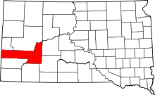 | |
| Towns | ||
| CDPs | ||
| Other unincorporated communities | ||
| Ghost towns | ||
| Footnotes | ‡This populated place also has portions in an adjacent county or counties | |