Hutchinson County, South Dakota
| Hutchinson County, South Dakota | |
|---|---|
 Hutchinson County Courthouse in Olivet | |
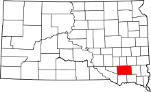 Location in the U.S. state of South Dakota | |
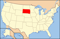 South Dakota's location in the U.S. | |
| Founded | 1871 |
| Seat | Olivet |
| Largest city | Parkston |
| Area | |
| • Total | 814 sq mi (2,108 km2) |
| • Land | 813 sq mi (2,106 km2) |
| • Water | 1.5 sq mi (4 km2), 0.2% |
| Population (est.) | |
| • (2015) | 7,301 |
| • Density | 9.0/sq mi (3/km²) |
| Congressional district | At-large |
| Time zone | Central: UTC-6/-5 |
Hutchinson County is a county located in the U.S. state of South Dakota. As of the 2010 census, the population was 7,343.[1] Its county seat is Olivet.[2] The county was created in 1862 and organized in 1871.[3] It was named for John Hutchinson, first territorial secretary.[4]
Geography
According to the U.S. Census Bureau, the county has a total area of 814 square miles (2,110 km2), of which 813 square miles (2,110 km2) is land and 1.5 square miles (3.9 km2) (0.2%) is water.[5]
Major highways
 U.S. Highway 18
 U.S. Highway 81
 South Dakota Highway 25
 South Dakota Highway 37
 South Dakota Highway 44
Adjacent counties
- Hanson County - north
- McCook County - northeast
- Turner County - east
- Yankton County - southeast
- Bon Homme County - south
- Charles Mix County - southwest
- Douglas County - west
- Davison County - northwest
Demographics
| Historical population | |||
|---|---|---|---|
| Census | Pop. | %± | |
| 1870 | 37 | — | |
| 1880 | 5,573 | 14,962.2% | |
| 1890 | 10,469 | 87.9% | |
| 1900 | 11,897 | 13.6% | |
| 1910 | 12,319 | 3.5% | |
| 1920 | 13,475 | 9.4% | |
| 1930 | 13,904 | 3.2% | |
| 1940 | 12,668 | −8.9% | |
| 1950 | 11,423 | −9.8% | |
| 1960 | 11,085 | −3.0% | |
| 1970 | 10,379 | −6.4% | |
| 1980 | 9,350 | −9.9% | |
| 1990 | 8,262 | −11.6% | |
| 2000 | 8,075 | −2.3% | |
| 2010 | 7,343 | −9.1% | |
| Est. 2015 | 7,301 | [6] | −0.6% |
| U.S. Decennial Census[7] 1790-1960[8] 1900-1990[9] 1990-2000[10] 2010-2015[1] | |||
2000 census
As of the census[11] of 2000, there were 8,075 people, 3,190 households, and 2,191 families residing in the county. The population density was 10 people per square mile (4/km²). There were 3,517 housing units at an average density of 4 per square mile (2/km²). The racial makeup of the county was 98.82% White, 0.09% Black or African American, 0.57% Native American, 0.10% Asian, 0.06% from other races, and 0.36% from two or more races. 0.52% of the population were Hispanic or Latino of any race.
63% of the population of Hutchinson County reports German ancestry and 8,3 speak German at home.
There were 3,190 households out of which 28.00% had children under the age of 18 living with them, 61.50% were married couples living together, 4.40% had a female householder with no husband present, and 31.30% were non-families. 29.60% of all households were made up of individuals and 18.50% had someone living alone who was 65 years of age or older. The average household size was 2.43 and the average family size was 3.03.
In the county, the population was spread out with 24.90% under the age of 18, 5.60% from 18 to 24, 22.10% from 25 to 44, 21.20% from 45 to 64, and 26.20% who were 65 years of age or older. The median age was 43 years. For every 100 females there were 94.90 males. For every 100 females age 18 and over, there were 90.70 males.
The median income for a household in the county was $30,026, and the median income for a family was $37,715. Males had a median income of $25,654 versus $18,141 for females. The per capita income for the county was $15,922. About 9.60% of families and 13.00% of the population were below the poverty line, including 18.30% of those under age 18 and 11.30% of those age 65 or over.
2010 census
As of the 2010 United States Census, there were 7,343 people, 2,930 households, and 1,871 families residing in the county.[12] The population density was 9.0 inhabitants per square mile (3.5/km2). There were 3,351 housing units at an average density of 4.1 per square mile (1.6/km2).[13] The racial makeup of the county was 97.4% white, 0.7% American Indian, 0.4% black or African American, 0.2% Asian, 0.5% from other races, and 0.9% from two or more races. Those of Hispanic or Latino origin made up 1.6% of the population.[12] In terms of ancestry, 67.7% were German, 8.7% were Russian, 7.4% were Norwegian, 6.9% were Irish, and 3.6% were American.[14]
Of the 2,930 households, 24.6% had children under the age of 18 living with them, 55.6% were married couples living together, 5.0% had a female householder with no husband present, 36.1% were non-families, and 33.4% of all households were made up of individuals. The average household size was 2.22 and the average family size was 2.82. The median age was 46.8 years.[12]
The median income for a household in the county was $39,310 and the median income for a family was $52,390. Males had a median income of $35,180 versus $25,417 for females. The per capita income for the county was $21,944. About 6.4% of families and 10.4% of the population were below the poverty line, including 11.5% of those under age 18 and 14.5% of those age 65 or over.[15]
Mennonites and Hutterites
Hutchinson County is the most heavily Mennonite-populated county of South Dakota. German-speaking Mennonites from Russia settled in the county beginning in 1874 until the early 1880s.[16] South Dakota has the nation's largest population of Hutterites,[17] a communal Anabaptist group who emigrated also from Russia during the same period as the Mennonites, with whom they share the Anabaptist faith. Hutterites live in communities each of about 150 people. Wolf Creek Colony is in Hutchinson County, where the Wolf meets the James River. This colony is west of Freeman and north of Olivet and Menno.[18]
Communities
Cities
Towns
Census-designate places
Townships
The county is divided into twenty-three townships:
- Capital
- Clayton
- Cross Plains
- Fair
- Foster
- German
- Grandview
- Kassel
- Kaylor
- Kulm
- Liberty
- Mittown
- Molan
- Oak Hollow
- Pleasant
- Sharon
- Silver Lake
- Starr
- Susquehanna
- Sweet
- Valley
- Wittenberg
- Wolf Creek
See also
References
- 1 2 "State & County QuickFacts". United States Census Bureau. Retrieved November 25, 2013.
- ↑ "Find a County". National Association of Counties. Retrieved 2011-06-07.
- ↑ "Dakota Territory, South Dakota, and North Dakota: Individual County Chronologies". Dakota Territory Atlas of Historical County Boundaries. The Newberry Library. 2006. Retrieved March 29, 2015.
- ↑ Gannett, Henry (1905). The Origin of Certain Place Names in the United States. Govt. Print. Off. p. 164.
- ↑ "2010 Census Gazetteer Files". United States Census Bureau. August 22, 2012. Retrieved March 26, 2015.
- ↑ "County Totals Dataset: Population, Population Change and Estimated Components of Population Change: April 1, 2010 to July 1, 2015". Retrieved July 2, 2016.
- ↑ "U.S. Decennial Census". United States Census Bureau. Retrieved March 26, 2015.
- ↑ "Historical Census Browser". University of Virginia Library. Retrieved March 26, 2015.
- ↑ Forstall, Richard L., ed. (March 27, 1995). "Population of Counties by Decennial Census: 1900 to 1990". United States Census Bureau. Retrieved March 26, 2015.
- ↑ "Census 2000 PHC-T-4. Ranking Tables for Counties: 1990 and 2000" (PDF). United States Census Bureau. April 2, 2001. Retrieved March 26, 2015.
- ↑ "American FactFinder". United States Census Bureau. Retrieved 2011-05-14.
- 1 2 3 "DP-1 Profile of General Population and Housing Characteristics: 2010 Demographic Profile Data". United States Census Bureau. Retrieved 2016-03-12.
- ↑ "Population, Housing Units, Area, and Density: 2010 - County". United States Census Bureau. Retrieved 2016-03-12.
- ↑ "DP02 SELECTED SOCIAL CHARACTERISTICS IN THE UNITED STATES – 2006-2010 American Community Survey 5-Year Estimates". United States Census Bureau. Retrieved 2016-03-12.
- ↑ "DP03 SELECTED ECONOMIC CHARACTERISTICS – 2006-2010 American Community Survey 5-Year Estimates". United States Census Bureau. Retrieved 2016-03-12.
- ↑ Unruh, J. D. (1956). "Hutchinson County (South Dakota, USA)". Global Anabaptist Mennonite Encyclopedia Online. Retrieved July 30, 2015.
- ↑ "Color them plain but successful". The Federal Reserve Bank of Minneapolis. Retrieved 2008-12-14.
- ↑ Johnson, Dirk (November 25, 1987). "Wolf Creek Journal; Idealists With a Knack For Being Prosperous". New York Times. Retrieved June 20, 2015.
 |
Davison County | Hanson County | McCook County | |
| Douglas County | |
Turner County | ||
| ||||
| | ||||
| Charles Mix County | Bon Homme County | Yankton County |
Municipalities and communities of Hutchinson County, South Dakota, United States | ||
|---|---|---|
| Cities | | |
| Towns | ||
| CDPs | ||
Coordinates: 43°20′N 97°45′W / 43.34°N 97.75°W