Charles Mix County, South Dakota
| Charles Mix County, South Dakota | |
|---|---|
 Charles Mix County Courthouse in Lake Andes | |
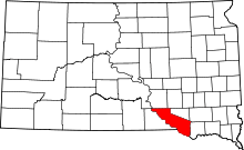 Location in the U.S. state of South Dakota | |
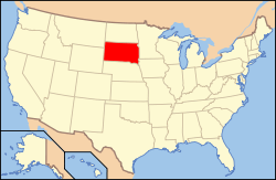 South Dakota's location in the U.S. | |
| Founded | 1879 |
| Named for | Charles Eli Mix |
| Seat | Lake Andes |
| Largest city | Wagner |
| Area | |
| • Total | 1,150 sq mi (2,978 km2) |
| • Land | 1,097 sq mi (2,841 km2) |
| • Water | 53 sq mi (137 km2), 4.6% |
| Population (est.) | |
| • (2015) | 9,383 |
| • Density | 8.3/sq mi (3/km²) |
| Congressional district | At-large |
| Time zone | Central: UTC-6/-5 |
| Website |
charlesmix |
Charles Mix County is a county located in the U.S. state of South Dakota. As of the 2010 census, the population was 9,129.[1] Its county seat is Lake Andes.[2] The county was created in 1862 and organized in 1879.[3] It was named after Charles Eli Mix, an official of the Bureau of Indian Affairs influential in signing a peace treaty with the local Lakota Indian tribes.[4] The easternmost approximately 60% of the county comprises the Yankton Indian Reservation.
Geography
According to the U.S. Census Bureau, the county has a total area of 1,150 square miles (3,000 km2), of which 1,097 square miles (2,840 km2) is land and 53 square miles (140 km2) (4.6%) is water.[5]
Major highways
 U.S. Highway 18
 U.S. Highway 281
 South Dakota Highway 44
 South Dakota Highway 45
 South Dakota Highway 46
 South Dakota Highway 50
 South Dakota Highway 1804
Adjacent counties
- Brule County - north
- Aurora County - northeast
- Douglas County - northeast
- Hutchinson County - east
- Bon Homme County - east
- Knox County, Nebraska - southeast
- Boyd County, Nebraska - southwest
- Gregory County - west
National protected areas
Demographics
| Historical population | |||
|---|---|---|---|
| Census | Pop. | %± | |
| 1870 | 152 | — | |
| 1880 | 407 | 167.8% | |
| 1890 | 4,178 | 926.5% | |
| 1900 | 8,498 | 103.4% | |
| 1910 | 14,899 | 75.3% | |
| 1920 | 16,256 | 9.1% | |
| 1930 | 16,703 | 2.7% | |
| 1940 | 13,449 | −19.5% | |
| 1950 | 15,558 | 15.7% | |
| 1960 | 11,785 | −24.3% | |
| 1970 | 9,994 | −15.2% | |
| 1980 | 9,680 | −3.1% | |
| 1990 | 9,131 | −5.7% | |
| 2000 | 9,350 | 2.4% | |
| 2010 | 9,129 | −2.4% | |
| Est. 2015 | 9,383 | [6] | 2.8% |
| U.S. Decennial Census[7] 1790-1960[8] 1900-1990[9] 1990-2000[10] 2010-2015[1] | |||
2000 census
As of the census of 2000, there were 9,350 people, 3,343 households, and 2,326 families residing in the county. The population density was 8 people per square mile (3/km²). There were 3,853 housing units at an average density of 4 per square mile (1/km²). The racial makeup of the county was 69.65% White, 0.13% Black or African American, 28.28% Native American, 0.10% Asian, 0.01% Pacific Islander, 0.47% from other races, and 1.37% from two or more races. 1.89% of the population were Hispanic or Latino of any race. 23.9% were of German, 10.2% Czech, 10.1% Dutch and 5.5% Norwegian ancestry.
There were 3,343 households out of which 34.20% had children under the age of 18 living with them, 53.10% were married couples living together, 11.70% had a female householder with no husband present, and 30.40% were non-families. 28.30% of all households were made up of individuals and 15.10% had someone living alone who was 65 years of age or older. The average household size was 2.74 and the average family size was 3.37.
In the county, the population was spread out with 32.00% under the age of 18, 7.10% from 18 to 24, 23.20% from 25 to 44, 20.40% from 45 to 64, and 17.30% who were 65 years of age or older. The median age was 36 years. For every 100 females there were 96.60 males. For every 100 females age 18 and over, there were 94.10 males.
The median income for a household in the county was $26,060, and the median income for a family was $30,688. Males had a median income of $24,747 versus $19,688 for females. The per capita income for the county was $11,502. About 20.80% of families and 26.90% of the population were below the poverty line, including 35.50% of those under age 18 and 21.00% of those age 65 or over.
2010 census
As of the 2010 United States Census, there were 9,129 people, 3,249 households, and 2,222 families residing in the county.[11] The population density was 8.3 inhabitants per square mile (3.2/km2). There were 3,849 housing units at an average density of 3.5 per square mile (1.4/km2).[12] The racial makeup of the county was 65.0% white, 31.7% American Indian, 0.2% Asian, 0.1% black or African American, 0.3% from other races, and 2.7% from two or more races. Those of Hispanic or Latino origin made up 1.7% of the population.[11] In terms of ancestry, 30.2% were German, 12.0% were Dutch, 11.7% were Czech, 6.8% were Norwegian, 5.1% were Irish, and 1.8% were American.[13]
Of the 3,249 households, 33.7% had children under the age of 18 living with them, 50.0% were married couples living together, 12.9% had a female householder with no husband present, 31.6% were non-families, and 29.0% of all households were made up of individuals. The average household size was 2.63 and the average family size was 3.23. The median age was 38.2 years.[11]
The median income for a household in the county was $35,808 and the median income for a family was $46,962. Males had a median income of $33,477 versus $25,740 for females. The per capita income for the county was $17,403. About 17.4% of families and 24.0% of the population were below the poverty line, including 32.9% of those under age 18 and 15.6% of those age 65 or over.[14]
Communities
.png)
Cities
- Geddes
- Lake Andes (county seat)
- Platte
- Wagner
Towns
Census-designated place
Townships
The county is divided into twenty-four townships:
- Bryan
- Carroll
- Choteau Creek
- Darlington
- Forbes
- Goose Lake
- Hamilton
- Highland
- Howard
- Jackson
- Kennedy
- La Roche
- Lake George
- Lawrence
- Lone Tree
- Moore
- Platte
- Plain Center
- Rhoda
- Roe
- Rouse
- Signal
- Waheheh
- White Swan
Unorganized territory
The unorganized territory of Castalia is located in the county.
Notable residents
- Doug Eggers, American football player
- Jack Sully was elected sheriff in 1872.
See also
References
- 1 2 "State & County QuickFacts". United States Census Bureau. Retrieved November 26, 2013.
- ↑ "Find a County". National Association of Counties. Archived from the original on 2011-05-31. Retrieved 2011-06-07.
- ↑ "Dakota Territory, South Dakota, and North Dakota: Individual County Chronologies". Dakota Territory Atlas of Historical County Boundaries. The Newberry Library. 2006. Retrieved March 29, 2015.
- ↑ Charles Mix County Archived June 9, 2010, at the Wayback Machine.
- ↑ "2010 Census Gazetteer Files". United States Census Bureau. August 22, 2012. Retrieved March 23, 2015.
- ↑ "County Totals Dataset: Population, Population Change and Estimated Components of Population Change: April 1, 2010 to July 1, 2015". Retrieved July 2, 2016.
- ↑ "U.S. Decennial Census". United States Census Bureau. Archived from the original on May 11, 2015. Retrieved March 23, 2015.
- ↑ "Historical Census Browser". University of Virginia Library. Retrieved March 23, 2015.
- ↑ Forstall, Richard L., ed. (March 27, 1995). "Population of Counties by Decennial Census: 1900 to 1990". United States Census Bureau. Retrieved March 23, 2015.
- ↑ "Census 2000 PHC-T-4. Ranking Tables for Counties: 1990 and 2000" (PDF). United States Census Bureau. April 2, 2001. Retrieved March 23, 2015.
- 1 2 3 "DP-1 Profile of General Population and Housing Characteristics: 2010 Demographic Profile Data". United States Census Bureau. Retrieved 2016-03-11.
- ↑ "Population, Housing Units, Area, and Density: 2010 - County". United States Census Bureau. Retrieved 2016-03-11.
- ↑ "DP02 SELECTED SOCIAL CHARACTERISTICS IN THE UNITED STATES – 2006-2010 American Community Survey 5-Year Estimates". United States Census Bureau. Retrieved 2016-03-11.
- ↑ "DP03 SELECTED ECONOMIC CHARACTERISTICS – 2006-2010 American Community Survey 5-Year Estimates". United States Census Bureau. Retrieved 2016-03-11.
External links
-
 "Charles Mix". The American Cyclopædia. 1879.
 |
Brule County | Aurora County and Douglas County | | |
| Gregory County | |
Hutchinson County and Bon Homme County | ||
| ||||
| | ||||
| Boyd County, Nebraska | Knox County, Nebraska |
Municipalities and communities of Charles Mix County, South Dakota, United States | ||
|---|---|---|
| Cities | | |
| Towns | ||
| CDP | ||
| Unincorporated communities | ||
| Indian reservation | ||
Coordinates: 43°13′N 98°35′W / 43.21°N 98.59°W