Ocampo, Camarines Sur
| Ocampo | |
|---|---|
| Municipality | |
| Motto: Padagos Ocampo! | |
 Map of Camarines Sur showing the location of Ocampo | |
.svg.png) Ocampo Location within the Philippines | |
| Coordinates: 13°34′N 123°23′E / 13.57°N 123.38°ECoordinates: 13°34′N 123°23′E / 13.57°N 123.38°E | |
| Country | Philippines |
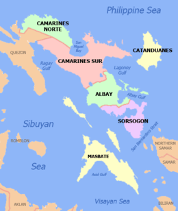
| Region | Bicol (Region V) |
| Province | Camarines Sur |
| District | 3rd district |
| Founded | 1949 |
| Barangays | 25 |
| Government[1] | |
| • Mayor | Corazon Olos |
| Area[2] | |
| • Total | 118.33 km2 (45.69 sq mi) |
| Population (2015 census)[3] | |
| • Total | 45,934 |
| • Density | 390/km2 (1,000/sq mi) |
| Time zone | PST (UTC+8) |
| ZIP code | 4419 |
| IDD : area code | +63 (0)54 |
| Income class | 3rd class; partially urban |
Ocampo is a 3rd class municipality in the province of Camarines Sur, Philippines. According to the 2015 census, it has a population of 45,934 people.[3]
History
Historical documents revealed that the municipality of Ocampo, known before as Mabato-bato, was existing since 1735. Mabato-bato started as a sitio which was described as abounding with rocks and boulders of various sizes which were scattered over the place.
Since the early 1900s, the town of Ocampo had been a part of Pili though it separated years later, in 1949, and became an independent municipality.
August 13, 1949, marked a major event in the history of the town as this was the inauguration date of Ocampo's elevation into a municipality. It was also during this day when the name Matobato was officially changed into Ocampo, in honor of the late Don Julian Ocampo, then the governor of Camarines Sur.
Ocampo is the place where Governor Luis Villafuerte chose to build a sprawling deer sanctuary where at present houses different deer species from both local and foreign origins. This has served both for tourist attraction and commercial purposes.
Barangays
Ocampo is politically subdivided into 25 barangays.[2]
- Ayugan
- Cabariwan
- Cagmanaba
- Del Rosario
- Gatbo
- Guinaban
- Hanawan
- Hibago
- La Purisima Nuevo
- May-Ogob
- New Moriones
- Old Moriones
- Pinit
- Poblacion Central
- Poblacion East
- Poblacion West
- Salvacion
- San Antonio
- San Francisco
- San Jose Oras
- San Roque Commonal
- San Vicente
- Santa Cruz
- Santo Niño
- Villaflorida
Demographics
| Population census of Ocampo | ||
|---|---|---|
| Year | Pop. | ±% p.a. |
| 1990 | 30,876 | — |
| 1995 | 34,898 | +2.32% |
| 2000 | 36,316 | +0.86% |
| 2007 | 39,759 | +1.26% |
| 2010 | 43,523 | +3.35% |
| 2015 | 45,934 | +1.03% |
| Source: Philippine Statistics Authority[3][4][5] | ||
In the 2015 census, the population of Ocampo, Camarines Sur, was 45,934 people,[3] with a density of 390 inhabitants per square kilometre or 1,000 inhabitants per square mile.
Language
Partido Dialect is the primary dialect spoken in the entire town. Riŋkonāda or Rinconada Bikol is spoken by a minority of the population, along with Bicol Naga. Tagalog and English are also spoken and understood.
Religion
The religious groups in the locality are: Roman Catholic, Seventh Day Adventist, The Church of Jesus Christ of Latter Day Saints, Jehovah's Witnesses, Iglesia Ni Cristo, Word International Ministries and other groups of Born-Again Christians.
Economy
Commercial establishments include internet shops, bank, pawnshops, hardware stores, groceries, drug stores, eateries, computer shops, bakeries, motorcycle dealers, agri-dealers, gas stations and several ricemills. Various businesses are sprouting. 7 Eleven opened a branch in Barangay Poblacion Central.
Local products include palay, corn, root crops, sugarcane, coconut, and vegetables. Livestock and poultry products are also available.
CASURECO IV supplies power requirement in the town.
Tourism
Tourist destinations include the Provincial-owned Deer Farm in Barangay Santa Cruz, Bamboo Farm in Barangay Hanawan and Murokburok spring in Barangay Gatbo. There's also Tera Mater Resort, the first resort in the town, located in Barangay New Moriones and a newly opened resort in Barangay San Antonio.
Strawberry Farm owned by Libreja family known as Bicol Strawberry Farm is found in Barangay Pinit.
Fiestas and festivals
The town fiesta of Ocampo is celebrated in the month August in commemoration of the town's patron saint, Saint Bernard Abbot. The only festival at Ocampo is the Tinagba Festival which showcases the locally produced products of the town. It is celebrated annually during the month of August a week before the town fiesta. During this time, various activities are done.
Transportation
The town is the gateway to 4th District of Camarines Sur, and via Hanawan junction, Consocep falls northward and Iriga City southward. Accessible by land transportation, via National Highway going to Lagonoy, Camarines Sur. From Naga City, the easiest way to go to the town is to ride a bus going to Lagonoy from the Naga City Central Bus Terminal and disembark at Ocampo bus stop.
Education
Elementary Schools
- Ocampo Evangelical School and Glorious Adonai Learning Academy offers elementary education.
- Ocampo Central School
- Ayugan Elementary School
- Cabariwan Elementary School
- Del Rosario Elementary School
- Gatbo Elementary School
- Guinaban Elementary School
- Hanawan Elementary School
- Hibago Elementary School
- La Purisima Elementary School
- May-Ogob Elementary School
- New Moriones Elementary School
- Pinit Elementary School
- San Antonio Elementary School
- San Jose Oras Elementary School
- San Roque Commonal Elementary School
- Santa Cruz Elementary School
- Santo Niño Elementary School
- Villaflorida Elementary School
High School
- Two secondary schools: Ocampo National High School in Barangay San Francisco and Hanawan High School in Barangay Hanawan. Ocampo National High School Cagmanaba Campus already opened last June 2015.
Vocational School
- Ryden International and IConnect Global are the two TESDA schools offering vocational courses.
See also
References
- ↑ "Municipalities". Quezon City, Philippines: Department of the Interior and Local Government. Retrieved 9 January 2013.
- 1 2 "Province: CAMARINES SUR". PSGC Interactive. Makati City, Philippines: National Statistical Coordination Board. Retrieved 9 January 2013.
- 1 2 3 4 "Region V (BICOL REGION)". Census of Population (2015): Total Population by Province, City, Municipality and Barangay (Report). PSA. Retrieved 20 June 2016.
- ↑ "Region V (BICOL REGION)". Census of Population and Housing (2010): Total Population by Province, City, Municipality and Barangay (Report). NSO. Retrieved 29 June 2016.
- ↑ "Province of Camarines Sur". Municipality Population Data. LWUA Research Division. Retrieved 24 July 2013.
External links
- Philippine Standard Geographic Code
- Philippine Census Information
- Official Site of the Province of Camarines Sur
 |
Mount Isarog | | ||
| Pili | |
Tigaon Sagñay | ||
| ||||
| | ||||
| Bula | Baao | Iriga City |
| Administrative Divisions |
|  | ||||||
|---|---|---|---|---|---|---|---|---|
| Geography | ||||||||
| History | ||||||||
| Religion | ||||||||
| Public Utilities and Services |
| |||||||
| Transportation | ||||||||
| Education | ||||||||
| Landmarks |
| |||||||
Pili (capital) | |
| Municipalities | |
| Component city | |
| Independent component city |
|