Batuan, Masbate
| Batuan | |
|---|---|
| Municipality | |
 Map of Masbate with Batuan highlighted | |
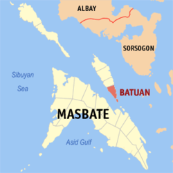
.svg.png) Batuan Location within the Philippines | |
| Coordinates: 12°25′N 123°46′E / 12.417°N 123.767°ECoordinates: 12°25′N 123°46′E / 12.417°N 123.767°E | |
| Country | Philippines |
| Region | Bicol (Region V) |
| Province | Masbate |
| District | 1st district |
| Founded | 1951 |
| Barangays | 14 |
| Government[1] | |
| • Mayor | Charlie D. Yuson III |
| Area[2] | |
| • Total | 56.28 km2 (21.73 sq mi) |
| Population (2010)[3] | |
| • Total | 13,764 |
| • Density | 240/km2 (630/sq mi) |
| Time zone | PST (UTC+8) |
| Zip Code | 5415 |
| Dialing code | 56 |
Batuan is a fifth class municipality in the province of Masbate, Philippines. It is located at the southern point of Ticao Island. According to the 2010 census, it has a population of 13,764 people.[3] It is the smallest municipality in Masbate, both in land area and population.
In 1951, the barrios of Batuan, Burgos, Gibraltar, Costa Rica, Panisihan, and Matabao were separated from San Fernando to form the Municipality of Batuan.[4]
The municipality is home to the Bongsanglay Natural Park.
Barangays
Batuan is politically subdivided into 14 barangays.[2]
- Burgos
- Cañares
- Canvañez
- Costa Rica
- Danao
- Gibraltar
- Mabuhay
- Matabao
- Nasandig
- Panisihan
- Poblacion
- Rizal
- Royroy
- Sawang
Demographics
| Population census of Batuan | ||
|---|---|---|
| Year | Pop. | ±% p.a. |
| 1990 | 10,525 | — |
| 1995 | 12,705 | +3.59% |
| 2000 | 12,038 | −1.15% |
| 2007 | 12,585 | +0.61% |
| 2010 | 13,764 | +3.31% |
| Source: National Statistics Office[3][5] | ||
References
- ↑ "Municipalities". Quezon City, Philippines: Department of the Interior and Local Government. Archived from the original on 25 January 2013. Retrieved 20 January 2013.
- 1 2 "Province: MASBATE". PSGC Interactive. Makati City, Philippines: National Statistical Coordination Board. Retrieved 20 January 2013.
- 1 2 3 "Total Population by Province, City, Municipality and Barangay: as of May 1, 2010" (PDF). 2010 Census of Population and Housing. National Statistics Office. Archived from the original (PDF) on 19 November 2012. Retrieved 20 January 2013.
- ↑ "An Act Creating the Municipality of Batuan in the Province of Masbate". LawPH.com. Retrieved 2011-04-09.
- ↑ "Province of Masbate". Municipality Population Data. LWUA Research Division. Retrieved 23 July 2013.
External links
- Philippine Standard Geographic Code
- Philippine Census Information
- Local Governance Performance Management System
 |
San Fernando | | ||
| Mobo / Masbate Pass | |
Samar Sea / San Vicente, Northern Samar | ||
| ||||
| | ||||
| Masbate Pass Uson |
Masbate City (capital) | |
| Municipalities | |
| Component city | |
This article is issued from Wikipedia - version of the 10/29/2016. The text is available under the Creative Commons Attribution/Share Alike but additional terms may apply for the media files.