Bicol Region
| Bicol Region Region V | ||||||||
|---|---|---|---|---|---|---|---|---|
| Region | ||||||||
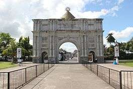
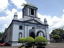
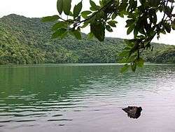
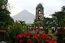
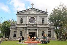
From top, left to right: Porta Mariae; Legazpi Cathedral; Lake Bulusan; Palumbanes; Mayon Volcano; Ateneo de Naga University Church | ||||||||
|
Nickname(s):
| ||||||||
 Location in the Philippines | ||||||||
| Coordinates: 13°30′N 123°20′E / 13.5°N 123.33°ECoordinates: 13°30′N 123°20′E / 13.5°N 123.33°E | ||||||||
| Country | Philippines | |||||||
| Island group | Luzon | |||||||
| Regional center | Legazpi | |||||||
| Area | ||||||||
| • Total | 18,155.82 km2 (7,010.00 sq mi) | |||||||
| Population (2015 census)[1] | ||||||||
| • Total | 5,796,989 | |||||||
| • Density | 320/km2 (830/sq mi) | |||||||
| Time zone | PST (UTC+8) | |||||||
| ISO 3166 code | PH-05 | |||||||
| Provinces | ||||||||
| Cities |
7
| |||||||
| Municipalities | 107 | |||||||
| Barangays | 3,471 | |||||||
| Cong. districts | 14 | |||||||
| Languages | ||||||||
| Website |
dilgbicol | |||||||

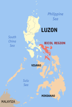
The Bicol Region, also known simply as Bicol, (Central Bikol: Rehiyon nin Bikol/Kabikolan; Rinconada Bicol: Rehiyon ka Bikol; Filipino: Kabikulan; Spanish: Bicolandia) is a region of the Philippines, designated as Region V. Bicol comprises six provinces, four on the Bicol Peninsula mainland (the southeastern end of Luzon) – Albay, Camarines Norte, Camarines Sur, and Sorsogon – and the offshore island provinces of Catanduanes and Masbate.[2]
The regional center and largest city is Legazpi City, Albay.[3][4] The region is bounded by the Lamon Bay to the north, Philippine Sea to the east, and the Sibuyan Sea and Ragay Gulf to the west. The northernmost provinces, Camarines Norte and Camarines Sur, are bordered to the west by the province of Quezon.
Geography
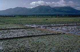
The Bicol Region comprises the southern part of Luzon, the largest island in the Philippine archipelago. The total land area is 5.9% of the total land area of the country. Around 69.3% of the total land area is alienable and disposable while the remaining 30.7% is public forest areas.[5]
History
The Bicol region was known as Ibalon, variously interpreted to derive form ibalio, "to bring to the other side"; ibalon, "people from the other side" or "people who are hospitable and give visitors gifts to bring home"; or as a corruption of Gibal-ong, a sitio of Magallanes, Sorsogon where the Spaniards first landed in 1567. The Bicol River was first mentioned in Spanish Documents in 1572. The region was also called Los Camarines after the huts found by the Spaniards in Camalig, Albay. No prehistoric animal fossils have been discovered in Bicol and the peopling of the region remains obscure. The Aeta from Camarines Sur to Sorsogon strongly suggest that aborigines lived there long ago, but earliest evidence is of middle to late Neolithic life.[6]
A barangay (village) system was in existence by 1569. Records show no sign of Islamic rule nor any authority surpassing the datu (chieftain). Precolonial leadership was based on strength, courage, and intelligence. The native seemed apolitical. Thus the datu's influence mattered most during crises like wars. Otherwise, early Bicol society remained family centered, and the leader was the head of the family.
The Spanish influence in Bicol resulted mainly from the efforts of Augustinian and Franciscan Spanish missionaries. The first churches in Bicol, the San Francisco Church, and the Naga Cathedral, both in Naga, along with the Holy Cross Parish in Nabua, Camarines Sur, are instituted by the Holy Order of the Franciscans. One of the oldest dioceses in the Philippines, the Archdiocese of Caceres, was also instituted in the Bicol Region. During this time, Bicol was dotted by many astilleros (shipyards) which were focused on constructing Manila Galleons from the local hardwood forests.[7]
Administrative divisions
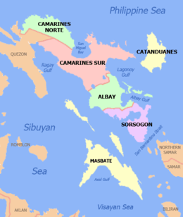
The region comprises six provinces: Albay, Camarines Norte, Camarines Sur, Sorsogon and the island-provinces of Catanduanes and Masbate.
As of 2015, Camarines Sur is the region's largest province in area and population, occupying 5,481.6 km2 (2,116.5 sq mi) or around 30.4% of the total land area with a population of 1,952,544. Catanduanes is the smallest in area as well as population with only 1,511.5 km2 (583.6 sq mi) or 8.4% of the total regional area and a population of 260,964.[1]
| Province | Capital | Population (2015)[1] | Area[8] | Density | Cities | Muni. | Bgy. | |||
|---|---|---|---|---|---|---|---|---|---|---|
| km2 | sq mi | /km2 | /sq mi | |||||||
| Albay | Legazpi City | 22.7% | 1,314,826 | 2,575.77 | 994.51 | 510 | 1,300 | 3 | 15 | 720 |
| Camarines Norte | Daet | 10.1% | 583,313 | 2,320.07 | 895.78 | 250 | 650 | 0 | 12 | 282 |
| Camarines Sur | Pili | 33.7% | 1,952,544 | 5,497.03 | 2,122.42 | 360 | 930 | 2 | 35 | 1,063 |
| Catanduanes | Virac | 4.5% | 260,964 | 1,492.16 | 576.13 | 170 | 440 | 0 | 11 | 315 |
| Masbate | Masbate City | 15.4% | 892,393 | 4,151.78 | 1,603.01 | 210 | 540 | 1 | 21 | 550 |
| Sorsogon | Sorsogon City | 13.7% | 792,949 | 2,119.01 | 818.15 | 370 | 960 | 1 | 14 | 541 |
| Total | 5,796,989 | 18,155.82 | 7,010.00 | 320 | 830 | 7 | 107 | 3,471 | ||
The region has one independent component city, Naga, and six component cities — Iriga, Legazpi, Ligao, Masbate City, Sorsogon City, and Tabaco. Masbate and Sorsogon are cities in their eponymous provinces.
| City | Population (2015)[1] | Area[9] | Density | City class | Income class | Province | ||
|---|---|---|---|---|---|---|---|---|
| Iriga City | 111,757 | 137.35 | 53.03 | 810 | 2,100 | Component | 4th | Camarines Sur |
| Legazpi City | 196,639 | 153.70 | 59.34 | 1,300 | 3,400 | Component | 2nd | Albay |
| Ligao City | 111,399 | 246.75 | 95.27 | 450 | 1,200 | Component | 4th | Albay |
| Masbate City | 95,389 | 188.00 | 72.59 | 510 | 1,300 | Component | 4th | Masbate |
| Naga City | 196,003 | 84.48 | 32.62 | 2,300 | 6,000 | Independent component | 2nd | Camarines Sur |
| Sorsogon City | 168,110 | 276.11 | 106.61 | 610 | 1,600 | Component | 2nd | Sorsogon |
| Tabaco City | 133,868 | 117.14 | 45.23 | 1,100 | 2,800 | Component | 4th | Albay |
Demographics
| Population census of Bicol | ||
|---|---|---|
| Year | Pop. | ±% |
| 1990 | 3,910,001 | — |
| 2000 | 4,686,669 | +19.9% |
| 2010 | 5,420,411 | +15.7% |
| 2015 | 5,796,989 | +6.9% |
| Source: National Statistics Office[10][1] | ||
Bicol Region has a population of 5,796,989 as of 2015 census, growing at an average annual rate of 1.29 percent between 2010 and 2015. The region's population density increased to 320 persons per square kilometer in 2015.
In 1970, Camarines Sur was the only province with close to a million population. Albay, which was next in rank, reached the 1970 population level of Camarines Sur only 20 years later. Masbate and Sorsogon were in the same level every census year from 1970 to 1980. It is noteworthy that distribution and growth of the 1970 population were towards areas that were sparsely populated but agriculturally rich and/or endowed with fishery resources. The island province of Catanduanes and its municipalities have exhibited very low population growth from 1970 to 1980.
In 1980, the pattern was towards urbanization. This was due to the pull of newly installed infrastructures, particularly roads, and the sporadic growth of trade in strategically situated municipalities that have better economic opportunities. The 1990 growth originated from the strong attraction of employment opportunities in established urban centers, which have become a source of growth of adjacent municipalities. This situation was highly evident in Naga and Legazpi areas, whose surrounding municipalities exhibited high growth rates. Unmistakably, the spill-over effects of development permeated those initial high growth areas.
Looking at the growth rates, all of the five provinces registered positive increases except for the province of Camarines Norte. Most evident were those for the provinces of Catanduanes, Masbate and Sorsogon, all of whom registered more than 50% increments in the 1980-1990 and 1990-2000 periods. The positive increase in the growth rate of Catanduanes was attributed to the improved sea transport facilities for ferrying people and cargo to and from the port of Tabaco. The opening of the port of San Andres and the rehabilitation of Virac Port likewise provided better access to goods and services in the province.
The Bicolanos are descended from the Austronesian-speaking immigrants who came from Southern China during the Iron Age. Many of Bicolanos also have Chinese, Arab, and Spanish admixtures. Most of the townsfolk have Spanish Mixtures and their language is referred to as Bicol or Bicolano. The Bicolano language is very fragmented, and its dialects are mutually incomprehensible to speakers of other Bicolano dialects. The majority of the Bicolano people are devout Roman Catholics due to the Spanish conquering the country and converting them to their religion. Catholic Mass is celebrated daily in many churches in the Bicol Region.
Language
The people of the Bicol Region, called Bicolanos, speak any of the several languages of the Bikol language family, called Bikol macrolanguages, an Austronesian languages closely grouped under the Central Philippine languages family such as the Visayan languages and Tagalog. The four major groups of language in Bikol are Coastal Bikol (with four sub-languages), Inland Bikol (with six sub-languages), Pandan Bikol (lone language) and Bisakol (with three sub-languages). The majority of Bicolanos understand and speak Central Bikol language (a member of Coastal Bikol group of languages) since it is the language used in literature and mass media, but with varying degrees. A known misconception of many Bicolanos is that Central Bikol, used in the cities of Legazpi and Naga, is the standard Bikol. Central Bikol, though spoken by the majority and with speakers represented in all provinces in the region, is not a standard Bikol since other forms of Bikol used in the region are separate languages and usually unintelligible. However, the standard form of Central Bikol language is the Canaman dialect.
Other Bikol languages are Rinconada Bikol, spoken in southern part of Camarines Sur province, Pandan Bikol spoken in northern part of Catanduanes island and the Albay Bikol group of languages that include Buhinon, Libon, West Miraya and East Miraya. Albay Bikol speakers can be found in Buhi, Camarines Sur, central and eastern parts of Albay and in Donsol, Sorsogon. The standard form of Rinconada Bikol both in pronunciation and writing is the Sinabukid (Highland) dialect of Iriga variant. On the other hand, Buhinon of Buhi, Camarines Sur and Libon of Libon, Albay are the languages that are only used in their respective municipalities. Rinconada Bikol and Albay Bikol group of languages are members of Inland Bikol, while Pandan Bikol is the only language with no sub-languages or division.
The majority of the population in Masbate and Sorsogon speaks Minasbate and Sorsoganon respectively. The two are Visayan languages but heavily influenced by Bikol languages, thus tagged and collectively referred to as Bisakol, a portmanteau of Bisaya (Visayan) and Bikol (Bicolano).
Aside from Masbateño, three more Visayan languages are spoken in Masbate, including Hiligaynon/Ilonggo is spoken in the southwestern tip, while Cebuano and Waray-Waray are spoken in the southern part of the island province respectively. Tagalog is the dominant and native language of Bicolanos living in the municipalities in the northern half of Camarines Norte.
Bicolanos also speak and understand Filipino, the national language of the Philippines. English is widely understood in businesses, schools and public places.
Religion

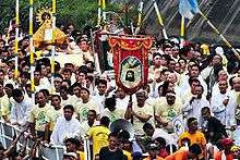
The region retains Roman Catholicism as the overwhelming religion of the great majority. The Catholic religion has the highest number of followers than any other area in the Philippines. The Catholic church grew in the Bicol Region through the efforts of the Bishops from Nueva Caceres(Naga) from the late 14th century until the Philippine Revolution in 1898. Naga, Camarines Sur is the religious center of the Bicol Region. The region houses one of the oldest dioceses in the Philippines, the ecclesiastical Archdiocese of Caceres, which is centered in Naga, Camarines Sur. Other dioceses include are the Dioceses of Legazpi, Sorsogon, Daet, Masbate, Libmanan and Virac. Fiestas (Feast day of saints) are annual celebrations of parishes, from a simple barrio fiesta honoring a patron associated for good harvest, to a town fiesta honoring a miraculous saint, a diocesan fiesta like the feast of Our Lady of Salvation, or a regional one such as the Our Lady of Peñafrancia Fiesta, the largest Marian devotion in Asia, a week-long celebration to honor the Virgin Mary, dubbed as the "Patroness of Bicolandia". In Luzon, the Bicol Region holds the most number of men entering the seminary for Catholic priesthood, or women entering the religious life to become Catholic nuns. This can be accredited to the Holy Rosary Seminary, Daughters of Mary, and Daughters of Charity Convents in Naga.
The largest minority religion in the region is Iglesia ni Cristo (INC) known for its magnificent worship buildings, commonly called chapels or kapilya, with towering spires that dot the Bicol landscape. Each province represents one ecclesiastical district (E.D.) with the exception of Camarines Sur which is divided into two - Camarines Southwest E.D. in Naga, and Camarines Southeast E.D. in Iriga City. In total, INC has seven ecclesiastical districts in the Bicol region. The chapel of local congregation of Legazpi, Albay is the biggest.
Other religions are also well represented in Bicol such as Protestants denominations of Seventh-Day Adventist church, Baptist Church, Pentecostal, born-again
Culture and traits
The Bicolano cuisine is primarily noted for the prominent use of chili peppers and gata (coconut milk) in its food. A classic example is the gulay na lada, known outside the region as Bicol Express, a well-loved dish using siling labuyo (native small chillies) and the aforementioned gata.
Like their other neighboring regions, Bicolanas are also expected to lend a hand in household work. They are even anticipated to offer assistance after being married. On the other hand, Bicolano men are expected to assume the role of becoming the primary source of income and financial support of his family.
Bicolanos are also known for being very religious, the place is known for Senora De Penafrancia. Bicolanos are often sweet, regionalistic, friendly, adventurous, puts high importance on education and social status. Contrary to what is believed, not all Bicolanos are fond of chili. Men often know how to cook.
Economy
Bicol Region has a large amount of rich flatland, and agriculture is the largest component of the economy, followed by commercial fishing. Coconuts, abaca, banana, coffee and jackfruit are the top five permanent crops in the region. Rice and corn are among the chief seasonal crops. Mining is also one of the contributors to the region's economy. Commercial fishing is also important with thirteen major fishing grounds supplying fish markets in places as far as Metro Manila.[11]
Tourism
_(794278440).jpg)
The region's tourism industry has been revived by the popularity of Mayon Volcano, the new CamSur Water Sports Complex, whale shark spotting, among others, which consequently increased the number of upscale resorts. Naga City has its colonial churches, and pilgrimages to Our Lady of Peñafrancia.[12][13][14]
The municipality of Daet and Catanduanes province have long been destinations for surfers.[15] The opening of the Southern Luzon International Airport in Legazpi City, which is under construction, is hoped to further boost tourism in the region.
Festivals
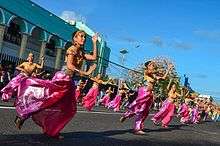
- Abaca Festival is an annual cultural celebration of the province. It cognizance of the importance of abaca in the local economy and the need to showcase its versatility as a major source of livelihood and craft material which has brought Catanduanes fame and fortune. The festival will showcase the life and resilient spirit of the Catandunganon and its culture, as well as the uniqueness and exoticness of the island and its people. The main features of the festival are: Padadyaw Ginamlangan or Padadyaw kan Abaka, Pinukpok Fashion Show, Urag Catandungan sports competitions, Kantang Catandungan or Musika kan Isla, Festival Dance Competition, Binibini and Ginoong Bikol, Hagyan sa Kabitoonan and Jobs Fair. It happens every 4th week of May.
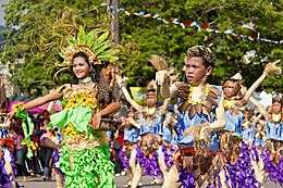
- Catandungan Festival is an annual prime celebration of the island province. It is the anniversary celebration and tribute to its founders, to continuously remind the people of Catanduanes of the provinces' independence from the province of Albay. The main features of the festival are: Street Dancing - Pantomina Dance, Beauty Pageant, Agro-Trade Fair, Sports Fest, Guided Tour, Surfing Cup, Art/Photo Exhibits, Etc. It happens every 24th-26 October.
- Coron Festival - A showcase of events highlighted by a street presentation participated in by the town’s different public and private schools and sectors gives a week of fun and merriment to visitors and locals. Held every third week of August in Tiwi, the religious package of devotion and prayer in honor of Albay’s patroness, Nuestra Señora de Salvacion (Our Lady of Salvation), is the peak event of the festival, colorfully drawing thousands of devotees and religious groups through a long maritime procession of different local sea vessels on the sea spray of the serene Pacific Ocean going to the quiet barangay of Joroan, the home of the miraculous image.
- The Pili Festival - celebrates the pili, which supports the livelihood of many Sorsoganons. Although the growing of pili is popular in the other provinces of Bicol, it is Sorsogon which has the largest land area devoted to pili farming. The Feast day of the Patron Saints of Sorsogon City- Sts. Peter and Paul coincides with the celebration of Pili Festival. Their feast day is on the 29th of June. Catholic Mass and Processions happen during this day.
- Ibalong Festival - A non-religious festival in Legazpi City, Albay held during August.
- Kasanggayahan Festival - celebrated in the whole province in the last week of October, commemorates the founding of Sorsogon as a province. Festivities include a series of cultural, historical, religious, agro-industrial and economic activities, showcasing the province's abundant agricultural products, particularly food and decorative items. Though a provincial event, most of the festivities during the Kasanggayahan Festival including the "Pantomina sa Tinampo", street dances and others are conducted in the city since this is the provincial capital of Sorsogon and the seat of the province is in the city.
- Kadagatan Festival - Formerly called the Bancathon race, the festival is a water sport activity participated in by fishermen from the different municipalities of Albay aimed to give recognition and at the same time provide a venue to the fishermen to show their strength, skills, and contributions to the socio-economic development of the region. Held in Bacacay every black Saturday.
- Kamundagan Festival - Naga City celebrates the Kamundagan Festival every Christmas time. It begins with the lighting of the Christmas Village in the Plaza Quezon Grandstand. After the lighting of the Christmas Village, six locally handmaid stars, known locally as parols are lighted with different meanings. Love, progress, peace, happiness, prosperity, and joy symbolize the stars. The giant Christmas tree is lighted twoweeks before Christmas. Every night, different fantasy-themed Christmas shows are held in the Plaza Quezon. A Grand Christmas Bazaar is also held near the Cathedral, exhibiting different talents in Magic, Trickery, Beauty, and Brains. The Bazaar also has some stores that sell locally-made Christmas themed products for visitor.[16][17]
- Katalingkasan Festival - The festivity retraces the valiant story of the virgins of the town who worked hard in making Libon as one of the earliest settlements in Albay. Featured activities are trade fairs, shows, and street dancing. Held every second week of July.
- Kinalas Festival - Naga City celebrates Kinalas Festival during its yearly anniversary of Chartership or Cityhood. It honors the most famous local delicacies, the Kinalas, and Siling Labuyo, with it having a food contest. Also known as Charter Day Festival, different organizations and schools, compete in Sports and Academics, as sponsored by the local government.[18]
- Magayon Festival - In admiration of the Majestic Mayon’s beauty and splendor, this festival is dubbed as Magayon, a Bikol term which means beautiful.[19]
- Our Lady of Peñafrancia Festival - The feast of Our Lady of Peñafrancia is celebrated on the third Saturday of September in Naga City, Bicol Philippines. All roads and routes will lead to Naga City in Camarines Sur where six million Bicolanos from here and abroad will flock to that progressive city to pay honor to the Virgin of Peñafrancia, miraculous patroness of the Bicol Region. Bicolanos from all walks of life will be in Naga City to meet their relatives and partidarios, share food, drinks, and prayers with them, and most of all, to pay homage and make thanksgiving to the Virgin of Peñafrancia, whom the Bicolanos fondly call Ina. Through the Franciscans, the annual feast of the Virgin of Peñafrancia, the Patroness of Bicolandia, was instituted. Fr. Miguel Robles asked a local artist to carve a replica of the statue of the Virgin in Salamanca; now, the statue is celebrated through an annual fluvial procession and regional feast in Naga City.[20][21] The Regional Civic Parade,[22] Regional Military Parade[23]
- Pagsuwak Festival - The act of thanksgiving for Guinobatan’s growth, development, and progress, fitted in with the people’s gesture of offering for the bountiful harvest. Held every 9th-15 August.
- Rodeo Masbateño Festival - Is an annual event which takes place in Masbate City which showcases skills in livestock handling, such as lassoing, wrestling, and riding cattle. Also included in the event are a fair and exhibitions and trade of cattle and horses. The event has taken place every summer since 1993 in the province of Masbate, which is traditionally considered the "Cattle Country of the Philippines."
- Salingoy Festival - Salingoy is a Bikol term that literally means looking back. A century of devotion (1901-2001) to one of Bacacay’s patron saints, Nuestra Señora de los Samparados, Salingoy Festival came into being, a centennial commemoration of unbroken reverence to God’s blessings and bounty. Salingoy looks back with humility by reminiscing into the richness of fidelity to Our Lady (Holy Mother Mary) and to relive Bacacay’s historical, socio-cultural, and religious heritage. Held every August 9 up to 15.
- Sarung Banggi - An annual fun-filled eight-day summer festivity immortalizing the timeless love song Sarung Banggi, and a tribute to its composer, Potenciano V. Gregorio. Held every 18th - 25 May in Sto. Domingo, the Sarung Banggi festival showcases a variety of cultural and religious activities. The entire colorful performance is shown at nighttime when the street parade routes are brightly lighted with large torches. The whole town becomes a true picture of rural life with the multitude of people occupying the streets to watch and join the nighttime merriment.
- Tinagbuan Festival - This festivity is in honor of the city’s patron saint, St. Stephen Protomartyr held every Christmas Day. Tinagbuan, from the term tagbuan, which means converging point, is exactly the essence of this festival as it enables Ligaoeños to come back to Ligao for a blessed reunion with their families and friends. The festival’s highlight is the street dance presentation.
- Tinagba Festival - Celebrated on February 11, it is a reenactment of an old pagan ritual of offering the best produce of the land. A parade of colorfully decorated bullcarts with equally colorful dressed men & women from all walks of life makes the celebration very festive.
Geology
Bicol region is highly volcanic in origin and part of the Pacific Ring of Fire. Known as the Bicol Volcanic Arc or Chain, the volcanoes are the results of the Philippine Sea Plate subducting under the Philippine Mobile Belt, along the Philippine Trench. Volcanism is evident by the number of hot springs, crater lakes, and volcanoes that dot the region starting from Mount Labo in Camarines Norte to the Gate Mountains in Matnog, Sorsogon.[24]
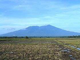
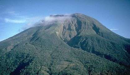
Mayon Volcano is the most prominent of the volcanoes in the region, famous for its perfect conical shape and for being the most active in the Philippines. Its eruptions have repeatedly inflicted disasters on the region, but during lulls in activity, it is a particularly magnificent peak. The southernmost tip of the peninsula is dominated by Bulusan Volcano, the other active volcano in the region. Tiwi in Albay and the Bacon-Manito area between Sorsogon and Albay are the sites of two major geothermal fields that contribute substantially to the Luzon Power Grid.[25][26]
Volcanoes
From North to South
| Photo | Name |
|---|---|
 |
Mount Isarog is a 1,966-metre (6,450 ft) fumarolic volcano with a 2.5-kilometre (1.6 mi) wide crater breached to the east.[27] The mountain and vicinity covering 10,112 hectares (24,990 acres) is a protected area in the Bicol Region under the name Mount Isarog Natural Park.[28] |
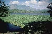 |
Mount Iriga is a 1,196-metre (3,924 ft) volcano with a large horseshoe-shaped collapsed crater located adjacent to Lake Buhi (foreground).[29] |
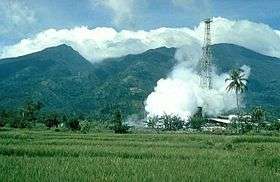 |
Mount Malinao is a 1,548-metre (5,079 ft) volcano with a large crater about 3 kilometres (1.9 mi) at its widest, which is breached to the east, The geothermal fields of Tiwi are located on its lower eastern slope.[30] |
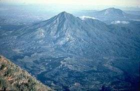 |
Mount Masaraga is a sharp-topped 1,328-metre (4,357 ft) Holocene volcano NW of Mayon.[31] |
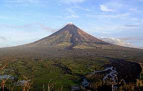 |
Mayon Volcano, the highest point of the region at 2,463 metres (8,081 ft), is also the most popular in the region for its beautifully symmetrical cone. It is also the most active in the country.[32] The volcano is one of the protected areas of Region V under the name Mayon Volcano Natural Park encompassing 5,776 hectares (14,270 acres).[28] |
 |
Pocdol Mountains with its highest elevation at 1,102 metres (3,615 ft), is a fumarolic group of volcanoes situated between Albay and Sorsogon provinces. It is the location of the Bac-Man Geothermal Power Plant and the PNOC Eco-Park, a 25,100-hectare (62,000-acre) ecotourism park maintained and protected by the Philippine National Oil Company (PNOC).[33][34] |
 |
Bulusan Volcano, the other active volcano of the region, has an altitude of 1,565 metres (5,135 ft). It is located on the remains of the 11-kilometre (6.8 mi) Irosin Caldera.[35] The volcano is a protected area and the centerpiece of the 3,672-hectare (9,070-acre) Bulusan Volcano Natural Park.[28] |
Education
From 1945 until 2011, the basic education system was composed of six years of elementary education starting at the age of 6, and four years of high school education starting at the age of 12. Further education was provided by technical or vocational schools, or in higher education institutions such as universities. Although the 1987 Constitution stated that elementary education was compulsory, this was never enforced.
In 2011, the country started to transition from its old 10-year basic educational system to a K–12 educational system, as mandated by the Department of Education.[36] The new 12-year system is now compulsory, along with the adoption of new curriculum for all schools (see 2010s and the K–12 program). The transition period will end with the 2017–2018 school year, which is the graduation date for the first group of students who entered the new educational system.
All public schools in the Philippines must start classes on the date mandated by the Department of Education (usually the first Monday for public, second Monday for private and third Monday for some colleges for the month of June) since the presidency of Joseph Estrada in 1999, and must end after each school completes the mandated 200-day school calendar organized by the Department of Education (usually around the third week of March to the second week of April). Private schools are not obliged to abide by a specific date, but must open classes no later than the last week of August.
Notable Bicolanos
| Name | Information |
|---|---|
| Raul Roco | Born in Naga City, a Filipino statesman, prominent lawyer, Congressman, Senator, Secretary of Education) during the Presidency of Gloria Macapagal Arroyo. |
| Joker Arroyo | A human rights lawyer, congressman and senator. |
| Francis "Chiz" Escudero | Senator, Vice-presidential aspirant and former Sorsogon representative. |
| Antonio Trillanes IV | Senator, Vice-Presidential aspirant and former military officer, Leader Magdalo group. |
| Gregorio Honasan | Senator, Vice-Presidential aspirant and former military officer. |
| Jesse Robredo | Secretary of the Interior and Local Government and former Naga City Mayor |
| Leni Robredo | The Vice President of the 16th republic of the Philippines and politician and lawyer currently serving as Member of the Philippine House of Representatives from Camarines Sur's Third District.[37] The widow of the late Interior Secretary Jesse Robredo. |
| Irene Cortes | Born in Legazpi City where she completed her intermediate studies, she was a former Associate Justice of the Supreme Court of the Philippines / First Female Dean of the UP College of Law |
| Shalani Soledad-Romulo | Valenzuela representative and TV host |
| Francisco Tatad | A native from Catanduanes, Former Senator of the Philippines (1992-2001) |
| Leandro Verceles Sr. | Philippine Ambassador, Governor, Philippine Immigration Commissioner, initiator of the Catanduanes Circumferential Road, initiator of the ARDCI, a micro-lending strategy that eventually led to the nationally acclaimed Vision Bank. |
| Leandro Verceles Jr. | Congressman (1992-2001), Governor (2001–2006), Principal author of the Philippine E-Commerce Act that paved the way for the burgeoning $20b BPO industry in the Philippines. |
| Arnulfo Fuentebella | House of Representatives of the Philippines 11th Congress Speaker of the House (2000 -2001) |
| Gina Vera-Perez de Venecia | She is daughter of the famed star-builder of Sampaguita Pictures, the late Doc Jose Perez and Azucena Vera-Perez. She is the wife of Jose de Venecia, Jr., Speaker of the House of Representatives of the Philippines from 1992 to 1998 and 2001 to 2008. |
| Name | Information |
|---|---|
| Merlinda Carullo Bobis | Born in Legazpi City, she is a contemporary Filipino writer and academic in Australia |
| Name | Information |
|---|---|
| Bernabe Concepcion | A native of Catanduanes and Filipino featherweight boxer |
| Name | Information |
|---|---|
| John Arcilla | Is a multi-awarded Filipino movie actor[38][39] and environmentalist.[40] |
| Nora Aunor | Multi-awarded Filipino actress, singer and producer. She is regarded as the "Superstar in Philippine Entertainment Industry". |
| Janelle Quintana Manahan | Teen actress/Best New Female Artist (19th Aliw Awards) nominee |
| Enchong Dee | Born Ernest Lorenzo Dee, is an actor, director and model, and an international competitive swimmer. He came to prominence after starring in Katorse (2009). |
| AJ Dee | Born Angel James Dee III, is an actor and an international competitive swimmer. He played the role of Tony Javier in the play A Portrait of an Artist. |
| Robin Padilla | Film/TV Actor and model popularly known as The Bad Boy of Philippine Movies. |
| Eddie Garcia | Popularly known as Manoy is a Filipino film actor and film director. A former member of the Philippine Scouts in Okinawa during World War II. The Philippine Military Academy Marangal (Honorable) Class of 1974, alongside First Gentleman Mike Arroyo. |
| Wally Bayola | Is a Filipino comedian, singer and actor. He is best known appearing alongside his co-tandem Jose Manalo on the noon-time television variety show Eat Bulaga!. |
| Gary V. | Is a Filipino musician. Also known as "Mr. Pure Energy", Valenciano has released 26 albums, and won the Awit Awards for "Best Male Performer" eleven times. In 1998, he became UNICEF Philippines first National Ambassador. |
| Imelda Papin | Is a Filipino singer and one of the bigger names in the Philippine music industry. Dubbed the "Sentimental Songstress", Imelda Papin is responsible for songs such as "Bakit (Kung liligaya ka sa piling ng iba)" and "Isang Linggong Pag-ibig". |
| Kyla | Melanie Calumpad Alvarez in real name. Kyla is a Filipino R&B singer-songwriter, producer, occasional actress and presenter dubbed as the Philippines' "Queen of R&B". |
| Carmen Camacho | 1960s Philippine Kundiman Diva |
| Noel Cabangon | Is a Filipino folk singer and composer, formerly of the band Buklod. He is known for composing socially-relevant songs such as Kanlungan and Tatsulok. |
| Jericho Rosales | Is a Filipino cinema and television actor, model,singer, and songwriter. |
| Bembol Roco | A Filipino film and television actor. He is famous for his role as Julio Madiaga in Maynila: Sa mga Kuko ng Liwanag. |
| Aga Muhlach | Actor,model, host and former matinée idol of Philippine movies. |
| Beatriz Saw | Actress, TV host and Pinoy Big Brother Season 2 big winner |
| Bugoy Drilon | Singer, actor and Pinoy Dream Academy Season 2 2nd Star Dreamer |
| Name | Information |
|---|---|
| Lara Quigaman | Film/TV actress,model,host and Miss International 2005 winner. |
| Venus Raj | Beauty queen, TV personality, model, and actress. She was crowned Binibining Pilipinas-Universe 2010. Fourth runner-up in 2010 Miss Universe pageant. |
| Miriam Quiambao | Is a Filipina television personality, occasional actress and 1st runner up at the Miss Universe 1999 pageant. |
| Bea Rose Santiago | Fords model and Miss International 2013 winner. She was born at Cataingan, Masbate. |
| Yvethe Marie Santiago | Graduated in Bicol University College of Business Economics and Management Binibining Pilipinas Supranational 2014 winner. |
| Name | Information |
|---|---|
| Jose Tomas Sanchez | Roman Catholic Prefect Emeritus of the Congregation for the Clergy and Cardinal Priest from the Philippines |
| Mike Velarde | Tele-evangelist, founder and Servant-Leader of El Shaddai DWXI-PPFI |
References
- 1 2 3 4 5 Census of Population (2015): Highlights of the Philippine Population 2015 Census of Population (Report). PSA. Retrieved 20 June 2016.
- ↑ "Overview of Bicol Region" Archived April 16, 2010, at the Wayback Machine.. Department of Agriculture Web Site; retrieved 22 May 2012.
- ↑ "DILG Regional Office No. 5 Directory". Bicol Region Official website; retrieved 22 May 2012.
- ↑ https://web.archive.org/web/20100416052024/http://bicol.da.gov.ph/Statistics/regional_profile.html. Archived from the original on April 16, 2010. Retrieved March 18, 2010. Missing or empty
|title=(help) - ↑ https://web.archive.org/web/20100416052024/http://bicol.da.gov.ph/Statistics/regional_profile.html. Archived from the original on April 16, 2010. Retrieved March 18, 2010. Missing or empty
|title=(help) - ↑ Mara Angelica Refraccion. "Bicol (pre colonial history)". Maraangelica.blogspot.com. Retrieved 2016-03-11.
- ↑ "Astilleros: the Spanish shipyards of Sorsogon" (PDF). Mary Jane Louise A. Bolunia. Archaeology Division, National Museum of the Philippines. Retrieved 26 October 2015.
- ↑ "PSGC Interactive; List of Provinces". Philippine Statistics Authority. Archived from the original on January 21, 2013. Retrieved 29 March 2016.
- ↑ "PSGC Interactive; List of Cities". Philippine Statistics Authority. Retrieved 29 March 2016.
- ↑ "Population and Annual Growth Rates for The Philippines and Its Regions, Provinces, and Highly Urbanized Cities" (PDF). 2010 Census and Housing Population. National Statistics Office. Archived from the original (PDF) on 28 September 2013. Retrieved 9 August 2013.
- ↑ "Bicol Regional Profile". denr.gov.ph. Retrieved 26 August 2014.
- ↑ Gatdula, Donnabelle L. (2013-06-03). "Naga City allots P1B for infra". Philstar.com. Retrieved 2016-03-11.
- ↑ F. J. Lagdameo (2010-09-23). "PNoy's EO declares Naga 'Pilgrim City'". Vox Bikol. Retrieved 2016-03-11.
- ↑ "Proclamation No. 33, s. 2010 | Official Gazette of the Republic of the Philippines". Gov.ph. 2010-09-10. Retrieved 2016-03-11.
- ↑ "Catanduanes Surfing like no other". Philippines-travel-guide.com. 2016-01-28. Retrieved 2016-03-11.
- ↑ "Naga's Kamundagan fest kicks off « Dagos po sa Maogmang Naga". Naga.gov.ph. Retrieved 2016-03-11.
- ↑ "SP HIGHLIGHTS: Kamundagan Festival". Bicol Mail. Retrieved 2016-03-11.
- ↑ "Naga City's Kinalas Festival – June 17, 2011". Angkulet.com. Retrieved 2016-03-11.
- ↑ "MAGAYON FESTIVAL ("Festival of Festivals Showdown")". Tourism.gov.ph. Archived from the original on 2016-03-16. Retrieved 2016-03-11.
- ↑ https://web.archive.org/web/20141109040145/http://www.ncca.gov.ph/about-culture-and-arts/articles-on-c-n-a/article.php?igm=4&i=244. Archived from the original on November 9, 2014. Retrieved November 9, 2014. Missing or empty
|title=(help) - ↑ "Peñafrancia viva la virgen Naga City Bicol Philippines". Philippinecountry.com. Retrieved 2016-03-11.
- ↑ "Peñafrancia civic parade reels off today; military parade on Friday « Dagos po sa Maogmang Naga". Naga.gov.ph. Retrieved 2016-03-11.
- ↑ "4th Regional Military Parade Winners ~ Naga City Deck". Nagacitydeck.com. 2012-09-14. Retrieved 2016-03-11.
- ↑ McDermott, Delfin, Defant, et al. (2005). "The Petrogenesis of Volcanics from Mt Bulusan and Mt. Mayon in the Bicol Arc, Philippines". University College Dublin School of Geologic Sciences; retrieved 22 May 2012.
- ↑ "Our Geothermal Projects". Energy Development Corporation; retrieved 1 August 2011.
- ↑ https://web.archive.org/web/20110806101817/http://www.jcmiras.net/jcm2/p91.htm. Archived from the original on August 6, 2011. Retrieved August 1, 2011. Missing or empty
|title=(help) - ↑ "Isarog". Global Volcanism Program. Smithsonian Institution. Retrieved 22 May 2012.
- 1 2 3 "Protected areas of Region 5". Bureau of Protected Areas and Wildlife Bureau; retrieved 22 May 2012.
- ↑ "Iriga". Global Volcanism Program. Smithsonian Institution. Retrieved 22 May 2012.
- ↑ "Malinao". Global Volcanism Program. Smithsonian Institution. Retrieved 22 May 2012.
- ↑ "Masaraga". Global Volcanism Program. Smithsonian Institution. Retrieved 22 May 2012.
- ↑ "Mayon". Global Volcanism Program. Smithsonian Institution. Retrieved 22 May 2012.
- ↑ "Pocdol Mountains". Global Volcanism Program. Smithsonian Institution. Retrieved 22 May 2012.
- ↑ Jamoralin, Reynaldo T.. "Places of Interest". Sorsogon Tourism; retrieved 22 May 2012.
- ↑ "Bulusan". Global Volcanism Program. Smithsonian Institution. Retrieved 22 May 2012.
- ↑ "K-12 Primer as of 20 December 2011" (PDF). Department of Education. Archived from the original (PDF) on 2012-05-22. Retrieved 28 April 2012.
- ↑ "Hon. Gerona-Robredo, Leni". Congress.gov. Retrieved 2016-03-11.
- ↑ "John Arcilla". IMDb.com. Retrieved 2016-03-11.
- ↑ "John Arcilla Photos | Who is John Arcilla dating? Girlfriend, Wife". Whosdatedwho.com. Retrieved 2016-03-11.
- ↑ Marya Salamat. "John Arcilla, actor, environmentalist attends Peoples' Mining Conference – Bulatlat". Bulatlat.com. Retrieved 2016-03-11.
External links
| Wikimedia Commons has media related to Bicol Region. |
- Bicol Region Official Website, Department of Interior and Local Government
- Department of Tourism at Wow Bicol
- Bicolano Radio Stations Online
- List of Bicol Region Festivals & Fiestas
- List of Places to stay and visit in Bicol

