MacArthur Highway
| MacArthur Highway | |
|---|---|
| |
|
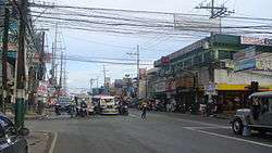
MacArthur Highway in Mabalacat, Pampanga | |
| Route information | |
| Length: | 500.0 km (310.7 mi) |
| Component highways: |
|
| Major junctions | |
| North end: | Maharlika Highway in Laoag City, Ilocos Norte |
| South end: | Bonifacio Monument Roundabout at Epifanio de los Santos Avenue in Caloocan, Metro Manila |
| Location | |
| Major cities: | |
| Towns: |
|
| Highway system | |
| Highways in the Philippines | |

MacArthur Highway, formerly the Manila North Road (Manor), is a major highway in northwestern Luzon, an island in the Philippines. This two- to six-lane national road stretches for 500 km (310 mi) from the Bonifacio Monument in Caloocan to the northern province of Ilocos Norte, passing through three cities in Metro Manila (Caloocan, Malabon, and Valenzuela), three provinces of Central Luzon (Bulacan, Pampanga and Tarlac), and four provinces of the Ilocos Region (Pangasinan, La Union, Ilocos Sur and Ilocos Norte).[1]
The highway parallels the North Luzon Expressway from Epifanio de los Santos Avenue (EDSA) to Mabalacat, the Subic–Clark–Tarlac Expressway from Mabalacat to Tarlac City, and the Tarlac-Pangasinan-La Union Expressway from Tarlac City to Rosario. It is a component of Radial Road 9 of Manila's arterial road network.
History
MacArthur Highway was built in sections beginning in 1928 during the American colonial period.[2] It followed much of the route of the old Manila Railroad line from Manila to Dagupan. It was named Highway 3 and was also called Route 3 in early U.S. military records.[3] The highway eventually reached the Ilocos provinces in the north and became known as the Manila North Road spanning a distance of over 500 km (310 mi).[1]
On June 17, 1961, the section of the Manila North Road between Manila and Pangasinan was renamed in honor of the Liberator of the Philippines during World War II, General Douglas MacArthur.[3][4]
Intersections
Metro Manila
- Bonifacio Monument Roundabout (Caloocan (South))
- NLEX-Karuhatan Link (Valenzuela)
- Maysan Road (Valenzuela)
Central Luzon
- Governor Fortunato Halili Avenue (Bocaue) – connects with NLEx-Bocaue Interchange
- Tabang Spur Road and Pan-Philippine Highway (Maharlika Highway) (Guiguinto) – Tabang Spur Road connects with NLEx-Tabang Exit and Maharlika Highway goes to Cagayan Valley (Cagayan, Isabela, Quirino and Nueva Vizcaya), Aurora, Nueva Ecija and municipalities of Plaridel, Baliuag, San Rafael, San Ildefonso and San Miguel within Bulacan.
- Pulilan Regional Road (Calumpit) – connects with NLEx-Pulilan Interchange and ends at the municipality of Pulilan
- Jose Abad Santos Avenue (Olongapo-Gapan Road) (San Fernando, Pampanga) – The flyover above the intersection carries the Olongapo-Gapan Road. Turning left goes to Bataan, Zambales and municipalities of Bacolor, Lubao and Guagua within Pampanga and turning right goes to Nueva Ecija and Cagayan Valley. JASA connects with NLEx-San Fernando Interchange.
- Pandan Road (Angeles) – connects with NLEx-Angeles Interchange
- Dau Access Road (Mabalacat) – connects with NLEx-Dau Interchange
- Clark Spur Road (Mabalacat) – connects with SCTEx-Mabalacat Interchange NLEx-SCTEx Exit
- Mabalacat-Magalang Road (Mabalacat) – connects with the northern terminus of NLEx or NLEx-Santa Ines Interchange. Mabalacat-Magalang Road goes to the municipality of Magalang.
- SCTEx-Dolores Interchange (Mabalacat) – SCTEx northbound goes to Tarlac for short travel time. It also serves as an alternate route to Nueva Ecija, Baguio, Pangasinan, Ilocos Provinces, Abra and La Union.
- Concepcion-Magalang Road (Concepcion) – connects with SCTEx-Concepcion Interchange. Concepcion-Magalang Road intersects with Mabalacat-Magalang Road at Magalang, Pampanga.
- Luisita Access Road and Romulo Highway (Tarlac City) – Luisita Access Road located at Hacienda Luisita connects with SCTEx-Hacienda Luisita Interchange and Romulo Highway goes to western parts of Tarlac and Pangasinan.
- Santa Rosa-Tarlac Road (Tarlac City) – the current northern terminus of SCTEx and the current southern terminus of Tarlac-Pangasinan-La Union Expressway. Santa Rosa-Tarlac Road goes to the municipality of La Paz, province of Nueva Ecija and Cagayan Valley Region.
- Tarlac-Victoria Road (Tarlac City) – connects with TPLEx-Victoria Interchange
- Gerona-Guimba Road (Gerona) – connects with TPLEx-Gerona Interchange. Eastern terminus located at Guimba, Nueva Ecija along Pangasinan-Nueva Ecija Road.
- Paniqui-Ramos Road (Paniqui) – connects with TPLEx-Paniqui Interchange
- Moncada-Anao Road (Moncada) – connects with TPLEx-Anao Interchange. Eastbound direction goes to Nampicuan and Cuyapo, Nueva Ecija.
See also
References
- 1 2 "Jica, World Bank to maintain 500-km MacArthur Highway". BusinessMirror. Retrieved 14 August 2014.
- ↑ "A window into Valenzuela City's past". BusinessMirror. Retrieved 14 August 2014.
- 1 2 The MacArthur Highway and Other Relics of American Empire in the Philippines. Joseph P. McCallus. Retrieved 14 August 2014.
- ↑ "Republic Act No. 3080". Chan Robles. Retrieved 14 August 2014.
| Wikimedia Commons has media related to MacArthur Highway. |
Coordinates: 15°33′09″N 120°20′43″E / 15.5525°N 120.3452°E