Legarda Street
| Legarda Street | |
|---|---|
 | |
| Route information | |
| Length: | 1.4 km (0.9 mi) |
| Component highways: |
|
| Major junctions | |
| From: | Lacson Avenue in Sampaloc |
|
Figueras Street Recto Avenue–Mendiola Street Bilibid Viejo Street–San Rafael Street | |
| To: | Nepomuceno Street in Quiapo |
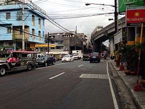
Legarda Street is a short street located in Sampaloc district in Manila, Philippines. It crosses through the eastern section of the University Belt area in a generally east-west orientation between the junction with Lacson Avenue in Sampaloc and the intersection with Nepomuceno Street and Concepcion Aguila Street in Quiapo. It is served by Legarda Station of the Manila LRT-2.
The street was named after Filipino legislator and resident commissioner to the U.S., Benito Legarda y Tuason.[1] It was formerly called Calle Alix, after Real Audiencia of Manila magistrate of the 1860s, José María Alix y Bonache.[2][3]
Route
Legarda Street commences at the intersection with Lacson Avenue in the east as a continuation of Magsaysay Boulevard from Santa Mesa district. It heads due west, traversing the southern edge of Sampaloc and skirting the northern boundary of San Miguel. After crossing Figueras Street, Legarda bends to the southwest following the course of Estero de Alix (Alix Creek). It intersects with Recto Avenue–Mendiola Street and Bilibid Viejo Street–San Rafael Street before terminating at the junction with Concepcion Aguila Street and Nepomuceno Street (formerly Tanduay Street) near the Basilica of San Sebastian in Quiapo district. Southwest of Concepcion Aguila, Legarda resumes as Pedro Casal Street heading into San Miguel and Ayala Bridge to Ermita on the southern bank of the Pasig River.
Notable establishments on Legarda Street include Arellano University, Sta. Catalina College, the main campus of ABE International Business College, San Lorenzo Ruiz Student Catholic Center, Mendiola Theater and the Department of Social Welfare and Development–NCR Office.
See also
References
- ↑ Did you know? Legarda Street published by the Philippine Daily Inquirer; accessed 2013-11-01.
- ↑ Legarda Street published by Historiles.com; accessed 2013-11-01.
- ↑ Full text of "Guía oficiál de España" published by Archive.org; accessed 2013-11-01.
Coordinates: 14°36′2″N 120°59′42″E / 14.60056°N 120.99500°E