Radial Road 10
| R-10 | |
|---|---|
| Radial Road 10 | |
|
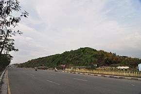
R-10 Road in Tondo, Manila | |
| Major junctions | |
| South end: | Pasig River in the City of Manila |
| North end: | Circumferential Road 4 (C-4) in Navotas |
| Highway system | |
| Highways in the Philippines | |
Radial Road 10, more commonly referred to as R-10, is a planned network of roads and bridges that altogether would form the tenth radial road of Manila in the Philippines.[1] It is the westernmost of the radial roads north of the Pasig River running north-south close to the shoreline of Manila Bay. When completed, the road would link the City of Manila with Navotas, and the northern coastal provinces of Bulacan, Pampanga and Bataan in Central Luzon.
At present, only the Tondo–Navotas segment of the road is complete.
Route
The road consists of the following segments:
Marcos Road
Between the Pasig River front of the district of Tondo and the Bangkulasi Bridge over the Bangkulasi Channel, R-10 is known as President Ferdinand E. Marcos Highway or Marcos Road. It is the only segment of R-10 ever completed, thus the name R-10 is thought only as an alternative name for Marcos Road, instead of a highway network as planned. It passes through the Manila North Harbor complex in Tondo before merging with Circumferential Road 4 (C-4) past the Bangkulasi Bridge in Navotas near the Navotas Fish Port Complex which leads to South Caloocan and Quezon City in the northeast.
Manila–Bataan Coastal Road
A highway linking Manila and the province of Bataan has been proposed as an extension of R-10.[2] Similar to Radial Road 1 and its segments, Roxas Boulevard and the Manila–Cavite Expressway, the highway would run along the coast of the Manila Bay north of the Pasig River. From the current terminus of R-10 in Navotas, the road would travel north along the coastal Bulacan municipalities of Obando, Bulakan, Malolos, Paombong and Hagonoy, and northwest along the Pampanga coast of Macabebe, Masantol, Sasmuan and Lubao, and terminating in Hermosa and Dinalupihan in Bataan. The proposed highway would be built over fishponds and would also serve as flood barriers for the coastal provinces.[3]
See also
References
- ↑ "Metro Manila Infrastructure Development" (PDF). University of the Philippines Diliman. Retrieved 30 July 2015.
- ↑ Gamboa, Rey (9 July 2013). "Numerous studies but job not done". Philippine Star. Retrieved 31 July 2015.
- ↑ Balabo, Dino (21 August 2012). "Manila-Bataan coastal road pushed". Philippine Star. Retrieved 31 July 2015.