Bonny Serrano Avenue
| Bonny Serrano Avenue | |
|---|---|
| Santolan Road | |
|
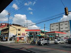
Bonny Serrano Avenue, at the junction with EDSA near Camp Aguinaldo | |
| Route information | |
| Length: | 2.2 km (1.4 mi) |
| Component highways: |
|
| Major junctions | |
| West end: | Conrado Benitez Street and Horseshoe Drive in Horseshoe Village |
|
Epifanio de los Santos Avenue Katipunan Avenue (C-5) | |
| East end: | Eulogio Rodriguez Jr. Avenue (C-5) and FVR Road in Libis |
Colonel Bonny Serrano Avenue, commonly known simply as Bonny Serrano Avenue (also spelled Boni Serrano Avenue), is a major east-west thoroughfare in the Eastern Manila District of Metro Manila, Philippines, running between San Juan City and Quezon City. It forms the northern limit of San Juan and the southern limit of Quezon City's New Manila and Cubao districts and links the Philippine National Police headquarters in Camp Crame with the Armed Forces of the Philippines headquarters in Camp Aguinaldo. The avenue, formerly called (and still known locally as) Santolan Road, runs from the border between Greenhills, San Juan and Horseshoe Village, Quezon City in the west to the villages of Libis and Blue Ridge by Quezon City's border with Marikina in the east. It was named after the decorated Korean War hero, Venancio "Bonny" Serrano.[1]
History
Bonny Serrano Avenue was formerly called the Carretera de Santolan (Santolan Road) which ran from the Santolan pumping station on the Mariquina River to El Deposito water reservoir in San Juan del Monte, the main source of water for Manila residents during the Spanish colonial period. It was built around 1901 during the early years of the American colonial period at a cost of $150 (150 pesos).[2] In 1935, the road, also known as the San Juan–Santolan Road, became the location of Camp Murphy, home of the United States Army Philippine Department, and eventually the Philippine Commonwealth Army, which was named after then Governor-General Frank Murphy. The military camp eventually became Camp Aguinaldo and Camp Crame when the Philippines gained independence after World War II. The San Juan–Quezon City segment of Santolan Road was then renamed after Serrano in 1970, three months after the war hero's death.[3]
Route description

The four-lane avenue begins as a continuation of Horseshoe Drive at Conrado Benitez Street in the border between North Greenhills and the New Manila village of Horseshoe. It proceeds due east and runs through the boundary between Quezon City's Bagong Lipunan ng Crame and San Juan's West Crame villages, passing through the San Juan Municipal Cemetery before arriving at the northern side of Camp Crame. East of the Epifanio de los Santos Avenue junction, the avenue runs the northern boundary of Camp Aguinaldo with the villages of Socorro (Cubao), San Roque and Bayanihan, and intersecting with 15th Avenue at Camp Aguinaldo Gate 1. It then intersects with Katipunan Avenue (C-5) via an overpass, passing through Blue Ridge and Saint Ignatius villages before terminating at Eulogio Rodriguez Jr. Avenue in Libis near Camp Atienza where it continues as FVR Road all the way to the Marikina–Infanta Highway in Calumpang, Marikina and Santolan, Pasig. This section of the avenue connecting Katipunan and Eulogio Rodriguez Jr. Avenue is designated as a component of Circumferential Road 5 (C-5 Road).
References
- ↑ "Bikol awardees give back to their birthplaces". Philippine Daily Inquirer. Retrieved 16 May 2015.
- ↑ "Public laws and resolutions passed by the United States Philippine Commission, during the quarter". United States Philippine Commission. Retrieved 16 May 2015.
- ↑ "Introducing Mrs. Bonny Serrano". Philippine Daily Inquirer. Retrieved 16 May 2015.
Coordinates: 14°36′37″N 121°03′11″E / 14.6102777°N 121.0530555°E