List of roads in Metro Manila
| Manila's arterial road network | |
|---|---|
 | |
| Highway system | |
| Highways in the Philippines |
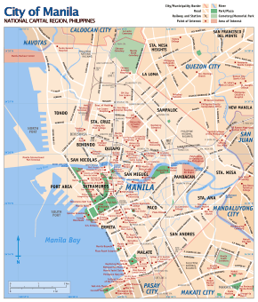
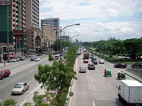
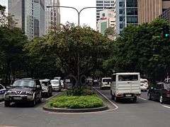
This list of roads in Metro Manila summarizes the major thoroughfares and the numbering system currently being implemented in Metro Manila, Philippines. Metro Manila's arterial road network consists of National Roads, the Circumferential Roads, and the Radial Roads, as well as the other major roads connecting the cities of Manila, Quezon, North and South Caloocan, Valenzuela, Malabon, Navotas, Pasay, Parañaque, Las Piñas, Taguig, Muntinlupa, Marikina, Pasig, Mandaluyong, Makati, Pateros, and San Juan as well as the surrounding provinces.[1][2]
List of numbered routes
The first road numbering system in the Philippines was adopted in 1930 by the administration of President Manuel Quezon, and was very much similar to U.S. Highway numbering system. Portions of it are 70 roads labeled Highway 1-Highway 60. Some parts of the numbering system are Admiral Dewey Boulevard (Highway 1), Calle Manila (Highway 50) and 19 de Junio (Highway 54).
In 1945, the Metropolitan Thoroughfare Plan was submitted by Quezon City planners Louis Croft and Antonio Kayanan which proposed the laying of 10 Radial Roads, which purposes in conveying traffic in and out of the City of Manila to the surrounding cities and provinces, and the completion of 6 Circumferential Roads, that will act as beltways of the city, forming altogether a web-like arterial road system.[3] The Department of Public Works and Highways (DPWH) is the government agency that deals with these projects.[1]
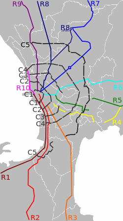
The road numbering for Radial Roads are R(Radial Road)-1 up to R-10. The radial roads never intersect one another and they do not intersect circumferential roads twice; hence they continue straight routes leading out from the city of Manila to the provinces. The numbering is arranged in a counter clockwise pattern, where in the southernmost is R-1 and the northernmost is R-10. The Circumferential Roads are numbered C(Circumferential Road)-1 to C-6. The innermost beltway in the city is C-1, while the outermost is C-6.
Radial roads
There are ten (10) radial roads that serves the purpose of conveying traffic in and out of the city of Manila to the surrounding cities of the metropolis and to the provinces, numbered in a counter clockwise pattern.[4] All radial roads starts at kilometre zero, which is, the Jose Rizal Memorial Monument in Rizal Park.[5][6]
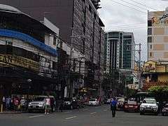
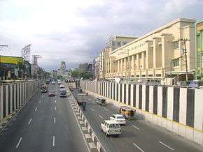
| Name | Image | Route | City(s) | Road(s) | Length | Description | Refs |
|---|---|---|---|---|---|---|---|
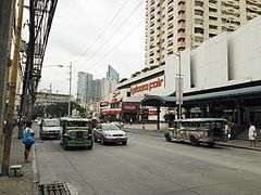
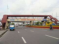
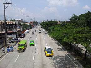
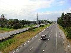
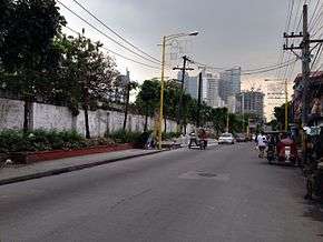
| Radial Road 1 |  | City of Manila–Cavite | Makati Pasay Las Piñas Bacoor, Cavite Kawit, Cavite Rosario, Cavite Tanza, Cavite Naic, Cavite |
|
41.5 kilometers or 25.8 miles | Radial Road 1 connects the City of Manila to the province of Cavite, officially starting at Bonifacio Drive, just south of Pasig River. The road skirts the coastline of Manila Bay entering Roxas Boulevard and later, after crossing NAIA Road, as the Manila-Cavite Expressway. The road will keep skirting the coastline until it ends in a junction with the Governor's Drive in Naic, Cavite, spanning 41.5 kilometres (25.8 mi) from Rizal Park to Cavite. | [3] |
| Radial Road 2 | 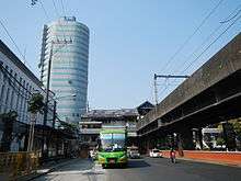 | City of Manila–Batangas | Pasay Las Piñas Bacoor, Cavite Imus, Cavite Dasmariñas, Cavite Silang, Cavite Tagaytay, Cavite |
|
64.2 kilometers or 39.9 miles | The road lies parallel to Radial Road 1, connecting the City of Manila to Cavite and Batangas. The road starts from the Lagusnilad Underpass in front of the National Museum in Ermita. The road, as Taft Avenue, will follow a straight route, and after crossing EDSA in Pasay, becomes Elpidio Quirino Avenue. E. Quirino Avenue serves as the main road in the suburb of Parañaque, until it becomes Diego Cera Avenue upon entering Las Piñas. The road then becomes the Aguinaldo Highway after crossing the Alabang–Zapote Road. Aguinaldo Highway serves as the main thoroughfare in the Province of Cavite, ending in the Tagaytay Rotunda, and becoming the Tagaytay-Talisay Road, which ends in front of the Taal Lake. The Manila LRT Line 1 follows the route of R-2 from Padre Burgos Street to EDSA. | [7] |
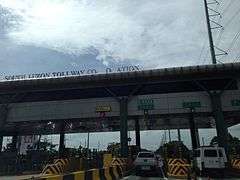
| Radial Road 3 |  | City of Manila–Batangas | Pasay Makati Taguig Las Piñas San Pedro, Laguna Calamba, Laguna Tanauan, Batangas Carmona, Cavite Santo Tomas, Batangas Batangas City, Batangas | 96 kilometers or 60 miles | The entire road is an expressway, except for its northern end starting from its junction with C5. It is jointly operated by the Skyway Operation and Management Corporation (SomCo) and the Citra Metro Manila Tollways Corporation (CMMTC). Although the kilometer zero of the road is at Rizal Park, the road officially starts from the junction of South Luzon Expressway and Quirino Avenue. The road will follow a straight route from Paco, Manila to Santo Tomas, Batangas, wherein it becomes the Southern Tagalog Arterial Road or the STAR Tollway. The STAR Tollway connects Sto. Tomas to the Batangas Port in Batangas City. | [8] | |
| Radial Road 4 |  | City of Manila–Rizal | Makati Pateros Taytay, Rizal |
|
23.5 kilometers or 14.6 miles | The road itself is incomplete. It starts from the junction of Pedro Gil Street and Quirino Avenue in Santa Ana, Manila, and it will enter Makati before ending in a junction with Zodiac Street. A logical continuation of the road starts from the junction of EDSA and Gil Puyat Avenue. The road again ends in a dead end in Kalawaan, Pateros. The continuation of the road starts from the east bank of the Manggahan Floodway, as Highway 2000. Highway 2000 becomes the Taytay Diversion Road after crossing Road 1 in Taytay, Rizal. The proposed Pasig River Expressway is also labeled R-4. The road currently spans 23.5 kilometres (14.6 mi). | [9] |
| Radial Road 5 | 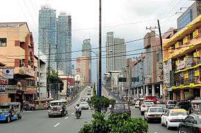 | City of Manila–Laguna | Mandaluyong Pasig Cainta, Rizal Taytay, Rizal Pililla, Rizal Famy, Laguna |
|
86.1 kilometers or 53.5 miles | Radial Road 5 starts from the upper banks of the Pasig River, parallel to Radial Road 4 on the lower banks. The road will enter Mandaluyong and will become an important thoroughfare in the industrial downtown of Pasig and the Ortigas Center. The road will eventually become the Manila East Road, the main transportation corridor of the Province of Rizal. | [10] |
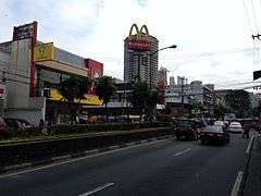
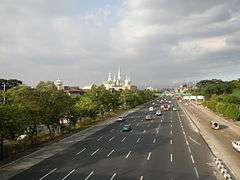
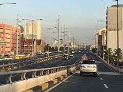
| Radial Road 6 | 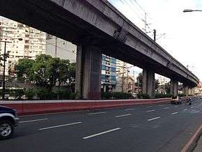 | City of Manila–Quezon | Quezon City Pasig Marikina Antipolo, Rizal Tanay, Rizal Sta Maria, Laguna Infanta, Quezon | 121.6 kilometers or 75.6 miles | Radial road 6 starts from the junction of Mendiola Street and Ayala Boulevard. The road will serve as an important thoroughfare in Santa Mesa, Manila, and will enter the New Manila District of Quezon City after crossing G. Araneta Avenue and becomes Aurora Boulevard. The boulevard will enter the District of Cubao in Quezon City and will serve as the main thoroughfare in Araneta Center. The road becomes Marikina–Infanta Highway (Marcos Highway) after crossing Katipunan Avenue. The highway will then pass through the cities of Marikina then in Pasig and transverse the province of Rizal. The road would continue further and will end in a dead end in Infanta, Quezon. The MRT Line 2 follows the route of R-6 from Legarda Street in San Miguel, Manila to Marcos Highway in between the boundaries of Santolan, Pasig and Calumpang, Marikina. The road spans 88.6 kilometres (55.1 mi) long. | [11] | |
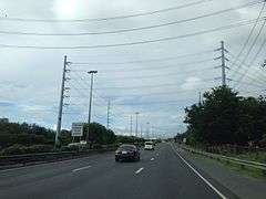
| Radial Road 7 |  | City of Manila–Bulacan | Quezon City Caloocan San Jose del Monte, Bulacan Norzagaray, Bulacan |
|
53.6 kilometers or 33.3 miles | Radial Road 7 starts from Quiapo, Manila. The road will follow a direct route to Quezon City. After crossing the Quezon City Memorial Circle, it becomes Commonwealth Avenue, the widest road in the Philippines. The route then follows Regalado Highway in Fairview, Quezon City, and it ends in a junction with Quirino Highway in the Neopolitan Business Park in Lagro. The road drives north to Bulacan, until it ends with a junction with Fortunato Halili Avenue. The currently under construction North Luzon East Expressway or the R-7 Expressway is a continuation of this road. | [12][13] |
| Radial Road 8 |  | City of Manila–La Union | Quezon City Caloocan Bocaue, Bulacan Balagtas, Bulacan Santa Rita, Pampanga San Fernando, Pampanga Angeles, Pampanga Tarlac City, Tarlac Urdaneta City, Pangasinan Rosario, La Union, La Union |
|
210.0 kilometers or 130.5 miles | Radial Road 8 starts from Quezon Bridge in Quiapo, Manila. The road will follow a direct route northwards, becoming the North Luzon Expressway after crossing EDSA. The road becomes SCTEX after crossing MacArthur Highway in the Paradise Ranch in Clark Freeport Zone, Angeles, Pamapanga. | [14][15] |
| Radial Road 9 |  | City of Manila–Benguet | 24 Town and Cities, between the City of Manila and Baguio. For the complete list, see Maharlika Highway. | 228.0 kilometers or 141.7 miles | The Radial Road 9 consists of the northern portion of the Pan-Philippine Highway or AH-26.(R-2 takes the southern portion) The LRT-1 follows the route of R-9 from Manila to Gracepark, Caloocan. R-9 starts as the Rizal Bridge from Padre Burgos Street. It follows a straight northward route parallel to R-8. The road becomes MacArthur Highway after crossing the Monumento Roundabout in Gracepark, Caloocan. The road officially ends in the road diversion in Baguio where it diverges into Kennon Road, Marcos Highway/Aspiras-Palispis Highway and the Pan-Philippine Highway | [16] | |
| Radial Road 10 | 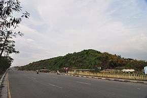 | City of Manila–Bataan | Quezon City Malabon Navotas Obando, Bulacan Malolos, Bulacan Macabebe, Pampanga Lubao, Pampanga Bagac, Bataan Balanga, Bataan |
|
105.0 kilometers or 65.2 miles | The Radial Road 10 is currently a 9.7 kilometres (6.0 mi) long highway from Tondo, Manila to C-4 Road. There was a proposed project of extending it to Bataan, as the Manila-Bataan Coastal Road. The project has long since died, but the top local government chiefs of Central Luzon led by RDC Chair and San Fernando City Mayor Oscar Rodriquez, and Zambales Governor Hermogenes Ebdane, Jr. revived the project and approved the CLIP for 2011 to 2016 in the recent 6th RDC meeting in Balanga. | [17] |
Circumferential roads
There are six (6) circumferential roads around the City of Manila that acts as beltways for the city. Two run inside the City of Manila Proper, while three run outside the City of Manila. Another circumferential road, the C-6, will run outside Metro Manila and is under construction.
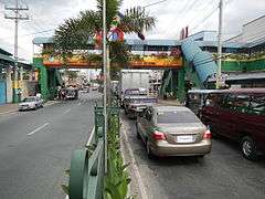
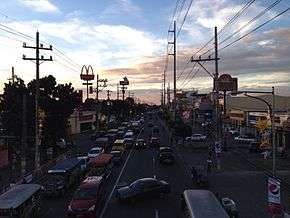
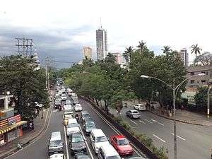
| Name | Image | Route | City(s) | Road(s) | Length | Description | Refs |
|---|---|---|---|---|---|---|---|
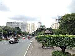
| Circumferential Road 1 | 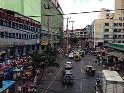 | City of Manila |
|
5.9 kilometers or 3.7 miles | Circumferential Road 1 or C-1 is a route that runs inside the City of Manila proper, passing through the Tondo, Binondo, Quiapo and Ermita districts. It starts from the North Port as Recto Avenue and becomes P. Casal Street after crossing R-6. The road crosses the Pasig River as Ayala Boulevard, which ends in Taft Avenue and enters Rizal Park as Finance Drive, which merges into the southern part of Padre Burgos Street, which ends in a junction with Roxas Boulevard. | ||
| Circumferential Road 2 |  | City of Manila |
|
10.0 kilometers or 6.2 miles | The C-2 Road starts from Tondo, Manila, passing through Binondo, Sampaloc, Pandacan and Paco Districts. It starts from R-10, becomes Tayuman Street in the Sampaloc district, then continues on as Arsenio H. Lacson Avenue after passing A. Mendoza Street. It crosses the Pasig River, then becomes President Quirino Avenue, which continues on until it reaches R-1 (Roxas Boulevard), passing through the Paco and Malate districts. | [18] | |
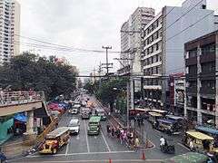
| Circumferential Road 3 | 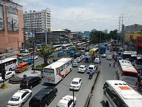 | Navotas–Pasay | Navotas Caloocan Quezon City San Juan Makati Pasay |
|
21.7 kilometers or 13.5 miles | The C-3 Road is a route that lies outside the City of Manila. It starts as the C-3 Road in Navotas, and becomes 5th Avenue after entering Caloocan. It becomes Sergeant E. Rivera Avenue after crossing A. Bonifacio Street, and becomes G. Araneta Avenue after crossing the Kaingin Road in Quezon City. The road ends shortly after entering San Juan, only resuming at the junction of J.P. Rizal Avenue and South Avenue. South Avenue becomes Ayala Avenue after crossing Chino Roces Avenue. The route is rerouted to Gil Puyat Avenue after Ayala Avenue enters the Ayala Triangle, an important industrial landmark in Makati. The proposed Metro Manila Skybridge will bridge the missing segment of the road. | [19] |
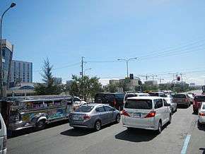
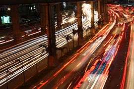
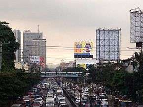
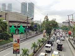
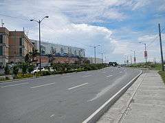
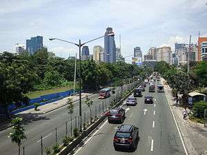
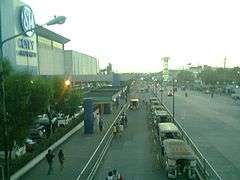
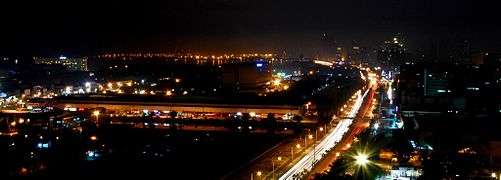
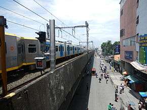
| Circumferential Road 4 | 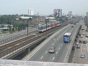 | Malabon–Pasay | Malabon Caloocan Quezon City Mandaluyong Makati Pasay | 28.1 kilometers or 17.5 miles | The C-4 Road starts from Malabon. It becomes Letre Road, then becomes Samson Road after entering Caloocan. After crossing the Monumento Roundabout, the C-4 Road becomes EDSA, the most important thoroughfare in the metropolis. With 2.34 million vehicles and almost 314,354 cars passing through it and its segments everyday, the road is also the most congested and busiest highway in the metropolis. The road ends Mall of Asia roundabout in Pasay. The MRT-3 follows the route of C-4, from North Avenue to Taft Avenue. | [20][21] | |
| Circumferential Road 5 | 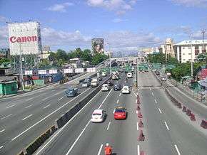 | Malabon-Parañaque | Malabon Valenzuela Quezon City Marikina Pasig Taguig Parañaque |
|
55.0 kilometers or 34.2 miles | Several arising controversies regarding an expressway MCTEP, properties of Sen. Manny Villar, and the constant squatter demolishing issues in Quezon City causes the C-5 Road, although complete, have less than half of the length, only 32.5 kilometres (20.2 mi), be functional. The road officially starts from Letre Road, but it only starts from the NLEX Segment that crosses the North Luzon Expressway and becomes Mindanao Avenue. The road will follow the route of Congressional Avenue and Luzon Avenue, crossing Commonwealth Avenue and becoming Tandang Sora Avenue, which becomes Katipunan Avenue after crossing C.P. Garcia Avenue in the University of the Philippines campus. The road will follow the route of Col. Bonny Serrano Avenue, which becomes C.P. Garcia Avenue after entering Pasig. The road ends in South Luzon Expressway. A continuation of the road currently provides no access, which starts from Merville, Parañaque to Coastal Road in Las Piñas. | [22] |
| Circumferential Road 6 |  | Marilao, Bulacan-Bacoor, Cavite | Marilao, Bulacan Meycauayan, Bulacan San Jose del Monte, Bulacan Cainta, Rizal Antipolo, Rizal Taytay, Rizal San Pedro, Laguna Dasmariñas, Cavite Bacoor, Cavite | 49.1 kilometers or 30.5 miles | The Bulacan-Rizal-Manila-Cavite Regional Expressway is a superhighway currently under construction. It will act as a beltway of Metro Manila, so that buses and other transportation vehicles coming from the southern provinces going to the northern provinces would not need to pass through Metro Manila, thus lessening traffic in the metropolis. Its northern terminus is MacArthur Highway and the southern terminus is in Bacoor, Cavite. | [23] |
Other major roads
Many other streets in the metropolis are considered major roads:
Capital District
- Blumentritt Road (Sampaloc)
- Lacson Avenue (Sampaloc)
- Quirino Avenue (Malate-San Andres-Paco-Pandacan)
- United Nations Avenue (Ermita, Paco)
- Padre Faura Street (Ermita)
- Magsaysay Boulevard (Santa Mesa)
- Padre Burgos Avenue (Ermita)
- Marcos Road (Tondo)
- Bonifacio Drive (Intramuros-Port Area)
- Pedro Gil Street (Ermita-Malate-Paco-Santa Ana)
- Ayala Boulevard (Downtown Manila)
- Quezon Boulevard (Quiapo)
- Tayuman Street (Juan Luna to Yuseco)
- Maria Orosa Avenue (Ermita-Malate)
- Del Pilar Street (Ermita-Malate)
- Adriatico Street (Ermita District)
- Jose Laurel Street (San Miguel)
- Escolta Street (Binondo)
- Pablo Ocampo Street (Malate-San Andres)
- Mendiola Street (San Miguel)
- Kalaw Avenue (Ermita)
- Legarda Street (Sampaloc)
- Victorino Mapa Street (Santa Mesa)
- Zobel Roxas Street (San Andres)
- Abad Santos Avenue (Tondo)
Eastern Manila District
Mandaluyong
- Acacia Lane
- Nueve de Febrero
- Shaw Boulevard (EDSA to Kalentong)
- Boni Avenue (Tomas Claudio Extension- EDSA)
- General Kalentong Street (P. Sanchez Street to Boni Avenue)
- Pioneer Street
- ADB Avenue
- San Miguel Avenue
Marikina
- Marikina-Infanta Highway (also known as Marcos Highway)
- A. Bonifacio Avenue (Aurora Boulevard - Sumulong Highway)
- Sumulong Highway (Marikina to the highlands of Antipolo)
- J. P. Rizal Avenue (Nangka bridge to Calumpang district, Marcos Highway of Marikina)
- Bayanbayanan Avenue (Concepción Uno)
- Gil Fernando Avenue (known as A. Tuazon Avenue)
- Amang Rodriguez Avenue
Pasig
- Lanuza Avenue
- Pioneer Street (EDSA - Pasig Boulevard)
- A. Luna Avenue (M.L. Quezon - M. Almeda)
- Meralco Avenue (Ortigas Avenue to Shaw Boulevard in Pasig)
- Julia Vargas Avenue (EDSA to C-5)
- ADB Avenue
- San Miguel Avenue
Quezon City
- Batasan Road (Batasan Hills, Quezon City)
- Batasan-San Mateo Road (Batasan Road in Quezon City to San Mateo, Rizal)
- Calle Industria (Pasig to C5)
- Bonny Serrano Avenue (formerly called Santolan Road; Katipunan Avenue to Ortigas Avenue)
- Greenmeadows Avenue (C5 to Ortigas Avenue)
- White Plains Avenue (Temple Drive to EDSA)
- Roosevelt Avenue (Quezon Avenue to EDSA in Quezon City)
- Del Monte Avenue (San Francisco del Monte neighbourhood of Quezon City)
- Mayon Avenue (La Loma neighbourhood of Quezon City)
- Banawe Avenue (Santa Mesa Heights neighbourhood of Quezon City)
- N.S. Amoranto Avenue (formerly called Retiro; G. Araneta Avenue to A. Maceda Avenue)
- Cordillera Street (Santa Mesa Heights)
- North Avenue (Project 6 neighbourhood of Quezon City)
- Timog Avenue (Barangay Laging Handa of Quezon City; Timog is Tagalog for "south")
- East Avenue (Diliman neighbourhood of Quezon City)
- West Avenue (Project 7 neighbourhood of Quezon City)
- Broadway Avenue - (formerly Doña Juana Rodriguez; New Manila neighbourhood of Quezon City)
- Gilmore Avenue (New Manila neighbourhood of Quezon City)
- Doña Hemady Avenue - (N. Domingo to E. Rodriguez, Sr. Blvd.; New Manila neighbourhood of Quezon City)
- Balete Drive (New Manila neighbourhood of Quezon City)
- Agham Road (East to North Avenue in Quezon City)
- Litex Road (Commonwealth Avenue to Rodriguez, Rizal)
- Kamuning Road (EDSA to Tomas Morato in Quezon City)
- Kamias Road (EDSA to Kalayaan Avenue)
- D. Tuazon Avenue (Sgt. Rivera to E. Rodriguez, Sr. Avenue in Quezon City)
- Tomas Morato Avenue (ABS-CBN Compound in Barangay South Triangle to E. Rodriguez, Sr. Avenue in Quezon City)
- Eulogio Rodriguez, Sr. Avenue (Welcome Rotunda to Cubao District of Quezon City)
- Visayas Avenue (Quezon Memorial Circle to Tandang Sora Avenue in Quezon City)
- Regalado Highway (Commonwealth Avenue to Quirino Highway in Fairview District, Quezon City)
- Regalado Avenue (North Fairview District)
- Mindanao Avenue (Regalado to Commonwealth Avenue; not to be confused with C-5 Road Mindanao Avenue)
- Don A. Roces Avenue (Quezon Avenue to Tomas Morato in Quezon City)
- Kalayaan Avenue (Elliptical Road to Kamuning Road)
- Zabarte Road (Quirino Highway to Caloocan)
- Susano Road (Novaliches)
San Juan
- Annapolis Street (EDSA to Greenhills neighbourhood)
- Pinaglabanan Street
- N. Domingo (V. Mapa Boulevard to Gregorio Araneta Avenue)
- Blumentritt Avenue (N. Domingo to Shaw Boulevard in Kalentong, Mandaluyong)
CAMANAVA District
Caloocan
- Samson Road
- Letre Road
- 10th Avenue
- 5th Aveue
- Zabarte Road (N Caloocan District)
- Susano Road (N Caloocan District - from Quezon City Boundary to Zabarte Road)
- Camarin Road (N Caloocan District)
- Bagumbong Road (N Caloocan District)
- Deparo Road (N Caloocan District)
Malabon
- Letre Road
- Governor Pascual Avenue
Navotas
Valenzuela
- Maysan Road (NLEX to MacArthur Highway)
- Karuhatan Road
Southern Manila District
Las Piñas
- Alabang–Zapote Road
- Diego Cera Avenue
- J. Aguilar Avenue (CAA-BF International, Las Piñas)
- Marcos Alvarez Avenue (Talon district of Las Piñas, Molino district of Bacoor, Cavite)
- Naga Road (Pulanglupa district of Las Piñas)
- CAA Road
- Daang Hari Road (Las Piñas-Bacoor in Cavite)
Makati
- Ayala Avenue (Makati Central Business District)
- Evangelista Street (Brgy. Bangkal)
- J.P. Rizal Avenue (EDSA to Zobel Roxas Avenue)
- Gil Puyat Avenue (EDSA to Pres. Diosdado Macapagal Boulevard)
- Makati Avenue (San Lorenzo Village to Barangay Poblacion in Makati)
- Kalayaan Avenue (Singkamas to Rockwell in Makati and Pinagkaisahan, Makati to Pasig)
- Paseo de Roxas (Buendia-Kalayaan Avenue)
- Arnaiz Avenue
- Chino Roces Avenue "formerly called and more commonly known as Pasong Tamo" (J.P. Rizal-SLEX)
- McKinley Road (Ayala Center- Bonifacio Global City, Taguig)
- South Avenue (Makati CBD to Olympia)
- Estrella Street (Rockwell Center)
- Nicanor Garcia Street (Bel-Air Village)
- Amorsolo Street (Makati CBD)
Parañaque
- Dr. Santos Avenue, or Sucat Road (Sucat district of Parañaque)
- Doña Soledad Avenue (Better Living Subdvision, Parañaque).
- Ninoy Aquino Avenue
- Asean Avenue
- Solaire Boulevard (Entertainment City)
- Pacific Avenue (Asiaworld City)
- Multinational Avenue
- Elpidio Quirino Avenue
Pasay
- Tramo Street (Aurora Boulevard) (Andrews Avenue to EDSA)
- Arnaiz Avenue "formerly called Libertad Street/Pasay Road"
- NAIA Road (Diosdado Macapagal Boulevard to NAIA - 2 in Pasay)
- Ninoy Aquino Avenue - Location of NAIA - 1 (NAIA Road in Pasay to Dr. Santos Avenue in Parañaque)
- Domestic Road - in front of Domestic Terminal (Airport Road or Andrews Avenue to NAIA Road in Pasay)
- Airport Road (Roxas Boulevard to NAIA 3 Entrance Rotonda in Pasay)
- Andrews Avenue (Roxas Boulevard to SLEX in Pasay-Taguig boundary in front of Terminal 3)
- Macapagal Boulevard - The main major road in Reclamation Area (Gil Puyat Avenue in Pasay to Pacific Avenue in Parañaque)
- Harrison Avenue
Pateros
- B. Morcilla Street (Pateros town proper)
- M. Almeda Street (from Gen. Luna Street, Taguig to R. Jabson Street, Pasig City)
- P. Rosales Street (going to Tipas area, Taguig)
- J.P. Rizal Avenue Extension (also Guadalupe-Pateros Road, going to Guadalupe, Makati City)
Taguig
- M.L. Quezon Street
- Maria Rodriguez Tinga Avenue (To C-5 Road)
- Arca Boulevard (formerly DBP Avenue) (Arca South)
- General Santos Avenue (To Bulacan-Rizal-Manila-Cavite Regional Expressway)
- Lawton Avenue
- Bayani Road
- South Diversion Road
- Levi B. Mariano Avenue (Cayetano Boulevard)
- General Luna Street
- Bagong Calzada Street
- 32nd Street (Bonifacio Global City)
- 26th Street (Bonifacio Global City)
- 5th Avenue (Bonifacio Global City)
- 11th Avenue (Bonifacio Global City)
- 8th Avenue (Bonifacio Global City)
- University Parkway (Bonifacio Global City)
- McKinley Parkway (Bonifacio Global City)
- Upper McKinley Road (Bonifacio Global City/McKinley Hill)
- Le Grande Avenue (Bonifacio Global City/McKinley West)
- McKinley Road (Bonifacio Global City to Makati)
- Carlos P. Garcia Avenue/C-5
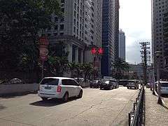
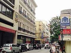
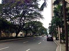
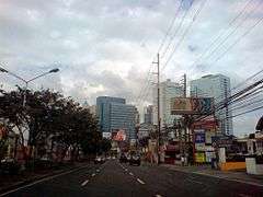
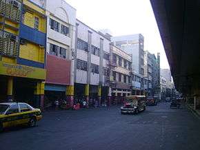
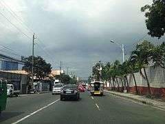
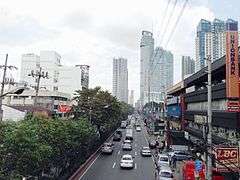
Gallery
-
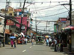
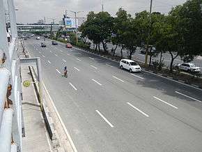
Dr. Sixto Antonio Avenue
-
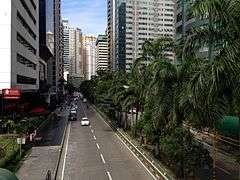
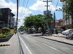
F. Ortigas Jr. Road
-
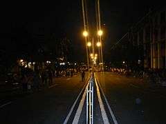
Nakpil Street (Manila)


See also
- Road numbering
- List of eponymous streets in Metro Manila
- List of renamed streets in Metro Manila
- List of expressways in the Philippines
- Highways in the Philippines
References
- 1 2 DPWH Philippines. "DPWH Philippines". Retrieved April 2012. Check date values in:
|access-date=(help) - ↑ URPO. "3rd Urpo" (PDF). Retrieved April 2012. Check date values in:
|access-date=(help) - 1 2 Tolentino, N. "The major roads of Metro Manila". The major roads of Metro Manila. Wordpress.com. Retrieved June 4, 2012.
- ↑ "Metro Manila Roads". Retrieved April 2012. Check date values in:
|access-date=(help) - ↑ Maranga, Mark Anthony (2010). "Kilometer Zero: Distance Reference of Manila". Philippines Travel Guide. Retrieved February 28, 2011.
- ↑ Manila City Government. "Manila Map". Retrieved April 2012. Check date values in:
|access-date=(help) - ↑ Philippine Star. "Philippine Roads". Retrieved April 2012. Check date values in:
|access-date=(help) - ↑ "South Metro Manila Skyway Project". Skyway Operation and Management Corporation (SomCo). Retrieved May 16, 2013.
- ↑ El-Hifnawi, Baher; Jenkins, Glenn. "Pasig River Expressway" (PDF). Kingston, Canada: Queen’s University. Retrieved May 16, 2013.
- ↑ Habagat Central. "Baras Rizal and Beyond Manila East Road". Retrieved June 15, 2012.
- ↑ Fullerton, Laurie (1995). Philippines Handbook. Moon Publications. Marcos Highway, Retrieved June 2012
- ↑ Doy Cinco. Commonwealth Avenue, the Killer Highway "Commonwealth Avenue, the Killer Highway" Check
|url=value (help). Retrieved April 2012. Check date values in:|access-date=(help)(Tagalog) - ↑ DPWH Philippines. "R-7 Expressway to be Built over Quezon Avenue". Retrieved June 2012. Check date values in:
|access-date=(help) - ↑ Marciano R. de Borja, Basques in the Philippines, University of Nevada Press, 2005, p. 132, accessed 20 January 2011
- ↑ mntc.com. "North Luzon Expressway". Retrieved July 2, 2012.
- ↑ Encyclopedia Britannica (1983). Pan Philippine Highway. United States of America: Britannica.
- ↑ "RDC Allots P8.7 Billion For Manila-Bataan Coastal Highway". August 19, 2012. Retrieved May 26, 2013.
- ↑ Citiatlas Metro Manila. Asiatype, Inc.,. 2002. p. 183. ISBN 9719171952.
- ↑ Manila Bulletin. "Skybridge". Retrieved May 2012. Check date values in:
|access-date=(help) - ↑ Philippine Daily Inquirer (July 7, 2009). "Inquirer Headlines: EDSA". Philippine Daily Inquirer. Retrieved July 9, 2012.
- ↑ Jao-Grey, Margarte (December 27, 2007). "Too Many Buses, Too Many Agencies Clog Edsa". Philippine Center for Investigative Journalism. Retrieved December 28, 2007.
- ↑ Flores, Asti (February 17, 2013). "MMDA, DPWH name the C-5 Road as an alternate route for EDSA overhaul". GMANews. Retrieved May 27, 2013.
- ↑ "Will C-6 road remain a metropolis dream?". Manila Times. 2006-03-16. Retrieved 2008-02-03.
External links
- DPWH Philippines official website
| Administrative divisions |
|
|---|---|
| Geography | |
| History |
|
| Economy |
|
| Public services and utilities |
|
| Education | |
| Culture | |
| Transportation | |