Manila–Cavite Expressway
| |
|---|---|
|
Aguinaldo Boulevard Coastal Road CAVITEx Manila — Cavite Coastal Road | |
|
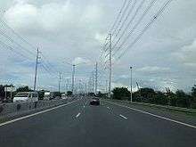
View of the expressway extension in Bacoor Bay | |
| Route information | |
| Length: | 14.0 km (8.7 mi) |
| Existed: | 1998[1] – present |
| Component highways: |
|
| Major junctions | |
| North end: | Roxas Boulevard (at NAIA Road in Parañaque) |
| |
| South end: | Tirona Highway (in Kawit, Cavite) |
| Location | |
| Major cities: | |
| Towns: | Kawit |
| Highway system | |
| Highways in the Philippines | |


The Manila–Cavite Expressway, more commonly known as CAVITEX and formerly as Aguinaldo Boulevard, is a 14-kilometre (8.7 mi) long access-controlled toll expressway linking Manila to the southern province of Cavite in the Philippines. It is considered part of the Radial Road 1 (R-1) of Metro Manila. It is owned and operated by the Public Estates Authority Tollway Corporation (PEATC), a government owned corporation and a subsidiary of the Public Estates Authority, an office under the Office of the President. It is also nicknamed the Coastal Road because of its vicinity to the Manila Bay.
At the north end, it feeds into and from Roxas Boulevard in the city of Parañaque in Metro Manila, also part of R-1. At the south end, it splits into two terminii, both along the north coast in Kawit, Cavite. One feeds into the intersection of Tirona Highway and Antero Soriano Highway. Left backtracks through Binakayan back to Bacoor, straight proceeds on Soriano towards the Cavite Economic Zone, and right proceeds towards the highway's other terminus on Tirona Highway near the Aguinaldo Shrine heading towards Noveleta.
In 2011, the extension going to Kawit, Cavite was opened to the public, where it will eventually connect to C-6, the now-under-construction Bulacan-Rizal-Manila-Cavite Regional Expressway and to the proposed Cavite-Laguna Expressway. Meanwhile, when the C-5 Road and the NAIA Expressway are extended southward, it will also eventually be connected to those expressways as well. It will be the street alignment of the Manila LRT-1 South Extension when completed in Parañaque. It will have 2 stations, namely: Asia World and Ninoy Aquino International Airport.
The highway features a limited number of interchanges. The original south terminus of the expressway in Bacoor has been converted into a full trumpet interchange. There are two toll barriers on the expressway: the original barrier at Las Piñas and the extension barrier in Kawit. Vehicles are charged a flat toll rate based on class. PEATC has also incorporated a near-field communication prepaid card it calls E-TAP. The Expressway is now also accepting an electronic toll collection system called Easydrive set up by Easytrip Serivices Corporation, which currently manages ETC for the North Luzon Expressway (however, Easydrive is not cross-compatible with the NLEX's Easytrip).
History
Originally conceived as one of 3 expressways emanating from Manila, Manila-Cavite Expressway (Coastal Road) is proposed since the Marcos era, however, it was not constructed. Manila-Cavite Expressway started as a 6.6-kilometre (4.1 mi) expressway built on reclaimed land in 1998. [1] On 2011, a 7-kilometre (4.3 mi) extension to Kawit, Cavite is opened.[1]
Expansion
C5 South Link
C-5 South Link Expressway is a 7.7-kilometer, six-lane which will connect C-5 road to the Manila–Cavite Expressway (Cavitex)
Technical specifications
- Name: Manila–Cavite Expressway
- Concession holder: Cavite Infrastructure Corporation
- Operator: Cavite Infrastructure Corporation
- Concession starting date: 1996
- Concession ending date: 2023
- Length: 14 km
- Highway exits: 4
- Lanes: 4 Lanes (2 Lanes each direction)
- Toll plazas: 2
- Rest and Service Areas: none
- Minimum Height Clearance on Underpasses:
Toll

Tolls are assessed in each direction at each barrier, based on class. In accordance with law, all toll rates include a 12% Value-Added Tax.
| Class | Las Piñas | Kawit |
|---|---|---|
| 1 | ₱24.00 | ₱64.00 |
| 2 | ₱48.00 | ₱129.00 |
| 3 | ₱72.00 | ₱194.00 |
Exits
Current exits
This exit list includes all exits, and also exits under construction.
| Region | Province | City/Municipality | Km | Mi | Destination | Notes |
|---|---|---|---|---|---|---|
| Metro Manila | Parañaque | 8 | NAIA Road | Start of expressway. Road continues as Roxas Boulevard | ||
| ? | Future access to NAIA Expressway | |||||
| 10 | Diosdado Macapagal Boulevard | Traffic light intersection. No right turns southbound. | ||||
| Las Piñas | 13 | Las Piñas Toll Plaza | ||||
| 14 | C-5 Road Extension | Right-in/right-out exit for C-5 Road Extension. | ||||
| Calabarzon | Cavite | Bacoor | 15 | Zapote | Trumpet interchange. Former terminus | |
| Kawit | 23 | Kawit Toll Plaza | ||||
| 24 | Kawit, Naic | At-grade intersection. End of expressway. Road continues south as Antero Soriano Highway | ||||
1.000 mi = 1.609 km; 1.000 km = 0.621 mi
| ||||||
Future Exits
| Kilometer No. | Exit | Interchange type | Location | Remarks |
|---|---|---|---|---|
| TBA | CAVITEx-CALAx | Y-shape (both northbound and southbound) | Kawit, Cavite | It connects Cavite–Laguna Expressway and this expressway. [2] |
| TBA | CAVITEx-BRMCRex | TBA | Bacoor, Cavite | It connects Bulacan–Rizal–Manila–Cavite Regional Expressway and Cavitex |
| TBA | CAVITEx-Sangley Point | TBA | Las Piñas | It connects Cavitex to the Airport on Cavite City. This is an underwater road with Light Rail Transit.[3] |
References
- 1 2 3 "Land Development". Philippine Reclamation Authority. Retrieved 20 January 2016.
- ↑ http://ppp.gov.ph/?p=7981
- ↑ http://www.ramboll.com/megatrend/feature-articles/gateway-asia-2030
External links
| Wikimedia Commons has media related to Manila–Cavite Expressway. |
| Operational | |
|---|---|
| Planned | |
| Under construction | |
Coordinates: 14°28′10″N 120°57′27″E / 14.46944°N 120.95750°E