Lorain, Ohio
| Lorain, Ohio | ||
|---|---|---|
| City | ||
| City of Lorain | ||
|
Lorain harbor | ||
| ||
| Nickname(s): "The International City" | ||
 Location within the state of Ohio | ||
 Location of Lorain in Lorain County | ||
| Coordinates: 41°26′54″N 82°10′8″W / 41.44833°N 82.16889°WCoordinates: 41°26′54″N 82°10′8″W / 41.44833°N 82.16889°W | ||
| Country | United States of America | |
| State | Ohio | |
| County | Lorain | |
| Founded | circa-1822 | |
| Government | ||
| • Mayor | Chase M. Ritenauer (D) | |
| • President of Council | Joel Arredondo (D) | |
| Area[1] | ||
| • Total | 24.14 sq mi (62.52 km2) | |
| • Land | 23.67 sq mi (61.31 km2) | |
| • Water | 0.47 sq mi (1.22 km2) | |
| Elevation | 610 ft (186 m) | |
| Population (2010)[2] | ||
| • Total | 64,097 | |
| • Estimate (2015[3]) | 63,647 | |
| • Density | 2,707.9/sq mi (1,045.5/km2) | |
| Time zone | EST (UTC-5) | |
| • Summer (DST) | EDT (UTC-4) | |
| ZIP codes | 44052-44055-44053-44054 | |
| Area code(s) | 440 | |
| FIPS code | 39-44856 | |
| GNIS feature ID | 1077529[4] | |
| Website | http://www.cityoflorain.org | |


Lorain is a city in Lorain County, Ohio, United States. The municipality is located in northeastern Ohio on Lake Erie, at the mouth of the Black River, about 30 miles west of Cleveland.
As of the 2010 census, the city had a total population of 64,097,[5] making it Ohio's tenth largest city. Incorporated 1874 (see 'History', below).
Ford Motor Company had the Lorain Assembly Plant in the city, mostly known for assembling the Ford Econoline (E-series) van, Ford Torino and Mercury Montego, and beginning in 1975 the Ford Thunderbird and Mercury Cougar (through 1997); the plant ceased all production on December 14, 2005 because the UAW and Ford management were unable to come to terms on a new contract. The sprawling United States Steel Mill stretches for nearly 3 miles (4.8 km) on the city's south side. These mills had operated in the city since 1895 and employed thousands of local residents. Though the blast furnaces were idled in late 2008, Republic Steel announced in December 2011 that they would be building electric arc furnaces to once again make steel in Lorain. However, Republic Steel closed its doors for good in July 2016.
Geography
Lorain, part of the Cleveland–Elyria–Mentor metropolitan area, is located at 41°26′54″N 82°10′8″W / 41.44833°N 82.16889°W (41.448241, -82.168862).[6]
According to the United States Census Bureau, the city has a total area of 24.14 square miles (62.52 km2), of which 23.67 square miles (61.31 km2) is land and 0.47 square miles (1.22 km2) is water.[1]
The Charles Berry Bridge is located in Lorain, and is the second-largest bascule bridge in the world.
Name and history
- The City of Lorain originally began as the small village named "Mouth of Black River", named at that time for its exact location on the west side of the mouth of the Black River (formerly called the 'Reneshoua River'). The village began to take form about 1822, through the efforts of pioneer settler John S. Reid, and later expanded by his son and sons-in-law who renamed the village "Charleston" in 1836, but it was shortly later again name-changed to simply "Black River" village.[7]
 1834 Plat Map for the village of "Mouth of Black River", from Durand survey. (click for more info).
.jpg)
- By 1874, the village had grown considerably, and so was incorporated as 'Lorain', named for the County in which it is located. (Some original records for the County indicate the name had originally been chosen as "Colerain"; however, the residents who had chosen the final name "Lorain" for this County(which became independent from Huron County in 1824), had no direct connection to the Alsace-Lorraine area of France, which later historians had theorized.
- The city eventually expanded to encompass land on the east side of the river, including land which had been previously owned by members of the Nathan Perry family of Cleveland, Ohio. Therefore, and because the Perry family are such well-known pioneers of Cleveland, some historians have attributed that family as the first pioneers of the City of Lorain; however, the Perry family never actually settled here (nor did they establish the actual original village of Mouth of Black River). Nathan Perry, Jr., who ran an Indian-trading-post shanty on the east side of the river, only did so for a couple of fair-weather seasons, but then permanently moved back to Cleveland in Fall 1808. But the much later village of "Mouth of Black River" on the opposite (west) side of the river, was established by John S. Reid, and his family. Reid had purchased this land directly from the Conn. Land Comp., and first arrived to the area of the Black River in 1809, and helped to clear many of the area roads through the wilderness, including the Lake Road from the Black River to the Huron River. John finally permanently moved his family to the Black River's mouth in 1811. In 1812 he ran the first U.S. post-office here from his blockhouse/tavern, and the future village of Mouth of Black River settlement then sprang up around Reid's location, and was accelerated in the 1830s due to prospects of a canal (about 1836) and early railroad (about 1838) going through it, although neither project occurred. The main commerce that kept the little village alive in its earliest years, was the grain-shipping industry, as well as being a very early shipbuilding port beginning in 1819.[8]
- John S. Reid's son Conrad Reid, was the first mayor after the city became named 'Lorain'.
- By the mid-20th-century, the city had expanded to encompass almost all of the original "Township of Black River", and also portions of Sheffield Twp.
[reference sources: County records and property-deeds of Huron County and Lorain County Ohio.]
Parks and recreation
Lorain is the site of Lakeview Park. The park is bisected by Erie Avenue (US Route 6). The south side of the park is managed by the City of Lorain; the north side of the park, on Lake Erie, is managed by Lorain County Metro Parks. The park features swimming, a historical rose garden, a fountain, and a restaurant.[9] In the summer, beach volleyball tournaments, concerts, and weddings are held at the park.
Politics
Politics in the City of Lorain have traditionally been closely tied to the local Democratic Party. However, through the years Republicans occasionally have been able to win offices. Since the late 1990s Lorain has elected all Democrats to city council, but in 1999 a Republican - Craig Foltin - was elected mayor. In 2003, the voters re-elected Craig L. Foltin.[10]
Lorain is one of the largest cities in Ohio to not have a charter. The city of Lorain functions under a Statutory government. This provides for a Mayor-Council form with until recently 3 at-large seats and 8 wards.
As of the 2008 General Election, the number of residents registered to a political party were:
- Democrats: 16,168
- Republicans: 2,346
The city is home to the Lorain Municipal Court, which serves the cities of Lorain and Sheffield Lake as well as Sheffield Township.
Federally, most of Lorain is part of Ohio's 9th congressional district, represented by Democrat Marcy Kaptur. A tiny section in the south is in Ohio's 4th congressional district, represented by Republican Jim Jordan.
Demographics
| Historical population | |||
|---|---|---|---|
| Census | Pop. | %± | |
| 1880 | 1,595 | — | |
| 1890 | 4,863 | 204.9% | |
| 1900 | 16,028 | 229.6% | |
| 1910 | 28,883 | 80.2% | |
| 1920 | 37,205 | 28.8% | |
| 1930 | 44,512 | 19.6% | |
| 1940 | 44,125 | −0.9% | |
| 1950 | 51,202 | 16.0% | |
| 1960 | 68,932 | 34.6% | |
| 1970 | 78,185 | 13.4% | |
| 1980 | 75,416 | −3.5% | |
| 1990 | 71,245 | −5.5% | |
| 2000 | 68,652 | −3.6% | |
| 2010 | 64,097 | −6.6% | |
| Est. 2015 | 63,647 | [11] | −0.7% |
| U.S. Decennial Census[12] 2012 Estimate[13] | |||
2000 census
As of the census of 2000, there were 68,652 people, 26,434 households, and 17,975 families residing in the city. The population density was 2,858.1 people per square mile (1,103.5/km²). There were 28,231 housing units at an average density of 1,175.5/sq mi (453.8/km²). The racial makeup of the city was 69.70% White, 15.94% African American, 0.44% Native American, 0.33% Asian, 0.03% Pacific Islander, 9.56% from other races, and 3.99% from two or more races. Hispanic or Latino of any race were 21.03% of the population.
There were 26,434 households out of which 33.3% had children under the age of 18 living with them, 43.6% were married couples living together, 19.2% had a female householder with no husband present, and 32.0% were non-families. 27.4% of all households were made up of individuals and 10.7% had someone living alone who was 65 years of age or older. The average household size was 2.57 and the average family size was 3.11.
In the city the population was spread out with 28.3% under the age of 18, 9.0% from 18 to 24, 28.2% from 25 to 44, 20.5% from 45 to 64, and 14.0% who were 65 years of age or older. The median age was 34 years. For every 100 females there were 90.2 males. For every 100 females age 18 and over, there were 85.4 males.
The median income for a household in the city was $33,917, and the median income for a family was $39,454. Males had a median income of $34,120 versus $23,065 for females. The per capita income for the city was $16,340. About 14.2% of families and 17.1% of the population were below the poverty line, including 26.5% of those under age 18 and 9.2% of those age 65 or over.
2010 census
As of the census[2] of 2010, there were 64,097 people, 25,529 households, and 16,368 families residing in the city. The population density was 2,707.9 inhabitants per square mile (1,045.5/km2). There were 29,144 housing units at an average density of 1,231.3 per square mile (475.4/km2). The racial makeup of the city was 67.9% White, 17.6% African American, 0.5% Native American, 0.4% Asian, 8.3% from other races, and 5.4% from two or more races. Hispanic or Latino of any race were 25.2% of the population.
There were 25,529 households of which 33.7% had children under the age of 18 living with them, 37.1% were married couples living together, 21.0% had a female householder with no husband present, 6.1% had a male householder with no wife present, and 35.9% were non-families. 30.8% of all households were made up of individuals and 11.5% had someone living alone who was 65 years of age or older. The average household size was 2.48 and the average family size was 3.09.
The median age in the city was 36.8 years. 26.7% of residents were under the age of 18; 8.8% were between the ages of 18 and 24; 24.6% were from 25 to 44; 26% were from 45 to 64; and 13.9% were 65 years of age or older. The gender makeup of the city was 47.5% male and 52.5% female.
Economy
CenturyTel of Ohio is based in Lorain.
Top employers
According to the City's 2013 Comprehensive Annual Financial Report, [14] the top employers in the city are:
| # | Employer | # of employees |
|---|---|---|
| 1 | Mercy Health | 1,657 |
| 2 | Lorain City School District | 870 |
| 3 | Lorain Tubular | 796 |
| 4 | Republic Steel | 633 |
| 5 | CAMACO, Inc. | 500 |
| 6 | The City Of Lorain | 468 |
| 7 | Grace Management Services | 314 |
| 8 | Cleveland Clinic | 300 |
| 9 | The Nord Center | 228 |
| 10 | Walmart | 211 |
Culture
Over 70 different nationalities live in the Lorain area, hence the nickname "The International City." One of the highlights of the summer season is the Lorain International Festival. Many were originally attracted by work in the steel mills and ship yards. Lorain is sometimes referred to as Steel City because of its well-known steel mill. Downtown Lorain was devastated by a tornado in 1924 and as part of an initiative to rebuild the downtown several historic buildings were constructed, including the Lorain Palace Theatre which opened in 1928 and continues to operate today.[15]
Pictures
 Broadway, looking north, about 1908
 Aerial view, looking north, 1908-1918
 "At the loop", 1913
 Aerial view of the harbor at Lorain, Ohio. View is to the southeast.
 Broadway, Downtown
Notable people
- Terry Anderson, journalist and former Lebanese hostage
- Dimitra Arliss, actress
- Don Barden, Detroit businessman and owner of several large U.S. based casinos, Served 2 terms as Lorain's first black city councilman.
- Charles J. Berry, Corporal, winner of the Medal of Honor during World War II
- Michael Dirda, Pulitzer Prize–winning book critic
- Stevan Dohanos, artist
- Gerald Freedman, American theatre director, librettist, and lyricist, and a college dean.
- Eddy Gragus, professional cyclist and 1996 US Professional Cycling Champion
- Diane Grob Schmidt, 2015 president of the American Chemical Society
- Robert Galambos (1914–2010), researcher who discovered how bats use echolocation.[16]
- Quincy Gillmore, General
- Ellen Hanley, singer
- William Hanley, author
- Raymont Harris, NFL running back
- Lofton Henderson, Major, a hero of the Battle of Midway
- Anthony Hitchens , Clearview High School Graduate, Dallas Cowboys Linebacker, Iowa Hawkeye
- JoBea Way Holt, planetary scientist
- Ernest J. King, Fleet Admiral, Chief of Naval Operations and Fleet Admiral of the U.S. Atlantic Fleet in World War II
- Ray Lawrence, bandleader, record company executive, record producer and personal manager.
- Sam McPheeters, singer of Born Against
- Jason Molina, singer-songwriter
- Toni Morrison, Nobel Prize laureate author
- Chad Muska, professional skateboarder, was born there, currently resides in the Woodland Hills, Los Angeles, California
- Don Novello, aka Father Guido Sarducci
- Ward Van Orman, three time winner of the Gordon Bennett Race
- Robert F. Overmyer, Colonel in the United States Marine Corps, test pilot and astronaut
- Martha Piper, former chancellor and president of the University of British Columbia
- Helen Steiner Rice, author and poet
- Pam Robinson, co-founder of the American Copy Editors Society, a national journalism organization
- Vince Villanucci, NFL player
- Bruce Weigl, prize winning poet
- Matt Wilhelm, football player, Elyria Catholic graduate, NFL Linebacker, Ohio State national champion and Super Bowl champ
- General Johnnie E. Wilson
References
- 1 2 "US Gazetteer files 2010". United States Census Bureau. Retrieved 2013-01-06.
- 1 2 "American FactFinder". United States Census Bureau. Retrieved 2013-01-06.
- ↑ "Population Estimates". United States Census Bureau. Retrieved 2016-06-04.
- ↑ "US Board on Geographic Names". United States Geological Survey. 2007-10-25. Retrieved 2008-01-31.
- ↑ "American FactFinder2". Retrieved 2010-03-20.
- ↑ "US Gazetteer files: 2010, 2000, and 1990". United States Census Bureau. 2011-02-12. Retrieved 2011-04-23.
- ↑ County government records and property-deeds of Huron County and Lorain County Ohio
- ↑ History of Lorain County; Williams, 1879
- ↑ "Lakeview Park at Lorain County Metro Parks". www.metroparks.cc. Retrieved 2016-01-19.
- ↑ "2003 General Election Results" (PDF). Lorain County Board of Elections. Lorain County Board of Elections. November 4, 2003. Retrieved January 15, 2016.
- ↑ "Annual Estimates of the Resident Population for Incorporated Places: April 1, 2010 to July 1, 2015". Retrieved July 2, 2016.
- ↑ United States Census Bureau. "Census of Population and Housing". Retrieved November 20, 2013.
- ↑ "Annual Estimates of the Resident Population: April 1, 2010 to July 1, 2012". Retrieved November 20, 2013.
- ↑ "Comprehensive Annual Financial Report: Year Ended December 31, 2013" (PDF). City of Lorain. p. 187.
- ↑ Lorain Palace Civic Center in Lorain, OH - Cinema Treasures
- ↑ Martin, Douglas. "Robert Galambos, Neuroscientist Who Showed How Bats Navigate, Dies at 96", The New York Times, July 15, 2010. Accessed July 16, 2010.
External links
| Wikisource has the text of the 1920 Encyclopedia Americana article Lorain. |
- City of Lorain
- Ohio Business College Lorain Campus
- Black River Historical Society - The Museum of the City of Lorain
- Local Announcements, Business Listings and Events Calendar
- U.S. Coast Guard Auxiliary Flotilla 092-06-04 Lorain, Ohio
-
 Lorain travel guide from Wikivoyage
 |
Lake Erie | Sheffield Lake | | |
| Vermilion | |
Sheffield | ||
| ||||
| | ||||
| Amherst | |
Elyria |
Municipalities and communities of Lorain County, Ohio, United States | ||
|---|---|---|
| Cities | 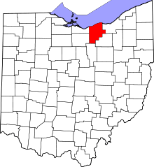 | |
| Villages | ||
| Townships | ||
| CDPs |
| |
| Unincorporated communities | ||
| Ghost town | ||
| Footnotes | ‡This populated place also has portions in an adjacent county or counties | |