Richland County, Ohio
| Richland County, Ohio | ||
|---|---|---|
 Richland County Courthouse | ||
| ||
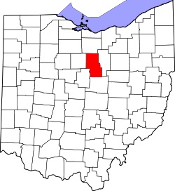 Location in the U.S. state of Ohio | ||
 Ohio's location in the U.S. | ||
| Founded | March 1, 1813 | |
| Named for | the fertile soil there | |
| Seat | Mansfield | |
| Largest city | Mansfield | |
| Area | ||
| • Total | 500 sq mi (1,295 km2) | |
| • Land | 495 sq mi (1,282 km2) | |
| • Water | 4.8 sq mi (12 km2), 1.0% | |
| Population | ||
| • (2010) | 124,475 | |
| • Density | 251/sq mi (97/km²) | |
| Congressional districts | 7th, 12th | |
| Time zone | Eastern: UTC-5/-4 | |
| Website |
www | |

Richland County is a county located in the U.S. state of Ohio. As of the 2010 census, the population was 124,475.[1] Its county seat is Mansfield.[2] The county was created in 1808 and later organized in 1813.[3] It is named for the fertile soil found there.[4]
Richland County is included in the Mansfield, OH Metropolitan Statistical Area as well as the Mansfield-Ashland-Bucyrus, OH Combined Statistical Area. The county is part of Northeast Ohio.
History
At its formation in 1806 Richland County encompassed a larger area. The land was mainly forest. Settlers cleared the land for farming and the population increased. In 1846, some eastern portions of the county (such as Green Township) were separated to contribute to formation of Ashland County.
Geography
According to the U.S. Census Bureau, the county has a total area of 500 square miles (1,300 km2), of which 495 square miles (1,280 km2) is land and 4.8 square miles (12 km2) (1.0%) is water.[5]
Adjacent counties
- Huron County (north)
- Ashland County (east)
- Knox County (south)
- Morrow County (southwest)
- Crawford County (west)
Demographics
| Historical population | |||
|---|---|---|---|
| Census | Pop. | %± | |
| 1820 | 9,169 | — | |
| 1830 | 24,006 | 161.8% | |
| 1840 | 44,532 | 85.5% | |
| 1850 | 30,879 | −30.7% | |
| 1860 | 31,158 | 0.9% | |
| 1870 | 32,516 | 4.4% | |
| 1880 | 36,306 | 11.7% | |
| 1890 | 38,072 | 4.9% | |
| 1900 | 44,289 | 16.3% | |
| 1910 | 47,667 | 7.6% | |
| 1920 | 55,178 | 15.8% | |
| 1930 | 65,902 | 19.4% | |
| 1940 | 73,853 | 12.1% | |
| 1950 | 91,305 | 23.6% | |
| 1960 | 117,761 | 29.0% | |
| 1970 | 129,997 | 10.4% | |
| 1980 | 131,205 | 0.9% | |
| 1990 | 126,137 | −3.9% | |
| 2000 | 128,852 | 2.2% | |
| 2010 | 124,475 | −3.4% | |
| Est. 2015 | 121,707 | [6] | −2.2% |
| U.S. Decennial Census[7] 1790-1960[8] 1900-1990[9] 1990-2000[10] 2010-2013[1] | |||
2000 census
As of the census[11] of 2000, there were 128,852 people, 49,534 households, and 34,277 families residing in the county. The population density was 259 people per square mile (100/km²). There were 53,062 housing units at an average density of 107 per square mile (41/km²). The racial makeup of the county was 88.16% White, 9.43% Black or African American, 0.20% Native American, 0.51% Asian, 0.03% Pacific Islander, 0.38% from other races, and 1.28% from two or more races. 0.93% of the population were Hispanic or Latino of any race. 96.0% spoke English, 1.2% German and 1.2% Spanish as their first language.
There were 49,534 households out of which 30.90% had children under the age of 18 living with them, 54.30% were married couples living together, 11.40% had a female householder with no husband present, and 30.80% were non-families. 26.50% of all households were made up of individuals and 10.90% had someone living alone who was 65 years of age or older. The average household size was 2.47 and the average family size was 2.98.
In the county, the population was spread out with 24.80% under the age of 18, 8.40% from 18 to 24, 28.60% from 25 to 44, 24.10% from 45 to 64, and 14.20% who were 65 years of age or older. The median age was 38 years. For every 100 females there were 101.30 males. For every 100 females age 18 and over, there were 99.30 males.
The median income for a household in the county was $37,397, and the median income for a family was $45,036. Males had a median income of $35,425 versus $22,859 for females. The per capita income for the county was $18,582. About 8.20% of families and 10.60% of the population were below the poverty line, including 15.30% of those under age 18 and 7.70% of those age 65 or over.
2010 census
As of the 2010 United States Census, there were 124,475 people, 48,921 households, and 32,510 families residing in the county.[12] The population density was 251.3 inhabitants per square mile (97.0/km2). There were 54,599 housing units at an average density of 110.2 per square mile (42.5/km2).[13] The racial makeup of the county was 87.5% white, 9.4% black or African American, 0.6% Asian, 0.2% American Indian, 0.4% from other races, and 1.9% from two or more races. Those of Hispanic or Latino origin made up 1.4% of the population.[12] In terms of ancestry, 30.6% were German, 13.3% were Irish, 12.6% were English, and 8.0% were American.[14]
Of the 48,921 households, 29.9% had children under the age of 18 living with them, 49.7% were married couples living together, 12.5% had a female householder with no husband present, 33.5% were non-families, and 28.8% of all households were made up of individuals. The average household size was 2.40 and the average family size was 2.93. The median age was 40.9 years.[12]
The median income for a household in the county was $42,664 and the median income for a family was $54,637. Males had a median income of $42,919 versus $31,228 for females. The per capita income for the county was $21,459. About 8.6% of families and 12.4% of the population were below the poverty line, including 18.9% of those under age 18 and 8.2% of those age 65 or over.[15]
Politics
| Year | Republican | Democrat |
|---|---|---|
| 2016 | 66.18% 35,805 | 28.89% 15,629 |
| 2012 | 58.59% 33,867 | 39.25% 22,687 |
| 2008 | 55.58% 34,034 | 42.01% 25,727 |
| 2004 | 59.62% 36,872 | 39.84% 24,638 |
| 2000 | 57.10% 30,138 | 38.98% 20,572 |
Government
County officials
- Commissioners: Marylin John, Gary Utt, Tim Wert
- Prosecutor: Bambi Couch Page (acting, following death of James J. Mayer, Jr., on Sept. 26, 2014) [17]
- Sheriff: J. Steve Sheldon
- Auditor: Patrick W. Dropsey
- Treasurer: Bart Hamilton
- Recorder: Sarah Davis
- Clerk of Courts: Linda H. Frary
- Engineer: Tom Beck
- Judges of the Court of Common Pleas: James DeWeese and James D. Henson; Robert L. Konstam (domestic):
Communities

Cities
Villages
Townships
Unincorporated communities
- Adario
- Alta
- Amoy
- Bangorville
- Bethlehem
- Coulter
- Crimson
- Culler Mill
- Darlington
- East Mansfield
- Epworth
- Fleming Falls
- Ganges
- Hanley Village
- Hastings
- Lincoln Heights
- Little Washington
- Lockhart
- London
- Millsboro
- Olivesburg
- Pavonia
- Pinhook
- Planktown
- Rome
- Shenandoah
- Spring Mill
- Taylortown
- Vernon Junction
- Washington
- Windsor
- Wooster Heights
Ghost towns
See also
References
- 1 2 "State & County QuickFacts". United States Census Bureau. Retrieved February 10, 2015.
- ↑ "Find a County". National Association of Counties. Archived from the original on May 31, 2011. Retrieved 2011-06-07.
- ↑ "Ohio: Individual County Chronologies". Ohio Atlas of Historical County Boundaries. The Newberry Library. 2007. Retrieved February 14, 2015.
- ↑ "Richland County data". Ohio State University Extension Data Center. Retrieved 2007-04-28.
- ↑ "2010 Census Gazetteer Files". United States Census Bureau. August 22, 2012. Retrieved February 10, 2015.
- ↑ "County Totals Dataset: Population, Population Change and Estimated Components of Population Change: April 1, 2010 to July 1, 2015". Retrieved July 2, 2016.
- ↑ "U.S. Decennial Census". United States Census Bureau. Archived from the original on May 11, 2015. Retrieved February 10, 2015.
- ↑ "Historical Census Browser". University of Virginia Library. Retrieved February 10, 2015.
- ↑ Forstall, Richard L., ed. (March 27, 1995). "Population of Counties by Decennial Census: 1900 to 1990". United States Census Bureau. Retrieved February 10, 2015.
- ↑ "Census 2000 PHC-T-4. Ranking Tables for Counties: 1990 and 2000" (PDF). United States Census Bureau. April 2, 2001. Retrieved February 10, 2015.
- ↑ "American FactFinder". United States Census Bureau. Archived from the original on 2013-09-11. Retrieved 2008-01-31.
- 1 2 3 "DP-1 Profile of General Population and Housing Characteristics: 2010 Demographic Profile Data". United States Census Bureau. Retrieved 2015-12-27.
- ↑ "Population, Housing Units, Area, and Density: 2010 - County". United States Census Bureau. Retrieved 2015-12-27.
- ↑ "DP02 SELECTED SOCIAL CHARACTERISTICS IN THE UNITED STATES – 2006-2010 American Community Survey 5-Year Estimates". United States Census Bureau. Retrieved 2015-12-27.
- ↑ "DP03 SELECTED ECONOMIC CHARACTERISTICS – 2006-2010 American Community Survey 5-Year Estimates". United States Census Bureau. Retrieved 2015-12-27.
- ↑ "Dave Leip's Atlas of U.S. Presidential Elections". Retrieved 2016-03-26.
- ↑ http://www.richlandsource.com/news/article_16998646-4805-11e4-a4ca-0017a43b2370.html
Further reading
- A.J. Baughman, A Centennial Biographical History of Richland County, Ohio. Chicago: Lewis Publishing Co., 1901.
- Abraham J. Baughman, History of Richland County, Ohio from 1808 to 1908: Also Biographical Sketches of Prominent Citizens of the County. In Two Volumes. Chicago: S.J. Clarke Publishing Co., 1908. [ Volume 1] | Volume 2
- A.A. Graham, History of Richland County, Ohio (Including the Original Boundaries), Its Past and Present: Containing a Condensed Comprehensive History of Ohio, Including an Outline History of the Northwest; A Complete History of Richland County Including Its Townships, Cities, Towns and Villages, Schools, Churches, Societies, Industries, etc.; A History of Its Soldiers in the Late War; Portraits of Its Early Settlers and Prominent Men... Mansfield, Ohio: A.A. Graham Publishing Co., 1880.
- Biographical History of Richland County, Ohio, 1983. Lexington, OH: Richland County Genealogical Society, 1983.
External links
 |
Huron County | | ||
| Crawford County | |
Ashland County | ||
| ||||
| | ||||
| Morrow County | Knox County |
Municipalities and communities of Richland County, Ohio, United States | ||
|---|---|---|
| Cities | | |
| Villages | ||
| Townships | ||
| Unincorporated communities | ||
| Ghost towns | ||
| Footnotes | ‡This populated place also has portions in an adjacent county or counties | |
Coordinates: 40°47′N 82°32′W / 40.78°N 82.54°W