Oberlin, Ohio
| Oberlin | |
|---|---|
| City | |
| City of Oberlin | |
 | |
| Motto: "Live. Learn. Lead." | |
 Location of Oberlin, Ohio | |
 Location of Oberlin in Lorain County | |
| Coordinates: 41°17′18″N 82°13′0″W / 41.28833°N 82.21667°WCoordinates: 41°17′18″N 82°13′0″W / 41.28833°N 82.21667°W | |
| Country |
|
| State |
|
| County |
|
| Government | |
| • Type | Council-manager |
| • City manager | Eric Norenberg |
| Area[1] | |
| • Total | 4.96 sq mi (12.85 km2) |
| • Land | 4.92 sq mi (12.74 km2) |
| • Water | 0.04 sq mi (0.10 km2) |
| Elevation[2] | 814 ft (248 m) |
| Population (2010)[3] | |
| • Total | 8,286 |
| • Estimate (2012[4]) | 8,300 |
| • Density | 1,684.1/sq mi (650.2/km2) |
| Time zone | Eastern (EST) (UTC-5) |
| • Summer (DST) | EDT (UTC-4) |
| ZIP code | 44074 |
| Area code(s) | 440 |
| FIPS code | 39-57834[5] |
| GNIS feature ID | 1049034[2] |
| Website | http://www.cityofoberlin.com/ |
Oberlin is a city in Lorain County, Ohio, United States, southwest of Cleveland. Oberlin is the home of Oberlin College, a liberal arts college and music conservatory with approximately 3,000 students.
The town is the birthplace of the Anti-Saloon League and the Hall-Héroult process, the process of reducing aluminum from its fluoride salts by electrolysis, which made industrial production of aluminum possible.[6]
The population was 8,286 at the 2010 census.
History
Oberlin was founded in 1833 by two Presbyterian ministers, John Jay Shipherd and Philo P. Stewart. The pair had become friends while spending the summer of 1832 together in nearby Elyria and discovered a shared dissatisfaction with what they saw as the lack of strong Christian morals among the settlers of the American West. Their proposed solution was to create a religious community that would more closely adhere to Biblical commandments, along with a school for training Christian missionaries who would eventually spread throughout the American frontier. The two decided to name their community after Jean-Frédéric Oberlin (1740–1826), an Alsatian minister whose pedagogical achievements in a poor and remote area had greatly impressed and inspired them.
Shipherd and Stewart rode south from Elyria into the forests that covered the northern part of Ohio in search of a suitable location for their community. After a journey of approximately eight miles, they stopped to rest and pray in the shade of an elm tree along the forest, and agreed that this would be a good place to start their community. Legend has it that while they prayed, a hunter saw a family of bears climb down from a nearby tree. The bears saw the two men, but turned away without harming them. On hearing this story from the hunter, the two ministers took it to be a sign from God that they had selected the right place for their community and school.
Shipherd traveled back east and convinced the owner of the land to donate 500 acres (2.0 km2) of land for the school, and he purchased an additional 5,000 acres (20 km2) for the town, at the cost of $1.50 per acre ($371/km²). While in that part of the country, he visited many of his friends and persuaded some to join in his adventure, and others to contribute money towards the construction of the community.
The motto of the new Oberlin Collegiate Institute was "Learning and Labor." In those days the words were taken quite literally: tuition at Oberlin was free, but students were expected to contribute by helping to build and sustain the community. This attracted a number of bright young people who would otherwise not have been able to afford tuition. Eventually this approach was deemed inefficient; the motto, however, remains to this day.
During the mid 1800s African Americans, predominantly free people of color and runaway slaves, settled in the area. [7][8][9]
In Oberlin's earliest years, transportation (especially for students) was relied heavily on weather-dependent Lake Erie transportation routes; the nearest railroad passed through Wellington, and travellers were forced to rely on stagecoaches between that village and Oberlin. This situation changed in 1852: in that year, the Toledo, Norwalk, and Cleveland Railroad opened a stop in Oberlin along its Grafton line, and immediately the college and village felt the effects of Fortuna's smile.[10] Fifteen years later, the Lake Shore and Michigan Southern Railway opened a new rail station along this line; no longer used for rail transportation, the depot has been converted for community use and sits at the center of a park.[11]
On June 28, 1924, the worst flood in Oberlin history occurred on the same day that a tornado killed 62 people in Lorain. Afterward, the water was so deep that children swam in Tappan Square.[12] Damage was caused to all of downtown Oberlin.[13]
The second largest employer in Oberlin (after the eponymous College) is the Federal Aviation Administration, which houses an Air Route Traffic Control Center in the town. Cleveland Air Route Traffic Control Center is one of the most transitioned air traffic control centers in the country, and oversees the airspace over six states and a small part of Canada.
Abolitionism
Towards the middle of the 19th century, Oberlin became a major focus of the abolitionist movement in the United States. The town was conceived as an integrated community and blacks attended Oberlin College from 1835, when brothers Gideon Quarles and Charles Henry Langston were admitted. Their younger brother John Mercer Langston, who became the first black elected to the United States Congress from Virginia in 1888, also graduated from Oberlin. Many Oberlin College graduates were dedicated abolitionists, who traveled throughout the South working to help slaves escape to the north.
In 1834, in response to a series of slavery debates at Lane Theological Seminary, the trustees of the Cincinnati, Ohio, school voted to prohibit antislavery agitation among its students and faculty. As a result, the "Lane Rebels", a group of about 50 students, trustee Asa Mahan, and professor John Morgan, left the school. Arthur Tappan, financial agent of the Oberlin Collegiate Institute, and co-founder John Shipherd, saw an opportunity to solve Oberlin's financial problems by inviting the rebels (including Mahan and Morgan) to come to Oberlin. The rebels agreed under three conditions: that Oberlin accept students regardless of color, that Oberlin respect students' freedom of speech, and that Oberlin not "interfere with the internal regulation of the school." In the fall of 1835, Oberlin opened a new theology school with Asa Mahan as President, Charles Finney as Professor of theology, and the Lane Rebels among the first theology students.[14]
By 1852, the town of Oberlin was an active terminus on the Underground Railroad, and thousands had already passed through it on their way to freedom. This effort was assisted by an Ohio law that allowed fugitive slaves to apply for a writ of habeas corpus, which protected them from extradition back to the southern states from which they had escaped. In 1858, a newly elected Democratic state legislature repealed this law, making fugitives around Oberlin vulnerable to enforcement of the Federal Fugitive Slave Law, which allowed southern slave-catchers to target and extradite them back to the South.
This situation came to a head with the Oberlin-Wellington Rescue, a pivotal event described in Nat Brandt's book The Town That Started the Civil War. On September 13, 1858, a fugitive named John Price was captured by federal officials and held in neighboring Wellington, Ohio. A large group of Oberlin residents, consisting of both white and black townspeople, students, and faculty, set out for Wellington to release Price from captivity.

The men took Price back from the arresting US Marshal, and eventually smuggled him to Canada, but the authorities were not content to let the matter rest. United States President James Buchanan personally requested prosecution of the group (now referred to by sympathetic parties as "the Rescuers"), and 37 of them were indicted. Twelve of those were free blacks, including Charles H. Langston. State authorities arrested the US Marshal who had captured Price. In negotiation, the state agreed to free the arresters, and the federal officials agreed to free all but two of those indicted. Simeon M. Bushnell, a white man, and Charles H. Langston were both tried and convicted by an all-Democrat jury. Langston's eloquent speech against slavery and injustice persuaded the judge to give them light sentences. They appealed to the Ohio Supreme Court for a writ of habeas corpus, but on May 30, 1859, their petition was denied.
The political ferment resulting from the case led to a number of major protests throughout the northern part of the state, and an unprecedented boost to the anti-slavery Republican party in the 1860 State elections. The governor of Ohio wrote to the new Republican President Abraham Lincoln urging him to repeal the Fugitive Slave Law. Though in point of fact, Lincoln declined this request, his decision did little to prevent a number of Southern states from seceding, and America was soon embroiled in the Civil War.
Geography
According to the United States Census Bureau, the city has a total area of 4.96 square miles (12.85 km2), of which, 4.92 square miles (12.74 km2) is land and 0.04 square miles (0.10 km2) is water.[1]
Climate
Oberlin experiences a humid continental (Köppen Dfa) climate. Winters are cold, dry and often snowy. Summers are warm to very warm and sometimes hot. The city rests within the northern snowbelt of Ohio and is tempered by the Great Lakes.
| Climate data for Oberlin, Ohio | |||||||||||||
|---|---|---|---|---|---|---|---|---|---|---|---|---|---|
| Month | Jan | Feb | Mar | Apr | May | Jun | Jul | Aug | Sep | Oct | Nov | Dec | Year |
| Record high °F (°C) | 74 (23) |
76 (24) |
83 (28) |
89 (32) |
93 (34) |
104 (40) |
102 (39) |
100 (38) |
100 (38) |
92 (33) |
80 (27) |
77 (25) |
104 (40) |
| Average high °F (°C) | 32.0 (0) |
35.7 (2.1) |
45.8 (7.7) |
58.0 (14.4) |
69.7 (20.9) |
78.6 (25.9) |
82.7 (28.2) |
80.8 (27.1) |
74.2 (23.4) |
62.6 (17) |
49.1 (9.5) |
37.1 (2.8) |
58.9 (14.9) |
| Average low °F (°C) | 15.6 (−9.1) |
18.1 (−7.7) |
26.7 (−2.9) |
36.2 (2.3) |
46.9 (8.3) |
56.1 (13.4) |
60.3 (15.7) |
58.2 (14.6) |
50.9 (10.5) |
40.1 (4.5) |
31.9 (−0.1) |
21.7 (−5.7) |
38.6 (3.7) |
| Record low °F (°C) | −23 (−31) |
−18 (−28) |
−15 (−26) |
6 (−14) |
19 (−7) |
30 (−1) |
38 (3) |
32 (0) |
25 (−4) |
16 (−9) |
2 (−17) |
−18 (−28) |
−23 (−31) |
| Average precipitation inches (mm) | 2.25 (57.2) |
2.02 (51.3) |
2.65 (67.3) |
3.22 (81.8) |
3.60 (91.4) |
3.85 (97.8) |
3.75 (95.3) |
3.49 (88.6) |
3.25 (82.6) |
2.37 (60.2) |
3.05 (77.5) |
2.73 (69.3) |
36.23 (920.2) |
| Average snowfall inches (cm) | 10.1 (25.7) |
9.4 (23.9) |
7.0 (17.8) |
1.5 (3.8) |
0 (0) |
0 (0) |
0 (0) |
0 (0) |
0 (0) |
0 (0) |
2.6 (6.6) |
8.6 (21.8) |
39.2 (99.6) |
| Average precipitation days (≥ 0.01 in) | 12.3 | 10.1 | 11.6 | 12.6 | 11.8 | 11.0 | 9.5 | 9.6 | 9.7 | 10.3 | 11.7 | 12.8 | 133 |
| Average snowy days (≥ 0.1 in) | 6.0 | 4.8 | 3.1 | 0.8 | 0 | 0 | 0 | 0 | 0 | 0 | 1.6 | 5 | 21.3 |
| Source: NOAA (normals, 1971–2000)[15] | |||||||||||||
Demographics
| Historical population | |||
|---|---|---|---|
| Census | Pop. | %± | |
| 1860 | 2,115 | — | |
| 1870 | 2,888 | 36.5% | |
| 1880 | 3,242 | 12.3% | |
| 1890 | 4,376 | 35.0% | |
| 1900 | 4,082 | −6.7% | |
| 1910 | 4,365 | 6.9% | |
| 1920 | 4,286 | −1.8% | |
| 1930 | 4,292 | 0.1% | |
| 1940 | 4,305 | 0.3% | |
| 1950 | 7,062 | 64.0% | |
| 1960 | 8,198 | 16.1% | |
| 1970 | 8,761 | 6.9% | |
| 1980 | 8,660 | −1.2% | |
| 1990 | 8,191 | −5.4% | |
| 2000 | 8,195 | 0.0% | |
| 2010 | 8,286 | 1.1% | |
| Est. 2015 | 8,350 | [16] | 0.8% |
| Sources:[17][18][19][20][21][22][5][23] | |||
2010 census
As of the census[3] of 2010, there were 8,286 people, 2,730 households, and 1,381 families residing in the city. The population density was 1,684.1 inhabitants per square mile (650.2/km2). There were 2,984 housing units at an average density of 606.5 per square mile (234.2/km2). The racial makeup of the city was 73.0% White, 14.8% African American, 0.2% Native American, 4.0% Asian, 1.4% from other races, and 6.5% from two or more races. Hispanic or Latino of any race were 5.1% of the population.
There were 2,730 households of which 24.0% had children under the age of 18 living with them, 35.9% were married couples living together, 11.2% had a female householder with no husband present, 3.4% had a male householder with no wife present, and 49.4% were non-families. 38.3% of all households were made up of individuals and 16.8% had someone living alone who was 65 years of age or older. The average household size was 2.19 and the average family size was 2.86.
The median age in the city was 23.3 years. 14.8% of residents were under the age of 18; 37.4% were between the ages of 18 and 24; 14.5% were from 25 to 44; 18.5% were from 45 to 64; and 14.7% were 65 years of age or older. The gender makeup of the city was 46.0% male and 54.0% female.
Of the city's population over the age of 25, 41.1% hold a bachelor's degree or higher.[24]
2000 census
As of the census[5] of 2000, there were 8,195 people, 2,678 households, and 1,395 families residing in the city. The population density was 1,871.5 people per square mile (722.4/km²). There were 2,836 housing units at an average density of 647.7 per square mile (250.0/km²). The racial makeup of the city was 71.92% White, 18.55% African American, 0.49% Native American, 3.40% Asian, 0.17% Pacific Islander, 1.21% from other races, and 4.26% from two or more races. Hispanic or Latino of any race were 3.04% of the population.
There were 2,678 households out of which 21.4% had children under the age of 18 living with them, 38.5% were married couples living together, 11.5% had a female householder with no husband present, and 47.9% were non-families. 35.7% of all households were made up of individuals and 16.6% had someone living alone who was 65 years of age or older. The average household size was 2.31 and the average family size was 2.89.
In the city the population was spread out with 14.7% under the age of 18, 36.9% from 18 to 24, 16.4% from 25 to 44, 17.0% from 45 to 64, and 15.0% who were 65 years of age or older. The median age was 24 years. For every 100 females there were 77.7 males. For every 100 females age 18 and over, there were 73.2 males.
The median income for a household in the city was $41,094, and the median income for a family was $59,358. Males had a median income of $42,170 versus $27,308 for females. The per capita income for the city was $20,704. About 6.7% of families and 19.4% of the population were below the poverty line, including 11.6% of those under age 18 and 7.5% of those age 65 or over.
Government
Oberlin is governed by a city manager and a seven-member council which is elected to two-year terms in a non-partisan election.
The city of Oberlin runs an online dashboard that displays the city's use of resources in real time. Effective from July 2013, the dashboard shows outputs of infrastructure, such as Oberlin's power plant and water treatment plant.[25]
Transportation
Oberlin lies at the intersection of state routes 58 and 511. Its municipal limits extend south to include parts of US Highway 20. Oberlin also lies on a paved bicycle and pedestrian path, the North Coast Inland Trail, which travels southwest to Kipton and northeast to Elyria. The path is built on the former railroad right-of-way of the Lake Shore and Michigan Southern Railway Southern Branch. Like many smaller municipalities across Ohio, Oberlin used to be served by railroads but currently has no railroad service. An old station is visible along the bike path.
The Cleveland & Southwestern interurban line from Elyria served Oberlin from approx. 1903 to its demise in 1928. Its rails basically followed Oberlin/Elyria Rd / Rt 231 from the east,entering town on E College St, then turned South and followed Rt 58 to Wellington. There was a wye at S. Main and the line continued West to Norwalk Ohio, competing with the Lake Shore Electric into the city.
Lorain County Transit (LCT) used to provide one bus route to Oberlin, but route 33 was shut down because of funding shortfalls.[26]
Notable people
- Frederic de Forest Allen, (1844–1897), born in Oberlin, was a noted classical scholar[27]
- Roger Bacon (1926-2007), inventor of graphite fiber in 1958.
- Antoinette Brown Blackwell
- Linda Eastman, (1867-1963), librarian.
- Charles Grandison Finney, (1792–1875), lived in Oberlin, minister of the gospel, professor and president of the Oberlin College (1851–1866).
- Charles Martin Hall, (1863−1914), lived in Oberlin 1873–1914, co-discoverer of Hall-Héroult process and founder of Alcoa.
- Oszkár Jászi, Hungarian social scientist, historian, and politician
- Albert Mussey Johnson, (1872−1948), born in Oberlin, eccentric multi-millionaire industrialist who is known best for constructing Scotty's Castle in what is now Death Valley National Park.
- Charles Henry Langston (1817–1892), one of two tried and convicted after Oberlin-Wellington Rescue, abolitionist and political activist in Ohio and Kansas.
- John Mercer Langston (1829–1899), abolitionist, activist, educator and politician – first dean of Howard University law school, first president of Virginia State University, in 1888 first black person to be elected to the United States Congress from Virginia.
- David Lewis (1941–2001), born in Oberlin, philosopher, known for his work on modal realism.
- John Miller
- Dwight Peabody, American football player
- Lucy Stone
- Cliff Stoudt, Former NFL quarterback with the Pittsburgh Steelers from 1977-1983.
- Mary Burnett Talbert, orator, activist, suffragist and reformer
- Hugh Thornton, Graduate of Oberlin High School. Current NFL football player for the Indianapolis Colts.
- Charles Henry Tyler Townsend (5 December 1863 Oberlin, Ohio – 17 March 1944 Itaquaquecetuba near São Paulo) was an eminent American entomologist and biologist.
- Don Treadwell, Former head football coach at Miami University. Current Running backs coach at Kent State University.
- Matt Wilhelm, born in Oberlin, Super Bowl winning linebacker for the Green Bay Packers
- Dale Willman, Award-winning journalist
Sister city
Oberlin has two sister cities, as designated by the Sister Cities International.[28]
See also
References
- 1 2 "US Gazetteer files 2010". United States Census Bureau. Archived from the original on January 24, 2012. Retrieved 2013-01-06.
- 1 2 "US Board on Geographic Names". United States Geological Survey. 2007-10-25. Retrieved 2008-01-31.
- 1 2 "American FactFinder". United States Census Bureau. Retrieved 2013-01-06.
- ↑ "Population Estimates". United States Census Bureau. Archived from the original on June 17, 2013. Retrieved 2013-06-17.
- 1 2 3 "American FactFinder". United States Census Bureau. Archived from the original on September 11, 2013. Retrieved 2008-01-31.
- ↑ US patent 400664, Charles Martin Hall, "Process of Reducing Aluminium from its Fluoride Salts by Electrolysis", issued 1889-04-02
- ↑ http://ohiosyesterdays.blogspot.com/2011_09_01_archive.html
- ↑ http://ohiosyesterdays.blogspot.com/2011/09/coming-north-martha-laughinghouse.html
- ↑ http://www.coastalcarolinaindians.com/
- ↑ Wright, G. Frederick, ed. A Standard History of Lorain County Ohio. Chicago and New York: Lewis, 1916, 509.
- ↑ Owen, Lorrie K., ed. Dictionary of Ohio Historic Places. Vol. 2. St. Clair Shores: Somerset, 1999, 892.
- ↑ 1924 flood in Oberlin, Ohio
- ↑ June 28, 1924: Lorain Tornado
- ↑ Records of the Graduate School of Theology (Group 11)
- ↑ "NCDC: U.S. Climate Normals" (PDF). National Oceanic and Atmospheric Administration. October 2011.
- ↑ "Annual Estimates of the Resident Population for Incorporated Places: April 1, 2010 to July 1, 2015". Retrieved July 2, 2016.
- ↑ "Population of Civil Divisions Less than Counties" (PDF). Statistics of the Population of the United States at the Tenth Census. U.S. Census Bureau. Retrieved 28 November 2013.
- ↑ "Population of Civil Divisions Less than Counties" (PDF). Statistics of the Population of the United States at the Tenth Census. U.S. Census Bureau. Retrieved 28 November 2013.
- ↑ "Population: Ohio" (PDF). 1910 U.S. Census. U.S. Census Bureau. Retrieved 28 November 2013.
- ↑ "Population: Ohio" (PDF). 1930 US Census. U.S. Census Bureau. Retrieved 28 November 2013.
- ↑ "Number of Inhabitants: Ohio" (PDF). 18th Census of the United States. U.S. Census Bureau. Retrieved 22 November 2013.
- ↑ "Ohio: Population and Housing Unit Counts" (PDF). U.S. Census Bureau. Retrieved 22 November 2013.
- ↑ "Incorporated Places and Minor Civil Divisions Datasets: Subcounty Population Estimates: April 1, 2010 to July 1, 2012". U.S. Census Bureau. Archived from the original on June 17, 2013. Retrieved 25 November 2013.
- ↑ http://quickfacts.census.gov/qfd/states/39/3957834.html
- ↑ Sarah Laskow (9 July 2013). "This online dashboard shows you a city's water and electric usage in real time". Grist. Grist Magazine, Inc. Retrieved 10 July 2013.
- ↑ $300,000 in LCT cuts approved: Greater Cleveland RTA connection in Avon Lake to end. Retrieved on 2009-05-22.
- ↑ Who Was Who in America, Historical Volume, 1607–1896. Marquis Who's Who. 1967.
- ↑ "Oberlin's Connections Around the World". Oberlin College. Retrieved 23 February 2014.
Bibliography
- Burroughs, Wilbur Greeley (1886-1974): Oberlin's Part in the Slavery Conflict, Ohio Archæological and Historical Society Publications: Volume 20 [1911], pp. 269-334.
Further reading
- Brandt, Nat. The Town That Started the Civil War. Syracuse University Press, 1990. 315 p.
- Hart, Albert Bushnell, ed. The American Nation: a history from original sources. New York: Harper & Brothers, 1904–18.
External links
| Wikimedia Commons has media related to Oberlin, Ohio. |
| Wikivoyage has a travel guide for Oberlin. |
- City of Oberlin
- Oberlin One Town Campaign
- Oberlin Business Partnership
- Electronic Oberlin Group
- History of the Oberlin-Wellington Rescue, compiled by Jacob R. Shipherd (from Library of Congress)
- Oberlin's Namesake, a multimedia presentation on J.F. Oberlin
- OBERLIN.COM Information hub for Oberlin, Ohio and surrounding areas
-
 "Oberlin". Encyclopedia Americana. 1920.
 - "Oberlin". Encyclopædia Britannica (11th ed.). 1911.
Municipalities and communities of Lorain County, Ohio, United States | ||
|---|---|---|
| Cities | 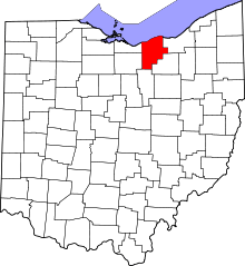 | |
| Villages | ||
| Townships | ||
| CDPs |
| |
| Unincorporated communities | ||
| Ghost town | ||
| Footnotes | ‡This populated place also has portions in an adjacent county or counties | |