Harrison County, Ohio
| Harrison County, Ohio | ||
|---|---|---|
|
| ||
| ||
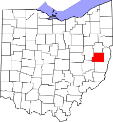 Location in the U.S. state of Ohio | ||
 Ohio's location in the U.S. | ||
| Founded | February 1, 1813[1][2] | |
| Named for | William Henry Harrison | |
| Seat | Cadiz | |
| Largest village | Cadiz | |
| Area | ||
| • Total | 411 sq mi (1,064 km2) | |
| • Land | 402 sq mi (1,041 km2) | |
| • Water | 8.4 sq mi (22 km2), 2.1% | |
| Population | ||
| • (2010) | 15,864 | |
| • Density | 39/sq mi (15/km²) | |
| Congressional district | 6th | |
| Time zone | Eastern: UTC-5/-4 | |
| Website |
www | |


Harrison County is a county located in the U.S. state of Ohio. As of the 2010 census, the population was 15,864,[3] making it the fifth-least populous county in Ohio. Its county seat is Cadiz.[4] The county is named for General William Henry Harrison, who was later President of the United States.[5]
History
Harrison County was formed from parts of Jefferson and Tuscarawas Counties in 1813. The county was named after General William Henry Harrison, the hero of the battle of Tippecanoe in the War of 1812 <(and later to become the 9th US President).
Geography
According to the U.S. Census Bureau, the county has a total area of 411 square miles (1,060 km2), of which 402 square miles (1,040 km2) is land and 8.4 square miles (22 km2) (2.1%) is water.[6]
On May 16, 2013 the Chicago Tribune Business section reported that the Utica Shale underlying Harrison County shows promise as a tight oil production zone.[7] To produce tight oil in large quantities would require horizontal drilling and fracturing of the shale formation as is being done in North Dakota and Texas.
Adjacent counties
- Carroll County (north)
- Jefferson County (east)
- Belmont County (south)
- Guernsey County (southwest)
- Tuscarawas County (west)
Conotton Creek Trail
The Conotton Creek Trail is a rails-to-trails path that runs along Conotton Creek from Bowerston to Jewett in northern Harrison County, Ohio. The paved multi-use trail is 11.4 miles or 18.3 kilometers long.
Demographics
| Historical population | |||
|---|---|---|---|
| Census | Pop. | %± | |
| 1820 | 14,345 | — | |
| 1830 | 20,916 | 45.8% | |
| 1840 | 20,099 | −3.9% | |
| 1850 | 20,157 | 0.3% | |
| 1860 | 19,110 | −5.2% | |
| 1870 | 18,682 | −2.2% | |
| 1880 | 20,456 | 9.5% | |
| 1890 | 20,830 | 1.8% | |
| 1900 | 20,486 | −1.7% | |
| 1910 | 19,076 | −6.9% | |
| 1920 | 19,625 | 2.9% | |
| 1930 | 18,844 | −4.0% | |
| 1940 | 20,313 | 7.8% | |
| 1950 | 19,054 | −6.2% | |
| 1960 | 17,995 | −5.6% | |
| 1970 | 17,013 | −5.5% | |
| 1980 | 18,152 | 6.7% | |
| 1990 | 16,085 | −11.4% | |
| 2000 | 15,856 | −1.4% | |
| 2010 | 15,864 | 0.1% | |
| Est. 2015 | 15,450 | [8] | −2.6% |
| U.S. Decennial Census[9] 1790-1960[10] 1900-1990[11] 1990-2000[12] 2010-2013[3] | |||
2000 census
As of the census[13] of 2000, there were 15,856 people, 6,398 households, and 4,516 families residing in the county. The population density was 39 people per square mile (15/km²). There were 7,680 housing units at an average density of 19 per square mile (7/km²). The racial makeup of the county was 96.49% White, 2.19% Black or African American, 0.08% Native American, 0.11% Asian, 0.01% Pacific Islander, 0.09% from other races, and 1.03% from two or more races. 0.37% of the population were Hispanic or Latino of any race.
There were 6,398 households out of which 29.1% had children under the age of 18 living with them, 58.5% were married couples living together, 8.8% had a female householder with no husband present, and 29.4% were non-families. 25.6% of all households were made up of individuals and 13% had someone living alone who was 65 years of age or older. The average household size was 2.44 and the average family size was 2.92.
In the county the population was spread out with 23% under the age of 18, 6.9% from 18 to 24, 26.6% from 25 to 44, 25.8% from 45 to 64, and 17.7% who were 65 years of age or older. The median age was 41 years. For every 100 females there were 94.1 males. For every 100 females age 18 and over, there were 89.9 males.
The median income for a household in the county was $30,318, and the median income for a family was $36,646. Males had a median income of $30,485 versus $18,813 for females. The per capita income for the county was $16,479. 13.3% of the population and 11% of families were below the poverty line. 17.5% of those under the age of 18 and 8.4% of those 65 and older were living below the poverty line.
2010 census
As of the 2010 United States Census, there were 15,864 people, 6,526 households, and 4,452 families residing in the county.[14] The population density was 39.4 inhabitants per square mile (15.2/km2). There were 8,170 housing units at an average density of 20.3 per square mile (7.8/km2).[15] The racial makeup of the county was 95.9% white, 2.1% black or African American, 0.1% Asian, 0.1% American Indian, 0.1% from other races, and 1.6% from two or more races. Those of Hispanic or Latino origin made up 0.5% of the population.[14] In terms of ancestry, 20.9% were German, 15.5% were Irish, 9.0% were English, 8.9% were American, and 5.7% were Polish.[16]
Of the 6,526 households, 28.1% had children under the age of 18 living with them, 53.4% were married couples living together, 9.5% had a female householder with no husband present, 31.8% were non-families, and 27.1% of all households were made up of individuals. The average household size was 2.40 and the average family size was 2.88. The median age was 44.4 years.[14]
The median income for a household in the county was $35,363 and the median income for a family was $44,325. Males had a median income of $38,489 versus $24,063 for females. The per capita income for the county was $19,318. About 14.1% of families and 18.4% of the population were below the poverty line, including 26.3% of those under age 18 and 12.6% of those age 65 or over.[17]
Politics
| Year | Republican | Democrat |
|---|---|---|
| 2016 | 71.75% 5,098 | 23.76% 1,688 |
| 2012 | 56.19% 4,019 | 41,24% 2,950 |
| 2008 | 49.53% 3,872 | 47.12% 3,683 |
| 2004 | 52.71% 4,274 | 46.61% 3,780 |
| 2000 | 47.72% 3,417 | 46.80% 3,351 |
Communities

Villages
- Adena
- Bowerston
- Cadiz (county seat)
- Deersville
- Freeport
- Harrisville
- Hopedale
- Jewett
- New Athens
- Scio
Townships
Census-designated place
Unincorporated communities
Notable residents
- John Bingham - Representative to Congress and author of significant portions of the Fourteenth Amendment to the Constitution
- Benjamin Cowen - Assistant Secretary of the Interior, who was principal political facilitator in establishing Yellowstone National Park and the idea that the use of national parks is for all Americans
- George Custer - served in the American Civil War and was killed in the Battle of Little Big Horn
- Thomas Custer - Medal of Honor recipient, and brother to George Custer
- Clark Gable - actor
- Edwin Stanton - Secretary of War in the Abraham Lincoln administration
- Cy Young - Baseball pitcher and member of the Baseball Hall of Fame
- William Henry Holmes - anthropologist, archaeologist, geologist, and museum director
See also
References
- ↑ "Ohio County Profiles: Harrison County" (PDF). Ohio Department of Development. Archived from the original (PDF) on 2007-06-21. Retrieved 2007-04-28.
- ↑ "Harrison County, Ohio". Archived from the original on 2007-06-08. Retrieved 2007-04-14.
- 1 2 "State & County QuickFacts". United States Census Bureau. Retrieved February 8, 2015.
- ↑ "Find a County". National Association of Counties. Archived from the original on 2011-05-31. Retrieved 2011-06-07.
- ↑ "Harrison County data". Ohio State University Extension Data Center. Retrieved 2007-04-28.
- ↑ "2010 Census Gazetteer Files". United States Census Bureau. August 22, 2012. Retrieved February 8, 2015.
- ↑ McAllister, Edward; Zawadzki, Sabina (May 16, 2013). "Ohio's well data shatters shale oil hopes". Chicago Tribune. Reuters. Retrieved May 20, 2013.
- ↑ "County Totals Dataset: Population, Population Change and Estimated Components of Population Change: April 1, 2010 to July 1, 2015". Retrieved July 2, 2016.
- ↑ "U.S. Decennial Census". United States Census Bureau. Archived from the original on May 11, 2015. Retrieved February 8, 2015.
- ↑ "Historical Census Browser". University of Virginia Library. Retrieved February 8, 2015.
- ↑ Forstall, Richard L., ed. (March 27, 1995). "Population of Counties by Decennial Census: 1900 to 1990". United States Census Bureau. Retrieved February 8, 2015.
- ↑ "Census 2000 PHC-T-4. Ranking Tables for Counties: 1990 and 2000" (PDF). United States Census Bureau. April 2, 2001. Retrieved February 8, 2015.
- ↑ "American FactFinder". United States Census Bureau. Archived from the original on 2013-09-11. Retrieved 2008-01-31.
- 1 2 3 "DP-1 Profile of General Population and Housing Characteristics: 2010 Demographic Profile Data". United States Census Bureau. Retrieved 2015-12-27.
- ↑ "Population, Housing Units, Area, and Density: 2010 - County". United States Census Bureau. Retrieved 2015-12-27.
- ↑ "DP02 SELECTED SOCIAL CHARACTERISTICS IN THE UNITED STATES – 2006-2010 American Community Survey 5-Year Estimates". United States Census Bureau. Retrieved 2015-12-27.
- ↑ "DP03 SELECTED ECONOMIC CHARACTERISTICS – 2006-2010 American Community Survey 5-Year Estimates". United States Census Bureau. Retrieved 2015-12-27.
- ↑ "Dave Leip's Atlas of U.S. Presidential Elections". Retrieved 2016-03-27.
External links
 |
Carroll County | | ||
| Tuscarawas County | |
Jefferson County | ||
| ||||
| | ||||
| Guernsey County | Belmont County |
Municipalities and communities of Harrison County, Ohio, United States | ||
|---|---|---|
| Villages | | |
| Townships | ||
| CDP | ||
| Unincorporated communities | ||
| Ghost towns | ||
| Footnotes | ‡This populated place also has portions in an adjacent county or counties | |
Coordinates: 40°17′N 81°05′W / 40.29°N 81.09°W