Scioto County, Ohio
| Scioto County, Ohio | |||
|---|---|---|---|
 Scioto County Courthouse | |||
| |||
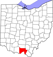 Location in the U.S. state of Ohio | |||
 Ohio's location in the U.S. | |||
| Founded | March 24, 1803[1] | ||
| Named for | a Wyandot [2] word for deer or deer-hunting | ||
| Seat | Portsmouth | ||
| Largest city | Portsmouth | ||
| Area | |||
| • Total | 616 sq mi (1,595 km2) | ||
| • Land | 610 sq mi (1,580 km2) | ||
| • Water | 5.9 sq mi (15 km2), 1.0% | ||
| Population | |||
| • (2010) | 79,499 | ||
| • Density | 130/sq mi (50/km²) | ||
| Congressional districts | 2nd, 6th | ||
| Time zone | Eastern: UTC-5/-4 | ||
| Website |
www | ||


Scioto County is a county located in the south central region of the U.S. state of Ohio. As of the 2010 census, the population was 79,499.[3] Its county seat is Portsmouth.[4] The county was founded March 24, 1803 from Adams County and is named for an Indian word referring to deer or deer-hunting.[5]
Scioto County comprises the Portsmouth, OH Micropolitan Statistical Area, which is also included in the Charleston-Huntington-Ashland, WV-OH-KY Combined Statistical Area. It is located at the confluence of the Scioto and Ohio rivers.
It is the childhood home of former Ohio governor Ted Strickland.[6]
Geography
According to the U.S. Census Bureau, the county has a total area of 616 square miles (1,600 km2), of which 610 square miles (1,600 km2) is land and 5.9 square miles (15 km2) (1.0%) is water.[7] Many parts of Scioto County are heavily forested, especially in the western half of the county with Shawnee State Park.
Adjacent counties
- Pike County (north)
- Jackson County (northeast)
- Lawrence County (southeast)
- Greenup County, Kentucky (south)
- Lewis County, Kentucky (southwest)
- Adams County (west)
National protected area
- Wayne National Forest (part)
Other parks
Shawnee State Forest and Park, the state's largest with over 88,000 acres (360 km2), covers most of western Scioto County, and Brush Creek State Park touches part of northwestern Scioto County. The county also has numerous parks and recreational areas in each of its townships, including Earl Thomas Conley Park on U.S. 52 west of Portsmouth. Public lands in the county also include the Wayne National Forest on the Ironton Ranger District. The 241,000-acre (980 km2) forest encompasses almost 12,000 acres (49 km2) in three townships in Scioto County (Vernon 6,793.50 acres (27.4923 km2), Green township 81,695 acres (330.61 km2), and Bloom 4,008.29 acres).
Within the city limits of Portsmouth, there are fourteen parks for the residents and for community use. These parks include Alexandria Park (Ohio and Scioto River confluence), Allard Park (Bonser Avenue in Sciotoville), Bannon Park (near Farley Square), Branch Rickey Park (on Williams Street near levee), Buckeye Park (near Branch Rickey Park), Cyndee Secrest Park (Sciotoville), Dr. Hartlage Park (Rose Street in Sciotoville), Labold Park (near Spartan Stadium), Larry Hisle Park (23rd Street and Thomas Avenue), Mound Park (17th and Hutchins Streets), York Park (riverfront), Spartan Stadium, Tracy Park (Chillicothe and Gay Streets), and Weghorst Park (Fourth and Jefferson Streets).[8]
Demographics
| Historical population | |||
|---|---|---|---|
| Census | Pop. | %± | |
| 1810 | 3,399 | — | |
| 1820 | 5,750 | 69.2% | |
| 1830 | 8,740 | 52.0% | |
| 1840 | 11,192 | 28.1% | |
| 1850 | 18,428 | 64.7% | |
| 1860 | 24,297 | 31.8% | |
| 1870 | 29,302 | 20.6% | |
| 1880 | 33,511 | 14.4% | |
| 1890 | 35,377 | 5.6% | |
| 1900 | 40,981 | 15.8% | |
| 1910 | 48,463 | 18.3% | |
| 1920 | 62,850 | 29.7% | |
| 1930 | 81,221 | 29.2% | |
| 1940 | 86,565 | 6.6% | |
| 1950 | 82,910 | −4.2% | |
| 1960 | 84,216 | 1.6% | |
| 1970 | 76,951 | −8.6% | |
| 1980 | 84,545 | 9.9% | |
| 1990 | 80,327 | −5.0% | |
| 2000 | 79,195 | −1.4% | |
| 2010 | 79,499 | 0.4% | |
| Est. 2015 | 76,825 | [9] | −3.4% |
| U.S. Decennial Census[10] 1790-1960[11] 1900-1990[12] 1990-2000[13] 2010-2013[3] | |||
2000 census
As of the census[14] of 2000, there were 79,195 people, 30,871 households, and 21,362 families residing in the county. The population density was 129 people per square mile (50/km²). There were 34,054 housing units at an average density of 56 per square mile (21/km²). The racial makeup of the county was 94.88% White, 2.73% Black or African American, 0.63% Native American, 0.24% Asian, 0.02% Pacific Islander, 0.18% from other races, and 1.31% from two or more races. 0.60% of the population were Hispanic or Latino of any race.
There were 30,871 households out of which 31.80% had children under the age of 18 living with them, 52.30% were married couples living together, 13.10% had a female householder with no husband present, and 30.80% were non-families. 26.90% of all households were made up of individuals and 12.50% had someone living alone who was 65 years of age or older. The average household size was 2.45 and the average family size was 2.96.
In the county, the population was spread out with 24.40% under the age of 18, 9.60% from 18 to 24, 28.30% from 25 to 44, 22.70% from 45 to 64, and 14.90% who were 65 years of age or older. The median age was 37 years. For every 100 females there were 95.30 males. For every 100 females age 18 and over, there were 91.20 males.
The median income for a household in the county was $28,008, and the median income for a family was $34,691. Males had a median income of $32,063 versus $21,562 for females. The per capita income for the county was $15,408. About 15.20% of families and 19.30% of the population were below the poverty line, including 25.40% of those under age 18 and 12.80% of those age 65 or over.
2010 census
As of the 2010 United States Census, there were 79,499 people, 30,870 households, and 20,911 families residing in the county.[15] The population density was 130.3 inhabitants per square mile (50.3/km2). There were 34,142 housing units at an average density of 56.0 per square mile (21.6/km2).[16] The racial makeup of the county was 94.4% white, 2.7% black or African American, 0.5% American Indian, 0.3% Asian, 0.3% from other races, and 1.7% from two or more races. Those of Hispanic or Latino origin made up 1.1% of the population.[15] In terms of ancestry, 22.9% were German, 15.0% were Irish, 12.1% were American, and 10.1% were English.[17]
Of the 30,870 households, 32.2% had children under the age of 18 living with them, 48.8% were married couples living together, 13.7% had a female householder with no husband present, 32.3% were non-families, and 27.4% of all households were made up of individuals. The average household size was 2.46 and the average family size was 2.96. The median age was 38.8 years.[15]
The median income for a household in the county was $32,812 and the median income for a family was $44,122. Males had a median income of $40,876 versus $29,675 for females. The per capita income for the county was $17,778. About 16.4% of families and 20.8% of the population were below the poverty line, including 28.4% of those under age 18 and 11.8% of those age 65 or over.[18]
Politics
| Year | Republican | Democrat |
|---|---|---|
| 2016 | 66.28% 20,550 | 29.46% 9,132 |
| 2012 | 49.56% 15,492 | 48.23% 15,077 |
| 2008 | 51.93% 16,994 | 45.61% 14,926 |
| 2004 | 51.87% 18,259 | 47.80% 16,827 |
| 2000 | 50.17% 15,022 | 46.74% 13,997 |
Government
Portsmouth is the county seat for Scioto County with the county courthouse located at the corner of Sixth and Court streets. It was constructed in 1936.
The county jail, once located in the courthouse, is now located in a new facility in the same location where the Norfolk and Western rail depot used to stand near U.S. 23. It was constructed in 2006.
Scioto County is the home of the Southern Ohio Correctional Facility, which is located in Lucasville. The facility is Ohio's only maximum security prison and the location of Ohio's death house where death row inmates are executed.
The county maintenance garage is located in Lucasville.
County officials
- Scioto County Commissioners: Mike Crabtree (R), Cathy Coleman (R), and Bryan Davis (R).
- Scioto County Engineer: Craig Opperman (D)
- Auditor: David L. Green (D)
- Treasurer: William K. Ogg (D)
- Recorder: Gail Alley (D)
- Clerk of Courts: Lisa D. Novinger (R)
- Sheriff: Marty Donini (R)
- Prosecutor: Mark Kuhn (R)
Source[20]
Economy
Scioto County's economy has come and gone with the success and failures of Portsmouth's economy. Until the 1970s, heavy industry such as steel mills and shoe factories drove the county's economy. Since the closure of these factories, Scioto County has suffered a loss of jobs and revenue. Today, the service industry such as the Southern Ohio Medical Center is the largest employer in the county. Scioto County is also home to the newest state university in Ohio, Shawnee State University. Shawnee State enrolls between 3,300 and 4,000 students and grants associate, baccalaureate and master's degrees. Much of the recent economic growth and change is based on service to SOMC and Shawnee State University. Recently Infra-Metals announced the fabrication of a new steel shipping/fabrication site in New Boston, Ohio in the Bob Walton Industrial Park. This plant is under construction and will have access to both barge and rail loading facilities.
In November 2002, the Portsmouth Uranium Enrichment Plant in nearby Piketon was recognized as an ANS Nuclear Historic Landmark by the American Nuclear Society. It had served a military function from 1952 until the mid-1960s when the mission changed from enriching uranium for nuclear weapons to one focused on producing fuel for commercial nuclear power plants. The Portsmouth Uranium Enrichment Plant ended enriching operations in 2001 and began to support operational and administrative functions and perform external contract work. All uranium enrichment in the area has been taken over by a sister plant located in Paducah, Kentucky. Uranium enrichment functions had previously been shared by the two plants. USEC interests in the area remain strong with the American Centrifuge Plant under construction in Piketon. This commercial uranium enrichment facility is expected to employ up to 500 people and reach an initial annual production level of 3.5 million SWU by 2010.
Scioto County has also been the benefactor of Suncoke (coke (fuel) production) and Duke Energy (electricity) facilities near Franklin Furnace. Sole Choice, Inc., the largest manufacturer of shoelaces in the world, is located in the county. Graf Brothers Flooring and Lumber, the world's largest manufacturer of rift and quartered oak products, has two satellite log yards in the county, with the company's main office being located across the river in South Shore, Kentucky.
Education
Colleges and universities
Scioto County used to be home to Ohio University Southern Campus; however, it moved to Lawrence County (Ironton) in the early 1980s. The former Ohio University buildings became home to Shawnee State University, which was founded in 1986 as Ohio's thirteenth and newest institution, after first becoming Shawnee State Community College.
K-12 schools
Scioto County has ten public school districts, one private school system, and one charter school system as well as several Christian schools. These districts include Bloom-Vernon (South Webster), Clay, Green, Minford, New Boston, Northwest, Notre Dame (Catholic), Portsmouth, Sciotoville Community School/East HS (charter), Valley, Washington-Nile (Ports. West) and Wheelersburg. These school systems are noted not only for their educational endeavors but also their athletic and community endeavors.
See also Ohio High School Athletic Association, Ohio High School Athletic Conferences, Southeastern Ohio Athletic League, and Southern Ohio Conference
Libraries
The Portsmouth Public Library, a Carnegie library, and its five branches have served the county since 1879. The library has branches in Lucasville, New Boston, McDermott, South Webster and Wheelersburg.
Transportation
Highways
Scioto County is served by two major highways, the north-south U.S. 23 and the east-west U.S. 52. Other routes include SR 73, SR 104, SR 125, SR 139, SR 140, SR 335, SR 348, SR 522, SR 728(Lucasville-Minford Road), and SR 776. State Routes 239, 253, 371, 772, and 852 go through Scioto County
Rail
Norfolk Southern offers a railyard for long distance shipping and is currently reopening the repair shops. Amtrak offers a passenger service to the Portsmouth/Scioto County area under the Cardinal route. The passenger station is located in South Shore, Kentucky, across the Ohio River.
Air
Scioto County offers air services with the Greater Portsmouth Regional Airport located in Minford, Ohio, which is approximately 14 miles (23 km) northeast of Portsmouth on SR 335. The nearest airport with scheduled passenger service is West Virginia's Huntington/Tri-State Airport (HTS) located approximately 60 miles (97 km) east of Portsmouth on I-64.
Public transportation
Public transportation for Scioto County is offered through Access Scioto County (ASC).
Media
Scioto County is a dividing line of numerous television markets, which includes the Columbus, Cincinnati and Huntington-Charleston markets. Local television stations include: WSAZ-NBC,(channel 3.1) WZAS-myNetwork (myZtv channel 3.2), WOWK-CBS (channel 13.1), WCHS-ABC (channel 8.1)and WQCW, a CW affiliate with an office in Portsmouth and Charleston, and more recently WTZP "The Zone" which is an America One Affiliate that offers a larger amount of local programming such as news, high school spots, community events and locally produced shows about the area. Local radio stations WIOI, WNKE, WNXT, and WZZZ serve the radio listeners in the county and surrounding areas.
The county is also served by three newspapers. The Portsmouth Daily Times is the county's only daily newspaper. The Community Common is a free bi-weekly newspaper and the Scioto Voice is a weekly newspaper, which is mailed to subscribers. The University Chronicle is the student-led newspaper at Shawnee State University.
Of the media mentioned only three are actually locally owned and operated. They are WTZP in television, WIOI in radio and The Scioto Voice in newspaper.
Sports
Professional
Scioto County had a series of semi-pro football teams in the 1920s and 1930s, the most notable being the Portsmouth Shoe-Steels, whose roster included player-coach Jim Thorpe. From 1929 to 1933, Portsmouth was home to a professional football team, The Portsmouth Spartans. This team later became the NFL franchise Detroit Lions in 1934. The Portsmouth Spartans also competed in the first professional football night game versus the Green Bay Packers in 1930.[21][22]
On the baseball front, the Portsmouth Explorers were one of the original teams in the Frontier League, a non-affiliated minor league baseball organization. The Explorers played in the league's first three seasons, from 1993 to 1995. In 1938, Portsmouth was also the home of the Portsmouth Red Birds, a minor league team owned by the St. Louis Cardinals.
Collegiate
Shawnee State University (SSU) is a member of the National Association of Intercollegiate Athletics (NAIA-Division II). SSU has participated in 24 National Championships in 6 of 11 sponsored sports. The university's women's basketball team has won an NAIA National Title in 1999 and finished in the final four in 1995.[23] The softball team has had national exposure as well, reaching the "Sweet 16" on several occasions. The team finished 10th in 1992, 8th in 1995, 9th in 1996, and 9th in 2001.[24]
Amateur
The twelve local high schools, the other educational institutions, the adult leagues, and the development leagues (e.g. AAU and club organizations) generate a great deal of participation as either participants or as followers of sports' teams. The teams have made 55 trips to the Ohio High School Athletic Association championships, winning 15 state titles. These have included three softball titles by Clay HS (1980, 1981, & 1983); three baseball titles (East HS in 1973, Valley HS in 1975, and Wheelersburg HS in 1996); three football titles (two by Notre Dame HS in 1967 and 1970 and Wheelersburg HS in 1989); and six boys' basketball titles (1931, 1961, 1978, and 1988 by Portsmouth HS and 2006 by South Webster HS).[25][26]
Culture
The Vern Riffe Arts Center, on the campus of Shawnee State University, hosts many local and traveling performances, including Broadway plays and Miss Ohio pageants. Scioto County is home to the Boneyfiddle Historical District (which is on the National Register of Historic Places), SSU's Clark Planetarium, the 1810 House, Greenup Locks & Dam, the Philip Moore Stone House, Roy Rogers' Memorabilia Exhibit, the Southern Ohio Museum and Spartan Municipal Stadium.
Events
Scioto County is best known for Portsmouth's "River Days" activities that include a parade, a pageant associated with the local high schools, boat races on the Ohio River (in the past), musical performances and a carnival. River Days occurs on Labor Day (the first Monday of September) weekend with the activities beginning on Thursday evening and the parade and pageant on Saturday.
The Scioto County Fair is held on the first full week of August of each year. It is one of the largest in the state, drawing approximately 75,000 visitors each year (with the single-day record being 17,000).[27] The first county fair was held in 1828;[28] in 1908 Lucasville became the official site when three fairs (Mount Joy, Portsmouth and Lucasville) merged into one.[29] The Roy Rogers' Homecoming Festival is held each June, and the county has numerous fireworks displays on the
Communities
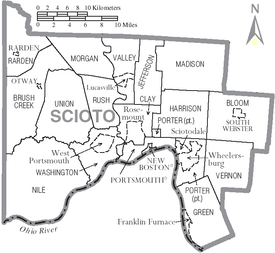
City
- Portsmouth (county seat)
Villages
- New Boston, Ohio
- Otway, Ohio
- Rarden, Ohio
- South Webster, Ohio
- McDermott, Ohio
- Lucasville, Ohio
- Wheelersburg, Ohio
Townships
Census-designated places
Unincorporated communities
- Alexandria
- Bear Creek
- Bloom Junction
- Buena Vista
- Dry Run
- Eifort‡
- Hales Creek
- Harrison Mills
- Haverhill
- Henley
- Junior Furnace
- Lombardsville
- Lyra
- McGaw
- Mount Joy
- Mule Town
- Pinkerman
- Pond Run
- Powellsville
- Rushtown
- Scioto Furnace
- Sedan
- Slocum
- Wallace Mills
Notable Residents
- Dale Bandy, former Ohio University basketball coach
- Kathleen Battle, opera singer
- Al Bridwell, former Major League Baseball player
- Earl Thomas Conley, country music singer and writer
- Martin Dillon, musician
- Chuck Ealey, football player
- Bill Harsha, congressman
- Larry Hisle, former Major League Baseball player, currently in Milwaukee Brewers organization
- Rocky Nelson, former Major League Baseball player
- Josh Newman, former Major league pitcher for the Colorado Rockies and Kansas City Royals
- Al Oliver, former Major League Baseball player
- Branch Rickey, baseball executive
- Vern Riffe, Ohio politician (1959–95), Speaker of the Ohio House of Representatives (1975–94)
- Brett Roberts, former NBA player
- Barbara Robinson, author
- Roy Rogers, singer and cowboy movie star
- Ted Strickland, former Governor of Ohio
- Gene Tenace, former Major League Baseball player
See also
References
- ↑ "Ohio County Profiles: Scioto County" (PDF). Ohio Department of Development. Retrieved 2007-04-28.
- ↑ http://www.thisweeknews.com/content/stories/Lentz-As-it-were/local-river-names-have-convoluted-origin.html
- 1 2 "State & County QuickFacts". United States Census Bureau. Retrieved February 11, 2015.
- ↑ "Find a County". National Association of Counties. Archived from the original on 2011-05-31. Retrieved 2011-06-07.
- ↑ "Scioto County data". Ohio State University Extension Data Center. Retrieved 2007-04-28.
- ↑ Allen, Wayne. "Strickland to Visit Area". The Community Common. Retrieved 2007-05-16.
- ↑ "2010 Census Gazetteer Files". United States Census Bureau. August 22, 2012. Retrieved February 11, 2015.
- ↑ "Portsmouth Area Resource Guide 2007-2008". The Community Common. 2007-07-29. p. 4.
- ↑ "County Totals Dataset: Population, Population Change and Estimated Components of Population Change: April 1, 2010 to July 1, 2015". Retrieved July 2, 2016.
- ↑ "U.S. Decennial Census". United States Census Bureau. Archived from the original on May 11, 2015. Retrieved February 11, 2015.
- ↑ "Historical Census Browser". University of Virginia Library. Retrieved February 11, 2015.
- ↑ Forstall, Richard L., ed. (March 27, 1995). "Population of Counties by Decennial Census: 1900 to 1990". United States Census Bureau. Retrieved February 11, 2015.
- ↑ "Census 2000 PHC-T-4. Ranking Tables for Counties: 1990 and 2000" (PDF). United States Census Bureau. April 2, 2001. Retrieved February 11, 2015.
- ↑ "American FactFinder". United States Census Bureau. Archived from the original on 2013-09-11. Retrieved 2008-01-31.
- 1 2 3 "DP-1 Profile of General Population and Housing Characteristics: 2010 Demographic Profile Data". United States Census Bureau. Retrieved 2015-12-27.
- ↑ "Population, Housing Units, Area, and Density: 2010 - County". United States Census Bureau. Retrieved 2015-12-27.
- ↑ "DP02 SELECTED SOCIAL CHARACTERISTICS IN THE UNITED STATES – 2006-2010 American Community Survey 5-Year Estimates". United States Census Bureau. Retrieved 2015-12-27.
- ↑ "DP03 SELECTED ECONOMIC CHARACTERISTICS – 2006-2010 American Community Survey 5-Year Estimates". United States Census Bureau. Retrieved 2015-12-27.
- ↑ "Dave Leip's Atlas of U.S. Presidential Elections". Retrieved 2016-04-02.
- ↑ "Portsmouth Area Resource Guide 2007-2008". The Community Common. 2007-07-29. p. 3.
- ↑ Ohio Historical Society. "National Football League". Retrieved 2007-05-16.
- ↑ Chris Murphy. "Portsmouth Spartans Historical Society". Retrieved 2007-05-16.
- ↑ SSU Athletic Department. "SSU Women's Basketball - Quick Facts". Retrieved 2007-08-02.
- ↑ SSU Athletic Department. "SSU Softball - Quick Facts". Retrieved 2007-08-02.
- ↑ Southern Ohio Conference
- ↑ Portsmouth High School
- ↑ "Gahm: Heat Doesn't Deter Fairgoers". Portsmouth Daily Times. 2007-08-11. p. A1.
- ↑ "County fairs of yesteryear". Scioto Voice. 2007-08-02. p. A8.
- ↑ Scioto County Fair Board (2007-08-05). "Fair Preview: Scioto County Fair has long history". Portsmouth Daily Times. p. 12.
Coordinates: 38°49′N 82°59′W / 38.81°N 82.99°W
External links
- Scioto County official website
- Clay Local School District
- Ohio History Central (Ohio Historical Society)
- Southern Ohio Museum
 |
Pike County | Jackson County | | |
| Adams County | |
Lawrence County | ||
| ||||
| | ||||
| Lewis County, Kentucky | Greenup County, Kentucky |
Municipalities and communities of Scioto County, Ohio, United States | ||
|---|---|---|
| City | | |
| Villages | ||
| Townships | ||
| CDPs | ||
| Unincorporated communities | ||
| Footnotes | ‡This populated place also has portions in an adjacent county or counties | |
Education in Scioto County, Ohio | ||
|---|---|---|
| Colleges and Universities |
| |
| High schools | ||
| Middle schools |
| |
| Elementary schools |
| |
| Others |
| |