List of Lake Erie Islands

Lake Erie Islands

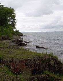
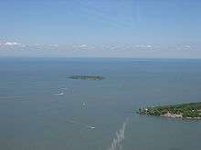
The Lake Erie Islands are a chain of archipelagic islands in Lake Erie. They include Kelleys Island, Pelee Island, the Bass Islands, and several others. The majority of these islands are under the sovereignty of Ohio in the United States. Pelee Island is the only major island administered by Ontario, while the smaller Middle Island is the southernmost point in Canada. Most islands that are large enough are popular tourist attractions with car ferries running from the mainland and between some islands and some small airports and numerous private marinas offering other ways to reach the islands. Combined with nearby Sandusky and Port Clinton, Ohio, the islands are part of the collective area known regionally as "Vacationland".[1]

Economy

Most of the islands remain financially stable via tourism. Grape growing and wineries were once the mainstay of the economy. Kelleys is heavily forested and has replaced them almost entirely, South Bass is more developed and still has a few large vineyards. Pelee is the only major island where vineyards remain popular. Limestone quarrying still occurs on Kellys Island; as well, there are a few hobby farms.

Residents

Most of the islands are headed by a small group of year-round residents. However, eager vacationers often raise the populations dramatically during the summer months, most notable on South Bass Island, which is the most tourist-friendly of the islands despite its small size.

Lake Erie islands

Map of the Lake Erie Islands.
Alvar habitat on Kelleys Island. Perry's Victory and International Peace Memorial is barely visible in the distance on neighboring South Bass Island
Green Island from the air, with South Bass Island in the foreground
Name State/Province Area
sq. mi.[2](km²)[3]
Location Inhabited?[4]
Pelee Island Ontario 16.140 sq. mi. (41.79 km²) 41°46′00″N 82°38′27″W / 41.7667°N 82.6409°W / 41.7667; -82.6409 (Pelee Island) Yes
Kelleys Island Ohio 4.41 sq. mi. (11.42 km²) 41°36′05″N 82°41′51″W / 41.601389°N 82.6975°W / 41.601389; -82.6975 (Kelleys Island) Yes
South Bass Island Ohio 2.482 sq. mi. (6.428 km²) 41°38′59″N 82°49′08″W / 41.6497°N 82.8189°W / 41.6497; -82.8189 (South Bass Island) Yes
Middle Bass Island Ohio 1.258 sq. mi. (3.258 km²) 41°40′45″N 82°48′40″W / 41.679167°N 82.811111°W / 41.679167; -82.811111 (Middle Bass Island) Yes
North Bass Island Ohio 1.076 sq. mi. (2.786 km²) 41°43′00″N 82°49′00″W / 41.716667°N 82.816667°W / 41.716667; -82.816667 (North Bass Island) Yes
Johnson's Island Ohio 0.469 sq. mi. (1.215 km²) 41°29′47″N 82°44′05″W / 41.4963°N 82.7346°W / 41.4963; -82.7346 (Johnson's Island) Yes
Rattlesnake Island Ohio 0.133 sq. mi. (0.344 km²) 41°40′45″N 82°50′57″W / 41.6791°N 82.8493°W / 41.6791; -82.8493 (Rattlesnake Island) Yes
West Sister Island Ohio 0.120 sq. mi. (0.311 km²) 41°44′23″N 83°06′19″W / 41.739722°N 83.105278°W / 41.739722; -83.105278 (West Sister Island) No Longer
Middle Island Ontario 0.072 sq. mi. (0.186 km²) 41°40′57″N 82°41′04″W / 41.6825°N 82.684444°W / 41.6825; -82.684444 (Middle Island) No Longer
East Sister Island Ontario 0.058 sq. mi. (0.150 km²) 41°48′47″N 82°51′23″W / 41.813056°N 82.856389°W / 41.813056; -82.856389 (East Sister Island) No
Sugar Island Ohio 0.047 sq. mi. (0.123 km²) 41°41′31″N 82°49′34″W / 41.692°N 82.826°W / 41.692; -82.826 (Sugar Island) Yes
Green Island Ohio 0.027 sq. mi. (0.069 km²) 41°38′44″N 82°51′54″W / 41.6456°N 82.8651°W / 41.6456; -82.8651 (Green Island) No Longer
Ballast Island Ohio 0.019 sq. mi. (0.049 km²) 41°40′40″N 82°47′07″W / 41.6778°N 82.7853°W / 41.6778; -82.7853 (Ballast Island) Yes
Mouse Island Ohio 41°35′28″N 82°49′59″W / 41.59111°N 82.83306°W / 41.59111; -82.83306 (Mouse Island) No Longer
Gibraltar Island Ohio 0.010 sq. mi. (0.026 km²) 41°39′30″N 82°49′14″W / 41.6582°N 82.8206°W / 41.6582; -82.8206 (Gibraltar Island) Yes
Indian Island Michigan 41°45′08″N 83°23′27″W / 41.752202°N 83.390962°W / 41.752202; -83.390962 (Indian Island) No
Hen Island and her "Chickens":
Big Chicken, Chick, and Little Chicken islands
Ontario 41°47′18″N 82°47′51″W / 41.788333°N 82.7975°W / 41.788333; -82.7975 (Hen Island) Hen Yes, the "chickens" No
Middle Sister Island Ontario 0.015 sq. mi. (0.039 km²) 41°50′55″N 83°00′03″W / 41.8487°N 83.0007°W / 41.8487; -83.0007 (Middle Sister Island) No Longer
North Harbour Island Ontario 41°49′30″N 82°51′36″W / 41.825°N 82.86°W / 41.825; -82.86 (North Harbour Island) Yes
Turtle Island Ohio/Michigan 0.002 sq. mi. (0.005 km²) 41°45′09″N 83°23′28″W / 41.7525°N 83.391111°W / 41.7525; -83.391111 (Turtle Island) No Longer
Ryerson's Island Ontario 42°36′08″N 80°16′54″W / 42.602358°N 80.281611°W / 42.602358; -80.281611 (Ryerson's Island) Yes
Second Island Ontario 42°35′24″N 80°16′15″W / 42.589883°N 80.270843°W / 42.589883; -80.270843 (Second Island) No
Starve Island Ohio 0.003 sq. mi. (0.008 km²) 41°37′36″N 82°49′21″W / 41.626667°N 82.8225°W / 41.626667; -82.8225 (Starve Island) No
Buckeye Island Ohio 41°39′53″N 82°47′25″W / 41.6648°N 82.7904°W / 41.6648; -82.7904 (Buckeye Island) No
Lost Ballast Island Ohio 41°40′32″N 82°47′11″W / 41.675475°N 82.786383°W / 41.675475; -82.786383 (Lost Ballast Island) No
Snow Island Ontario 42°34′47″N 80°15′33″W / 42.579731°N 80.259129°W / 42.579731; -80.259129 (Snow Island) No
Mohawk Island (formerly Gull Island) Ontario 0.015 sq. mi. (0.039 km²) 42°50′02″N 79°31′21″W / 42.833889°N 79.5225°W / 42.833889; -79.5225 (Mohawk Island) No Longer
Gull Island, Ohio Ohio 41°39′35″N 82°41′14″W / 41.659761°N 82.687328°W / 41.659761; -82.687328 (Gull Island) No[5]
Catawba Island
(former island)[6]
Ohio 5.700 sq. mi. (14.8 km²) 41°33′49″N 82°50′20″W / 41.563611°N 82.838889°W / 41.563611; -82.838889 (Catawba Island) Yes
Gard Island Michigan 41°45′00″N 83°26′32″W / 41.750064°N 83.44212°W / 41.750064; -83.44212 (Gard Island) No Longer
Presque Island
(former island)
Pennsylvania 4.863 sq. mi. (12.594 km²) 42°09′47″N 80°06′03″W / 42.163056°N 80.100833°W / 42.163056; -80.100833 (Presque Island) Yes
Kafralu Island Ohio 41°27′53″N 82°40′25″W / 41.464719°N 82.673476°W / 41.464719; -82.673476 (Kafralu Island) No Longer
Bird Island New York 42°53′43″N 78°54′24″W / 42.895333°N 78.906722°W / 42.895333; -78.906722 (Squaw Island) No

See also

References

Wikivoyage has a travel guide for Lake Erie Islands.
This article is issued from Wikipedia - version of the 2/27/2016. The text is available under the Creative Commons Attribution/Share Alike but additional terms may apply for the media files.