Trumbull County, Ohio
| Trumbull County, Ohio | ||
|---|---|---|
| ||
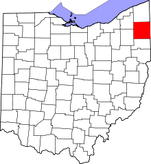 Location in the U.S. state of Ohio | ||
 Ohio's location in the U.S. | ||
| Founded | July 10, 1800[1] | |
| Named for | Jonathan Trumbull | |
| Seat | Warren | |
| Largest city | Warren | |
| Area | ||
| • Total | 637 sq mi (1,650 km2) | |
| • Land | 618 sq mi (1,601 km2) | |
| • Water | 18 sq mi (47 km2), 2.9% | |
| Population (est.) | ||
| • (2013) | 206,442 | |
| • Density | 340/sq mi (131/km²) | |
| Congressional districts | 13th, 14th | |
| Time zone | Eastern: UTC-5/-4 | |
| Website |
www | |

Trumbull County is a county located in the U.S. state of Ohio. As of the 2010 census, the population was 210,312.[2] Its county seat is Warren.[3]
Trumbull County is part of the Youngstown–Warren–Boardman, OH–PA Metropolitan Statistical Area.
History
After the discovery of the New World, the land that became Trumbull County was originally part of the French colony of Canada (New France), which was ceded in 1763 to Great Britain and renamed Province of Quebec. In the late 18th century the land became part of the Connecticut Western Reserve in the Northwest Territory, then was purchased by the Connecticut Land Company in 1795. Originally, Trumbull County consisted of the entire area of the Connecticut Western Reserve before being divided into smaller counties.
The county is named for Jonathan Trumbull, Governor of Connecticut, who once owned the land in this region.[4]
Geography

According to the U.S. Census Bureau, the county has a total area of 637 square miles (1,650 km2), of which 618 square miles (1,600 km2) is land and 18 square miles (47 km2) (2.9%) is water.[5] It is approximately a square with sides of 25 miles; it is the only square county in Ohio.[6]
Adjacent counties
- Ashtabula County (north)
- Crawford County, Pennsylvania (northeast)
- Mercer County, Pennsylvania (east)
- Mahoning County (south)
- Portage County (southwest)
- Geauga County (northwest)
Demographics
| Historical population | |||
|---|---|---|---|
| Census | Pop. | %± | |
| 1800 | 1,302 | — | |
| 1810 | 8,671 | 566.0% | |
| 1820 | 15,546 | 79.3% | |
| 1830 | 26,153 | 68.2% | |
| 1840 | 38,107 | 45.7% | |
| 1850 | 30,490 | −20.0% | |
| 1860 | 30,656 | 0.5% | |
| 1870 | 38,659 | 26.1% | |
| 1880 | 44,880 | 16.1% | |
| 1890 | 42,373 | −5.6% | |
| 1900 | 46,591 | 10.0% | |
| 1910 | 52,766 | 13.3% | |
| 1920 | 83,920 | 59.0% | |
| 1930 | 123,063 | 46.6% | |
| 1940 | 132,315 | 7.5% | |
| 1950 | 158,915 | 20.1% | |
| 1960 | 208,526 | 31.2% | |
| 1970 | 232,579 | 11.5% | |
| 1980 | 241,863 | 4.0% | |
| 1990 | 227,813 | −5.8% | |
| 2000 | 225,116 | −1.2% | |
| 2010 | 210,312 | −6.6% | |
| Est. 2015 | 203,751 | [7] | −3.1% |
| U.S. Decennial Census[8] 1790-1960[9] 1900-1990[10] 1990-2000[11] 2010-2013[2] | |||
2000 census
As of the census[12] of 2000, there were 225,116 people, 89,020 households, and 61,690 families residing in the county. The population density was 365 people per square mile (141/km²). There were 95,117 housing units at an average density of 154 per square mile (60/km²). The racial makeup of the county was 90.21% White, 7.90% Black or African American, 0.15% Native American, 0.45% Asian, 0.02% Pacific Islander, 0.21% from other races, and 1.07% from two or more races. 0.80% of the population were Hispanic or Latino of any race. 94.6% spoke English and 1.0% German as their first language.
There were 89,020 households out of which 29.90% had children under the age of 18 living with them, 52.90% were married couples living together, 12.50% had a female householder with no husband present, and 30.70% were non-families. 26.90% of all households were made up of individuals and 11.40% had someone living alone who was 65 years of age or older. The average household size was 2.48 and the average family size was 3.02.
In the county, the population was spread out with 24.40% under the age of 18, 7.70% from 18 to 24, 27.30% from 25 to 44, 24.80% from 45 to 64, and 15.70% who were 65 years of age or older. The median age was 39 years. For every 100 females there were 93.80 males. For every 100 females age 18 and over, there were 90.60 males.
The median income for a household in the county was $38,298, and the median income for a family was $46,203. Males had a median income of $36,823 versus $24,443 for females. The per capita income for the county was $19,188. About 7.90% of families and 10.30% of the population were below the poverty line, including 15.40% of those under age 18 and 7.60% of those age 65 or over.
2010 census
As of the 2010 United States Census, there were 210,312 people, 86,011 households, and 56,874 families residing in the county.[13] The population density was 340.1 inhabitants per square mile (131.3/km2). There were 96,163 housing units at an average density of 155.5 per square mile (60.0/km2).[14] The racial makeup of the county was 89.0% white, 8.3% black or African American, 0.5% Asian, 0.2% American Indian, 0.3% from other races, and 1.8% from two or more races. Those of Hispanic or Latino origin made up 1.3% of the population.[13] In terms of ancestry, 21.6% were German, 16.5% were American, 14.3% were Irish, 13.7% were Italian, and 10.6% were English.[15]
Of the 86,011 households, 28.8% had children under the age of 18 living with them, 47.4% were married couples living together, 13.7% had a female householder with no husband present, 33.9% were non-families, and 29.2% of all households were made up of individuals. The average household size was 2.40 and the average family size was 2.95. The median age was 42.8 years.[13]
The median income for a household in the county was $42,296 and the median income for a family was $52,731. Males had a median income of $43,382 versus $30,859 for females. The per capita income for the county was $21,854. About 11.5% of families and 15.4% of the population were below the poverty line, including 24.9% of those under age 18 and 8.1% of those age 65 or over.[16]
Politics
| Year | Republican | Democrat |
|---|---|---|
| 2016 | 50.71% 49,024 | 44.49% 43,014 |
| 2012 | 37.54% 38,279 | 60.48% 61,672 |
| 2008 | 37.44% 40,164 | 59.80% 64,145 |
| 2004 | 37.89% 40,977 | 61.65% 66,673 |
| 2000 | 36.01% 34,654 | 59.90% 57,643 |
Trumbull County is historically a democratic stronghold, though its residents have tended to be conservative on social issues. In 2016, however, Donald J. Trump won the county by a reasonably comfortable margin of 6.22 points. It remains to be seen whether this is a one-time occurrence, or the beginning of a new trend in Rust Belt politics.
Education
- Kent State University Trumbull is a regional campus of Kent State University, offering several associate degrees and a few bachelor's degrees.
Communities

Cities
- Cortland
- Girard
- Hubbard
- Newton Falls
- Niles
- Warren (county seat)
- Youngstown (part)
Villages
Townships
Defunct township
Census-designated places
Unincorporated communities
The Camp Ravenna Joint Military Training Center, formally known as the Ravenna Training and Logistics Site and commonly known as the Ravenna Arsenal, occupies a small part of Braceville Township.
See also
References
- Specific
- ↑ "Ohio County Profiles: Trumbull County" (PDF). Ohio Department of Development. Retrieved 2007-04-28.
- 1 2 "State & County QuickFacts". United States Census Bureau. Retrieved February 11, 2015.
- ↑ "Find a County". National Association of Counties. Archived from the original on 2011-05-31. Retrieved 2011-06-07.
- ↑ "Trumbull County data". Ohio State University Extension Data Center. Retrieved 2007-04-28.
- ↑ "2010 Census Gazetteer Files". United States Census Bureau. August 22, 2012. Retrieved February 11, 2015.
- ↑ "TRUMBULL COUNTY TOURISM BUREAU".
- ↑ "County Totals Dataset: Population, Population Change and Estimated Components of Population Change: April 1, 2010 to July 1, 2015". Retrieved July 2, 2016.
- ↑ "U.S. Decennial Census". United States Census Bureau. Archived from the original on May 11, 2015. Retrieved February 11, 2015.
- ↑ "Historical Census Browser". University of Virginia Library. Retrieved February 11, 2015.
- ↑ Forstall, Richard L., ed. (March 27, 1995). "Population of Counties by Decennial Census: 1900 to 1990". United States Census Bureau. Retrieved February 11, 2015.
- ↑ "Census 2000 PHC-T-4. Ranking Tables for Counties: 1990 and 2000" (PDF). United States Census Bureau. April 2, 2001. Retrieved February 11, 2015.
- ↑ "American FactFinder". United States Census Bureau. Archived from the original on 2013-09-11. Retrieved 2008-01-31.
- 1 2 3 "DP-1 Profile of General Population and Housing Characteristics: 2010 Demographic Profile Data". United States Census Bureau. Retrieved 2016-01-19.
- ↑ "Population, Housing Units, Area, and Density: 2010 - County". United States Census Bureau. Retrieved 2016-01-19.
- ↑ "DP02 SELECTED SOCIAL CHARACTERISTICS IN THE UNITED STATES – 2006-2010 American Community Survey 5-Year Estimates". United States Census Bureau. Retrieved 2016-01-19.
- ↑ "DP03 SELECTED ECONOMIC CHARACTERISTICS – 2006-2010 American Community Survey 5-Year Estimates". United States Census Bureau. Retrieved 2016-01-19.
- ↑ "Dave Leip's Atlas of U.S. Presidential Elections". Retrieved 2016-03-27.
External links
 |
Geauga County | Ashtabula County | Crawford County, Pennsylvania | |
| |
Mercer County, Pennsylvania | |||
| ||||
| | ||||
| Portage County | Mahoning County |
Municipalities and communities of Trumbull County, Ohio, United States | ||
|---|---|---|
| Cities | | |
| Villages | ||
| Townships | ||
| CDPs |
| |
| Unincorporated communities | ||
| Footnotes | ‡This populated place also has portions in an adjacent county or counties | |
Coordinates: 41°19′N 80°46′W / 41.32°N 80.76°W