Darke County, Ohio
| Darke County, Ohio | |
|---|---|
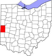 Location in the U.S. state of Ohio | |
 Ohio's location in the U.S. | |
| Founded | March 1, 1817 |
| Named for | William Darke |
| Seat | Greenville |
| Largest city | Greenville |
| Area | |
| • Total | 600 sq mi (1,554 km2) |
| • Land | 598 sq mi (1,549 km2) |
| • Water | 1.7 sq mi (4 km2), 0.3% |
| Population | |
| • (2010) | 52,959 |
| • Density | 89/sq mi (34/km²) |
| Congressional district | 8th |
| Time zone | Eastern: UTC-5/-4 |
| Website |
www |
Darke County is a county located in the U.S. state of Ohio. As of the 2010 census, the population was 52,959.[1] Its county seat is Greenville.[2] The county was created in 1809 and later organized in 1817.[3] It is named for William Darke, an officer in the Revolution.[4]
Darke County comprises the Greenville, OH Micropolitan Statistical Area, which is also included in the Dayton-Springfield-Sidney, OH Combined Statistical Area.
Notable people included Annie Oakley, famed 19th-century markswoman who performed with Buffalo Bill's Wild West show, who was born in Darke County; and Lucullus Virgil McWhorter, a farmer and frontiersman who studied and wrote about the historical American Indian tribes of West Virginia and Ohio. After moving to Yakima, Washington in 1903, he documented and became an advocate for the contemporary Yakama and Nez Perce peoples. In addition, he collected their oral histories. Legendary travel author and broadcaster, Lowell Thomas, was born in Darke County.
Geography
According to the U.S. Census Bureau, the county has a total area of 600 square miles (1,600 km2), of which 598 square miles (1,550 km2) is land and 1.7 square miles (4.4 km2) (0.3%) is water.[5]
Adjacent counties
- Mercer County (north)
- Shelby County (northeast)
- Miami County (east)
- Montgomery County (southeast)
- Preble County (south)
- Wayne County, Indiana (southwest)
- Randolph County, Indiana (west)
- Jay County, Indiana (northwest)
Demographics
| Historical population | |||
|---|---|---|---|
| Census | Pop. | %± | |
| 1820 | 3,622 | — | |
| 1830 | 6,204 | 71.3% | |
| 1840 | 13,282 | 114.1% | |
| 1850 | 20,276 | 52.7% | |
| 1860 | 26,009 | 28.3% | |
| 1870 | 32,278 | 24.1% | |
| 1880 | 40,496 | 25.5% | |
| 1890 | 42,961 | 6.1% | |
| 1900 | 42,532 | −1.0% | |
| 1910 | 42,933 | 0.9% | |
| 1920 | 42,911 | −0.1% | |
| 1930 | 38,009 | −11.4% | |
| 1940 | 38,831 | 2.2% | |
| 1950 | 41,799 | 7.6% | |
| 1960 | 45,612 | 9.1% | |
| 1970 | 49,141 | 7.7% | |
| 1980 | 55,096 | 12.1% | |
| 1990 | 53,619 | −2.7% | |
| 2000 | 53,309 | −0.6% | |
| 2010 | 52,959 | −0.7% | |
| Est. 2015 | 52,076 | [6] | −1.7% |
| U.S. Decennial Census[7] 1790-1960[8] 1900-1990[9] 1990-2000[10] 2010-2013[1] | |||
2000 census
As of the census[11] of 2000, there were 53,309 people, 20,419 households, and 14,905 families residing in the county. The population density was 89 people per square mile (34/km²). There were 21,583 housing units at an average density of 36 per square mile (14/km²). The racial makeup of the county was 98.09% White, 0.39% Black or African American, 0.17% Native American, 0.25% Asian, 0.02% Pacific Islander, 0.34% from other races, and 0.74% from two or more races. 0.86% of the population were Hispanic or Latino of any race. 43.1% were of German, 20.1% American, 8.1% English, 6.8% Irish and 5.8% French ancestry according to Census 2000.
There were 20,419 households out of which 33.30% had children under the age of 18 living with them, 61.00% were married couples living together, 8.00% had a female householder with no husband present, and 27.00% were non-families. 23.50% of all households were made up of individuals and 11.00% had someone living alone who was 65 years of age or older. The average household size was 2.56 and the average family size was 3.03.
In the county the population was spread out with 26.30% under the age of 18, 7.80% from 18 to 24, 27.50% from 25 to 44, 23.20% from 45 to 64, and 15.30% who were 65 years of age or older. The median age was 37 years. For every 100 females there were 96.10 males. For every 100 females age 18 and over, there were 93.30 males.
The median income for a household in the county was $39,307, and the median income for a family was $45,735. Males had a median income of $32,933 versus $23,339 for females. The per capita income for the county was $18,670. About 6.00% of families and 8.00% of the population were below the poverty line, including 10.10% of those under age 18 and 9.20% of those age 65 or over.
2010 census
As of the 2010 United States Census, there were 52,959 people, 20,929 households, and 14,673 families residing in the county.[12] The population density was 88.5 inhabitants per square mile (34.2/km2). There were 22,730 housing units at an average density of 38.0 per square mile (14.7/km2).[13] The racial makeup of the county was 97.8% white, 0.4% black or African American, 0.3% Asian, 0.2% American Indian, 0.4% from other races, and 0.9% from two or more races. Those of Hispanic or Latino origin made up 1.2% of the population.[12] In terms of ancestry, 38.9% were German, 11.5% were American, 10.6% were Irish, and 9.0% were English.[14]
Of the 20,929 households, 31.9% had children under the age of 18 living with them, 56.7% were married couples living together, 9.0% had a female householder with no husband present, 29.9% were non-families, and 25.9% of all households were made up of individuals. The average household size was 2.50 and the average family size was 3.00. The median age was 40.8 years.[12]
The median income for a household in the county was $44,280 and the median income for a family was $53,454. Males had a median income of $40,402 versus $28,310 for females. The per capita income for the county was $21,483. About 7.5% of families and 10.6% of the population were below the poverty line, including 14.5% of those under age 18 and 8.1% of those age 65 or over.[15]
Politics
| Year | Republican | Democrat |
|---|---|---|
| 2016 | 78.17% 20,012 | 17.46% 4,470 |
| 2012 | 71.21% 18,108 | 26.84% 6,826 |
| 2008 | 66.92% 17,290 | 27.48% 7,964 |
| 2004 | 69.57% 18,306 | 29.82% 7,846 |
| 2000 | 63.68% 14,817 | 33.27% 7,741 |
Government
Darke County has a 3-member Board of County Commissioners that oversee the various County departments, similar to all but 2 of the 88 Ohio counties. Darke County's elected commissioners are: Mike Rhoades, Mike Stegall, and Diane Delaplane.[17]
Education
Public school districts
- Ansonia Local Schools
- Ansonia High School, Ansonia (the Tigers)
- Arcanum-Butler Local School District
- Arcanum High School, Arcanum (the Trojans)
- Franklin Monroe Schools
- Franklin Monroe Middle School/High School, Pitsburg (the Jets)
- Greenville City School District
- Greenville Senior High School, Greenville (the Green Wave)
- Mississinawa Valley Local School District
- Mississinawa Valley Junior/Senior High School, Union City (the Blackhawks)
- Tri-Village Local School District
- Tri-Village High School, New Madison (the Patriots)
- Versailles Exempted Village Schools
- Versailles High School, Versailles (the Tigers)
Communities

City
- Greenville (county seat)
Villages
Townships
Other communities
- Abbottsville
- Baker
- Beamsville
- Braffetsville
- Brock
- Coletown
- Cosmos
- Dawn
- Delisle
- Fort Jefferson
- Frenchtown
- Hill Grove
- Horatio
- Hunchberger Corners
- Jaysville
- Lightsville
- Nashville
- New Harrison
- North Dayton
- Otterbein
- Painter Creek
- Pikeville
- Poplar Ridge
- Rose Hill
- Savona
- Sharpeye
- Stelvideo
- Tampico
- Weavers
- Webster
- Willowdell
- Woodington
- Yankeetown
Historic places
Darke County has 25 places listed on the National Register of Historic Places, including the Darke County Courthouse, Sheriff's House and Jail and the Versailles Town Hall and Wayne Township House.
See also
Footnotes
- 1 2 "State & County QuickFacts". United States Census Bureau. Retrieved February 7, 2015.
- ↑ "Find a County". National Association of Counties. Retrieved 2011-06-07.
- ↑ "Ohio: Individual County Chronologies". Ohio Atlas of Historical County Boundaries. The Newberry Library. 2007. Retrieved February 14, 2015.
- ↑ Gannett, Henry (1905). The Origin of Certain Place Names in the United States. Govt. Print. Off. p. 100.
- ↑ "2010 Census Gazetteer Files". United States Census Bureau. August 22, 2012. Retrieved February 7, 2015.
- ↑ "County Totals Dataset: Population, Population Change and Estimated Components of Population Change: April 1, 2010 to July 1, 2015". Retrieved July 2, 2016.
- ↑ "U.S. Decennial Census". United States Census Bureau. Retrieved February 7, 2015.
- ↑ "Historical Census Browser". University of Virginia Library. Retrieved February 7, 2015.
- ↑ Forstall, Richard L., ed. (March 27, 1995). "Population of Counties by Decennial Census: 1900 to 1990". United States Census Bureau. Retrieved February 7, 2015.
- ↑ "Census 2000 PHC-T-4. Ranking Tables for Counties: 1990 and 2000" (PDF). United States Census Bureau. April 2, 2001. Retrieved February 7, 2015.
- ↑ "American FactFinder". United States Census Bureau. Retrieved 2008-01-31.
- 1 2 3 "DP-1 Profile of General Population and Housing Characteristics: 2010 Demographic Profile Data". United States Census Bureau. Retrieved 2015-12-27.
- ↑ "Population, Housing Units, Area, and Density: 2010 - County". United States Census Bureau. Retrieved 2015-12-27.
- ↑ "DP02 SELECTED SOCIAL CHARACTERISTICS IN THE UNITED STATES – 2006-2010 American Community Survey 5-Year Estimates". United States Census Bureau. Retrieved 2015-12-27.
- ↑ "DP03 SELECTED ECONOMIC CHARACTERISTICS – 2006-2010 American Community Survey 5-Year Estimates". United States Census Bureau. Retrieved 2015-12-27.
- ↑ "Dave Leip's Atlas of U.S. Presidential Elections". Retrieved 2016-03-27.
- ↑ "Elected Officials". Darke County Ohio Home Page. Retrieved February 19, 2015.
Further reading
- Frazer E. Wilson, History of Darke County, Ohio from Its Earliest Settlement to the Present Time: Also Biographical Sketches of Many Representative Citizens of the County. In Two Volumes. Milford, OH: Hobart Publishing Co., 1914. Volume 1 | Volume 2
- A Biographical History of Darke County, Ohio: Compendium of National Biography. Chicago: Lewis Publishing Co., 1900.
- The History of Darke County, Ohio Containing a History of the County; Its Cities, Towns, etc.; General and Local Statistics; Portraits of Early Settlers and Prominent Men; History of the Northwest Territory; History of Ohio; Map of Darke County; Constitution of the United States, Miscellaneous Matters, etc., etc. Chicago: W.H. Beers and Co., 1880.
External links
 |
Jay County, Indiana | Mercer County | Shelby County | |
| Randolph County, Indiana | |
Miami County | ||
| ||||
| | ||||
| Wayne County, Indiana | Preble County | Montgomery County |
Municipalities and communities of Darke County, Ohio, United States | ||
|---|---|---|
| City | | |
| Villages | ||
| Townships | ||
| Unincorporated communities | ||
| Footnotes | ‡This populated place also has portions in an adjacent county or counties | |
Coordinates: 40°08′N 84°37′W / 40.13°N 84.62°W