Pittsfield Township, Lorain County, Ohio
| Pittsfield Township, Lorain County, Ohio | |
|---|---|
| Township | |
|
Main intersection at Pittsfield Center | |
 Location of Pittsfield Township in Lorain County | |
| Coordinates: 41°14′38″N 82°12′52″W / 41.24389°N 82.21444°W | |
| Country | United States |
| State | Ohio |
| County | Lorain |
| Area | |
| • Total | 26.3 sq mi (68.1 km2) |
| • Land | 26.3 sq mi (68.0 km2) |
| • Water | 0.0 sq mi (0.1 km2) |
| Elevation[1] | 820 ft (250 m) |
| Population (2000) | |
| • Total | 1,549 |
| • Density | 59.0/sq mi (22.8/km2) |
| Time zone | Eastern (EST) (UTC-5) |
| • Summer (DST) | EDT (UTC-4) |
| FIPS code | 39-62960[2] |
| GNIS feature ID | 1086517[1] |

Pittsfield Township is one of the eighteen townships of Lorain County, Ohio, United States. The 2000 census found 1,549 people in the unincorporated portions of the township.[3]
Geography
The township is a square of five miles (approximately 8.05 kilometers) on each side, thus possessing an area of 25 miles² (64.7 kilometers²). At the center of Pittsfield Township is located the intersection of State Routes 58 and 303.
Located in central Lorain County, it borders the following townships:
- New Russia Township - north
- Carlisle Township - northeast corner
- LaGrange Township - east
- Penfield Township - southeast corner
- Wellington Township - south
- Brighton Township - southwest corner
- Camden Township - west
- Henrietta Township - northwest corner
A small part of the city of Oberlin is located in northern Pittsfield Township.
Demographics
According to the United States Census Bureau, in 2000 Pittsfield had 1,549 residents with an average age of 39.33 years. The population density was 22.77 per square kilometer (58.96 per square mile). There were 576 housing units. The median household income was $54,750 and the per capita income was $22,470.
Name and history
It is the only Pittsfield Township statewide.[4]
Pittsfield Township was part of the Connecticut Western Reserve. There were white settlers before 1813 but they left. Milton Whitney, one of the large landowners in the area, arranged for settlers to move in in 1821. In 1831, the township was separated from Wellington Township and named Pittsfield after Pittsfield, Massachusetts, Milton Whitney's original home. The township government was organized in 1832.
On April 11, 1965, one of the tornadoes in the Palm Sunday tornado outbreak passed through Pittsfield, killing seven people and destroying every building in the town.
Government
The township is governed by a three-member board of trustees, who are elected in November of odd-numbered years to a four-year term beginning on the following January 1. Two are elected in the year after the presidential election and one is elected in the year before it. There is also an elected township fiscal officer,[5] who serves a four-year term beginning on April 1 of the year after the election, which is held in November of the year before the presidential election. Vacancies in the fiscal officership or on the board of trustees are filled by the remaining trustees.
References
- 1 2 "US Board on Geographic Names". United States Geological Survey. 2007-10-25. Retrieved 2008-01-31.
- ↑ "American FactFinder". United States Census Bureau. Retrieved 2008-01-31.
- ↑ Lorain County, Ohio — Population by Places Estimates Ohio State University, 2007. Accessed 14 May 2007.
- ↑ "Detailed map of Ohio" (PDF). United States Census Bureau. 2000. Retrieved 2007-02-16.
- ↑ §503.24, §505.01, and §507.01 of the Ohio Revised Code. Accessed 4/30/2009.
Further reading
- Wright, G. Frederick. A Standard History of Lorain County, Ohio. Chicago: Lewis, 1916.
External links
Coordinates: 41°14′13″N 82°13′09″W / 41.23694°N 82.21917°W
Municipalities and communities of Lorain County, Ohio, United States | ||
|---|---|---|
| Cities | 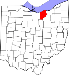 | |
| Villages | ||
| Townships | ||
| CDPs |
| |
| Unincorporated communities | ||
| Ghost town | ||
| Footnotes | ‡This populated place also has portions in an adjacent county or counties | |