Crosbyton, Texas
| Crosbyton, Texas | |
|---|---|
| City | |
|
The Crosby County Courthouse in Crosbyton | |
| Motto: "Where the 19th century meets the 21st century" | |
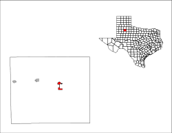
 Location of Crosbyton, Texas | |
 | |
| Coordinates: 33°39′24″N 101°14′20″W / 33.65667°N 101.23889°WCoordinates: 33°39′24″N 101°14′20″W / 33.65667°N 101.23889°W | |
| Country | United States |
| State | Texas |
| County | Crosby |
| Incorporated (city) | 1917 |
| Government | |
| • Type | Mayor-Council |
| • Mayor | Dusty Cornelius |
| Area | |
| • Total | 2.1 sq mi (5.5 km2) |
| • Land | 2.1 sq mi (5.5 km2) |
| • Water | 0.0 sq mi (0.0 km2) |
| Elevation | 3,022 ft (921 m) |
| Population (2010) | |
| • Total | 1,741 |
| • Density | 825/sq mi (318.5/km2) |
| • Demonym | Crosbytonian |
| Time zone | Central (CST) (UTC-6) |
| • Summer (DST) | CDT (UTC-5) |
| ZIP code | 79322 |
| Area code(s) | 806 |
| FIPS code | 48-17768[1] |
| GNIS feature ID | 1355398[2] |
| Website |
www |

Crosbyton is a city in and the county seat of Crosby County, Texas, United States.[3] The population was 1,741 at the 2010 census.[4] Crosbyton is part of the Lubbock Metropolitan Statistical Area.
History
The city was named for land office commissioner Stephen Crosby.[5]
Geography
Crosbyton is located slightly northeast of the center of Crosby County at 33°39′24″N 101°14′20″W / 33.65667°N 101.23889°W (33.656733, -101.238811),[6] along U.S. Route 82 about 2 miles (3 km) west of Blanco Canyon at the eastern edge of the Llano Estacado. US 82 leads east 24 miles (39 km) to Dickens and west 38 miles (61 km) to Lubbock.
According to the United States Census Bureau, Crosbyton has a total area of 2.1 square miles (5.5 km2), all of it land.[4]
Demographics
| Historical population | |||
|---|---|---|---|
| Census | Pop. | %± | |
| 1920 | 809 | — | |
| 1930 | 1,250 | 54.5% | |
| 1940 | 1,615 | 29.2% | |
| 1950 | 1,879 | 16.3% | |
| 1960 | 2,088 | 11.1% | |
| 1970 | 2,251 | 7.8% | |
| 1980 | 2,289 | 1.7% | |
| 1990 | 2,026 | −11.5% | |
| 2000 | 1,874 | −7.5% | |
| 2010 | 1,741 | −7.1% | |
| Est. 2015 | 1,699 | [7] | −2.4% |
As of the census[1] of 2000, there were 1,874 people, 677 households, and 482 families residing in the city. The population density was 886.9 people per square mile (342.9/km²). There were 781 housing units at an average density of 369.6 per square mile (142.9/km²). The racial makeup of the city was 62.49% White, 5.71% African American, 0.21% Native American, 0.05% Asian, 30.15% from other races, and 1.39% from two or more races. Hispanic or Latino of any race were 47.65% of the population.
There were 677 households out of which 34.6% had children under the age of 18 living with them, 55.8% were married couples living together, 11.1% had a female householder with no husband present, and 28.8% were non-families. 27.3% of all households were made up of individuals and 17.6% had someone living alone who was 65 years of age or older. The average household size was 2.68 and the average family size was 3.26.
In the city the population was spread out with 28.8% under the age of 18, 8.8% from 18 to 24, 24.3% from 25 to 44, 20.8% from 45 to 64, and 17.4% who were 65 years of age or older. The median age was 36 years. For every 100 females there were 85.9 males. For every 100 females age 18 and over, there were 82.4 males.
The median income for a household in the city was $24,722, and the median income for a family was $30,900. Males had a median income of $22,647 versus $18,000 for females. The per capita income for the city was $16,329. About 23.7% of families and 28.0% of the population were below the poverty line, including 36.9% of those under age 18 and 25.9% of those age 65 or over.
Government
Former Crosby County administrative County Judge Joseph P. Heflin represented District 85 in the Texas House of Representatives from 2007-2011. During his tenure Heflin was the only Democrat from either West Texas or the Panhandle serving in the legislature. He was unseated in the 2010 general election by the Republican Jim Landtroop of Plainview in Hale County. In 2006, Heflin had defeated Landtroop by fewer than 225 votes.
Education
The city is served by the Crosbyton Consolidated Independent School District.
Climate
| Climate data for Crosbyton, Texas (1981–2010) | |||||||||||||
|---|---|---|---|---|---|---|---|---|---|---|---|---|---|
| Month | Jan | Feb | Mar | Apr | May | Jun | Jul | Aug | Sep | Oct | Nov | Dec | Year |
| Average high °F (°C) | 53.9 (12.2) |
58.1 (14.5) |
66.2 (19) |
75.1 (23.9) |
82.5 (28.1) |
89.0 (31.7) |
92.3 (33.5) |
91.3 (32.9) |
84.4 (29.1) |
75.2 (24) |
63.9 (17.7) |
54.0 (12.2) |
73.8 (23.2) |
| Average low °F (°C) | 26.2 (−3.2) |
29.2 (−1.6) |
36.1 (2.3) |
44.6 (7) |
54.9 (12.7) |
63.4 (17.4) |
66.7 (19.3) |
65.9 (18.8) |
58.4 (14.7) |
47.8 (8.8) |
36.1 (2.3) |
27.2 (−2.7) |
46.4 (8) |
| Average precipitation inches (mm) | 0.81 (20.6) |
0.98 (24.9) |
1.41 (35.8) |
2.05 (52.1) |
2.75 (69.9) |
3.17 (80.5) |
2.36 (59.9) |
2.52 (64) |
2.99 (75.9) |
2.22 (56.4) |
1.10 (27.9) |
0.96 (24.4) |
23.32 (592.3) |
| Average snowfall inches (cm) | 2.1 (5.3) |
1.6 (4.1) |
0.7 (1.8) |
0.1 (0.3) |
0.0 (0) |
0.0 (0) |
0.0 (0) |
0.0 (0) |
0.0 (0) |
0.0 (0) |
0.7 (1.8) |
1.6 (4.1) |
6.8 (17.3) |
| Source: NOAA[9] | |||||||||||||
Notable people
- Don Maynard, member of the Pro Football Hall of Fame
- Ivan Guerra
- Joey Peck, Star linebacker of the past. Noted of wearing the single bar helmet.
See also
Jerrod williams
References
- 1 2 "American FactFinder". United States Census Bureau. Archived from the original on September 11, 2013. Retrieved 2008-01-31.
- ↑ "US Board on Geographic Names". United States Geological Survey. 2007-10-25. Retrieved 2008-01-31.
- ↑ "Find a County". National Association of Counties. Archived from the original on May 31, 2011. Retrieved 2011-06-07.
- 1 2 "Geographic Identifiers: 2010 Census Summary File 1 (G001): Crosbyton city, Texas". U.S. Census Bureau, American Factfinder. Retrieved August 6, 2015.
- ↑ "Profile for Crosbyton, Texas". ePodunk. Retrieved 2010-06-15.
- ↑ "US Gazetteer files: 2010, 2000, and 1990". United States Census Bureau. 2011-02-12. Retrieved 2011-04-23.
- ↑ "Annual Estimates of the Resident Population for Incorporated Places: April 1, 2010 to July 1, 2015". Retrieved July 2, 2016.
- ↑ "Census of Population and Housing". Census.gov. Archived from the original on May 11, 2015. Retrieved June 4, 2015.
- ↑ "NOWData - NOAA Online Weather Data". National Oceanic and Atmospheric Administration. Retrieved May 6, 2013.
External links
Municipalities and communities of Crosby County, Texas, United States | ||
|---|---|---|
| Cities | 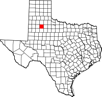 | |
| Unincorporated communities | ||
| Ghost towns |
| |
| Footnotes | ‡This populated place also has portions in an adjacent county or counties | |
