Rockwall, Texas
| City of Rockwall, Texas | |
|---|---|
| City | |
|
Rusk Street in Rockwall | |
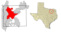 Location of Rockwall in Rockwall County, Texas | |
| Coordinates: 32°55′12″N 96°27′35″W / 32.92000°N 96.45972°WCoordinates: 32°55′12″N 96°27′35″W / 32.92000°N 96.45972°W | |
| Country |
|
| State |
|
| County | Rockwall |
| Government | |
| • Type | Council-Manager |
| • City Council |
Mayor: Jim Pruitt Mayor Pro Tem Dennis Lewis David White Kevin Fowler John Hohenshelt Scott Milder Michael Townsend |
| • City Manager | Rick Crowley |
| Area | |
| • Total | 22.6 sq mi (58.7 km2) |
| • Land | 22.3 sq mi (57.7 km2) |
| • Water | 0.4 sq mi (1.0 km2) 1.63% |
| Elevation | 591 ft (180 m) |
| Population (2010)[1] | |
| • Total | 37,490 |
| • Estimate (2013)[1] | 40,922 |
| • Density | 806.9/sq mi (311.5/km2) |
| Time zone | CST (UTC-6) |
| • Summer (DST) | CDT (UTC-5) |
| ZIP codes | 75032, 75087 |
| Area code(s) | 972 |
| FIPS code | 48-62828[2] |
| GNIS feature ID | 1345424[3] |
| Website | http://www.rockwall.com/ |
.jpg)
Rockwall is a city in Rockwall County, Texas, United States, and a suburb of Dallas and part of the Dallas/Fort Worth Metroplex. It is the county seat of Rockwall County.[4] The population was 37,490 at the 2010 census. The name Rockwall is derived from a naturally jointed geological formation, which has the appearance of an artificial wall.[5][6]
History
The association of Paleo-Indian artifacts with extinct Pleistocene mammal remains in various archeological sites within in the Texas Prairie-Savannah Region of eastern North Central Texas, including a site in Collin County and Clovis points recovered from the Brushy Creek Clovis Site in Hunt County, demonstrates that Rockwall region was occupied by prehistoric Native American cultures at least as far back as 13,500 to 13,000 years ago.<ref
(Edited by A.J. Key)
(( Western Science would have you believe that this sight was created by mongoloid Native Americans. This is not possible for two concrete reasons.
1st and formost is that White skin and it's subsequent genea types I.e. Mongoloid, did not evolve until 8,000 years ago.
2nd. The northen Glacier caused by the Wurm Glaciation of the last ice age did not recede until approximatley 10,000 to 12,000 years ago. There was no access pathway or corridor from the north;
(Behring Straight Human migration), during the time of the occupation of this area.
Therefore the only occupants of this and all other areas of the Americas prior to 8,000 years ago were Africoid humans who were the true indigenous people of this area, and all of Northern and Southern American continent. This information is based on the anylization of Masonry, the Cave paintings and more significantly, The Skeletal remains found in south America in strata of 12,500 years.
Link to the video clip to observe the latest scientific research and discoveries.
https://www.youtube.com/shared?ci=samRdc1v7KU
Those who are sincerley interested in the truth will research these details, and those who are bigoted and wish to promote false history will ignore or erase what I have posted.
A.J. Key Face Book))
Ref continued;
Name="CrookOthers2009a">Crook, W.W. III, M.D. Hughston and J.L. McCraw, 2009, The Brushy Creek Clovis Site (41HU74): An Early Paleoindian Occupation in Hunt County, Texas. The Record, Dallas Archeological Society 56(1):1-18.</ref>[7][8] More recently, the Rockwall region was occupied by Caddo Indians. Creek Indians moved to the area in early 19th century.
In 1851, as the first Anglo-American settlers moved to the area, they started to dig wells. During the digging, they found large underground rock walls that were initially believed to be manmade. Later study of the wall-like features by geologists and archaeologists found them to be jointed, natural sandstone dikes that had intruded Cretaceous marl.[5][6]
The town was established April 17, 1854 and named after these natural rock walls. While originally part of Kaufman County, in 1873, Rockwall County was formed with Rockwall being the county seat.
Geography
Rockwall is located at 32°55′12″N 96°27′35″W / 32.92000°N 96.45972°W (32.920014, -96.459715).[9]
According to the United States Census Bureau, the city has a total area of 31.6 square miles (82 km2), of which, 22.3 square miles (58 km2) of it is land and 0.4 square miles (1.0 km2) of it (1.63%) is water.
Rockwall is on the east shore of Lake Ray Hubbard. It is on State Highways 205 & 740, north of Interstate 30.
The highest point in Rockwall is at 591 ft. at the First Baptist Church.
Climate
The climate in this area is characterized by hot, humid summers and generally mild to cool winters. According to the Köppen Climate Classification system, Rockwall has a humid subtropical climate, abbreviated "Cfa" on climate maps.[10]
Demographics
| Historical population | |||
|---|---|---|---|
| Census | Pop. | %± | |
| 1880 | 215 | — | |
| 1890 | 843 | 292.1% | |
| 1900 | 1,245 | 47.7% | |
| 1910 | 1,136 | −8.8% | |
| 1920 | 1,388 | 22.2% | |
| 1930 | 1,074 | −22.6% | |
| 1940 | 1,318 | 22.7% | |
| 1950 | 1,501 | 13.9% | |
| 1960 | 2,166 | 44.3% | |
| 1970 | 3,121 | 44.1% | |
| 1980 | 5,939 | 90.3% | |
| 1990 | 10,486 | 76.6% | |
| 2000 | 17,976 | 71.4% | |
| 2010 | 37,490 | 108.6% | |
| Est. 2015 | 42,566 | [11] | 13.5% |
As of the census[2] of 2000, there were 17,976 people, 6,605 households, and 5,158 families residing in the city. The population density was 806.9 people per square mile (311.5/km²). There were 7,089 housing units at an average density of 318.2 per square mile (122.8/km²). The racial makeup of the city was 91.35% White, 3.00% African American, 0.38% Native American, 1.39% Asian, 0.03% Pacific Islander, 2.57% from other races, and 1.28% from two or more races. Hispanic or Latino of any race were 6.44% of the population.
There were 6,605 households out of which 39.4% had children under the age of 18 living with them, 66.8% were married couples living together, 8.7% had a female householder with no husband present, and 21.9% were non-families. 18.6% of all households were made up of individuals and 5.4% had someone living alone who was 65 years of age or older. The average household size was 2.68 and the average family size was 3.06.
In the city the population was spread out with 27.5% under the age of 18, 6.9% from 18 to 24, 30.9% from 25 to 44, 25.1% from 45 to 64, and 9.7% who were 65 years of age or older. The median age was 37 years. For every 100 females there were 95.5 males. For every 100 females age 18 and over, there were 92.1 males.
The median income for a household in the city was $65,411, and the median income for a family was $75,121. Males had a median income of $55,370 versus $35,139 for females. The per capita income for the city was $29,843. About 3.2% of families and 3.9% of the population were below the poverty line, including 4.6% of those under age 18 and 3.0% of those age 65 or over.
Though Rockwall County is the smallest county in Texas, it is also one of the top five fastest-growing counties in the United States. As of the 2006 census by the North Texas Central Council of Governments, the city had a population of 29,500. In 2006, Rockwall County was the fastest-growing county in the United States by population.
Economy
According to the City's 2014 Comprehensive Annual Financial Report,[13] the top employers in the city are:
| # | Employer | # of Employees |
|---|---|---|
| 1 | Rockwall Independent School District | 1,556 |
| 2 | Presbyterian Hospital | 592 |
| 3 | Wal-Mart Superstore | 492 |
| 4 | Rockwall County | 299 |
| 5 | Texas Star Express | 275 |
| 6 | City of Rockwall | 262 |
| 7 | Hilton Bella Harbor | 250 |
| 8 | Costco | 250 |
| 9 | Special Products and Manufacturing | 205 |
| 10 | Target Corporation | 200 |
Government
Local government

According to the city’s most recent Comprehensive Annual Financial Report Fund Financial Statements, the city’s various funds had $39.0 million in Revenues, $42.2 million in expenditures, $32.3 million in total assets, $3.6 million in total liabilities, and $25.9 million in investments.[14]
The structure of the management and coordination of city services is:[15]
| Department | Director |
|---|---|
| City Manager | Rick Crowley |
| Assistant City Manager | Mary Smith |
| Assistant City Manager | Brad Griggs |
| Director of Administrative Services | Cheryl Dunlop |
| Chief of Police | Kirk Riggs |
| Fire Chief | Mark Poindexter |
| Director of Community Development | Ryan Miller |
The city of Rockwall is a voluntary member of the North Central Texas Council of Governments association, the purpose of which is to coordinate individual and collective local governments and facilitate regional solutions, eliminate unnecessary duplication, and enable joint decisions.
State government
Rockwall is represented in the Texas Senate by Republican Bob Hall, District 2,[16] and in the Texas House of Representatives by Republican Scott Turner, District 33.[17]
Federal government
At the Federal level, the two U.S. Senators from Texas are Republicans John Cornyn and Ted Cruz; Rockwall is part of Texas' US Congressional 4th District, which is currently represented by Republican John Ratcliffe.
Education
Public schools
The city is served by the Rockwall Independent School District. There are two high schools in Rockwall. The older is Rockwall High School and the newer is Rockwall-Heath High School built in 2005.
Higher education
The city is home to the Higher Education Center at Rockwall, which is part of the community college district, Collin College. The campus is the District's first campus outside of Collin County itself. Texas A&M University-Commerce holds classes at the Center. Texas A&M University-Commerce also has a campus located at the Rockwall Technology Park.
Transportation
Rockwall is served by the following highways that run through the city:
-
 Interstate 30
 -
 U.S. Highway 67 (runs concurrent with Interstate 30)
 -
 State Highway 66
 -
 State Highway 205
 -
 State Highway 276
 -
 Farm to Market 552
 -
 Farm to Market 740
Ralph M. Hall/Rockwall Municipal Airport is located two miles east of the city and is used mostly by small general aviation aircraft.
Sports
Rockwall offers many different sports complexes as well as activities. For example, Lake Ray Hubbard has several boating marinas and is used for jet skiing.
Rockwall also offers 22 different Golf Courses within 17 miles of the center of Rockwall.
Notable people
- Amber Carrington - Semi-finalist of The Voice (U.S. season 4)
- Allie Gonino Singer, actress, and violinist most notable for playing Laurel Mercer in The Lying Game
- Jason Castro - Top 12 contestant on American Idol (season 7)
- Joe Driver - Texas State Representative from 1993 to 2013
- Cliff Harris - Professional football safety who played for the Dallas Cowboys
- Alex Jones - Radio talk show host who grew up in Rockwall during the 1980s and early 1990s
- Mason Musso - Lead singer and guitarist in Metro Station
- Mitchel Musso - Actor most notable for portraying character Oliver Oken in Hannah Montana
- Larry Lea - Former televangelist whose ministry was based in Rockwall during the 1980s and early 1990s
- Marina Oswald Porter - the widow of Lee Harvey Oswald.
- Andy Tanner - former New Orleans Saints WR.
References
- 1 2 "State and County Quick Facts". United States Census Bureau. Retrieved May 14, 2015.
- 1 2 "American FactFinder". United States Census Bureau. Retrieved 2008-01-31.
- ↑ "US Board on Geographic Names". United States Geological Survey. 2007-10-25. Retrieved 2008-01-31.
- ↑ "Find a County". National Association of Counties. Retrieved 2011-06-07.
- 1 2 Monroe, J.N., 1950, Origin of the clastic dikes in the Rockwall area, Texas. Field and Laboratory. v. 18, no. 4, pp. 133-143.
- 1 2 Ellwood, B.B., J. Payne, and G.J. Long, 1989, The Rockwall, Texas: A study of unusual natural magnetic effects in geoarcheological surveys produced by mineral oxidation. Geoarchaeology. v. 4, no. 2, pp. 103-118.
- ↑ Crook, W. W., III, 2011, A Possible Association of Worked Flakes with Probosidian Bones near Lake Lavon, Collin County, Texas. Archeological Journal of the Texas Prairie-Savannah 1(1):4-8.
- ↑ Ferring, C.R., 2000, The Archeology and Paleoecology of the Aubrey Clovis Site (41DN79) Denton County, Texas. Center for Environmental Archeology, Department of Geography, University of North Texas, Denton.
- ↑ "US Gazetteer files: 2010, 2000, and 1990". United States Census Bureau. 2011-02-12. Retrieved 2011-04-23.
- ↑ Climate Summary for Rockwall, Texas
- ↑ "Annual Estimates of the Resident Population for Incorporated Places: April 1, 2010 to July 1, 2015". Retrieved July 2, 2016.
- ↑ "Census of Population and Housing". Census.gov. Retrieved June 4, 2015.
- ↑ "Comprehensive Annual Financial Report" (PDF). September 30, 2014. p. 132. Retrieved April 24, 2015.
- ↑ City of Rockwall 2009 CAFR retrieved 2010-11-17
- ↑ "Comprehensive Annual Financial Report" (PDF). September 30, 2012. p. 19. Retrieved June 3, 2013.
- ↑ "Senator Bob Hall: District 2". Retrieved April 24, 2015.
- ↑ "Texas House Member". Retrieved April 24, 2015.
External links
- The City of Rockwall Home Page
- Planet Rockwall ~ Online Magazine & Directory for Rockwall, TX
- Headlines about Rockwall, Rowlett and Heath from The Dallas Morning News
Municipalities and communities of Rockwall County, Texas, United States | ||
|---|---|---|
| Cities | 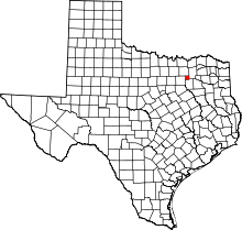 | |
| Footnotes | ‡This populated place also has portions in an adjacent county or counties | |
