Andrews, Texas
| Andrews, Texas | ||
|---|---|---|
| City | ||
| City of Andrews | ||
|
Water tower | ||
| ||
| Motto: "Move Ahead" | ||
 Location of Andrews, Texas | ||
| Coordinates: 32°19′17″N 102°33′6″W / 32.32139°N 102.55167°WCoordinates: 32°19′17″N 102°33′6″W / 32.32139°N 102.55167°W | ||
| Country | United States | |
| State | Texas | |
| County | Andrews | |
| GovernmentCouncil-Manager | ||
| • Type | Elected(non-compensatory)Mayor-Council/ appointed City Manager | |
| • City Manager | Glen Hackler | |
| • Mayor | Flora Braly | |
| Area | ||
| • Total | 4.9 sq mi (12.7 km2) | |
| • Land | 4.9 sq mi (12.7 km2) | |
| • Water | 0.0 sq mi (0.0 km2) | |
| Elevation | 3,176 ft (968 m) | |
| Population (2010)[1] | ||
| • Total | 11,088 | |
| • Estimate (2013)[2] | 12,718 | |
| Time zone | Central (CST) (UTC-6) | |
| • Summer (DST) | CDT (UTC-5) | |
| ZIP code | 79714 | |
| Area code(s) | 432 | |
| FIPS code | 48-03216[3] | |
| GNIS feature ID | 1329539[4] | |
| Website |
www | |
Andrews is a city in and the county seat of Andrews County in the State of Texas within the West Texas region.[5] The population was 12,718 as of 2013.[6]
Andrews was incorporated on February 2, 1937. Both the city and county were named for Richard Andrews, the first Texan soldier to die in the Texas Revolution.[7]
Geography
Andrews is located at 32°19′17″N 102°33′6″W / 32.32139°N 102.55167°W (32.321401, -102.551733).[8]
U.S. Highway 385 (north–south), State Highway 115 (east–west), and State Highway 176 (east–west) pass through Andrews.

Andrews Loop 1910 is a 13.1-mile-long (21.1 km), $12.5 million, city-maintained, ring road that through trucks are directed to follow. Although it is not a state highway, it is designated similar to a state highway loop, with a special blue shield. The number refers to the year Andrews County was organized, a name chosen after a city-wide competition was held to name the new loop.[9]
Demographics
| Historical population | |||
|---|---|---|---|
| Census | Pop. | %± | |
| 1940 | 611 | — | |
| 1950 | 3,294 | 439.1% | |
| 1960 | 11,135 | 238.0% | |
| 1970 | 8,625 | −22.5% | |
| 1980 | 11,061 | 28.2% | |
| 1990 | 10,678 | −3.5% | |
| 2000 | 9,652 | −9.6% | |
| 2010 | 11,088 | 14.9% | |
| Est. 2015 | 13,816 | [10] | 24.6% |
| U.S. Decennial Census[11] 2013 Estimate[2] | |||
As of the census[3] of 2000, there were 9,652 people, 3,478 households, and 2,598 families residing in the city. The population density was 2,017.5 people per square mile (779.6/km²). There were 4,047 housing units at an average density of 845.9 per square mile (326.9/km²). The racial makeup of the city was 75.65% White, 2.04% African American, 0.90% Native American, 0.71% Asian, 0.03% Pacific Islander, 17.72% from other races, and 2.94% from two or more races. Hispanic or Latino of any race were 41.95% of the population.
There were 3,478 households out of which 40.3% had children under the age of 18 living with them, 61.3% were married couples living together, 10.2% had a female householder with no husband present, and 25.3% were non-families. 23.7% of all households were made up of individuals and 11.1% had someone living alone who was 65 years of age or older. The average household size was 2.75 and the average family size was 3.26.
In the city the population was spread out with 31.5% under the age of 18, 8.1% from 18 to 24, 27.3% from 25 to 44, 20.0% from 45 to 64, and 13.1% who were 65 years of age or older. The median age was 34 years. For every 100 females there were 93.9 males. For every 100 females age 18 and over, there were 88.6 males.
The median income for a household in the city was $32,774, and the median income for a family was $36,172. Males had a median income of $31,527 versus $22,266 for females. The per capita income for the city was $16,101. About 15.3% of families and 17.7% of the population were below the poverty line, including 22.5% of those under age 18 and 12.8% of those age 65 or over.
Economic development
Andrews is a city built on oil and soil. After the first oil well was drilled (1929) by Deep Rock Oil Company on Missourian Charles E. Ogden's property Andrews County became one of the major oil producing counties in the State of Texas, having produced in excess of 1 billion barrels (160,000,000 m3) of oil. However, the cyclical nature of the oil business (as well as diminishing production on existing wells), has caused the community to look into new means of economic development, such as waste disposal, which in some areas has caused controversy.
Waste Control Specialists (WCS), owned by Harold Simmons and headquartered in Dallas, Texas, operates a 14,000 acres (57 km2) site in Andrews County on the border with New Mexico. The company was awarded a license to dispose of radioactive waste by the TCEQ in 2009. The permit allows for disposal of radioactive materials such as uranium, plutonium and thorium from commercial power plants, academic institutions and medical schools.[12] The company finished construction on the project in 2011 and started disposing of waste in 2012. There are two radioactive waste landfills at the site. The 30-acre compact site is owned and regulated by the State of Texas for use by Texas, Vermont, and up to 36 other states. The 90-acre federal site is owned by the United States federal government and is used for Department of Energy and other federal waste.[12] The company employs 130 people or about 1% of the total labor force in Andrews.[13]
For years there has been a simmering dispute over which state these waste sites are lawfully a part of: Texas or New Mexico? The straight north-south border between the two states was originally defined as the 103rd meridian, but the 1859 survey that was supposed to mark that boundary mistakenly set the border between 2.29 and 3.77 miles too far west of that line, making the waste sites, along with the current towns of Farwell, Texline, and part of Glenrio, appear to be within the State of Texas. New Mexico's short border with Oklahoma, in contrast, was surveyed on the correct meridian. New Mexico's draft constitution in 1910 stated that the border is on the 103rd meridian as intended. The disputed strip, hundreds of miles long, includes parts of valuable oilfields of the Permian Basin. A bill was passed in the New Mexico Senate to fund and file a lawsuit in the U.S. Supreme Court to recover the strip from Texas, but the bill did not become law. Today, land in the strip is included in Texas land surveys and the waste sites for all purposes are taxed and governed by The State of Texas.[14]
The city was set to be the location of the now defunct $400 million HT3R project.
In 1972, Andrews became the site of the first Kirby Company vacuum cleaner factory outside of the original location in Ohio. It is often referred to as "Kirby West" to signify the westward expansion of the country. The company employs about 200 people.
In 2011 the city opened Business Park South to provide more incentive options for attracting businesses. Energy Business Park was also opened by the city in 2014.[15]
The city completed more than $3 million in airport renovations. Voters approved bonds to construct a new $13 million loop around town which opened in October 2013.[9] A brand new $2 million fire station opened at the end of 2013. A new $60 million hospital is also planned to open in 2015.[16]
The town began to sell alcohol for the first time on December 19, 2013.
Education
Students are served by the Andrews Independent School District. The school opened two new $18.5 million elementary school campuses and a $20 million performance center at the high school in 2008.
The high school started issuing laptop computers to each student in 2012. The elementary and middle school campuses also began to issue iPad tablets to all students. Students are allowed to take the devices home, but must return them at the end of the school year.[17]
Due to increased enrollments several construction projects began construction in 2013. New classrooms were added to all school campuses.[18]
Junior College
The Andrews Business and Technology Center was completed in January 2006, in conjunction with Odessa College and the University of Texas of the Permian Basin. The school focuses on technology and is a hub for distance learning. A $1 million expansion of the campus was completed in 2013 adding space for a Registered Nurse (RN) program.
Parks and recreation
Andrews County Veterans Memorial
The Andrews County Veterans Memorial is a memorial in Andrews which was created in 2006 as a tribute to those Andrews County residents who served in the United States' armed forces. Soldiers from every major conflict in which America has participated are honored.[19]
Andrews Bird Viewing Trail
The Andrews Bird Viewing Trail opened to the public in 2007. The park includes a .2 mile trail alongside ponds with an overlook deck, benches, and an observation binocular stand.
ACE Arena
In effort to attract events to the community, the city funded and built ACE Arena (a multi-purpose arena) which opened in March 2007. A smaller outdoor arena was also constructed in 2012 adjacent to the indoor arena.
Andrews Splash Park
The city approved a $2 million water park to replace the former city pool in 2013.[20]
Museum of Andrews
The city started construction on a new museum in 2013 inside the first home built in Andrews. The house was relocated to property adjacent to the Andrews County Veterans Memorial.
Notable people
- Chad Campbell, professional golfer; born in Andrews[21]
- Max Lucado, author and pastor; reared in Andrews and graduated from Andrews High School[22]
- Mickey Matthews, former James Madison University head football coach; born in Andrews
- Randy Pendleton, state representative from District 73; reared and educated in Andrews
- Eagle Pennell, independent filmmaker; born in Andrews
- Shaud Williams, running back for the Buffalo Bills; born and reared in Andrews, graduated from Andrews High School[23]
In popular culture
- The Bachelor filmed episode 705 in Andrews in 2005.
- Black Gold was filmed in Andrews for the 1st season.
- Parts of Gasland were filmed in Andrews.
Climate
According to the Köppen Climate Classification system, Andrews has a semi-arid climate, abbreviated "BSk" on climate maps.[24]
References
- ↑ "American FactFinder". United States Census Bureau. Retrieved October 17, 2014.
- 1 2 "Population Estimates". United States Census Bureau. Retrieved October 17, 2014.
- 1 2 "American FactFinder". United States Census Bureau. Archived from the original on September 11, 2013. Retrieved 2008-01-31.
- ↑ "US Board on Geographic Names". United States Geological Survey. October 25, 2007. Retrieved January 31, 2008.
- ↑ "Find a County". National Association of Counties. Archived from the original on May 31, 2011. Retrieved June 7, 2011.
- ↑ "Fastest growing boomtowns: Andrews, Texas". CNN. March 19, 2013. Retrieved October 16, 2013.
- ↑ Tarpley, Fred (5 July 2010). 1001 Texas Place Names. University of Texas Press. p. 11. ISBN 978-0-292-78693-6.
- ↑ "US Gazetteer files: 2010, 2000, and 1990". United States Census Bureau. February 12, 2011. Retrieved April 23, 2011.
- 1 2 Williams, Alexa (October 8, 2013). "Reliever Route Finally Opens in Andrews". Midland, TX: KWES-TV. Retrieved December 30, 2014.
- ↑ "Annual Estimates of the Resident Population for Incorporated Places: April 1, 2010 to July 1, 2015". Retrieved July 2, 2016.
- ↑ United States Census Bureau. "Census of Population and Housing". Archived from the original on May 11, 2015. Retrieved October 17, 2014.
- 1 2 http://abcnews.go.com/US/wireStory/texas-site-begins-taking-federal-nuclear-waste-19343196#.UblWMfk3vg0
- ↑ http://www.andrewsedc.com/profiles.pdf
- ↑ Daniel Gertson. "Border War Brewing?". Retrieved 2016-09-24.
- ↑ "Archived copy". Archived from the original on August 10, 2013. Retrieved 2014-01-05.
- ↑ http://permianbasin360.com/fulltext?nxd_id=260212
- ↑ http://www.cbs7kosa.com/news/details.asp?ID=37786
- ↑ http://www.cbs7kosa.com/news/details.asp?ID=53004
- ↑ Andrews County Veterans Memorial http://www.andrewscountyveteransmemorial.com/index.htm[] Retrieved January 13, 2008
- ↑ http://www.newswest9.com/story/22848250/splashparks-approved-for-andrews
- ↑ "Chad Campbell". PGA Tour. Retrieved 2016-09-28.
- ↑ "About Max Lucado". Retrieved 2016-09-28.
- ↑ "Shaud Rashae Williams". Pro-Football-Reference.Com. Retrieved December 10, 2012.
- ↑ Climate Summary for Andrews, Texas
External links
| Wikimedia Commons has media related to Andrews, Texas. |
- City of Andrews official website
- Andrews Chamber of Commerce
- Andrews School District
- Andrews, Texas from the Handbook of Texas Online
Municipalities and communities of Andrews County, Texas, United States | ||
|---|---|---|
| City | 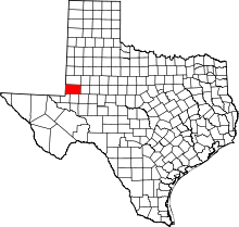 | |
| CDP | ||
| Ghost towns | ||
