Karnes City, Texas
| Karnes City, Texas | |
|---|---|
| City | |
|
Welcome sign at Karnes City | |
 Location of Karnes City, Texas | |
 | |
| Coordinates: 28°53′N 97°54′W / 28.883°N 97.900°WCoordinates: 28°53′N 97°54′W / 28.883°N 97.900°W | |
| Country | United States |
| State | Texas |
| County | Karnes |
| Area | |
| • Total | 2.1 sq mi (5.5 km2) |
| • Land | 2.1 sq mi (5.5 km2) |
| • Water | 0.0 sq mi (0.0 km2) |
| Elevation | 430 ft (131 m) |
| Population (2000) | |
| • Total | 3,457 |
| • Density | 1,627.6/sq mi (628.4/km2) |
| Time zone | Central (CST) (UTC-6) |
| • Summer (DST) | CDT (UTC-5) |
| ZIP code | 78118 |
| Area code(s) | 830 |
| FIPS code | 48-38452[1] |
| GNIS feature ID | 1360493[2] |


Karnes City is a city in Karnes County, Texas, United States. The population was 3,042 at the 2010 census. It is the county seat of Karnes County.[3] The town was named after Henry Karnes of the Texas Revolution.[4] Karnes is some twenty-five miles south of Floresville on U.S. Highway 181.
History
In 1894, as a result of a special election, the county seat was moved from Helena to Karnes City. Colonel William G. Butler (1831–1912) blamed the town and its corrupt mayor for the death of his son, Emmett, who was killed on December 26, 1884, by a stray bullet from a bar fight. When the townspeople would not identify Emmett's killer, Butler reportedly shouted: "All right! For that I'll kill the town that killed my son!" Following through on his threat, Butler, a veteran of the American Civil War and a wealthy rancher, arranged for the since defunct San Antonio and Aransas Pass Railway to be built 7 mi (11 km) bypassing Helena. Then, in a bitterly contested election, the county seat was moved to Karnes City, and Helena faded away into a ghost town.
The popular character actor Jim Davis played the role of Colonel Butler in the 1969 episode "The Oldest Law" of the syndicated television series, Death Valley Days, hosted by Robert Taylor not long before Taylor's own death. Tom Lowell (born 1941) played Emmett Butler; Stacy Harris, the corrupt Mayor Ackerson, and Tyler McVey, Parson Blake.[5]
Geography
Karnes City is located at 28°53′N 97°54′W / 28.883°N 97.900°W (28.8882, -97.9013).[6]
According to the United States Census Bureau, the city has a total area of 2.1 square miles (5.4 km2) all land.
Karnes City is about 60 miles (97 km) southeast of San Antonio.[7]
Demographics
| Historical population | |||
|---|---|---|---|
| Census | Pop. | %± | |
| 1920 | 787 | — | |
| 1930 | 1,141 | 45.0% | |
| 1940 | 1,571 | 37.7% | |
| 1950 | 2,588 | 64.7% | |
| 1960 | 2,693 | 4.1% | |
| 1970 | 2,926 | 8.7% | |
| 1980 | 3,296 | 12.6% | |
| 1990 | 2,916 | −11.5% | |
| 2000 | 3,457 | 18.6% | |
| 2010 | 3,042 | −12.0% | |
| Est. 2015 | 3,371 | [8] | 10.8% |
As of the census[1] of 2000, there were 3,457 people, 1,007 households, and 720 families residing in the city. The population density was 1,627.6 people per square mile (629.6/km²). There were 1,180 housing units at an average density of 555.6 per square mile (214.9/km²).
There were 1,007 households out of which 35.8% had children under the age of 18 living with them, 46.7% were married couples living together, 19.3% had a female householder with no husband present, and 28.5% were non-families. 25.2% of all households were made up of individuals and 14.8% had someone living alone who was 65 years of age or older. The average household size was 2.81 and the average family size was 3.37.
In the city the population was spread out with 25.9% under the age of 18, 11.5% from 18 to 24, 31.1% from 25 to 44, 16.6% from 45 to 64, and 14.9% who were 65 years of age or older. The median age was 33 years. For every 100 females there were 122.7 males. For every 100 females age 18 and over, there were 130.6 males.
The median income for a household in the city was $25,156, and the median income for a family was $27,206. Males had a median income of $30,446 versus $18,261 for females. The per capita income for the city was $12,243. About 23.1% of families and 27.0% of the population were below the poverty line, including 36.6% of those under age 18 and 22.6% of those age 65 or over.
Education
Karnes City is served by the Karnes City Independent School District; Roger E. Sides Elementary School,[10] Karnes City Junior High School, and Karnes City High School.
Climate
The climate in this area is characterized by hot, humid summers and generally mild to cool winters. According to the Köppen Climate Classification system, Karnes City has a humid subtropical climate, abbreviated "Cfa" on climate maps.[11]
References
- 1 2 "American FactFinder". United States Census Bureau. Retrieved 2008-01-31.
- ↑ "US Board on Geographic Names". United States Geological Survey. 2007-10-25. Retrieved 2008-01-31.
- ↑ "Find a County". National Association of Counties. Archived from the original on May 31, 2011. Retrieved 2011-06-07.
- ↑ Roberta M. Ziegler and Robert H. Thonhoff. "The Handbook of Texas Online". Texas State Historical Association.
- ↑ "The Oldest Law on Death Valley Days". Internet Movie Data Base. Retrieved July 16, 2015.
- ↑ "US Gazetteer files: 2010, 2000, and 1990". United States Census Bureau. 2011-02-12. Retrieved 2011-04-23.
- ↑ Malislow, Craig. "Wells Fargo Hit for Funding Allegedly Badly Run Private Texas Prison." Houston Press. Monday July 4, 2011. Retrieved on November 3, 2011.
- ↑ "Annual Estimates of the Resident Population for Incorporated Places: April 1, 2010 to July 1, 2015". Retrieved July 2, 2016.
- ↑ "Census of Population and Housing". Census.gov. Archived from the original on May 11, 2015. Retrieved June 4, 2015.
- ↑ "Roger E. Sides". Retrieved 2009-03-01.
- ↑ Climate Summary for Karnes City, Texas
Municipalities and communities of Karnes County, Texas, United States | ||
|---|---|---|
| Cities | 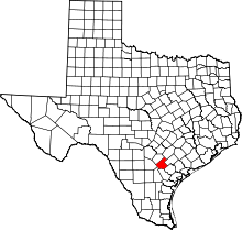 | |
| Town | ||
| Unincorporated communities | ||
| Ghost towns | ||